Holland
|
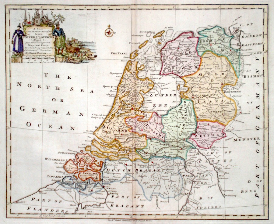
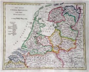
Holland 'A New and Correct Map of the Seven United Provinces...' Bowen, E. (c. 1745) 42 x 35 A finely engraved and detailed map of the Seven United Provinces by Emanuel Bowen. Published in Tindal's translation of Paul Rapin De Toras's History of England. The map features extensive detail on the area which is now primarily Holland. The map title is contained in a particularly fine cartouche, showing Dutch costume of the time and shipbuilding aspects. Excellent condition. Later colour. 160.00 GBP |


|
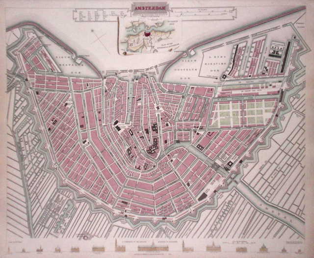
Holland 'Amsterdam' Davies, B. (1835) 39 x 33 Finely executed plan of the city by B R Davies for The Society for the Diffusion of Useful Knowledge. Inset plan of the environs of Amsterdam. Steel engraving, later colour. 110.00 GBP |
|
Holland 'Netherlands. Drawn from the best Authorities….' Russell, J. (c. 1799) 46 x 39 Fine map of The Netherlands by John Charles Russell for Guthrie's " New System of Geography". Double page folio size map, original hand colour 80.00 GBP |

|
Holland 'The Seven United Provinces…' Russell, J. (c. 1799) 46 x 40 Fine map of The United Provinces, Holland, Groningen, Gelders, Friesland, Overyessel, Utrecht and Zealand by John Charles Russell for Guthrie's " New System of Geography". Double page folio size map, original hand colour 80.00 GBP |

|
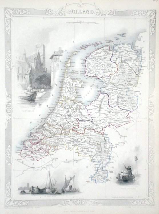
Holland Rapkin, J. (1851) 26 x 36 Fine map of the Country by John Rapkin, for John Tallis's highly decorative "The Illustrated Atlas". The vignettes show; Rotterdam, On the River Dort, Dutch people. Single page map (no central fold). Original colour as published. Condition fine. 80.00 GBP |
|
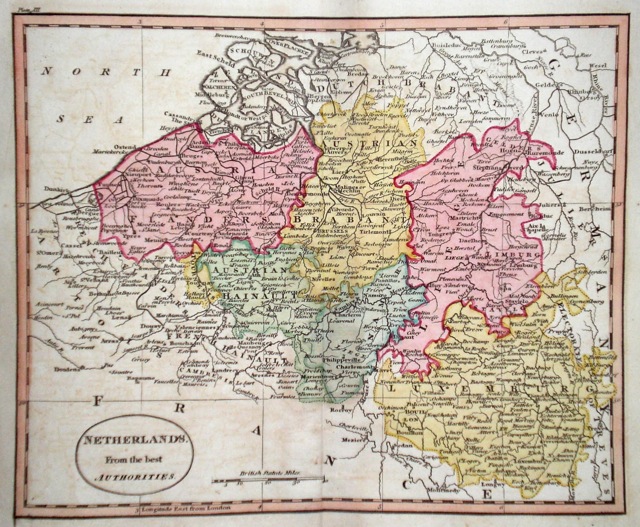
Holland 'Netherlands from the best Authorities' Russell, J. (1818) 22.5 x 19 60.00 GBP |
|
Holland 'The Seven United Provinces' Cooke's New Encyclopaedia (c. 1789) 27 x 22 The seven united provinces founded in 1579 lasted as such until 1795 when it was invaded by the French. Later hand colour. A few marks outside the engraving but generally good condition. 45.00 GBP |
|
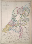
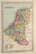
Holland 'Kingdoms of Holland and Belgium' Starling, T. (c. 1832) 9 x 15 Uncommon and finely engraved map of the two countries from The Royal Cabinet Atlas. A numbered key identifies the various provinces. Bright original colouring. 40.00 GBP |
|
Holland Dispatch Atlas (1863) 30 x 43 Early outline colour to each province. 35.00 GBP |