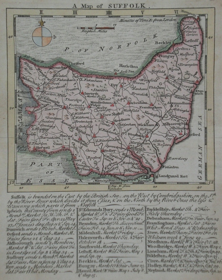
Suffolk
Including Ipswich, Bury St. Edmunds, Lowestoft, Felixstowe, Sudbury, Haverhill, Bungay
|
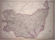
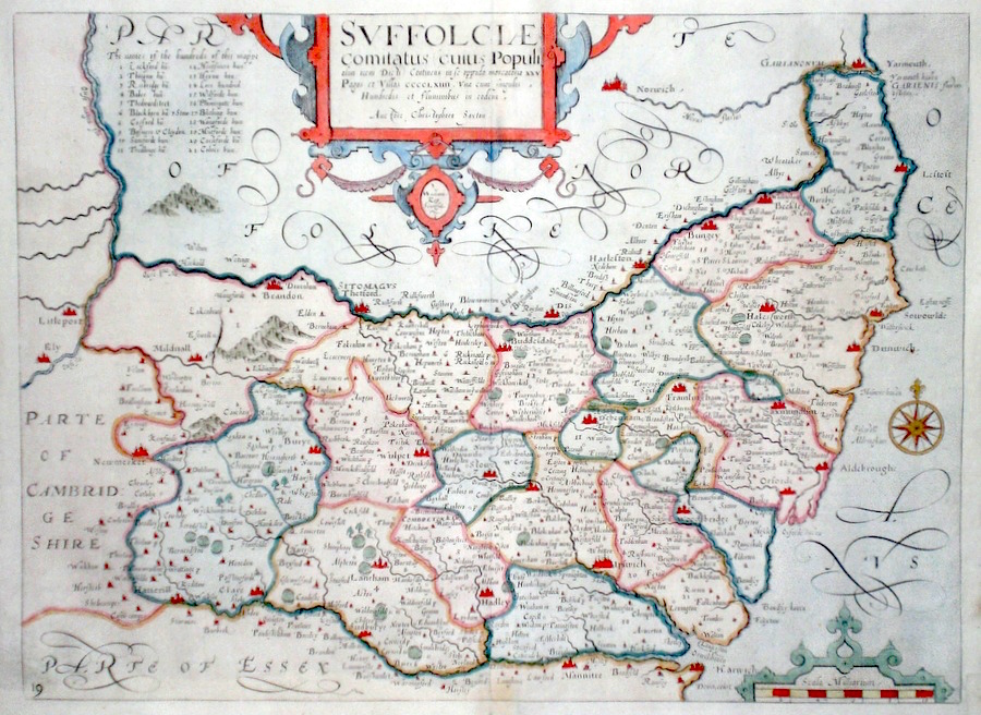
Suffolk 'Suffolkiae Comitatus...' Kip, W. (c. 1637) 38 x 28 Fine early map of the county by William Kip after Christopher Saxton. From Camden's Britannia. One of the earliest maps of the single county. No text verso. Excellent condition with good margins. Early colour. 180.00 GBP |
|
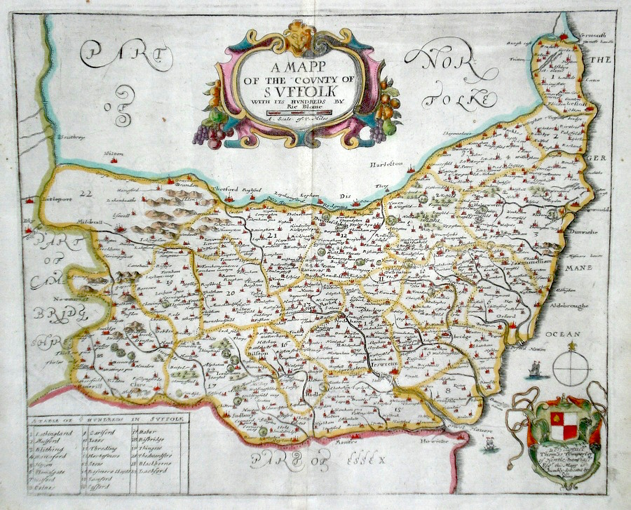
Suffolk 'A Mapp of the County of Suffolk...' Blome, R. (1673) 32 x 27 Decorative map of the County by Richard Blome for his publication "Britannia". The largest series of county maps published by Blome, and generally based on those of Speed. Maps by Blome are characteristic and attractive. Fine condition, later colour. 160.00 GBP |
|
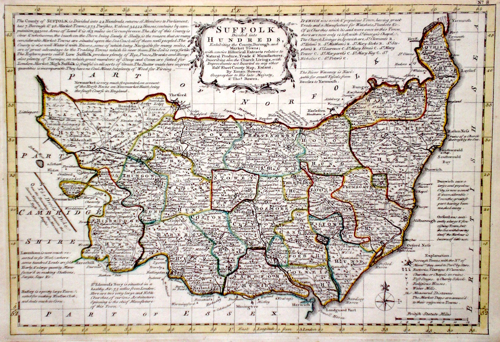
Suffolk 'Suffolk divided into Hundreds' Bowen E. and T. (1767) 33 x 22.5 Very finely engraved map of the County by Emanuel and Thomas Bowen from the "Atlas Anglicanus". The maps are generally derived from those in "The Large English Atlas", and extensive county information accompanying the maps is also a feature of this series. A rare item. Bright original colouring. 120.00 GBP |
|
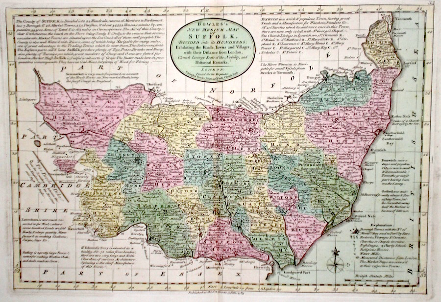
Suffolk 'Bowles's New Medium Map of Suffolk..' Bowen, E. & T. (1785) 33 x 23 Finely engraved and detailed map of the county from "Bowles's New Medium English Atlas". The maps in this series are based on those in Emanuel and Thomas Bowen's Atlas Anglicanus, and feature extensive county information on the map. They are distinguished primarily by having newly engraved cartouches, distances from London added to towns, and different imprints at the bottom. Full original colour. Fine condition. 120.00 GBP |
||||||||||||||


|
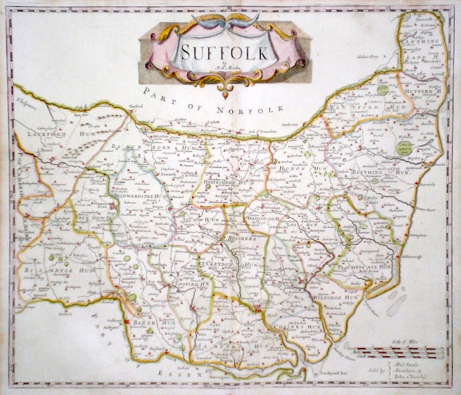
Suffolk 'Suffolk by Robt. Morden' Morden, R. (c. 1695) 42 x 36 Attractive map of the county for the first edition of Camden's Britannia to contain maps by Robert Morden. Later colour. Condition excellent. 100.00 GBP |
||||||||||||||
|
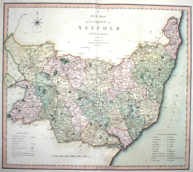
Suffolk 'A New Map of the County of Suffolk divided into hundreds' Smith, C. (1804) 50 x 45 Large size and decorative map of the County by Jones, Smith & Co. for Smith's New English Atlas. The first map of the County to show longitudes measured from the meridian of Greenwich. Very fine original hand colouring. 75.00 GBP |
|
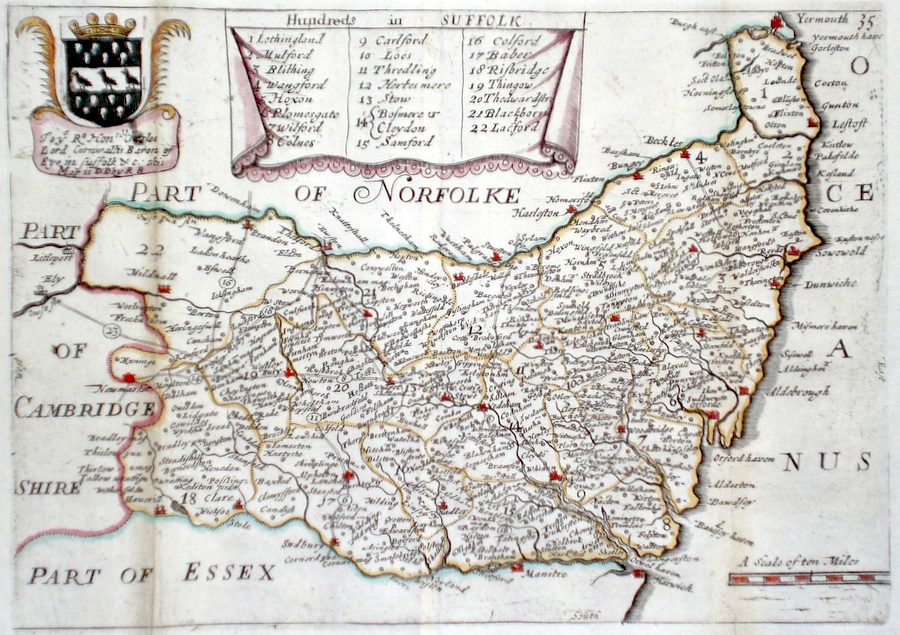
Suffolk 'Hundreds in Suffolk' Blome, R. (c. 1731) 25 x 17 Finely engraved map of the county by Richard Blome from the atlas "England Exactly Described or a Guide to Travellers…" first published by Thomas Taylor, but herewith from the later edition published by Thomas Bakewell. A major addition to the earlier plates is that roads and distances between towns are now included, after the road surveys of John Ogilby. Fine condition. Later colour 75.00 GBP |
|
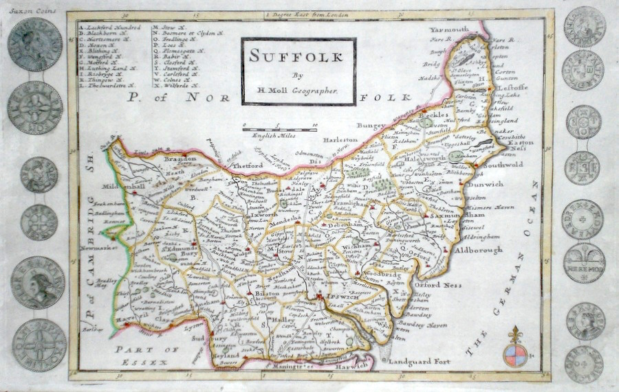
Suffolk Moll, H. (c. 1724) 32 x 20 Finely engraved map of the county by Herman Moll for the publication "A New Description of England and Wales…" The maps in this series include engraved borders of local architectural and antiquarian interest. A unique feature. On this map Saxon coins. Later colour, fine condition. 70.00 GBP |
|
Suffolk Newmarket Measom, W & G. (1874) 48 x 32 Large Size wood engraved view of the town published in the "Illustrated Sporting and Dramatic News" 60.00 GBP |

|
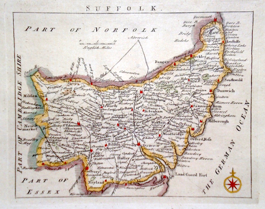
Suffolk 'A Map of Suffolk from the Best Authorities' Cary, J. (c. 1789) 52 x 41 Finely enraved map of the County by John Cary. From the 1789 edition of Camden's Britannia. Later colour with good margins 60.00 GBP |

|
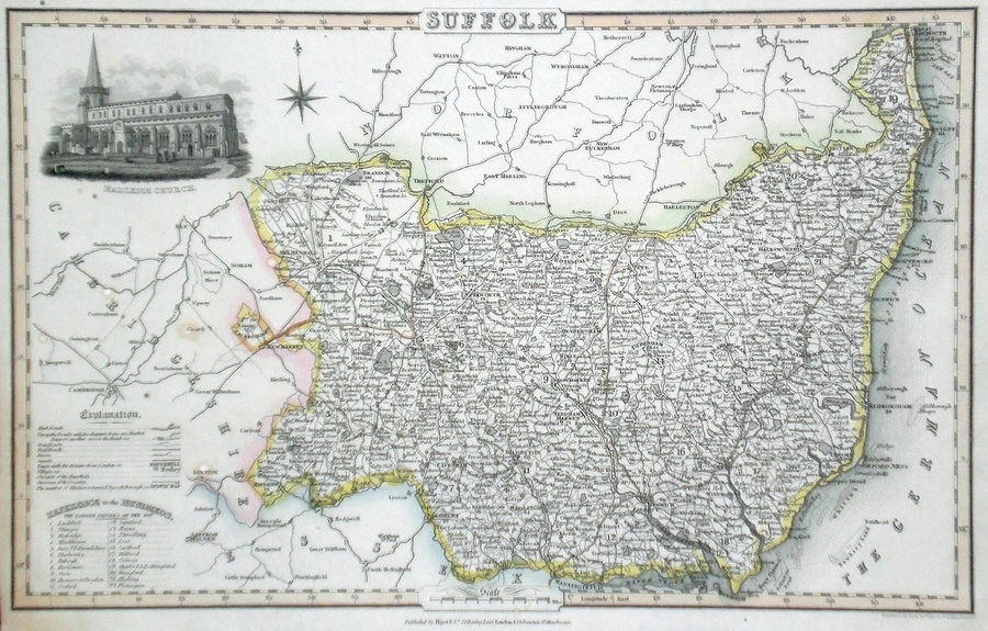
Suffolk Pigot, J. (c. 1826) 36 x 23 Attractive and detailed steel engraved map by James Pigot from his publication Pigot & Co.'s British Atlas. Features include a fine vignette engraving of Hadleigh Church. Original hand colour. Excellent condition 60.00 GBP |
|
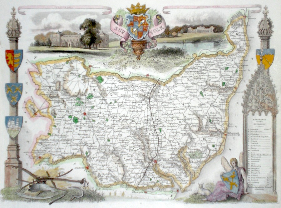
Suffolk Moule, T. (c. 1841) 26 x 20 Steel engraved map of the county by Thomas Moule. Moule was a Heraldry expert and antiquarian and the attractive embellishments on his maps make them amoungst the last of the decorative maps to be published. Views of Euston Hall, and Hevening Hall. Later colour. Excellent condition. 55.00 GBP |
|
Suffolk Rocque, J. (c. 1769) 20 x 17 Finely engraved map of the county by John Rocque for the publication "England Displayed". Later colour 50.00 GBP |
|
Suffolk 'The County of Suffolk' Seller, J. (1703) 15 x 13 Fine map of the county by the Hydrographer and instrument maker John Seller for his "Anglia Contracta". This series of maps were first published in 1695. They were later used in a simplified form by Francis Grose for his "Supplement to the Antiquities of England and Wales, published from 1787. 50.00 GBP |

|
Suffolk 'A Map of Suffolk' Kitchin/Jefferys (1751) 13.5 x 18 Finely engraved map of the county by Thomas Kitchin and Thomas Jefferys from their publication "The Small English Atlas". This rare series of maps are distinctive by featuring considerable county information below the map. Later colour 50.00 GBP |
|
Suffolk Baker, B. (c. 1807) 23 x 19 Suffolk from Laurie and Whittle's New and improved English Atlas. Originally engraved by Benjamin Baker. Original colour 50.00 GBP |
|
Suffolk Ipswich Starling, T. (1819) 17 x 16 Attractively engraved map of the town by Thomas Starling. Later colour. 40.00 GBP |

|
Suffolk The County of Suffolk Seller, J. (c. 1787) 14.5 x 12 Attractive map originally engraved for Seller's Anglia Contracta of 1695. Reissued for use in "The Antiquities of England And Wales" by Francis Grose. 40.00 GBP |
|
Suffolk Map of England and Wales Cary, J. (c. 1790) 21 x 27 Sheet 35 of John Cary's Map of England and Wales published in 81 sheets. Covers the area of East Suffolk and Norfolk includes Newmarket, Bury St. Edmunds Ipswich, Swaffam etc. Original colour. 40.00 GBP |
|
Suffolk Roper, J. (c. 1810) 24 x 18 Detailed and decorative map of the county by Cole and Roper for The British Atlas. Original hand colouring. Excellent condition. 35.00 GBP |

|
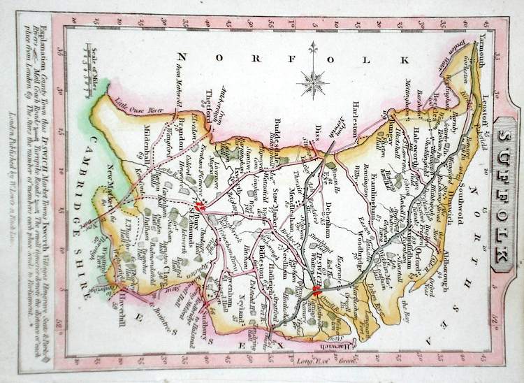
Suffolk Lewis, W. (c. 1835) 14 x 10 Detailed and attractive miniature map of the County by William Lewis for his "Lewis's New Traveller's Guide". A particular feature of this charming series of maps is the clear and precise engraving of the roads. Adjacent numbers indicating the distances from London. Also included with the map is the accompanying page of text giving the county information relevant to travellers - principal towns and inns are listed, distances between towns, principal fair dates, and even sites for the best views of the county. Later colour. 35.00 GBP |
|
Suffolk Dispatch Atlas (1863) 44 x 31 Early outline colour. 20.00 GBP |