Nottinghamshire
Including Nottingham, Mansfield, Worksop, Newark, Retford, Southwell
|
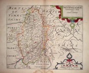
Nottinghamshire 'Nottingamiae Comitatus olim pars Coritanorum' Camden, W (1637) 32 x 27 Copper plate engraved map of Nottinghamshire by William Kip based on Saxton, included in Camden's Brittania, later hand colour, dark impression. Small water stain to lower margin outside of engraved area. 200.00 GBP |


|
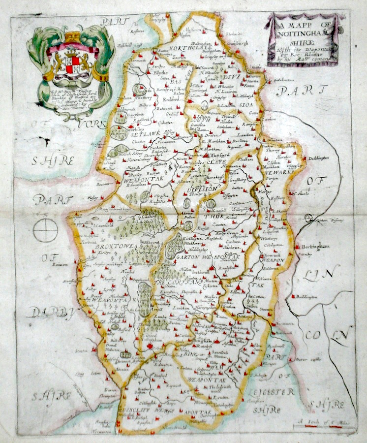
Nottinghamshire 'A Mapp of Nottinghamshire...' Blome, R. (1673) 26 x 32 Decorative map of the County by Richard Blome for his publication "Britannia". The largest series of county maps published by Blome, and generally based on those of Speed. Maps by Blome are characteristic and attractive. Fine condition, later colour. 120.00 GBP |
||||||||||||||
|
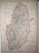
Nottinghamshire 'Nottinghamshire divided into Wapentakes…' Bowen E. and T. (1767) 22.5 x 33 Very finely engraved map of the County by Emanuel and Thomas Bowen from the "Atlas Anglicanus". The maps are generally derived from those in "The Large English Atlas", and extensive county information accompanying the maps is also a feature of this series. A rare item. Bright original colouring. 120.00 GBP |
||||||||||||||
|
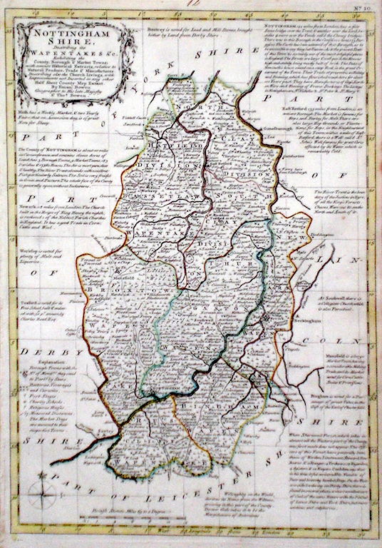
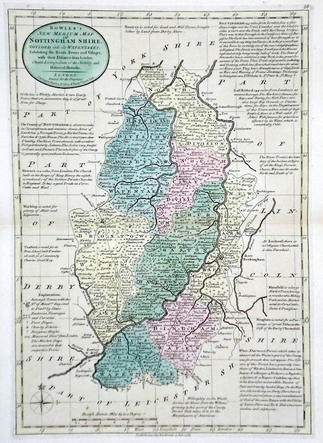
Nottinghamshire 'Bowles's New Medium Map of Nottinghamshire...' Bowen, E. & T. (1785) 23 x 33 Finely engraved and detailed map of the county from "Bowles's New Medium English Atlas". The maps in this series are based on those in Emanuel and Thomas Bowen's Atlas Anglicanus, and feature extensive county information on the map. They are distinguished primarily by having newly engraved cartouches, distances from London added to towns, and different imprints at the bottom. Full original colour. Fine condition. 110.00 GBP |
|
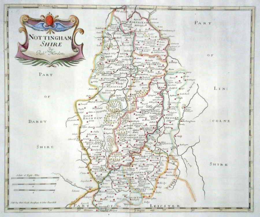
Nottinghamshire 'Nottinghamshire by Robert Morden' Morden, R. (1722) 36 x 42 Superbly engraved and decorative map of the county by Robert Morden. From the 1722 edition of Camden's Britannia. Excellent condition with good margins. Later colour 95.00 GBP |
||||||||||||||
|
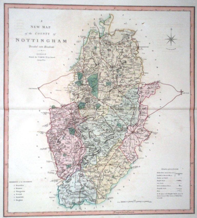
Nottinghamshire 'A New Map of the County of Nottingham divided into hundreds' Smith, C. (1804) 45 x 49 Large size and decorative map of the County by Jones, Smith & Co. for Smith's New English Atlas. The first map of the County to show longitudes measured from the meridian of Greenwich. Very fine original hand colouring. 65.00 GBP |
||||||||||||||
|
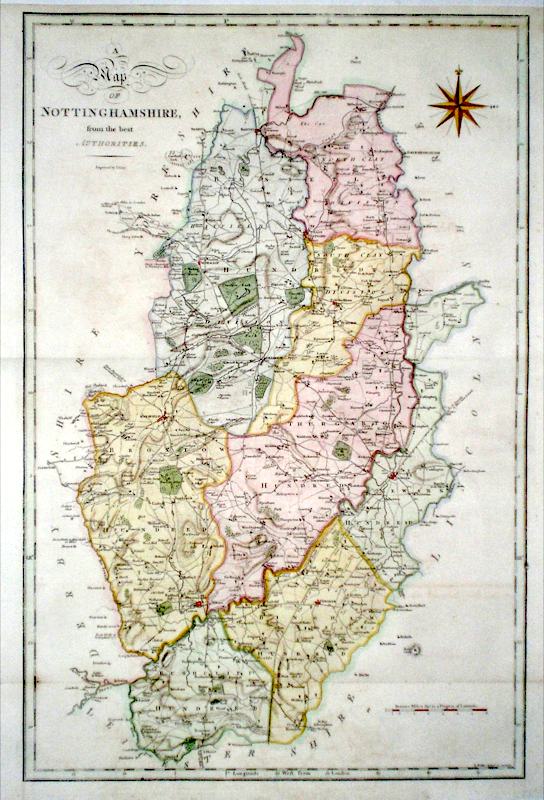
Nottinghamshire 'A Map of Nottinghamshire from the Best Authorities' Cary, J. (1789) 35 x 53 Finely engraved double page map of the county by John Cary for the first edition of Richard Gough's translation of Camden's Britannia. A dark impression with good margins all round. Later colour 60.00 GBP |
|
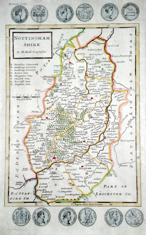
Nottinghamshire Moll, H. (c. 1724) 20 x 32 Finely engraved map of the county by Herman Moll for the publication "A New Description of England and Wales…" The maps in this series include engraved borders of local architectural and antiquarian interest. A unique feature. On this map various ancient coins Later colour, fine condition. 60.00 GBP |
|
Nottinghamshire Simpson, S. (1746) 16 x 18 Fine map of the county by Samuel Simpson for his publication "The Agreeable Historian". Most of the maps in this rare series are said by Simpson to be based on those of Herman Moll. Later colour 50.00 GBP |

|
Nottinghamshire Teesdale, H. (c. 1830) 34 x 42 Attractive and detailed map of the County by Robert Rowe, published by Henry Teesdale. Original colour. Excellent condition. 50.00 GBP |
|
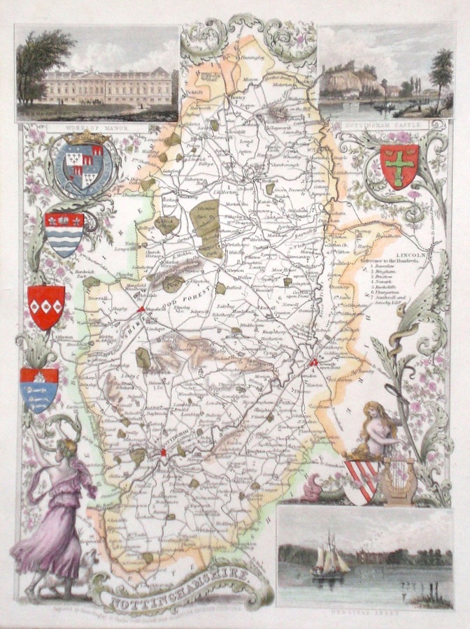
Nottinghamshire Moule, T. (c. 1848) 20 x 26.5 Decorative steel engraved map of the county by Thomas Moule. The inset illustrations are of Worksop Manor, Nottingham Castle, Newstead Abbey. Later colour. 50.00 GBP |
|
Nottinghamshire Rocque, J. (c. 1769) 16 x 20 Finely engraved map of the county by John Rocque for the publication "England Displayed". Later colour 45.00 GBP |
|
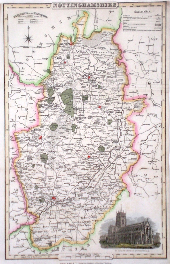
Nottinghamshire Pigot, J. (c. 1826) 23 x 36 Finely engraved map of the county by James Pigot and Co. An early edition ca. 1826. A particular feature of this series of county maps is the attractive accompanying vignette. In this case a view of St. Mary's Church in Nottingham. Re-margined to the top, generally good condition. Later colour 45.00 GBP |
|
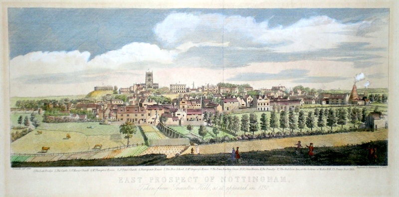
Nottinghamshire 'East Prospect of Nottingham, Taken from Sneinton Hill, as it appeared in 1750' Sandby, T. (1850) 42 x 20 Fine view of the city by Stevenson and co., 1850 after the 1750 drawing by Sandby. Plate mark and good margins. Some skilfully made old repairs and laid onto card but generally fair condition. Later colour. 45.00 GBP |
|
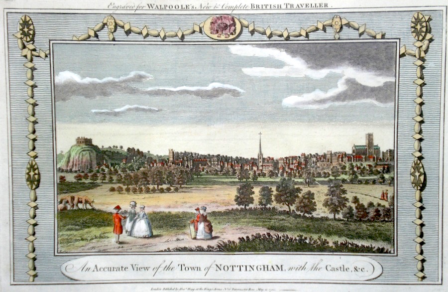
Nottinghamshire 'An Accurate View of the Town of Nottingham with the Castle...' 1784 34 x 23 Fine view of the City probably engraved by Thomas Conder for Walpoole's "New and Complete British Traveller" Later colour 40.00 GBP |
|
Nottinghamshire Roper, J. (1810) 18 x 24 Detailed and decorative map of the county by Cole and Roper for The British Atlas. Original hand colouring. Excellent condition. 40.00 GBP |

|
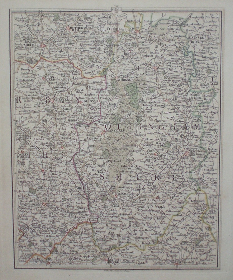
Nottinghamshire 'Map of England and Wales' Cary, J. (c. 1790) 21 x 27 Sheet 42 of John Cary's Map of England and Wales published in 81 sheets. Covers the whole area of Nottinghamshire and also includes Derby, Sheffield etc. Original colour. 40.00 GBP |


|
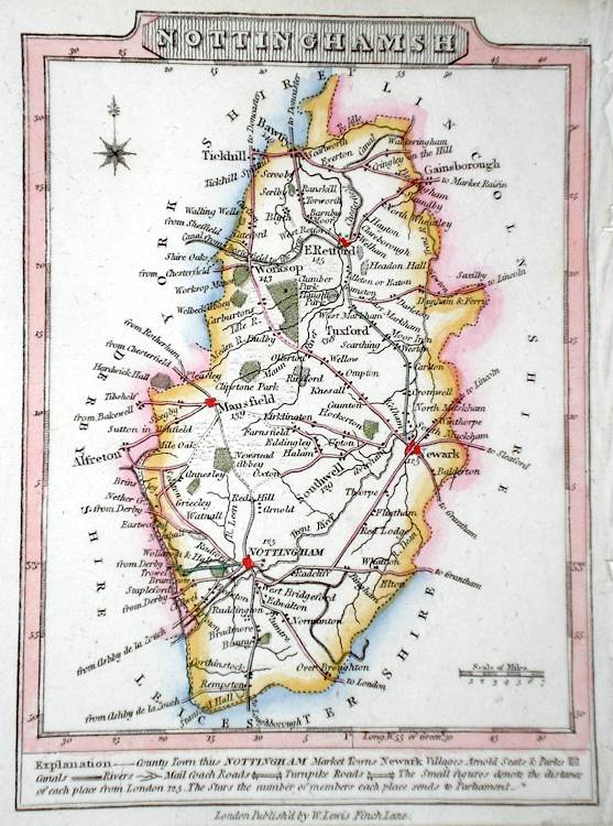
Nottinghamshire Lewis, W. (c. 1835) 10 x 14 Detailed and attractive miniature map of the County by William Lewis for his "Lewis's New Traveller's Guide". A particular feature of this charming series of maps is the clear and precise engraving of the roads. Adjacent numbers indicating the distances from London. Also included with the map is the accompanying page of text giving the county information relevant to travellers - principal towns and inns are listed, distances between towns, principal fair dates, and even sites for the best views of the county. Later colour. 35.00 GBP |
|
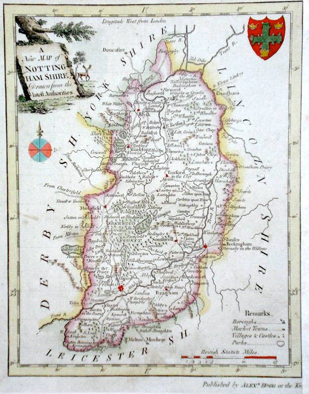
Nottinghamshire 'A New Map of Nottinghamshire Drawn from the latest Authorities' Conder, T. (c. 1784) 16 x 21 Finely engraved map of the county by Thomas Conder for the publication 'The New British Traveller'. Features include a Coat of Arms, and decorative Title Cartouche. Later colour 35.00 GBP |
|
Nottinghamshire Dispatch Atlas (1863) 31 x 44 Early outline colour. 18.00 GBP |