Berkshire
Including Reading, Bracknell, Maidenhead, Newbury, Windsor, Wokingham, Abingdon
|
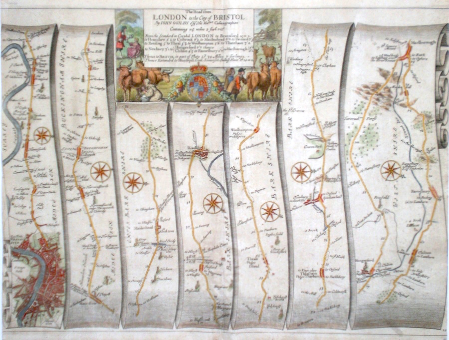
Berkshire 'The Road from London to the City of Bristol...' Ogilby, J. (1698) 46 x 34 The road from West London. to Brentford, Hounslow, Maidenhead, Reading, Newbury, Hungerford, Marlborough. From John Ogilby's Britannia, generally considered one of the most important cartographical works of the seventeenth century. Features include town plan of London, Reading and a fine cartouche depicting a rural scene. Later colour. Plate number 10. Excellent condition. 225.00 GBP |


|
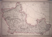
Berkshire 'A Map of the County of Berks' Greenwood, C & J (1829) 69 x 57 Fine original wash colour, vignette of Windsor Castle, good margins, slight offsetting. 200.00 GBP |
|
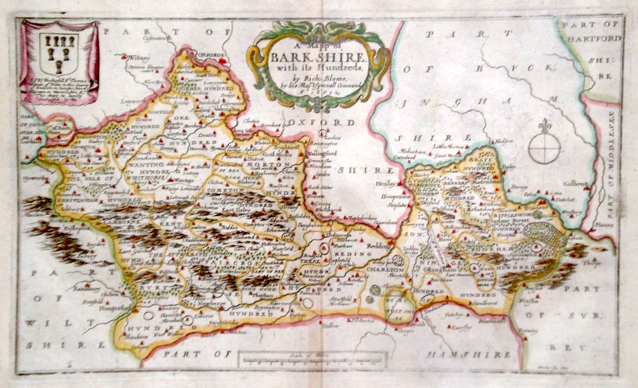
Berkshire 'A Mapp of Barkshire...' Blome, R. (1673) 31 x 19 Decorative map of the County by Richard Blome for his publication "Britannia". The largest series of county maps published by Blome, and generally based on those of Speed. Maps by Blome are characteristic and attractive. Fine condition, later colour. 200.00 GBP |
|
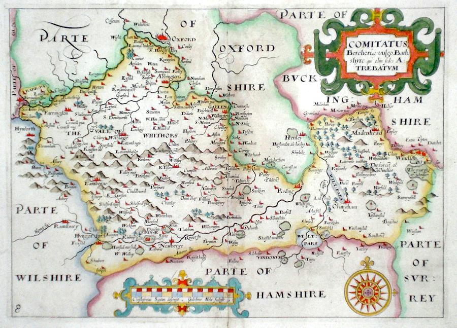
Berkshire 'Comitatus Bercheriae vulgo Barkshyre... Saxton, C. (1637) 32 x 23 Fine map of the county by Christopher Saxton engraved by William Hole for the first edition of Camden's Britannia to contain county maps. Later colour. 185.00 GBP |
|
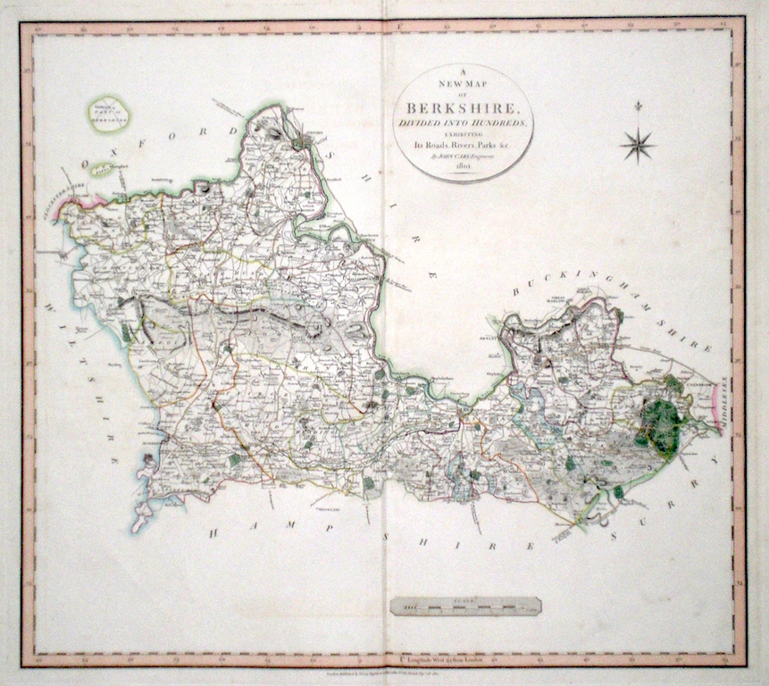
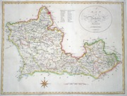
Berkshire 'A New Map of Berkshire divided into Hundreds exhibiting its Roads, Rivers, Parks...' Cary, J. (1809) 54 x 49 Superbly engraved map of the county by John Cary. From "Cary's New English Atlas". The atlas was issued in parts from 1801 to 1809 and published as a complete work in 1809. Very fine original hand colour. 120.00 GBP |
|
Berkshire 'Bowles's New Medium Map of Berk shire...' Bowen, E. & T. (1785) 33 x 23 Finely engraved and detailed map of the county from "Bowles's New Medium English Atlas". The maps in this series are based on those in Emanuel and Thomas Bowen's Atlas Anglicanus, and feature extensive county information on the map. They are distinguished primarily by having newly engraved cartouches, distances from London added to towns, and different imprints at the bottom. Full original colour. Some slight offsetting to the left hand side, otherwise Fine condition 120.00 GBP |
||||||||||||||

|
Berkshire 'Bark Shire by Robt. Morden' Nicholls, S. (1722) 42 x 36 Robert Morden's fine map of Berkshire for Camden's Britannia. Engraved by Sutton Nichols. Later colour 120.00 GBP |

|
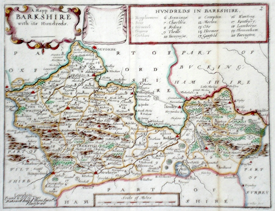
Berkshire 'A Mapp of Barkshire with its hundreds' Hollar, W. (c. 1731) 24 x 18 Finely engraved map of the county by Wenceslaus Hollar from the atlas "England Exactly Described or a Guide to Travellers…" first published by Thomas Taylor, but herewith from the later edition published by Thomas Bakewell. A major addition to the earlier plates is that roads and distances between towns are now included, after the road surveys of John Ogilby. Fine condition. Later colour 95.00 GBP |
|
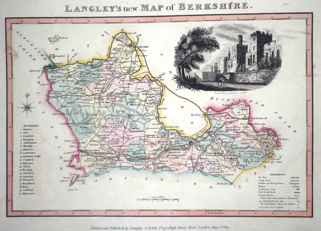
Berkshire 'Langley's new Map of Berkshire' Langley, E. (c. 1818) 26 x 20 Attractive and uncommon map of the county by the partnership of Edward Langley and William Belch from their publication Langley's New County Atlas of England and Wales. The vignette shows a view of Windsor Castle. Fine original hand colouring. 90.00 GBP |
|
Berkshire 'A Map of Berkshire from the Authorities' Cary, J. Camden's Britannia (1798) 53 x 40 Finely engraved double page map. Later colour. 70.00 GBP |
|
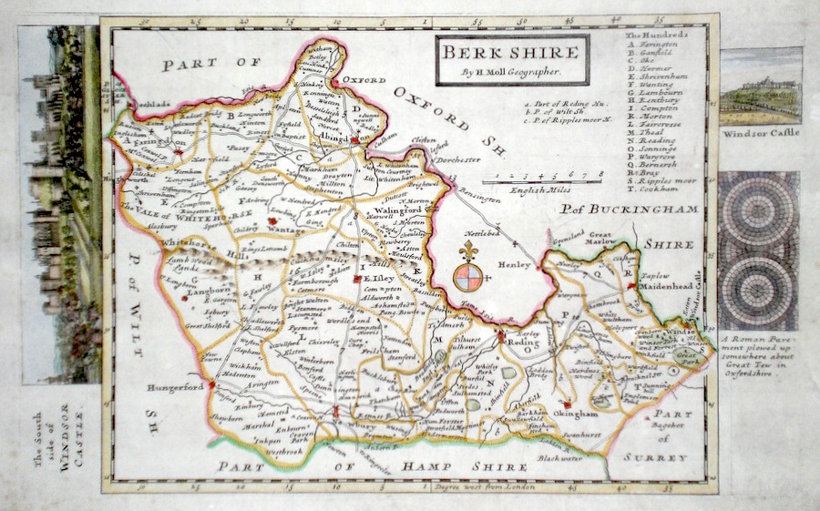
Berkshire Moll, H. (c. 1724) 32 x 20 Finely engraved map of the county by Herman Moll for the publication "A New Description of England and Wales…" The maps in this series include engraved borders of local architectural and antiquarian interest. A unique feature. On this map one large and one smaller views of Windsor Castle, and a diagram of a discovered Roman pavement. Later colour, fine condition. 65.00 GBP |
|
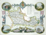
Berkshire Moule, T. (c. 1840) 27 x 21 Steel engraving showing the hundreds and views of Windsor, Abingdon,Virginia Water. Later hand colour. 55.00 GBP |
|
Berkshire 'Berkshire divided into its Hundreds containing the Boroughs and Market Towns with the Roads ' Bowen, E. (c. 1758) 20 x 18 Clearly engraved map of Berkshire from The Natural History of England, part of the General Magazine of Arts and Sciences. 55.00 GBP |
|
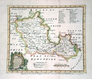
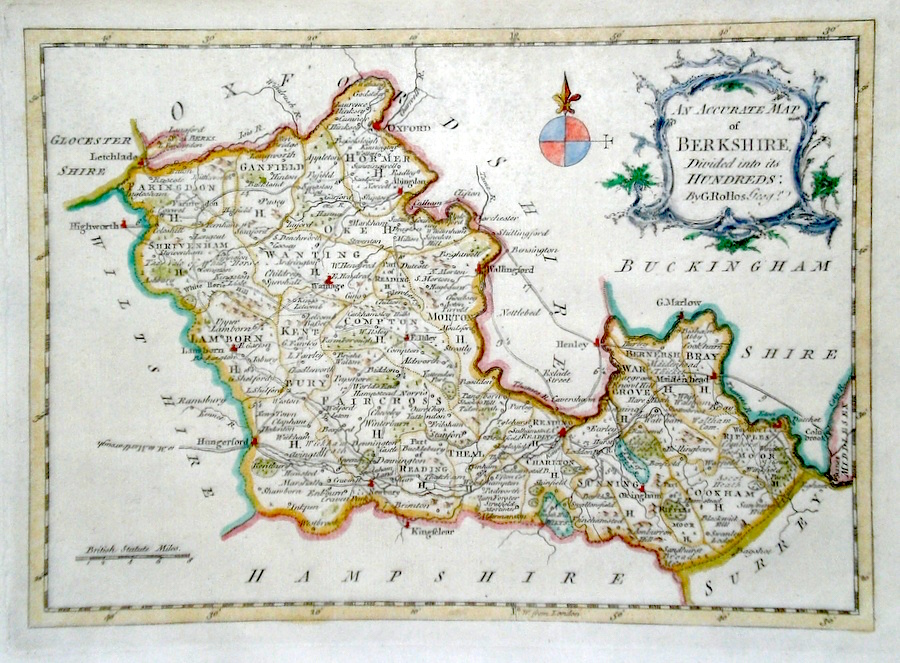
Berkshire 'An Accurate Map of Berkshire divided into its Hundreds...' Rollos, G. (c. 1769) 26 x 19 Finely engraved map of the county by George Rollos for the publication "England Displayed". Later colour 55.00 GBP |
|
Berkshire Seller, J. (c. 1703) 15 x 13 Fine map of the county by the Hydrographer and instrument maker John Seller for his "Anglia Contracta". This series of maps were first published in 1695. They were later used in a simplified form by Francis Grose for his "Supplement to the Antiquities of England and Wales", published from 1787. 50.00 GBP |

|
Berkshire 'A Map of Berkshire' Kitchin/Jefferys (1751) 13.5 x 18 Finely engraved map of the county by Thomas Kitchin and Thomas Jefferys from their publication "The Small English Atlas". This rare series of maps are distinctive by featuring considerable county information below the map. Later colour 50.00 GBP |
|
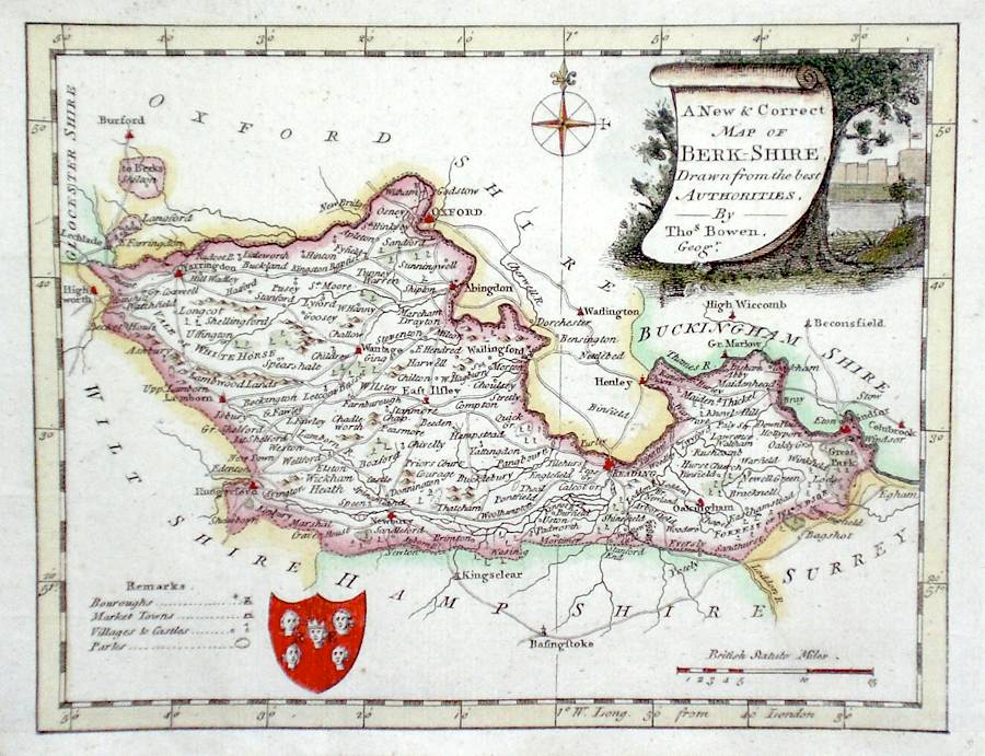
Berkshire 'A New and Correct Map of Berkshire Drawn from the Best Authorities' Bowen, T. (c. 1784) 20 x 16 Finely engraved map of the county by Thomas Bowen for the publication "The New British Traveller" Features include a Coat of Arms, and decorative Title Cartouche. Later colour. 50.00 GBP |
|
Berkshire Walker J & C (c. 1850) 42 x 30 Map of the various hunt regions in the county, from Hobson's Foxhunting Atlas. Shows all the places of the foxhound meetings. Original colour 50.00 GBP |

|
Berkshire Roper, J. (1810) 24 x 18 Detailed and decorative map of the county by Cole and Roper for The British Atlas. Original hand colouring. Excellent condition. 40.00 GBP |

|
Berkshire Seller, J. (c. 1787) 15 x 21 Attractive copperplate map of the county by John Seller from Francis Grose's Antiquities of England and Wales. Accompanying text. 40.00 GBP |
|
Berkshire 'A New Map of Berkshire Drawn from the Best Authorities' Kitchin, T. (1764) 25 x 19.5 Finely engraved and detailed map showing roads, borough and market towns etc. Later colour. 45.00 GBP |
|
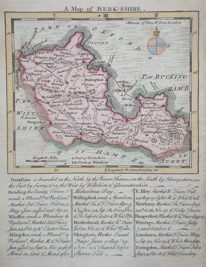
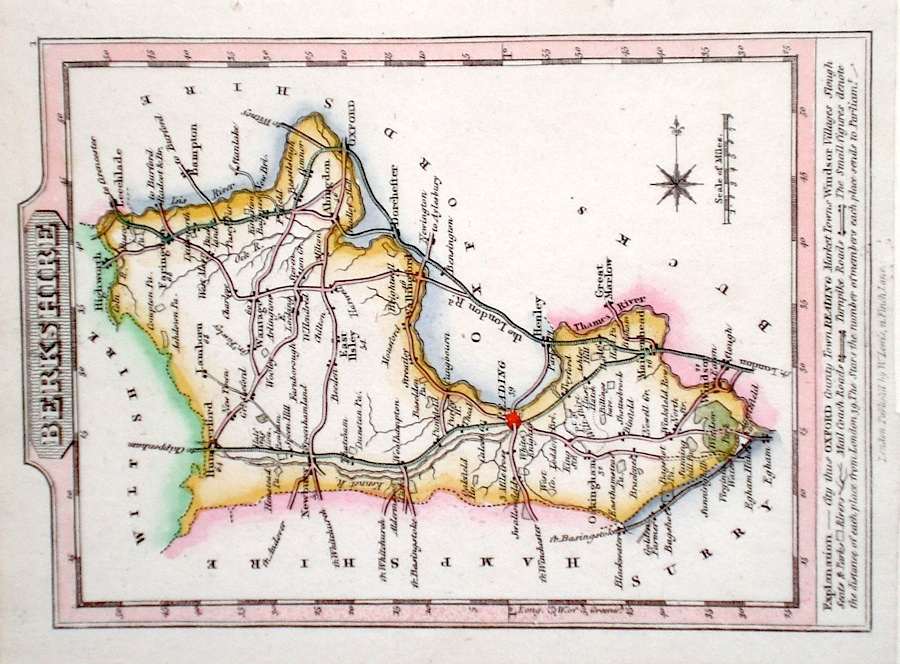
Berkshire Lewis, W. (c. 1835) 14 x 10 Detailed and attractive miniature map of the County by William Lewis for his "Lewis's New Traveller's Guide". A particular feature of this charming series of maps is the clear and precise engraving of the roads. Adjacent numbers indicating the distances from London. Also included with the map is the accompanying page of text giving the county information relevant to travelers - principal towns and inns are listed, distances between towns, principal fair dates, and even sites for the best views of the county. Later colour. 35.00 GBP |
|
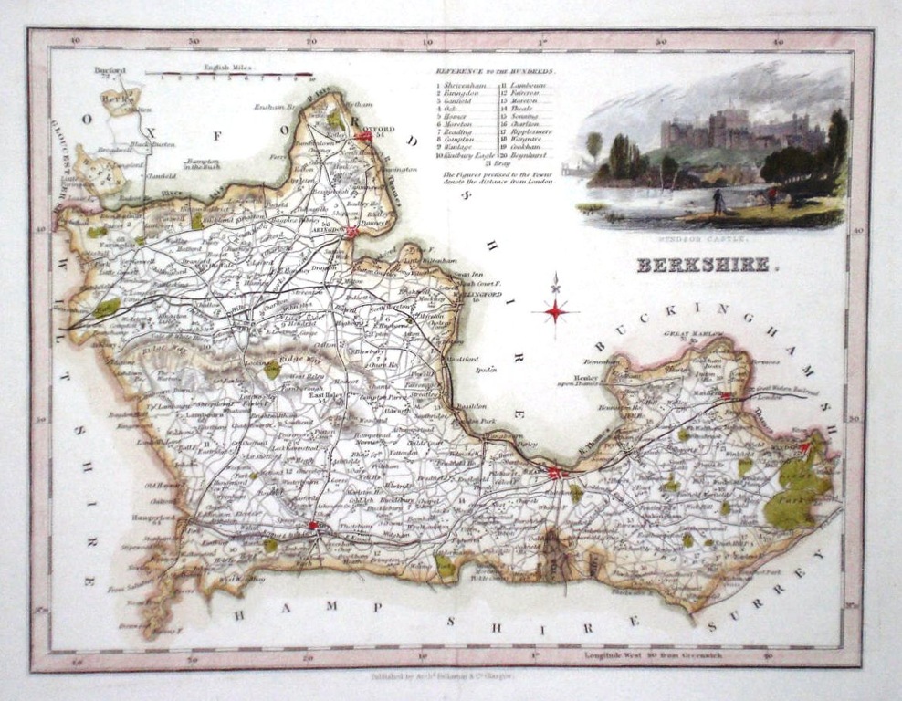
Berkshire Fullarton, A. (c. 1843) 25 x 20 Attractive steel engraved map of the county by Archibald Fullarton. The vignette shows Windsor Castle. Later colour 35.00 GBP |
|
Berkshire Dispatch Atlas (1863) 45 x 31 Early outline colour, 2 cm tear to lower margin, expertly repaired. 20.00 GBP |