Herefordshire
Including Hereford, Ross-on-Wye, Leominster, Ledbury, Bromyard, Kington
|
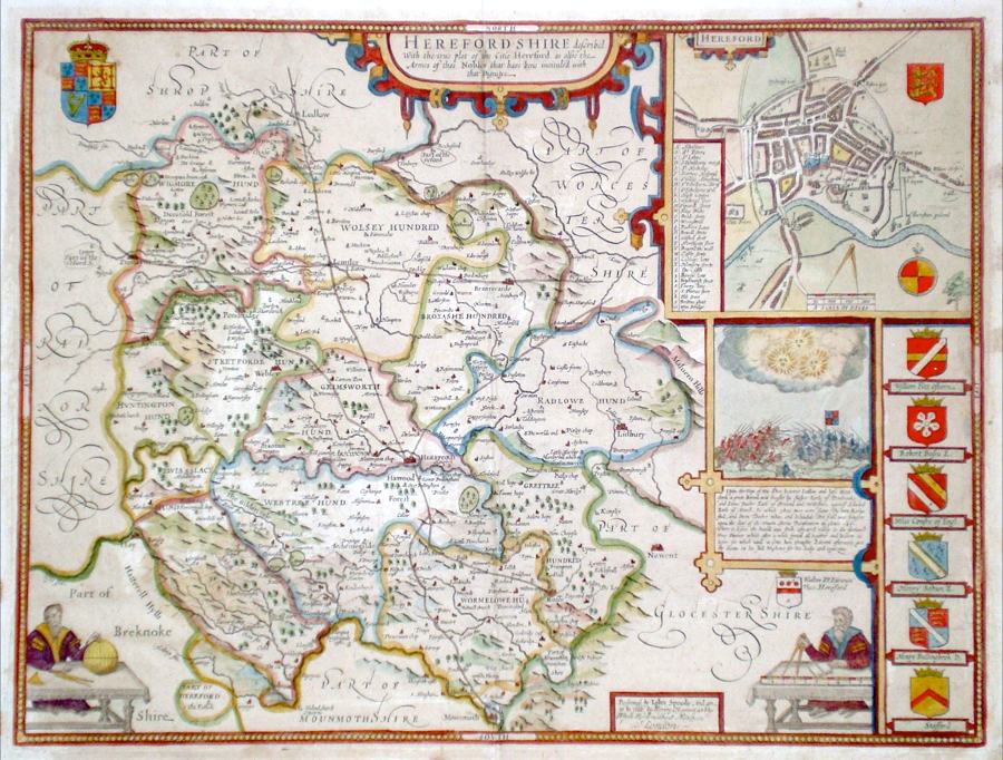
Herefordshire 'Herefordshire described…' Speed, J. (c. 1720-43) 51 x 38 Fine map of the county by John Speed. Published by Henry Overton. It is believed that Overton purchased the Speed plates around 1713, and the map shows further changes to the plate by Overton. The main changes are the addition of roads using information from John Ogilby's Britannia and a change in the publication inscription to "solde by Henry Overton at the White Horse without Newgate". Features include town plan of Hereford, depiction of two cartographers at their work, a battle scene and numerous heraldic shields. No text verso. Early colouring. Old tape marks present in the margins but otherwise in good condition. 335.00 GBP |


|
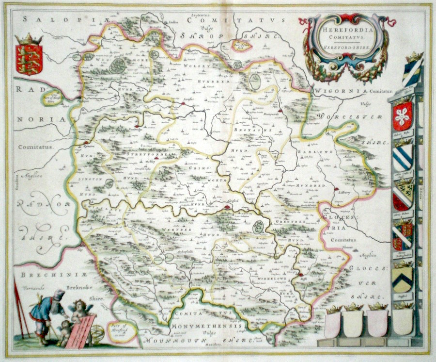
Herefordshire 'Herefordia Comitatus Hereford-shire' Blaeu, J. (c. 1645) 50 x 41 Very fine map of the County by Joan Blaeu. The map embodies the finest features of Dutch Cartography of the Seventeenth century. Superbly engraved and arranged, with shields and coats of arms. A fine cartouche shows a surveyor being assisted by putti. No text verso. Bright Original colour. Excellent condition. 285.00 GBP |
|
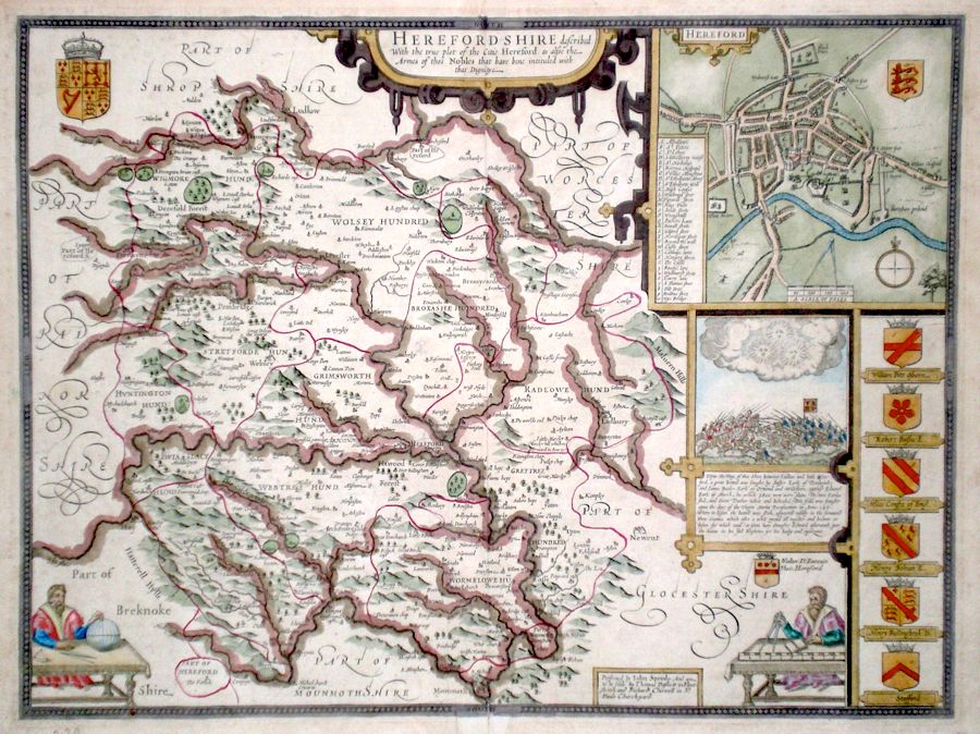
Herefordshire 'Herefordshire described...' Speed, J. (c. 1676) 51 x 38 John Speed's map of the county, published by Bassett and Chiswell. Features include a fine town plan of Hereford, a battle scene and two cartouches of cartographers, one incorporating the scale. Interestingly hand coloured in a traditional style with colour applied to the river systems. English text verso. Large margins 275.00 GBP |
|
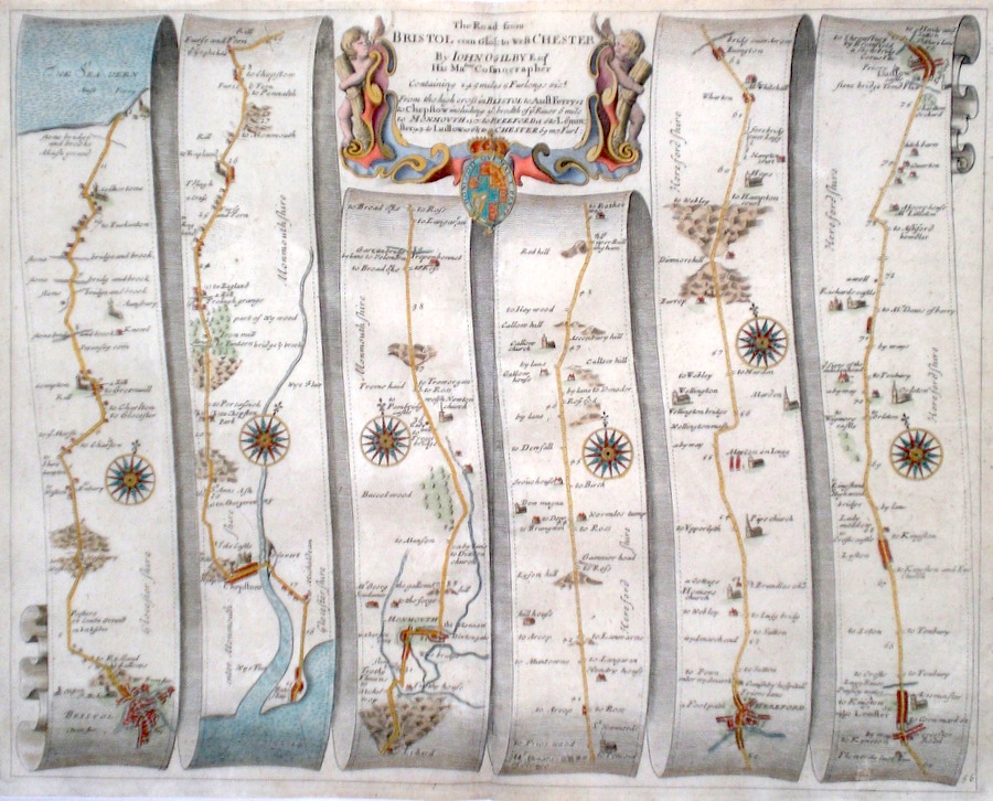
Herefordshire 'The Road from Bristol com. Glos. To West Chester' Ogilby, J. (1698) 44 x 35 The Road from Bristol to Aust Ferry, crossing the Severn river to Chepstow, Monmouth, Hereford, Leominster, Ludlow. From John Ogilby's Britannia, generally considered one of the most important cartographical works of the seventeenth century. Features include town plans of Bristol and Hereford, and a fine cartouche. Later colour. Plate number 56. Excellent condition. 175.00 GBP |
|
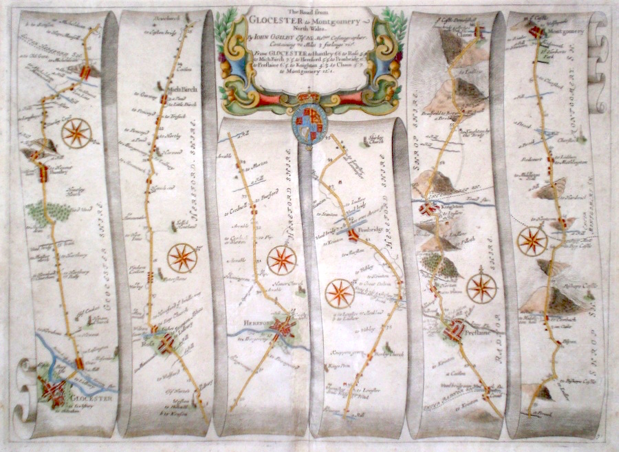
Herefordshire 'The Road from Glocester to Montgomery-North Wales' Ogilby, J. (1698) 45 x 34 The Road from Gloucester to Ross, Hereford, Pembridge, Prestaine, Clunn, Montgomery. From John Ogilby's Britannia, generally considered one of the most important cartographical works of the seventeenth century. Features include town plans of Gloucester and Hereford and a fine cartouche. Later colour. Plate number 71. Excellent condition. 170.00 GBP |
|
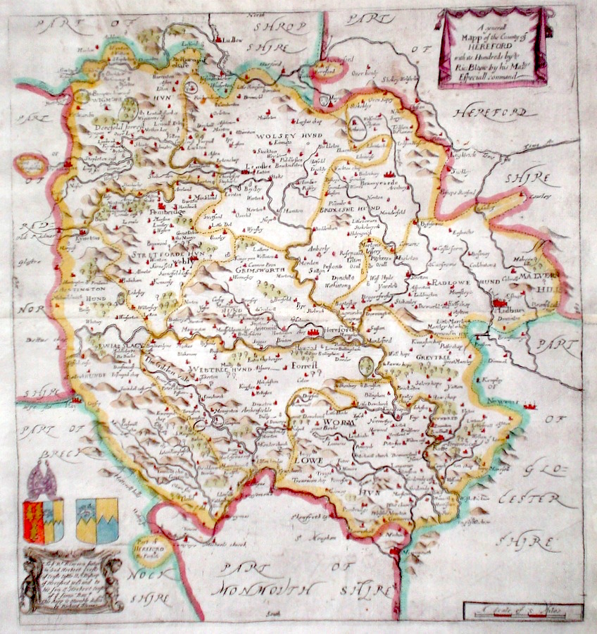
Herefordshire 'A Generall Mapp of the County of Hereford' Blome, R. (1673) 28 x 31 Decorative map of the County by Richard Blome for his publication "Britannia". The largest series of county maps published by Blome, and generally based on those of Speed. Maps by Blome are characteristic and attractive. Fine condition, later colour. 140.00 GBP |
|
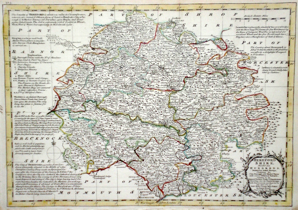
Herefordshire 'Herefordshire divided into Hundreds' Bowen E. & T. (1767) 33 x 22.5 Very finely engraved map of the County by Emanuel and Thomas Bowen from the "Atlas Anglicanus". The maps are generally derived from those in "The Large English Atlas", and extensive county information accompanying the maps is also a feature of this series. A rare item. Bright original colouring. 120.00 GBP |
|
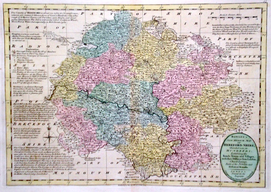
Herefordshire 'Bowles's New Medium Map of Hereford shire...' Bowen, E. & T. (1785) 33 x 23 Finely engraved and detailed map of the county from "Bowles's New Medium English Atlas". The maps in this series are based on those in Emanuel and Thomas Bowen's Atlas Anglicanus, and feature extensive county information on the map. They are distinguished primarily by having newly engraved cartouches, distances from London added to towns, and different imprints at the bottom. Full original colour. Some slight offsetting to the left hand side, otherwise Fine condition 98.00 GBP |
||||||||||||||
|
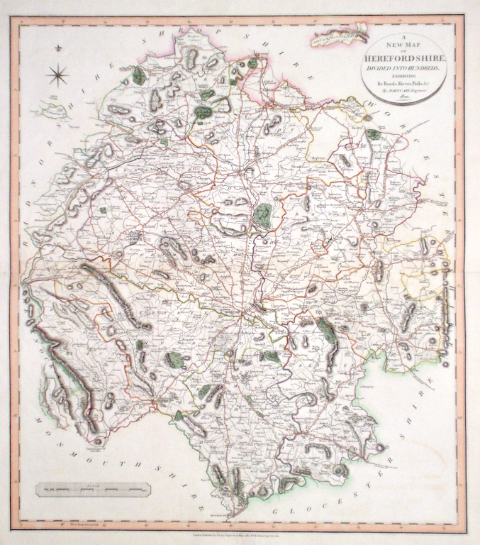
Herefordshire 'A New Map of Herefordshire divided into Hundreds exhibiting its Roads, Rivers, Parks' Cary, J. (1809) 49 x 54 Superbly engraved map of the county by John Cary. From "Cary's New English Atlas". The atlas was issued in parts from 1801 to 1809 and published as a complete work in 1809. Very fine original hand colour. 90.00 GBP |
|
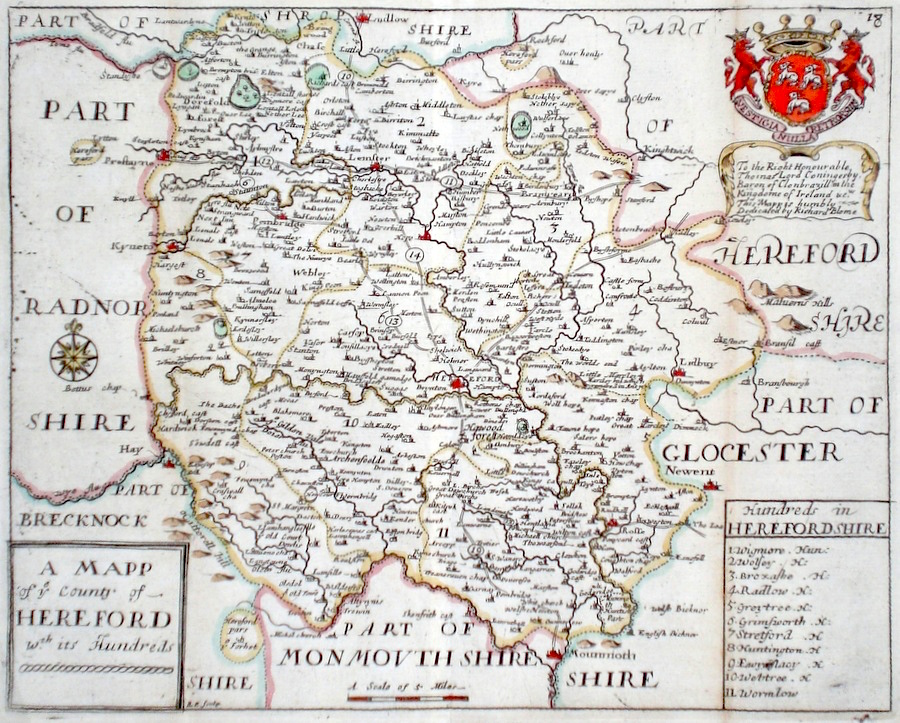
Herefordshire 'A Mapp of ye county of Hereford wth its Hundreds' Palmer, R. (c. 1731) 24 x 19 Finely engraved map of the county by Richard Palmer from the atlas "England Exactly Described or a Guide to Travellers…" first published by Thomas Taylor, but herewith from the later edition published by Thomas Bakewell. A major addition to the earlier plates is that roads and distances between towns are now included, after the road surveys of John Ogilby. Fine condition. Later colour 85.00 GBP |
|
Herefordshire 'Herefordshire by Robt. Morden' Morden, R. (1722) 42 x 36 Finely engraved Map of the county by Robert Morden. From the 1722 edition of Camden's Britannia. Decorative map with later colour. 75.00 GBP |
|
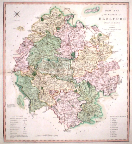
Herefordshire 'A New map of the County of Hereford divided into hundreds' Smith, C. (1804) 45 x 50 Large size and decorative map of the County by Jones, Smith & Co. for Smith's New English Atlas. The first map of the County to show longitudes measured from the meridian of Greenwich. Very fine original hand colouring. 60.00 GBP |
|
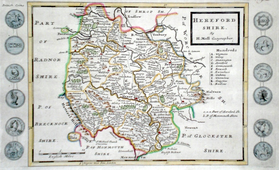
Herefordshire Moll, H. (c. 1724) 32 x 20 Finely engraved map of the county by Herman Moll for the publication "A New Description of England and Wales…" The maps in this series include engraved borders of local architectural and antiquarian interest. A unique feature. On this map various ancient coins Later colour, fine condition. 60.00 GBP |
||||||||||||||
|
Herefordshire 'A Map of Hereford-shire' Kitchin/Jefferys (1751) 14 x 18 Finely engraved map of the Country by Thomas Kitchin and Thomas Jefferys from their publication "The Small English Atlas" This rare series of county maps are notable for the accompanying county information. Later colour 50.00 GBP |
|
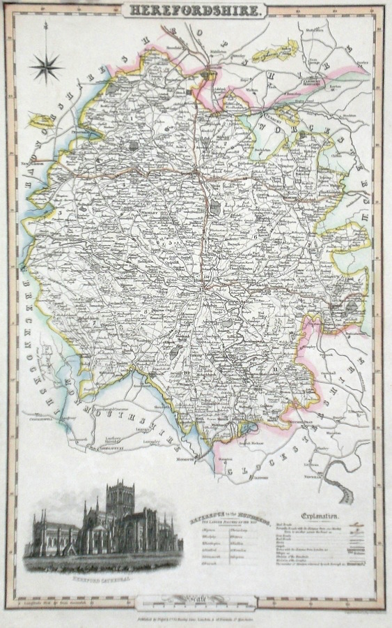
Herefordshire Pigot, J. (c. 1826) 23 x 36 Attractive and detailed steel engraved map by James Pigot from his publication Pigot & Co.'s British Atlas. Features include a fine vignette engraving of Hereford Cathedral. Original hand colour. Excellent condition 50.00 GBP |
|
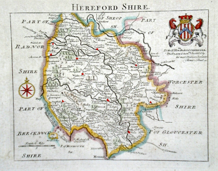
Herefordshire Rocque, J. (c. 1769) 20 x 16 Finely engraved map of the county by John Rocque for the publication "England Displayed". The coat of Arms to the right are those of Lord Carpenter. Later colour 50.00 GBP |
|
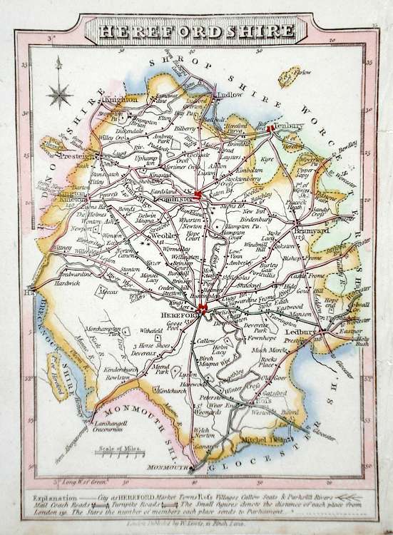
Herefordshire Lewis, W. (c. 1835) 10 x 14 Detailed and attractive miniature map of the Region by William Lewis for his "Lewis's New Traveller's Guide". A particular feature of this charming series of maps is the clear and precise engraving of the roads. Adjacent numbers indicating the distances from London. Also included with the map is the accompanying page of text giving the county information relevant to travellers,- principal towns and inns are listed, distances between towns, principal fair dates, and even sites for the best views of the county. Later colour. 35.00 GBP |
|
Herefordshire 'A Modern Map of Herefordshire Drawn from the latest Surveys...' Ellis, J. (c. 1766) 20 x 25 Scarce and finely detailed map of the county by John Ellis. Published in Ellis's English Atlas. Later colour 35.00 GBP |
