Wales
|
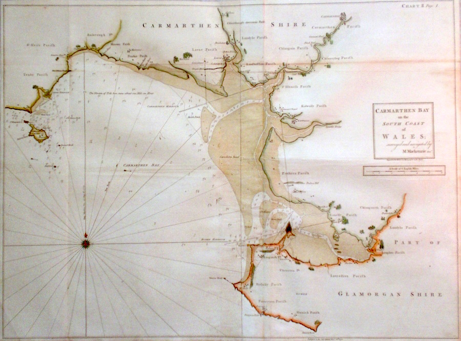
Wales 'Carmarthen Bay on the South Coast of Wales; surveyed and navigated by M Mackenzie Senr.' Kitchen, T. (c. 1775) 93 x 68 Superb large scale chart of the Carmarthen and western Glamorganshire coastline of Wales surveyed by Mackenzie and engraved by Thomas Kitchen. Condition excellent. Later colour 375.00 GBP |


|
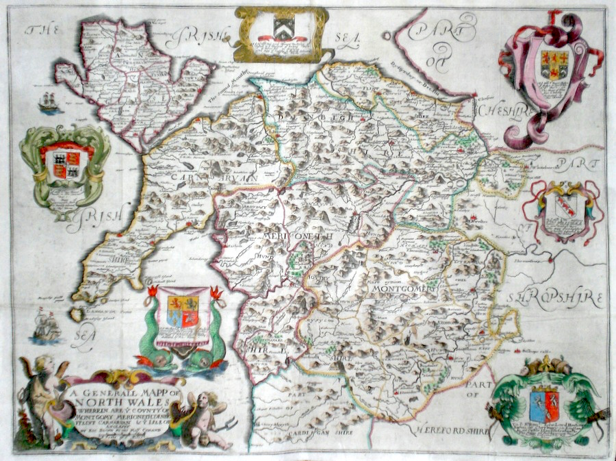
North Wales 'A General Mapp of North Wales' Blome, R. (1673) 45 x 34 Decorative map of the area by Richard Blome for his publication "Britannia". The largest series of county maps published by Blome, and generally based on those of Speed. The counties included in this map are: Carnarvon, Flint, Denbigh, Merioneth, Mongomery and The Island of Anglesey Maps by Blome are characteristic and attractive. Old folds but generally excellent condition, later colour. 250.00 GBP |
|
Wales 'The South Coast of Cardigan Bay in Wales; surveyed and navigated by M. Mackenzie Senr.' Bowen, T. (c. 1775) 144 x 50 Superb large scale chart of the Pembrokeshire and Cardiganshire coastline of Wales surveyed by Mackenzie and engraved by Bowen. Condition excellent. Later colour 245.00 GBP |

|
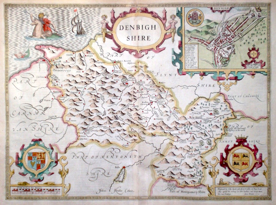
Denbighshire Speed, J. (c. 1646) 51 x 38 Superb copy of John Speed's map of Denbighshire. Engraved by Jodocus Hondius for The Theatre of the empire of Great Britaine. Features include town plan of Denbigh, and mythological creatures in the sea. A good impression. English text verso. Condition excellent. Later colour. 250.00 GBP |
|
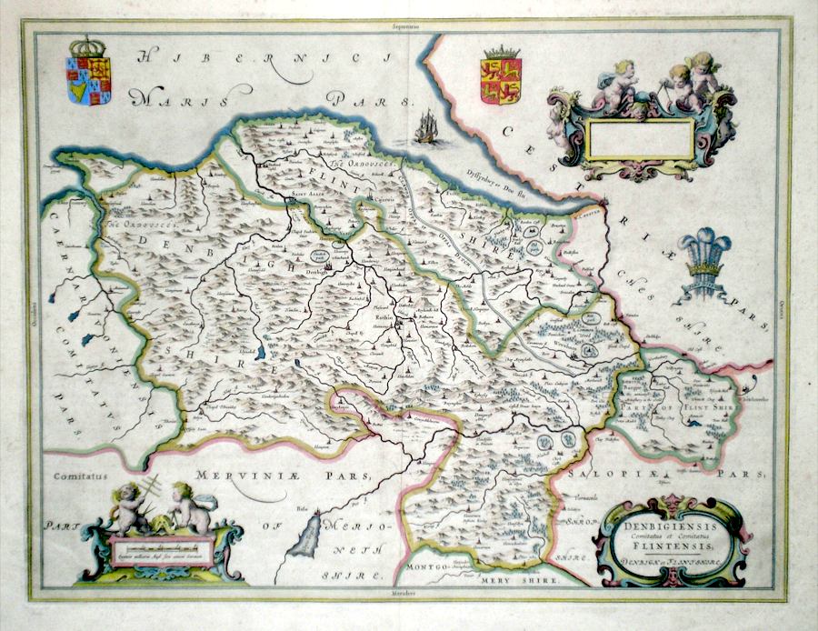
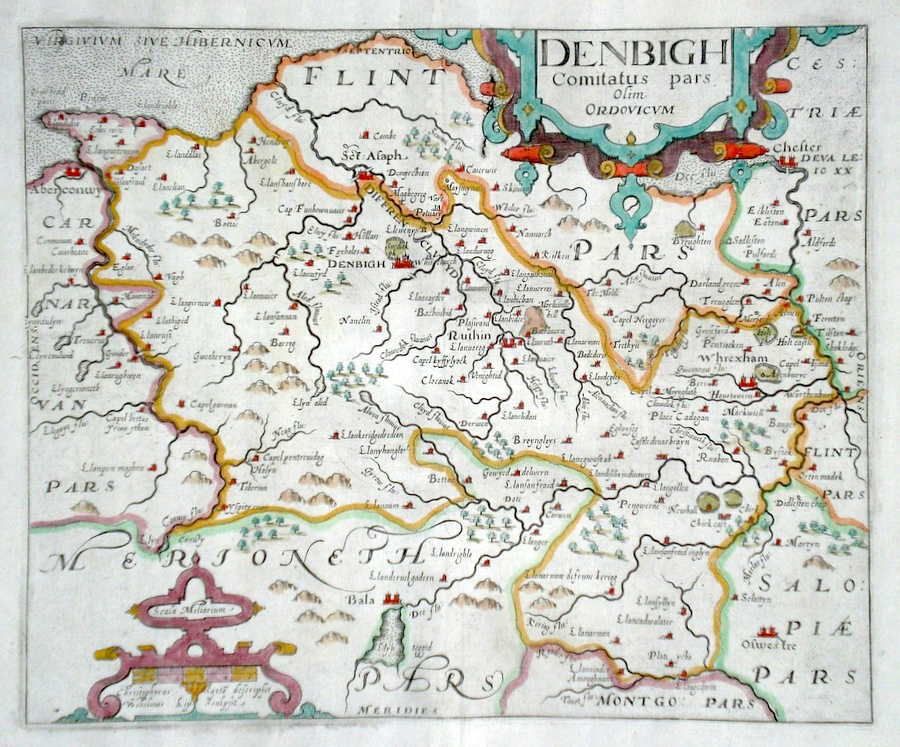
Denbigh & Flintshire 'Denbigiensis comitatus et comitatus Flintensis' Blaeu, J. (c. 1645) 50 x 38.5 Decorative and finely engraved map of the two counties by J. Blaeu. The map is after Speed who showed the two counties separately. Features include two coats of arms, The Prince of Wales feathers, two cartouches with putti, and a separate title cartouche. A galleon is shown navigating the river Dee estuary. Old colour. Excellent condition. 195.00 GBP |
|
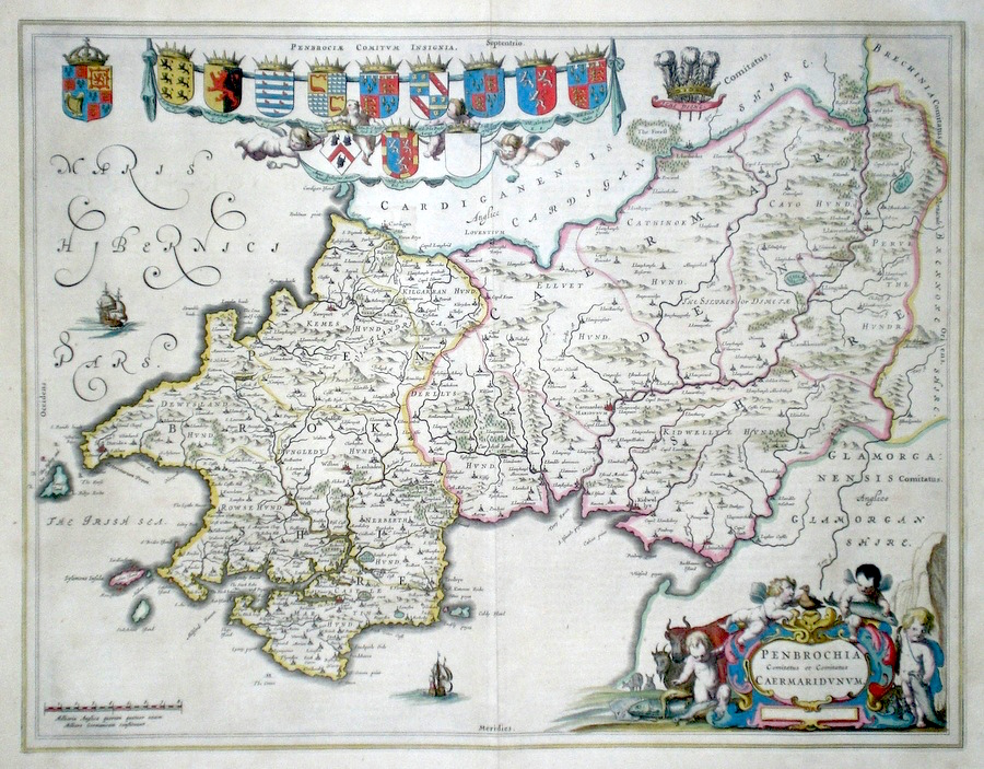
Pembrokeshire and Caermathenshire 'Penbrochia Comitatus et Comitatus Caermaridunum' Blaeu, J. (c. 1650) 53 x 42 Superbly engraved map of the two Counties Pembrokeshire and Caermarthenshire by Joan Blaeu. A fine example of map-making by the pre-eminent Dutch mapmaker of the Seventeenth century. Decoratively arranged with multiple coats of arms, the Prince of Wales emblem and a fine title cartouche with fishing, cattle and wildfowl embellishments. French text verso. Fine condition with full margins. Original colour of very high standard. 195.00 GBP |
|
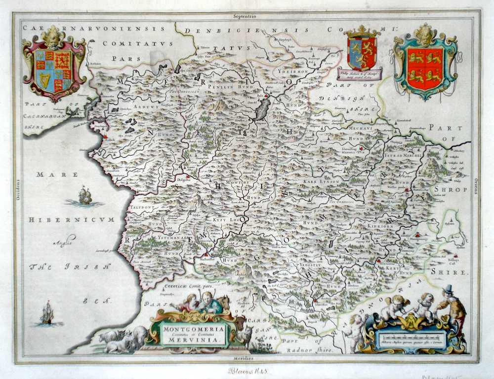
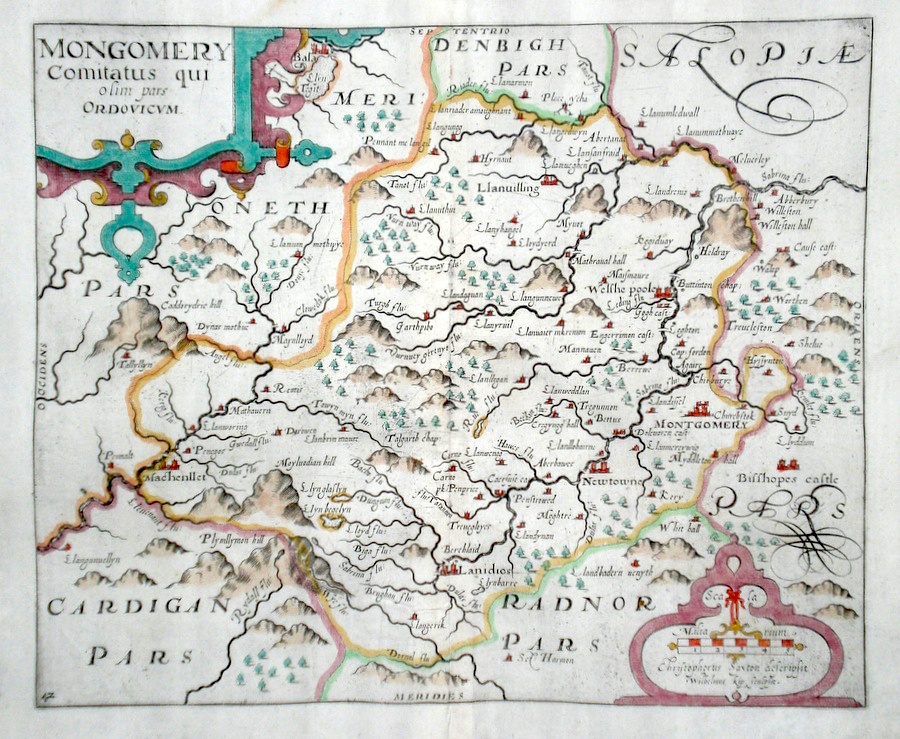
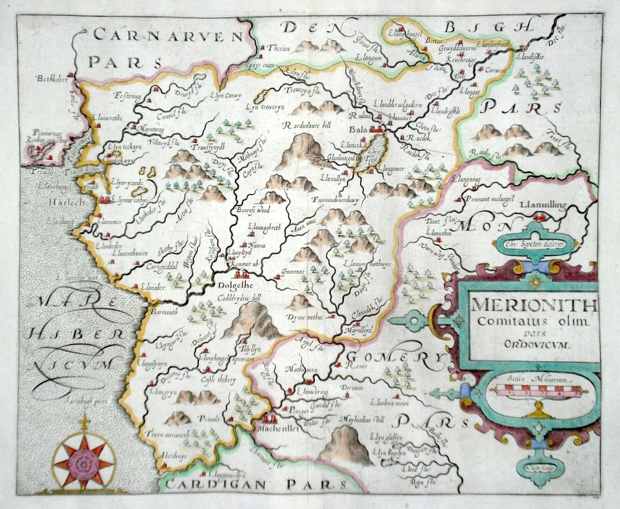
Montgomeryshire and Merionethshire 'Montgomeria Comitatus et Comitatus Mervinia' Blaeu, J. (c. 1645) 50 x 38.5 Very finely engraved map of the two Counties, Montgomeryshire and Merionethshire which constitute the whole of the central area of Wales. Engraved and published by Johannes Blaeu, after Jansson. Features include two attractive cartouches, and Coats of Arms. Galeons sailing in The Irish Sea. Latin text verso. Beneath the map written in ink in an old hand "Blaeu 1645". Margins, a little reduced. Hand colour 170.00 GBP |
|
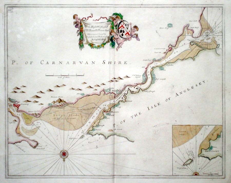
North Wales The Menai Straits Collins, Capt. G. (c. 1700) 58 x 46 Fine, untitled sea-chart of The Menai Strait by Captain Greenvile Collins. The survey extends on the north shore from Landdwin point to Twyndu, in Anglesey and on the southern shore from Conway to Dinas Dinlle on the mainland North Wales. Features include a very fine dedication Cartouche, to Sir William Williams. North is to the bottom on this survey. Later colour condition excellent. 175.00 GBP |
|
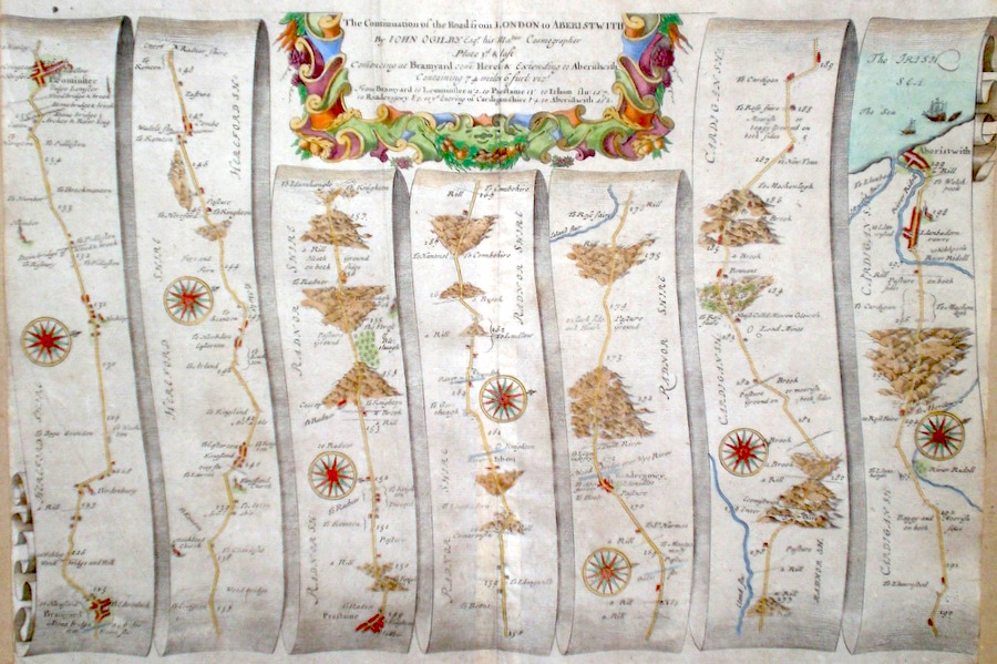
Wales 'The Continuation of the Road from London to Aberistwith ' Ogilby, J. (c. 1698) 44 x 32 The road from Bramyard to Leominster, Prestaine, Riadergowy, Aberystwyth in Cardiganshire. From John Ogilby's Britannia, generally considered one of the most important cartographical works of the seventeenth century. Features include town plans of Leominster, Aberystwyth, and a fine cartouche. Later colour. Plate number 3. Slightly trimmed to left and right. Otherwise good condition 180.00 GBP |
|
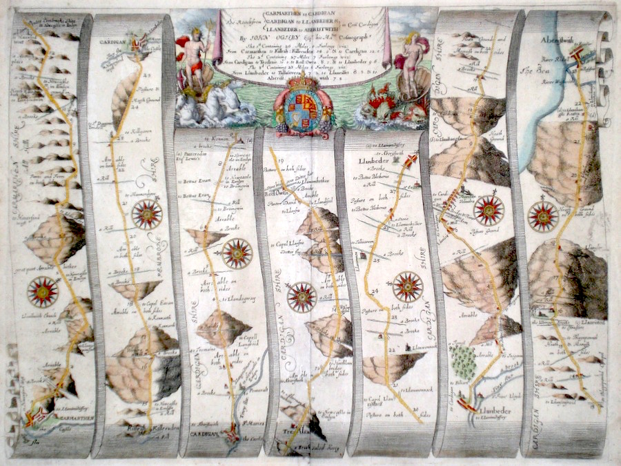
Wales 'The Road from Carmarthen to Cardigan, to Llanbeder, to Aberistwith' Ogilby, J. (1698) 45 x 34 The Road from Carmarthen to Cardigan, Llanpeter, Aberystwyth. From John Ogilby's Britannia, generally considered one of the most important cartographical works of the seventeenth century. Features include town plans of Carmarthen and Cardigan and a fine cartouche depicting a mythical seascape with sea monsters and white horses. Later colour. Plate number 91, Excellent condition. 170.00 GBP |
|
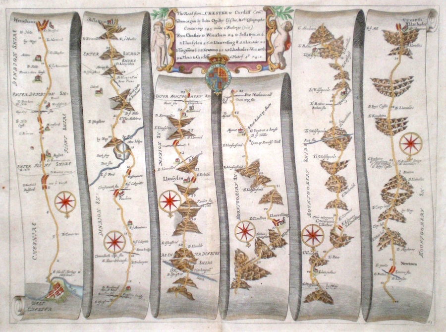
Wales 'The Road from Chester to Cardiff com. Glamorgan' Ogilby, J. (c. 1698) 43 x 32 The Road from Chester to Wrexham, Selattyn, Llanfyllin, Llanvelling, Llanfair, Newtown, Llanbader Vunneth. From John Ogilby's Britannia, generally condidered one of the most important cartographical works of the seventeenth century. Features include town plan of Chester and a fine cartouche. Later colour. Plate number 63. Excellent condition 170.00 GBP |
|
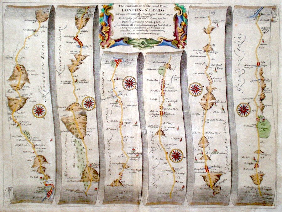
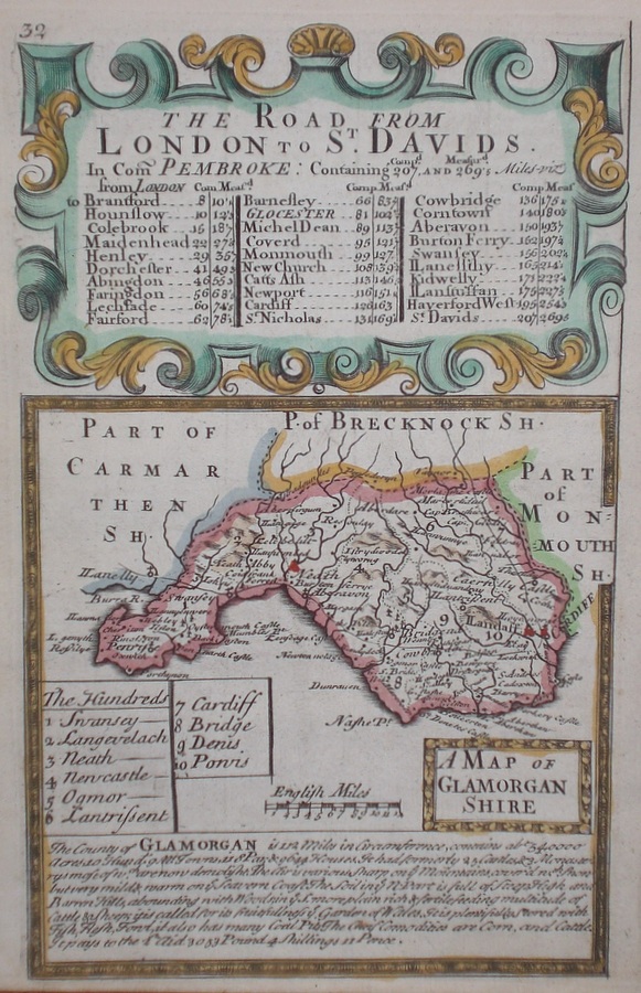
Wales 'The Continuation of the Road from London to St. Davids' Ogilby, J. (c. 1698) 44 x 33 The road from Monmouth to Newchurch, Newport, Cardiff, Cowbridge, Aberavon, Burton ferry. From John Ogilby's Britannia, generally considered one of the most important cartographical works of the seventeenth century. Features include town plans of Monmouth, Cardiff, and a fine cartouche. Later colour. Plate number 16 Excellent condition 170.00 GBP |
|
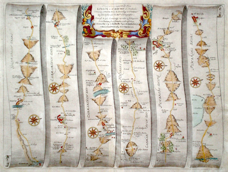
Wales 'The Continuation of the Road from London to St. Davids' Ogilby, J. (c. 1698) 44 x 33 The road from Burton ferry to Swansea, Llanethly, Kidwelly, Llantuffan, Haverford West, St. Davids. From John Ogilby's Britannia, generally considered one of the most important cartographical works of the seventeenth century. Features include town plans of Llanethly, Haverford West, and a fine cartouche. Later colour. Plate number 17 Excellent condition 170.00 GBP |
|
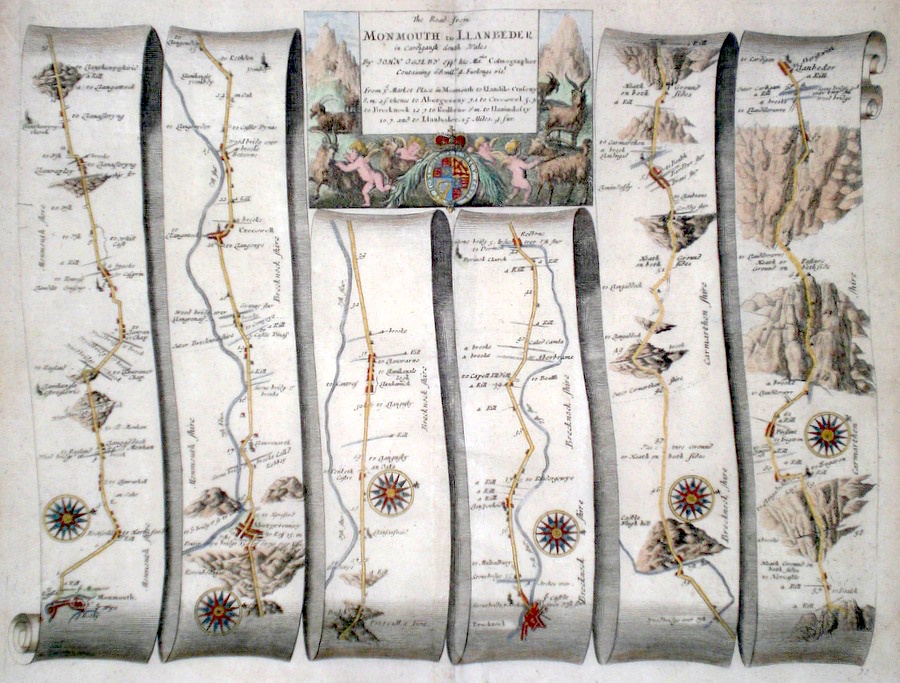
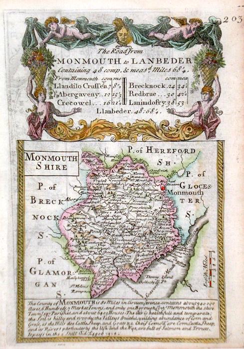
Wales 'The Road from Monmouth to Llanbeder in Cardigansh South Wales' Ogilby, J. (1698) 44 x 34 The road from Monmouth to Abergavenney, Crickhowell, Brecknock, Llandovery, Lampeter. From John Ogilby's Britannia, generally considered one of the most important cartographical works of the seventeenth century. Features include town plan of Monmouth and a fine cartouche depicting Putti herding goats in a mountain landscape. Later colour. Plate number 77. Excellent condition 160.00 GBP |
|
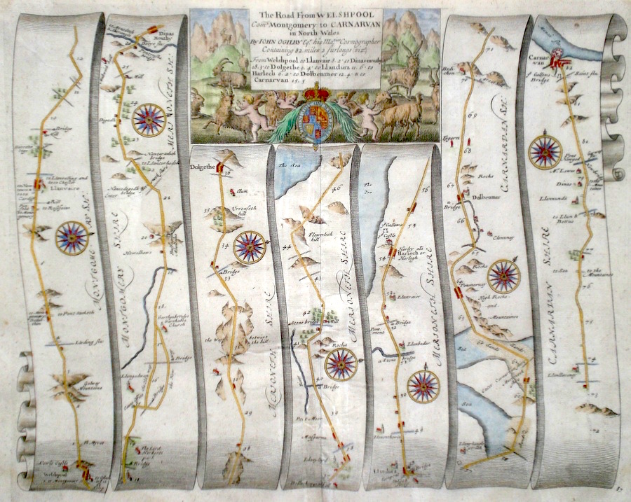
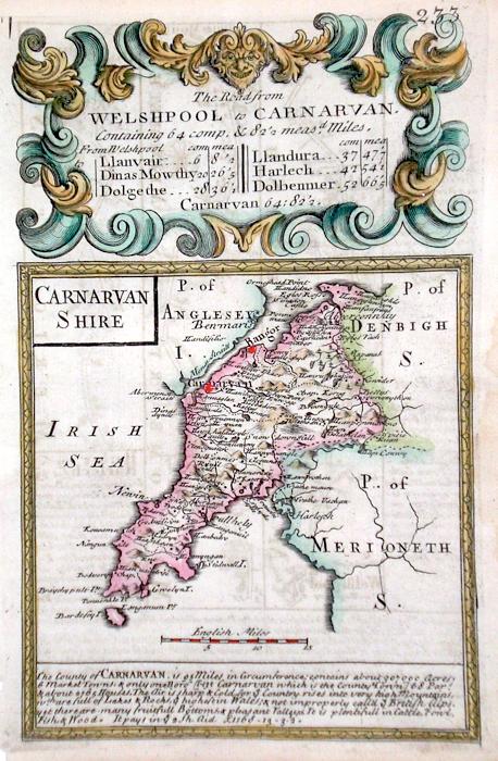
Wales 'The Road from Welshpool Com. Montgomery to Carnarvan in North Wales' Ogilby, J. (c. 1698) 43 x 34 The road from Welshpool to Llanvair, Dinas, Dolgethly, Llandura, Harlech, Dolbenma, Carnarvan. From John Ogilby's Britannia, generally considered one of the most important cartographical works of the seventeenth century. Features include town plans of Carnarvan , and a fine cartouche depicting Mountains, goats and putti. Later colour. Plate number 87 Excellent condition 160.00 GBP |
|
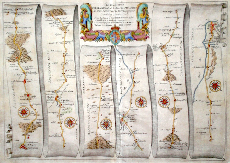
Wales 'The Road from Prestaine in Com. Radnor to Carmarthen' Ogilby, J. (c. 1698) 44 x 32 The road from Prestaine to Bealth, Llandovery, Abermarlis, Rue Raddor, Carmarthen. From John Ogilby's Britannia, generally considered one of the most important cartographical works of the seventeenth century. Features include town plans of Carmarthen, Bealth, and a fine cartouche. Later colour. Plate number 84. Excellent condition 160.00 GBP |
|
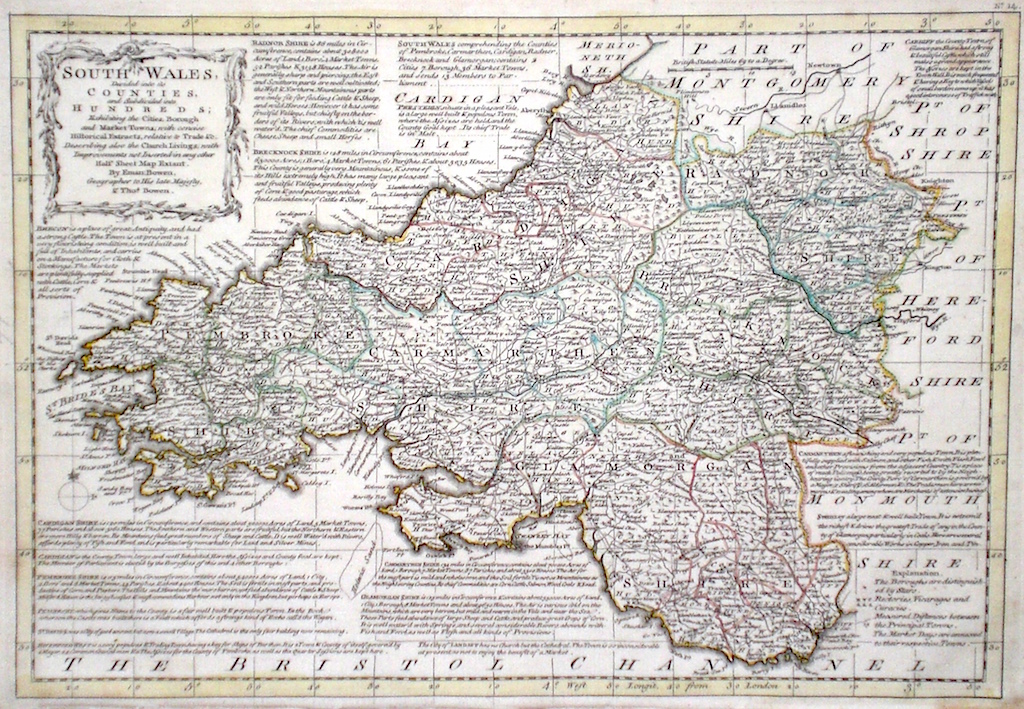
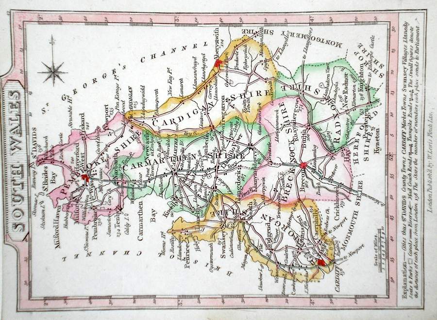
South Wales 'South Wales divided into its Counties and subdivided into Hundreds….' Bowen E. and T. (1767) 33 x 22.5 Very finely engraved map of South Wales by Emanuel and Thomas Bowen from the "Atlas Anglicanus". The maps are generally derived from those in "The Large English Atlas", and extensive county information accompanying the maps is also a feature of this series. A rare item. Bright original colouring. 165.00 GBP |
|
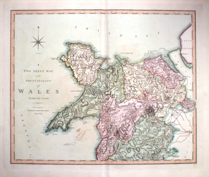
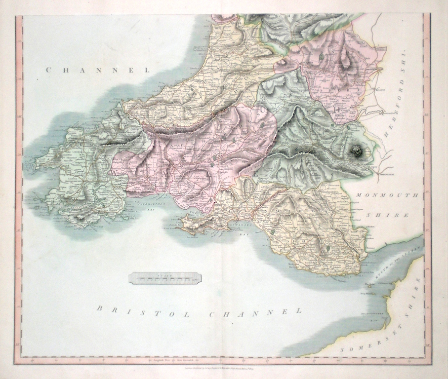
Wales 'A Two Sheet Map of the Principality of Wales Divided into Counties' Smith, C. (1804) 54 x 44 (2) Large size and decorative map of Wales by Jones, Smith & Co. for Smith's New English Atlas. Shows longitudes measured from the meridian of Greenwich. Two double page folio sheets. Very fine original wash colouring to the Counties 140.00 GBP |
|
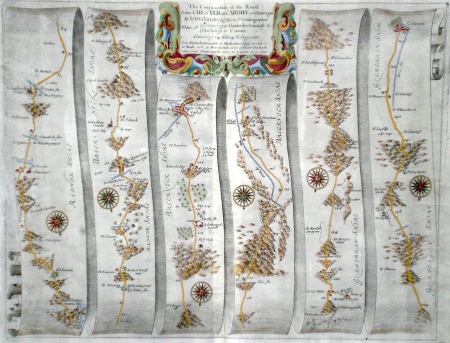
Wales 'The Continuation of the Road from Chester to Cardiff' Ogilby ,J. (c. 1698) 45 x 34 The Continuation of the Road from Chester to Cardiff. From John Ogilby's Britannia, generally considered one of the most important cartographical works of the seventeenth century. The road crosses Radnorshire, and Brecknockshire into Glamorganshire and to Cardiff. Features include small scale town plans of Brecknock and Cardiff. Plate number 64. Good condition. Later colour 135.00 GBP |
|
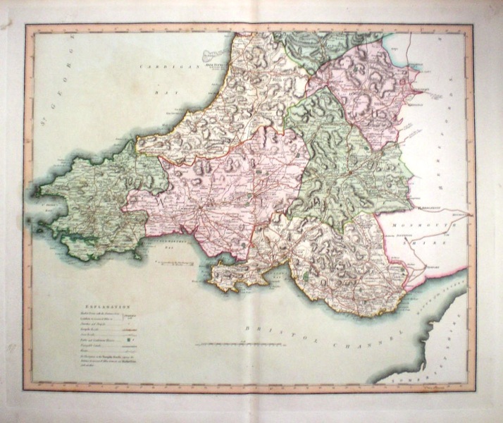
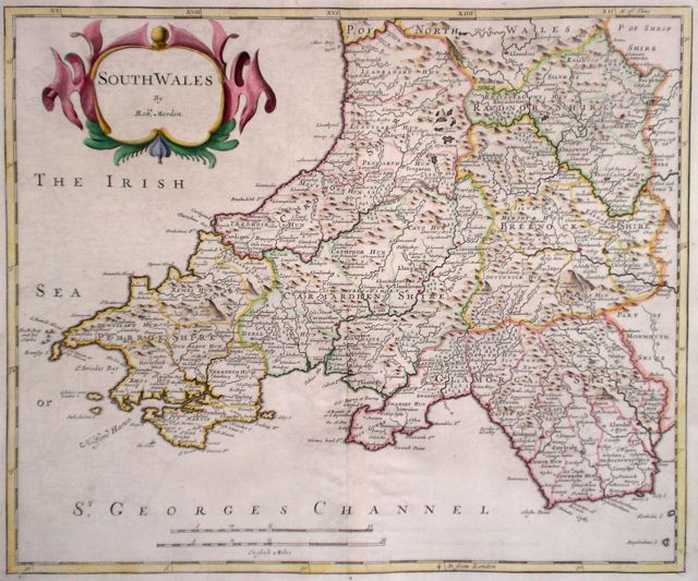
Wales 'South Wales by Robt. Morden' Morden, R. (1722) 43 x 36 Finely engraved map of South Wales, from the 1722 edition of Camden's Britannia. Excellent condition, good margins. Later colour. 120.00 GBP |
|
North Wales 'A New and Correct Map of North-Wales' Morden, R. (1722) 43 x 36 Superbly engraved and decorative map of North Wales by Robert Morden. From the 1722 edition of Camden's Britannia. Excellent condition. A dark copy with good margins. Later colour 120.00 GBP |

|
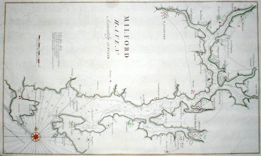
Wales 'Milford Haven Accurately Surveyd' Halley, E. (c. 1730) 30 x 49 Chart of Milford Haven harbour By Edmund Halley & Nathaniel Cutler published in the Atlas Maritimus & Commercialis. Halley was one of England's foremost astronomers but was also an accomplished mapmaker and surveyor. Later colour 95.00 GBP |
|
South Wales 'Cary, J. (1809) 57 x 49 Superbly engraved map of South Wales county by John Cary. From "Cary's New English Atlas". The atlas was issued in parts from 1801 to 1809 and published as a complete work in 1809. Very fine original hand colour. 85.00 GBP |
|
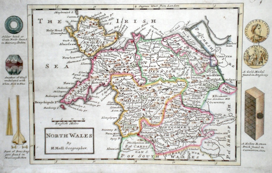
North Wales Moll, H. (c. 1724) 32 x 20 Finely engraved map of North Wales by Herman Moll for the publication "A New Description of England and Wales…" The maps in this series include engraved borders of local architectural and antiquarian interest. A unique feature. On this map various stone and ancient antiquities and also gold medals and a Roman brick. Later colour, fine condition. 60.00 GBP |
|
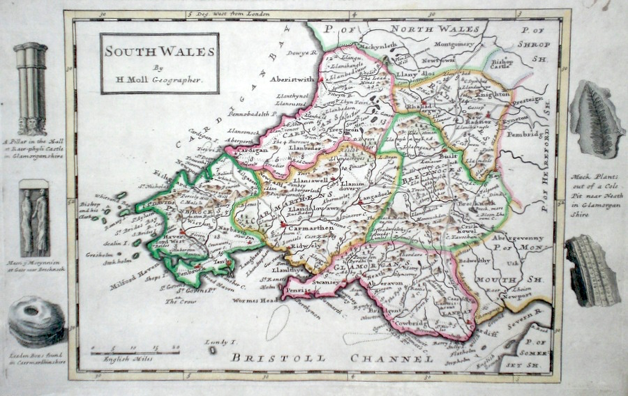
South Wales Moll, H. (c. 1724) 32 x 20 Finely engraved map of South Wales by Herman Moll for the publication "A New Description of England and Wales…" The maps in this series include engraved borders of local architectural and antiquarian interest. A unique feature. On this map various stone and ancient antiquities and also fossils. Later colour, fine condition. 60.00 GBP |
|
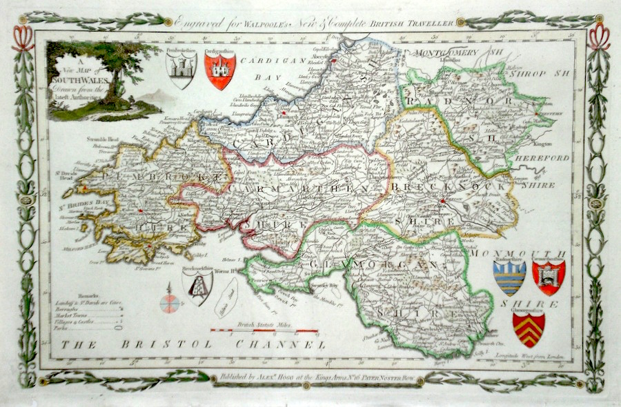
South Wales 'A New Map of South Wales drawn from the latest Authorities' Conder, T. (1784) 35 x 23 Finely engraved and decorative map of South Wales by Thomas Conder for the publication "The New British Traveller". Features include a cartouche of a rural scene and six coats of arms of the various counties. Later colour 60.00 GBP |
|
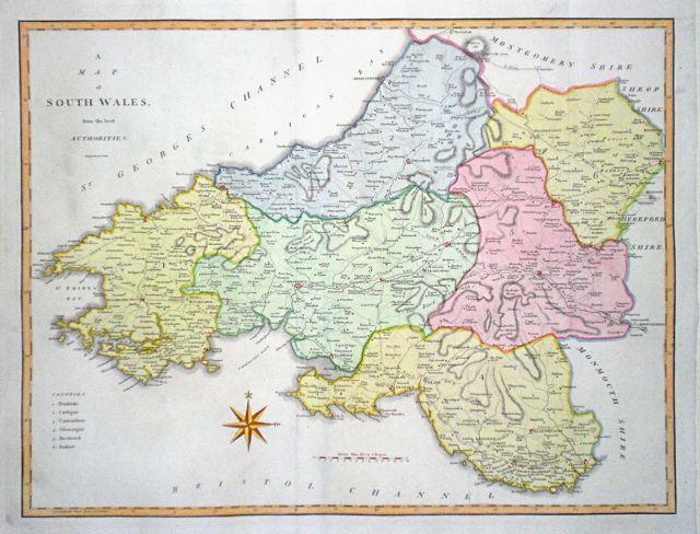
South Wales 'A Map of South Wales from the best Authorities' Cary, J. (1789) 52.5 x 40 Finely engraved, double page map showing southern counties. Later colour. 60.00 GBP |
|
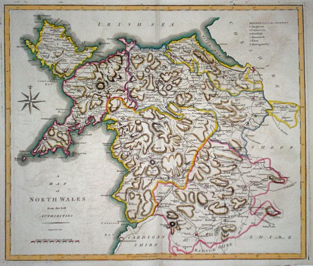
North Wales 'A Map of North Wales from the best Authorities' Cary, J. (1789) 47.5 x 40.5 Finely engraved double page map. Strong dark impression with good margins. Later hand colour. 60.00 GBP |
|
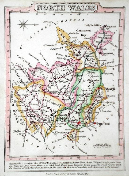
North Wales Lewis, W. (c. 1835) 14 x 10 Detailed and attractive miniature map of the County by William Lewis for his "Lewis's New Traveller's Guide". A particular feature of this charming series of maps is the clear and precise engraving of the roads. Adjacent numbers indicating the distances from London. Also included with the map is the accompanying page of text giving the county information relevant to travellers - principal towns and inns are listed, distances between towns, principal fair dates, and even sites for the best views of the county. Later colour. 40.00 GBP |
|
South Wales Lewis, W. (c. 1835) 14 x 10 Detailed and attractive miniature map of the County by William Lewis for his "Lewis's New Traveller's Guide". A particular feature of this charming series of maps is the clear and precise engraving of the roads. Adjacent numbers indicating the distances from London. Also included with the map is the accompanying page of text giving the county information relevant to travellers - principal towns and inns are listed, distances between towns, principal fair dates, and even sites for the best views of the county. Later colour. 40.00 GBP |
|
Denbeighshire 'Denbigh Comitatus' Saxton, C. (c. 1610) 32.5 x 26.5 Decorative map of the County engraved by William Kip after Christopher Saxton for the first edition of Camden's Britannia containing county maps. Later colour. Excellent condition 100.00 GBP |
|
Montgomeryshire 'Montgomery comitatus qui olim pars Ordovicum' Saxton, C. (c. 1610) 32 x 26.5 Decorative map of the County engraved by William Kip after Christopher Saxton for the first edition of Camden's Britannia containing county maps. Later colour. Excellent condition 100.00 GBP |
|
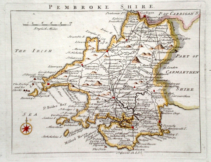
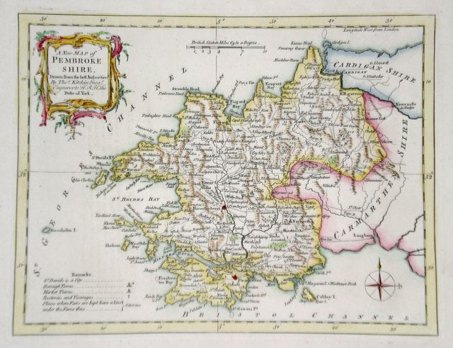
Pembrokeshire Rocque, J. (c. 1769) 20 x 16 Finely engraved map of the county by John Rocque for the publication "England Displayed". Later colour 50.00 GBP |
|
Pembrokeshire 'A New Map of Pembrokeshire drawn from the best Authorities' Kitchin, T. (1764) 26 x 20 Detailed map showing a wealth of county information. Later hand colour. Excellent condition. 40.00 GBP |
|
Pembrokeshire Roper, J. (c. 1810) 24 x 18 Detailed and decorative map of the county by Cole and Roper for The British Atlas. Original hand colouring. Excellent condition. 30.00 GBP |

|
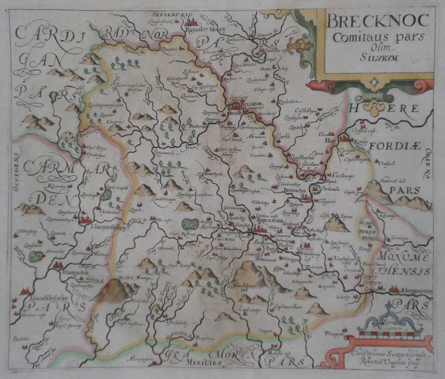
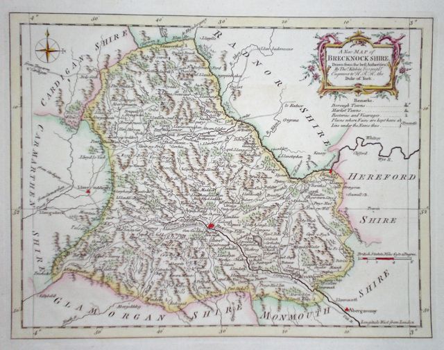
Brecknockshire Saxton, C. (1637) 31 x 26.5 Map of the county after Christopher Saxton, re-engraved by Robert Vaughan for the 1637 edition of Camden's Britannia. Fine dark engraving with later colour. One or two strengthened areas otherwise excellent condition. 95.00 GBP |
|
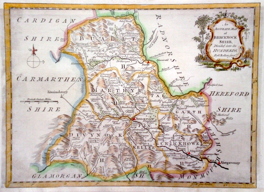
Brecknockshire 'An Accurate Map of Brecknockshire...' Rollos, G. (c. 1769) 25 x 22 Finely engraved map of the county by George Rollos for the publication "England Displayed". Later colour 50.00 GBP |
|
Brecknockshire 'A New Map of Brecknockshire' Kitchen, T. (1764) 26 x 20 Detailed map with a wealth of county information. Later colour 35.00 GBP |
|
Glamorganshire Bowen, E. (c. 1720) 13 x 19 Finely engraved map of the county by Emanuel Bowen for "Britannia Depicta" published in partnership with George Owen. Later colour 40.00 GBP |
|
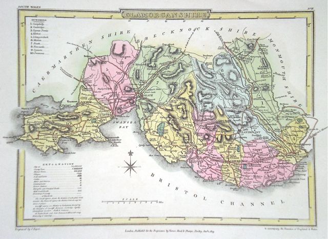
Glamorganshire Roper, J. (1809) 27 x 19 Attractively engraved map showing the hundreds. Original wash colour. 35.00 GBP |
|
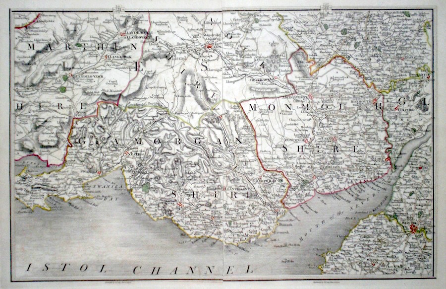
Glamorganshire and Monmouthshire
Cary, J. (c. 1794) 40 x 26 Glamorganshire and Monmouthshire area map by John Cary from his British Atlas. Two maps conjoined to make one larger one. Original colour 50.00 GBP |
|
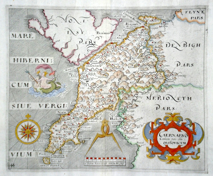
Carnarvonshire 'Caernarvo Comitatus pars olim Ordovicum' Saxton, C. (c. 1610) 30.5 x 25 Decorative map of the County engraved by William Kip after Christopher Saxton for the first edition of Camden's Britannia containing county maps. Later colour. Excellent condition 120.00 GBP |
|
Carnarvonshire Bowen, E. (c. 1724) 12 x 19 Finely engraved map of the County by Emanuel Bowen and John Owen for the publication "Britannia Depicta". To the top are given details of the Road from Welshpool to Caernarvon and verso the road from Welshpool to Dolgelly is featured. After John Ogilby. Later colour 40.00 GBP |
|
Carnarvonshire Seller, J. (c. 1796) 15 x 13 Attractive map of the County by John Seller published in Francis Grose's "Antiquities of Great Britain". Text below and verso. Later colour. Excellent condition 40.00 GBP |

|
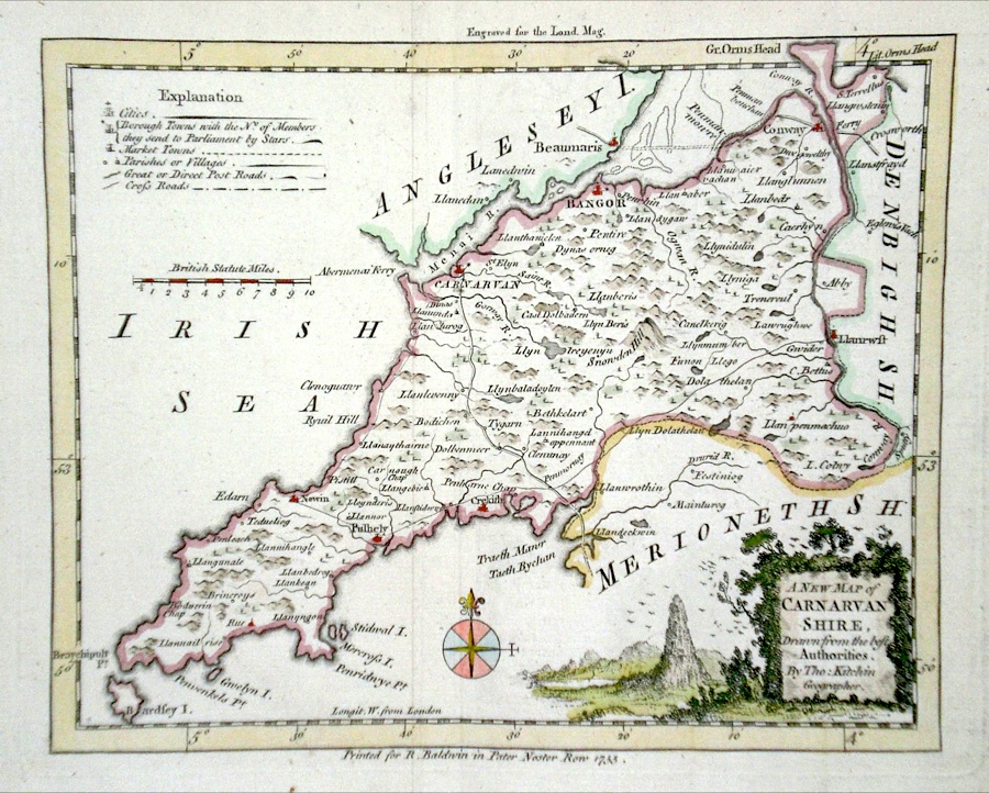
Carnarvonshire 'A New Map of Carnarvan Shire Drawn from the Best Authorities' Kitchin, T. (c. 1755) 21 x 17 Finely engraved map of the county by Thomas Kitchin, published in the "London Magazine". Later colour 40.00 GBP |
|
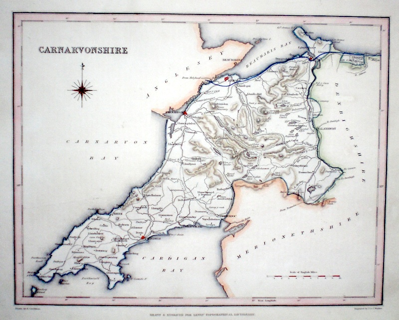
Carnarvonshire Walker, J. & C. (c. 1840) 25 x 20 Steel engraved map of the county produced for Samuel Lewis' Topographical Dictionary and engraved by J & C Walker. Later colour. 35.00 GBP |
|
Carnarvonshire Roper, J. (c. 1810) 24 x 18 Detailed and decorative map of the county by Cole and Roper for The British Atlas. Original hand colouring. Excellent condition. 30.00 GBP |

|
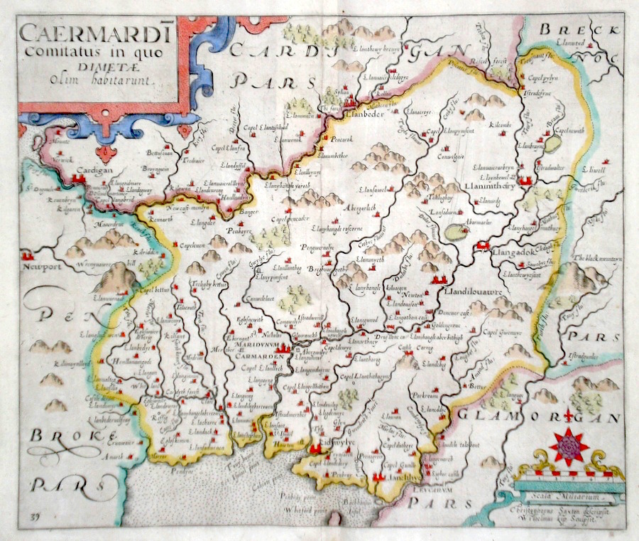
Carmarthenshire 'Cearmardi comitatus in quo Dimetae olim habitarunt' Kip, W. (1637) 33 x 28 Early map by Wiliam Kip after Christopher Saxton, from Camden's Britannia. Later colour. Fine condition. 110.00 GBP |
|
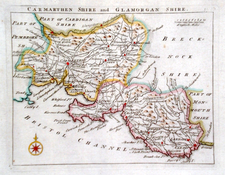
Carmarthenshire 'Carmarthenshire and Glamorganshire' Rocque, J. (c. 1769) 20 x 16 Finely engraved map of the two adjacent counties by John Rocque for the publication "England Displayed". Later colour 50.00 GBP |
|
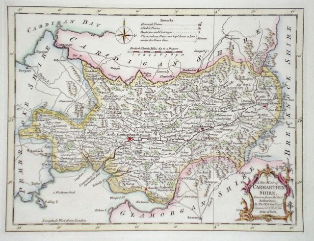
Carmarthenshire 'A New map of Carmarthenshire, Drawn from the Best Authorities' Kitchen, T. (1764) 26 x 20 Detailed map showing a wealth of county information. Later hand colour. 32.00 GBP |
|
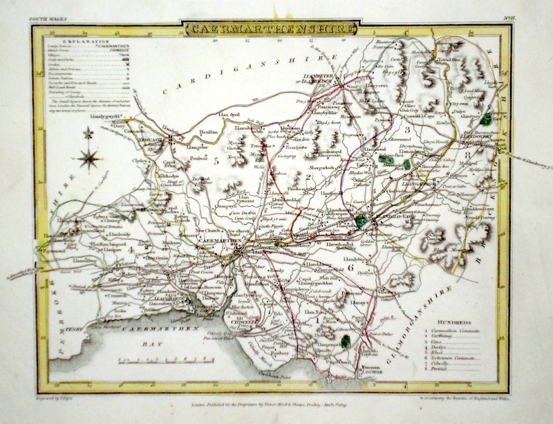
Carmarthenshire Roper, J. (c. 1810) 24 x 18 Detailed and decorative map of the county by Cole and Roper for The British Atlas. Original hand colouring. Excellent condition. 30.00 GBP |
|
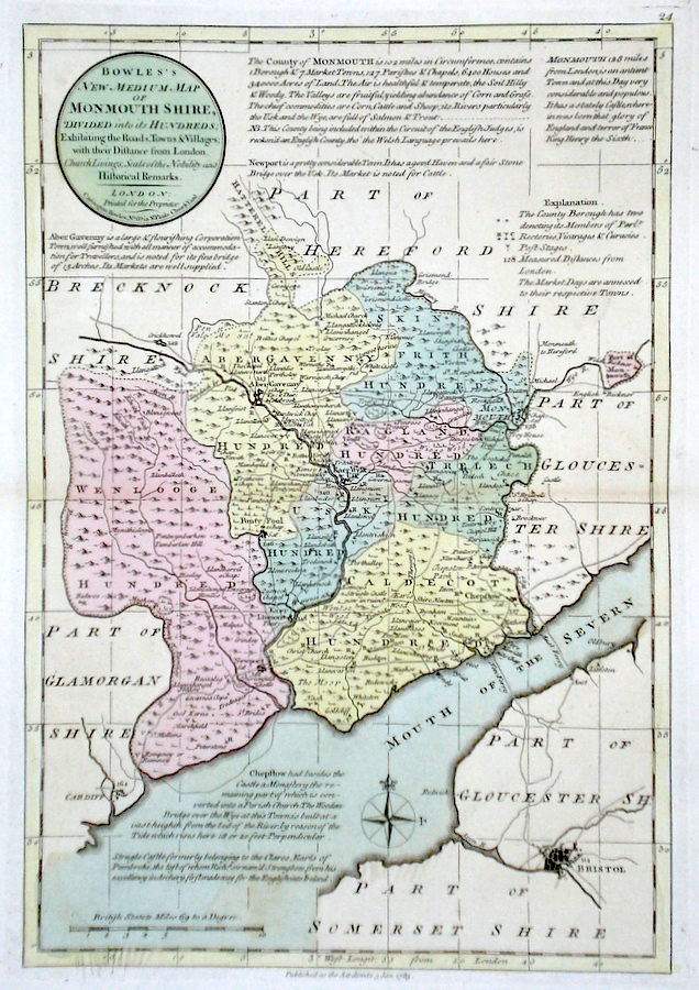
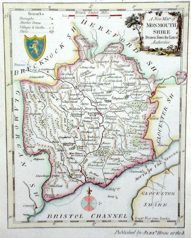
Monmouthshire 'Bowles's New Medium Map of Monmouth shire...' Bowen, E. & T. (1785) 23 x 33 Finely engraved and detailed map of the county from "Bowles's New Medium English Atlas". The maps in this series are based on those in Emanuel and Thomas Bowen's Atlas Anglicanus, and feature extensive county information on the map. They are distinguished primarily by having newly engraved cartouches, distances from London added to towns, and different imprints at the bottom. Full original colour. Some slight offsetting to the left hand side, otherwise fine condition 85.00 GBP |
|
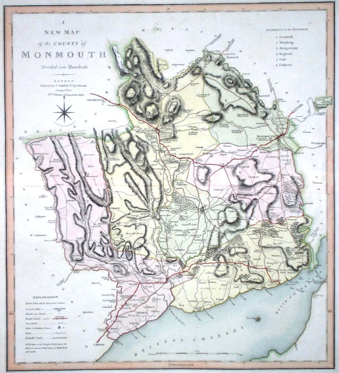
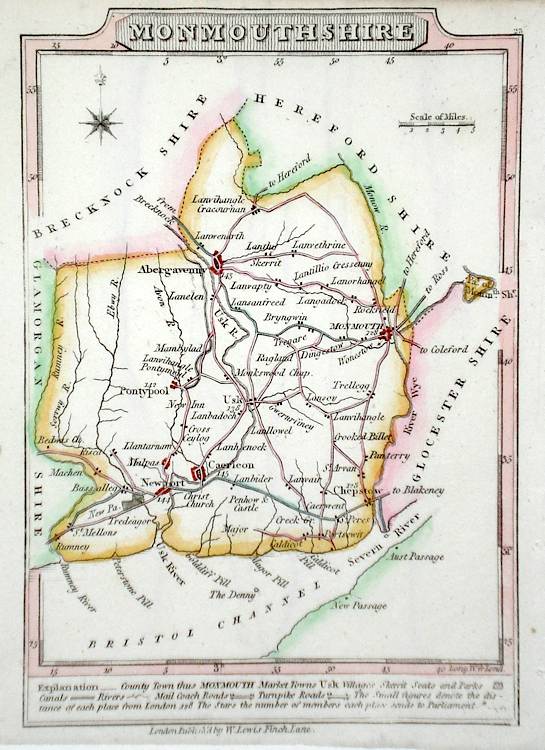
Monmouthshire 'A New Map of Monmouthshire divided into Hundreds exhibiting its Roads, Rivers, Parks' Cary, J. (1809) 49 x 54 Superbly engraved map of the county by John Cary. From "Cary's New English Atlas". The atlas was issued in parts from 1801 to 1809 and published as a complete work in 1809. Very fine original hand colour. 80.00 GBP |
|
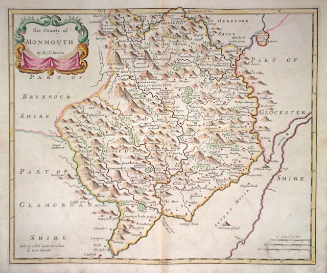
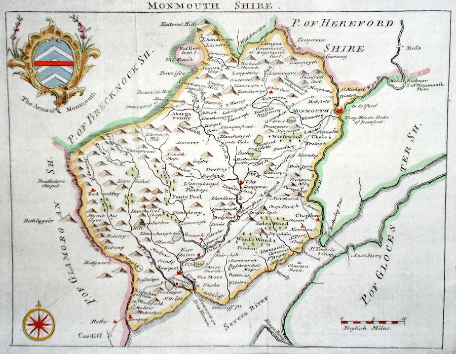
Monmouthshire 'The county of Monmouth by Robt. Morden' Morden, R. (1722) 42 x 36 Finely engraved map of the county by Robert Morden. From the 1722 edition of Camden's Britannia. Excellent condition. Later colour 75.00 GBP |
|
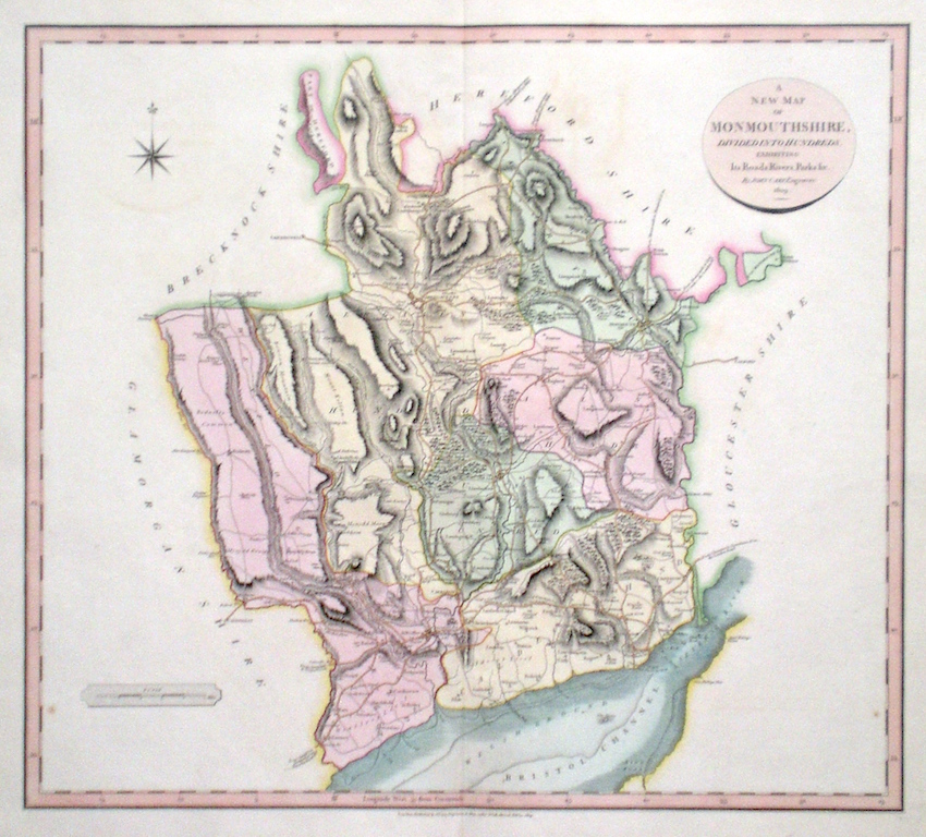
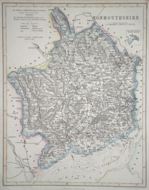
Monmouthshire 'A New Map of the county of Monmouth Divided into its hundreds' Smith, C. (1808) 45 x 50 Large size and decorative map of the county by Jones, Smith & Co. for Smith's New English Atlas. The first map of the County to show longitudes measured from the meridian of Greenwich. Original colour. 55.00 GBP |
|
Monmouthshire 'A Map of Monmouthshire from the best Authorities' Cary, J. Camden's Britannia (1789) 41 x 46 Finely engraved double page map. 55.00 GBP |

|
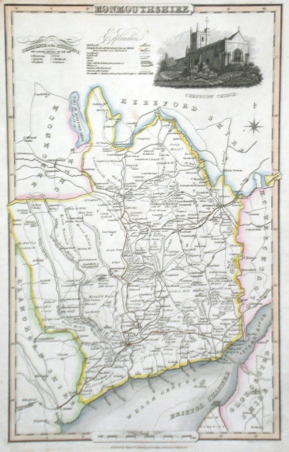
Monmouthshire Pigot, J. (c. 1826) 23 x 36 Attractive and detailed steel engraved map by James Pigot from his publication Pigot & Co.'s British Atlas. Features include a fine vignette engraving of Chepstow Cathedral. Original hand colour. Excellent condition 50.00 GBP |
|
Monmouthshire Simpson, S. (1746) 18 x 16 Fine map of the county by Samuel Simpson for his publication "The Agreeable Historian". Most of the maps in this rare series are said by Simpson to be based on those of Herman Moll. Later colour 50.00 GBP |
|
Monmouthshire Bowen, E. (c. 1724) 12 x 19 Finely engraved map of the County by Emanuel Bowen and John Owen for the publication "Britannia Depicta". To the top are given details of the Road from Monmouth to Lanbeder and verso the road from Monmouth to Abergavenny is featured. After John Ogilby. Later colour 40.00 GBP |
|
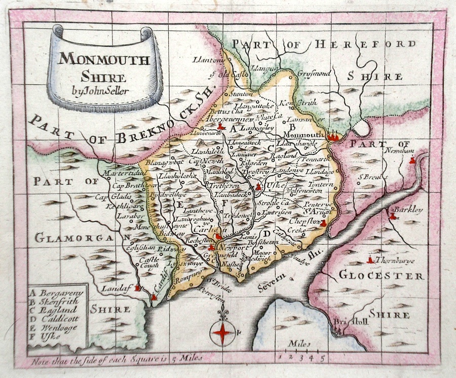
Monmouthshire Seller, J. (c. 1703) 15 x 13 Fine map of the county by the Hydrographer and instrument maker John Seller for his "Anglia Contracta". This series of maps were first published in 1695. They were later used in a simplified form by Francis Grose for his "Supplement to the Antiquities of England and Wales", published from 1787. 40.00 GBP |
|
Monmouthshire 'A New Map of Monmouthshire Drawn from the Latest Authorities' Conder, T. (c. 1784) 16 x 20 Finely engraved map of the county by Thomas Conder for the publication "The New British Traveller". Features include a coat of arms, and decorative title cartouche. Later colour 40.00 GBP |
|
Monmouthshire Lewis, W. (c. 1835) 10 x 14 Detailed and attractive miniature map of the Region by William Lewis for his "Lewis's New Traveller's Guide". A particular feature of this charming series of maps is the clear and precise engraving of the roads. Adjacent numbers indicating the distances from London. Also included with the map is the accompanying page of text giving the county information relevant to travellers,- principal towns and inns are listed, distances between towns, principal fair dates, and even sites for the best views of the county. Later colour. 35.00 GBP |
|
Monmouthshire Becker, F. (c. 1842) 27 x 35 Detailed steel engraved map of the county with original colour. Published in Fisher's County Atlas, the only cartographical work from this company 35.00 GBP |
|
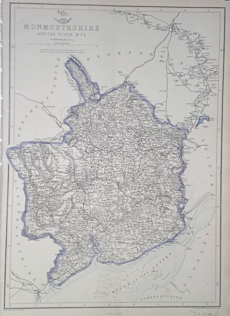
Monmouthshire Monmouthshire and the River Wye Dispatch Atlas (1863) 31 x 43 Early Outline Colour 20.00 GBP |
|
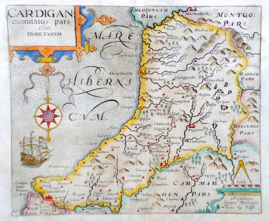
Cardiganshire 'Cardigan Comitatus pars olim Dimetarum' Saxton, C./Kip, W. (c. 1637) 32 x 27 Fine map of the county by Christopher Saxton, engraved by William Kip. Published in the 1637 edition of Camden's Britannia, and one of the earliest maps of the county. Later colour. Good condition 85.00 GBP |
|
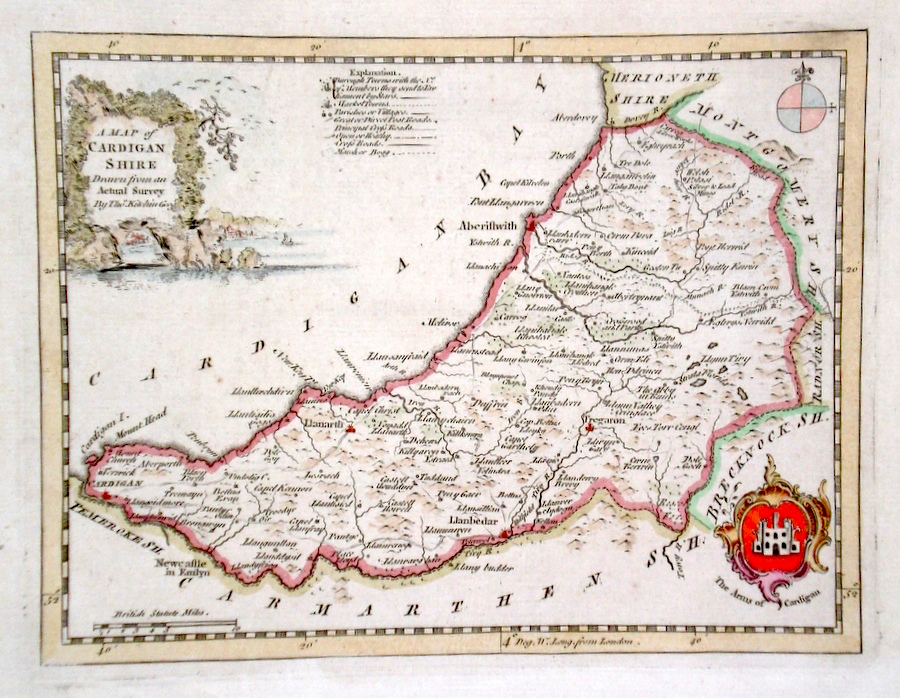
Cardiganshire 'A Map of Cardiganshire Drawn from an Actual Survey..' Kitchen, T. (c. 1769) 23 x 17 Finely engraved map of the county by Thomas Kitchen for the publication "England Displayed". The cartouche, shows a local rural scene. The arms are that of Cardigan Later colour 50.00 GBP |
|
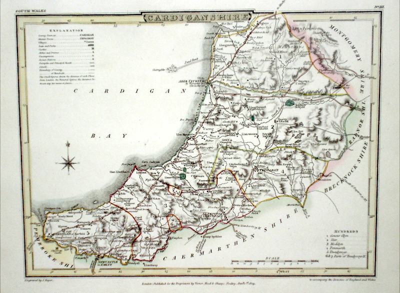
Cardiganshire Roper, J. (c. 1810) 24 x 18 Detailed and decorative map of the county by Cole and Roper for The British Atlas. Original hand colouring. Excellent condition. 30.00 GBP |
|
Merionethshire 'Merionith Comitatus' Saxton, C. (c. 1610) 32 x 26.5 Decorative map of the County engraved by William Kip after Christopher Saxton for the first edition of Camden's Britannia containing county maps. Later colour. Excellent condition 100.00 GBP |
|
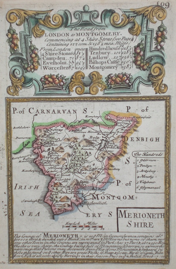
Merionethshire Bowen, E. (c. 1720) 13 x 19 Finely engraved map of the county by Emanuel Bowen for "Britannia Depicta" published in partnership with George Owen. Later colour 40.00 GBP |
|
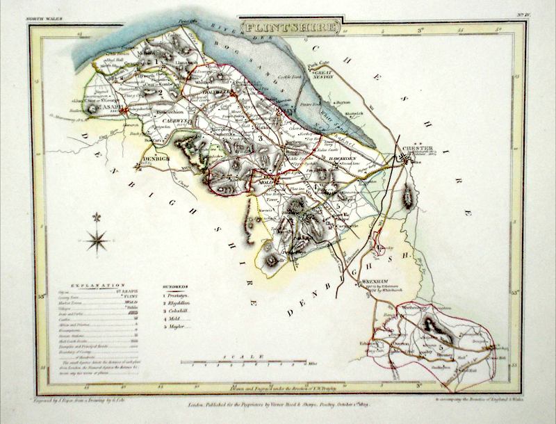
Flintshire Seller, J. (c. 1703) 15 x 13 Fine map of the county by the Hydrographer and instrument maker John Seller for his "Anglia Contracta". This series of maps were first published in 1695. They were later used in a simplified form by Francis Grose for his "Supplement to the Antiquities of England and Wales", published from 1787. 40.00 GBP |
|
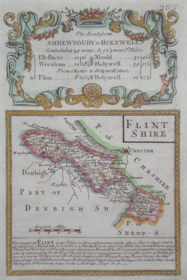
Flintshire Bowen, E. (c. 1720) 13 x 19 Finely engraved map of the county by Emanuel Bowen for "Britannia Depicta" published in partnership with George Owen. Later colour 40.00 GBP |
|
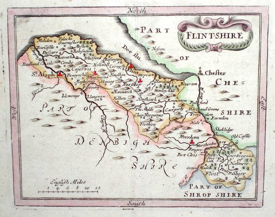
Flintshire Roper, J. (c. 1810) 24 x 18 Detailed and decorative map of the county by Cole and Roper for The British Atlas. Original hand colouring. Excellent condition. 30.00 GBP |
|
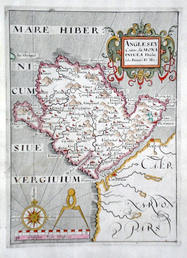
Anglesey 'Anglesey Comitatus. Olim Mona Insula….' Saxton, C. (c. 1610) 18.5 x 25.5 Decorative map of the Island after Christopher Saxton for the first edition of Camden's Britannia containing county maps. Single page. Later colour. Fine condition 100.00 GBP |
|
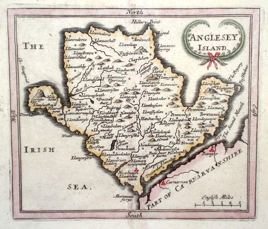
Anglesey 'Anglesey Island' Seller, J. (c. 1703) 15 x 13 Fine map of the Island by the Hydrographer and instrument maker John Seller for his "Anglia Contracta". This series of maps were first published in 1695. They were later used in a simplified form by Francis Grose for his "Supplement to the Antiquities of England and Wales", published from 1787. 45.00 GBP |
|
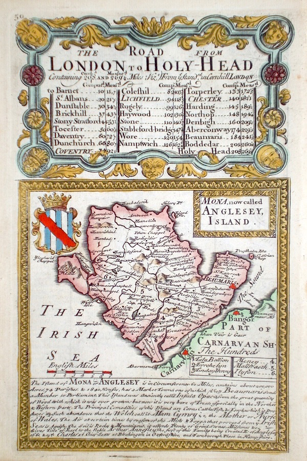
Anglesey 'Mona' (now called Anglesey Island) Bowen E. (c. 1724) 12 x 19 Finely engraved map of the Island by Emanuel Bowen and John Owen for the publication "Britannia Depicta". To the top are given details of the Road from London to Holy-Head and verso the road from Maidstone to Hith is engraved. After John Ogilby. Later colour 40.00 GBP |
|
Anglesey Roper, J. (1810) 24 x 18 Detailed and decorative map of the county by Cole and Roper for The British Atlas. Original hand colouring. Excellent condition. 30.00 GBP |

|
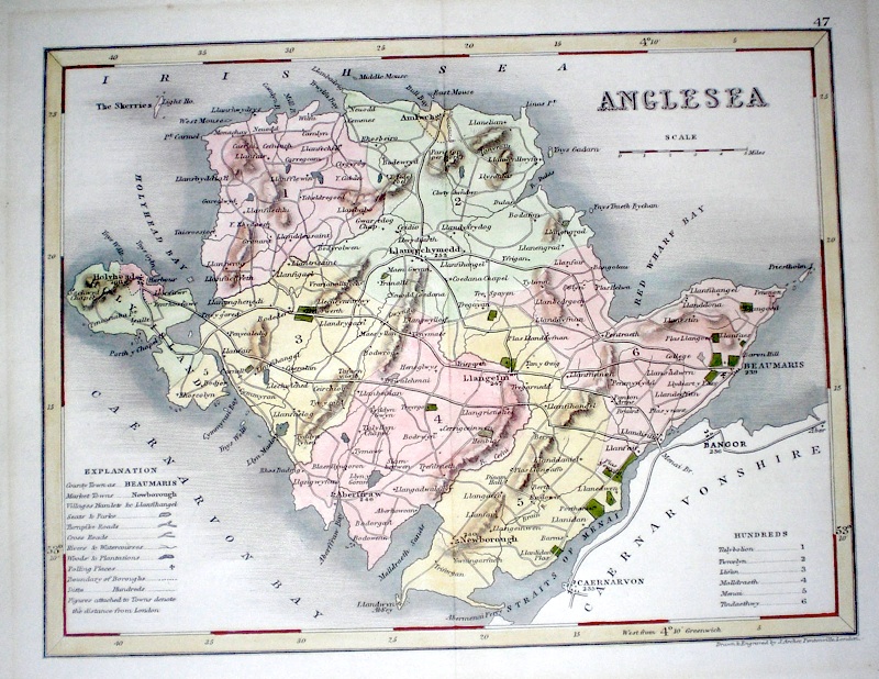
Anglesea Archer, J. (c. 1840) 24 x 18 Steel engraved map of the island by Joshua Archer. Later hand colour. 35.00 GBP |