Africa
|
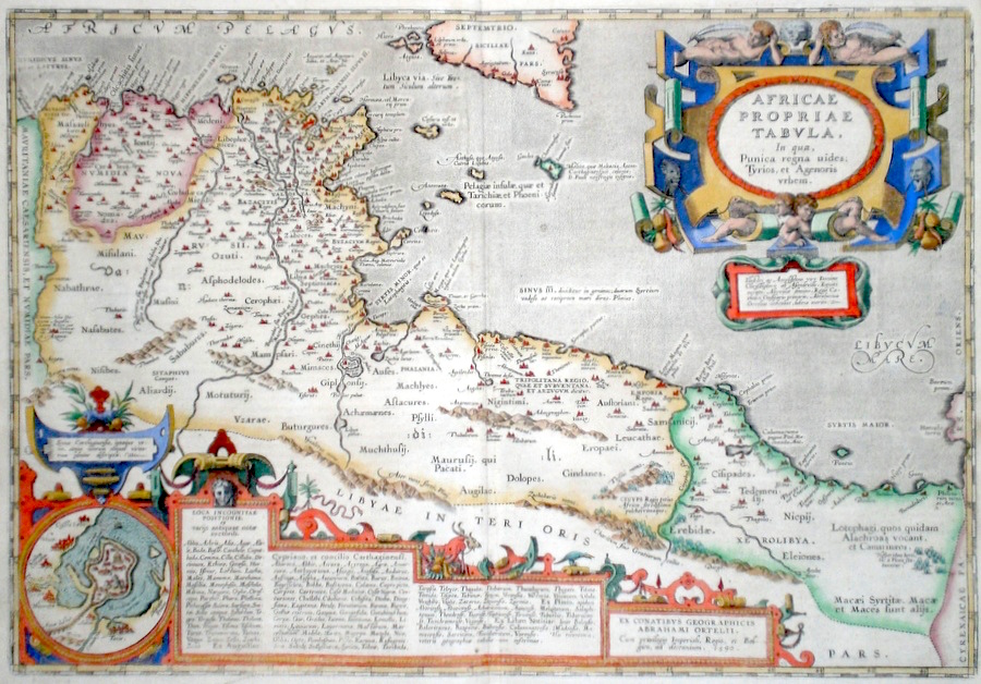
Africa 'Africae Propriae Tabula' Ortelius, A. (c. 1618) 49 x 34 Superb map of classical North Africa by Abraham Ortelius Published by Petrus Bertius in the Atlas "Theatrum Geographiae Veteris". This rare atlas compiled by Bertius used purchased Ortelius copperplates and other plates from Mercator to publish a classical atlas similar to the Ortelius Parergon. The map covers the area of modern Algeria and Libya and focuses on the Punic Wars. Features include two fine elaborate cartouches and an inset map of Carthage before its destruction Latin text to verso. Later hand colour. Condition fine 395.00 GBP |


|
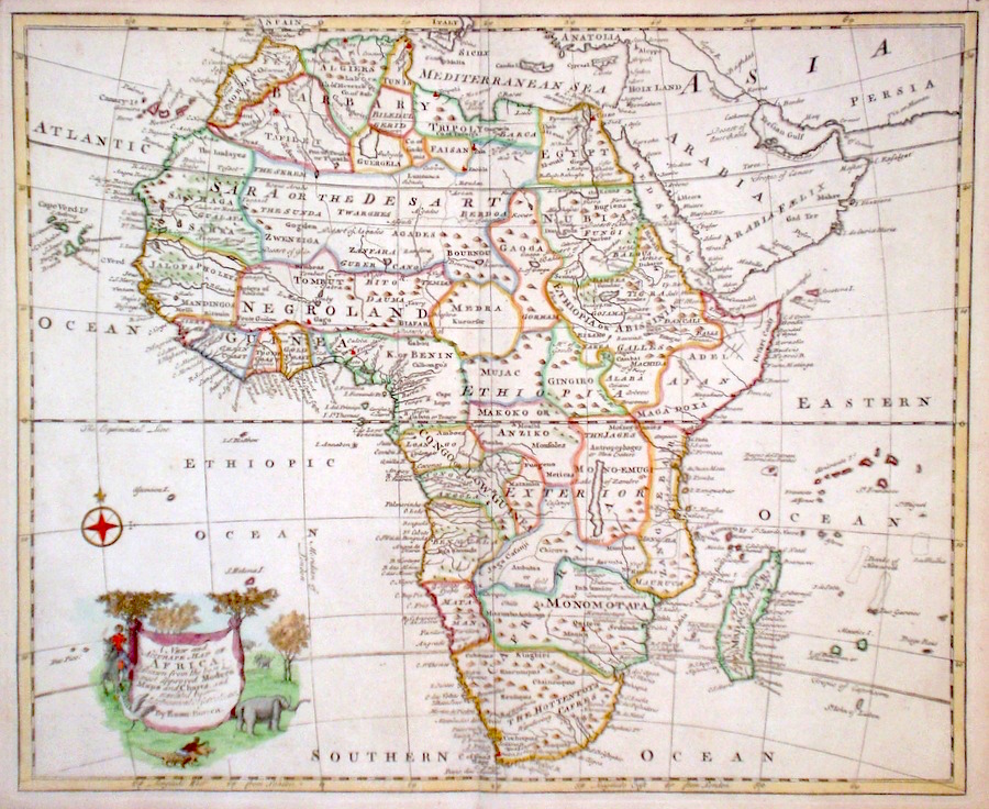
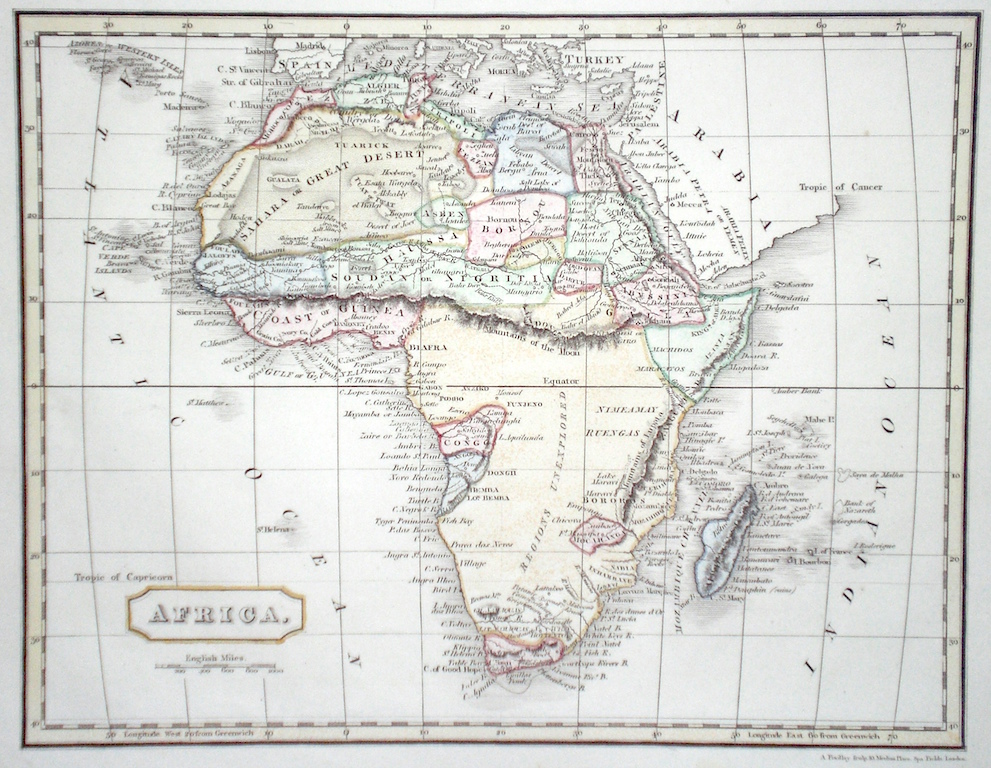
Africa 'A New and Accurate Map of Africa' Bowen, E. (1766) 43 x 35 Finely engraved and detailed map of Africa by Emanuel Bowen. Features include a fine cartouche depicting a scene with elephants, a wading bird, and a man capturing a crocodile. Condition excellent, a dark impression on thick paper. Later hand colour 240.00 GBP |
|
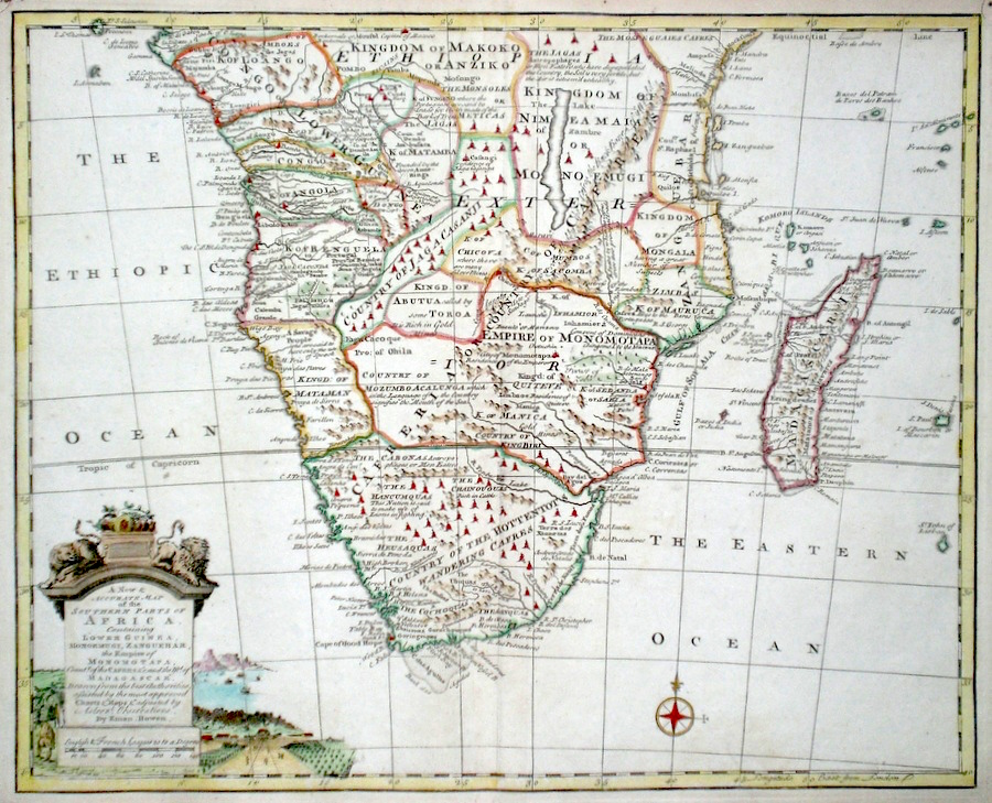
Africa 'A New and Accurate Map of the Southern Parts of Africa' Bowen, E. (1766) 43 x 35 Finely engraved and detailed map of southern Africa and Madagascar by Emanuel Bowen. Much detail of the indigenous tribes is given. Other features include a cartouche depicting a rural scene. Condition excellent, a dark impression on thick paper. Later hand colour 220.00 GBP |
|
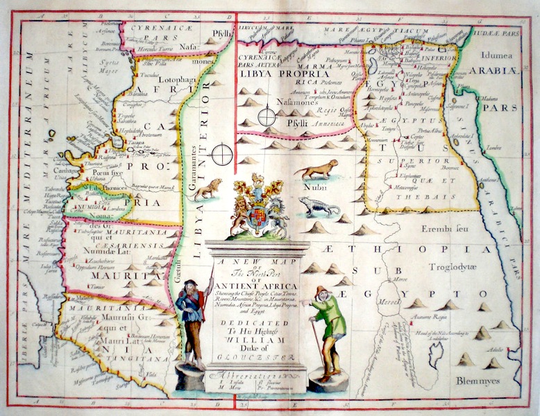
Africa 'A New Map of The North Part of Antient Africa...' Wells, E. (c. 1700) 49 x 37 Early map of North Africa by Edward Wells. Full title: "A New Map of The North Part of Antient Africa Shewing the Chief People, Cities, Towns, Rivers, Mountains &c. in Mauretania, Numidia, Africa Propria, Libya Propria and Egypt. Dedicated to his Highness William Duke of Gloucester". Double page copperplate engraving with later colour. Condition excellent. 200.00 GBP |
|
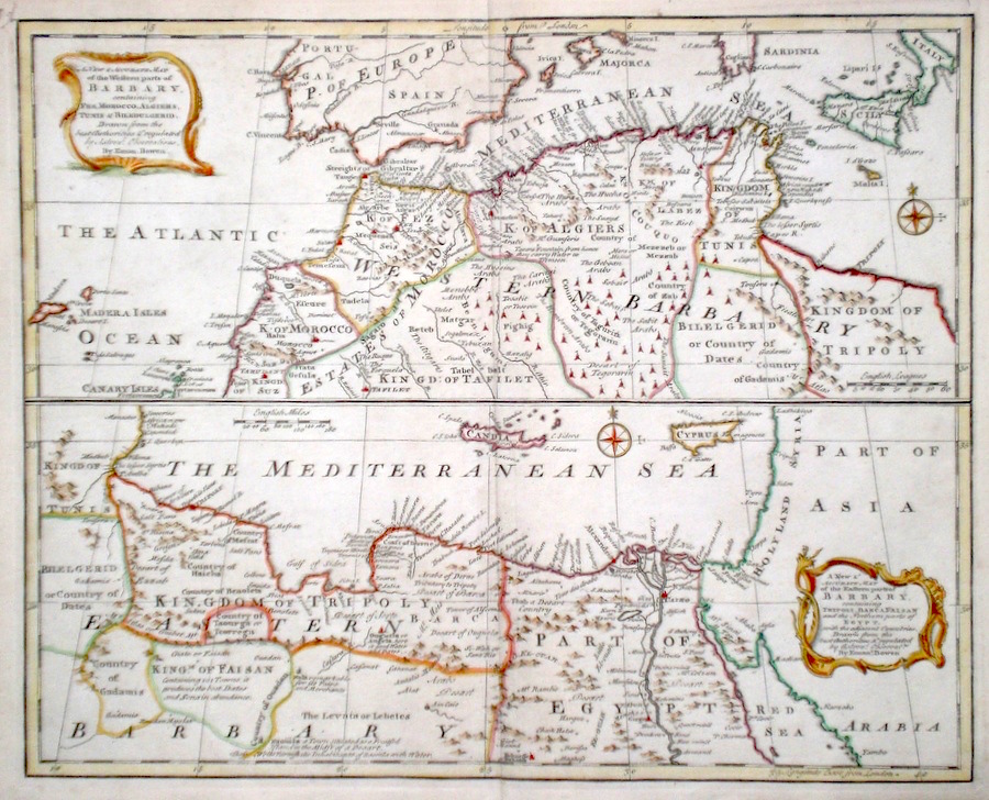
Africa 'A New and Accurate Map of Western Barbary. A New and Accurate Map of Eastern Barbary' Bowen, E. (1766) 43 x 35 Finely engraved and detailed maps of Western and Eastern Barbary coasts of Africa by Emanuel Bowen. Two separate maps on one sheet. Features include fine rococo cartouches. Condition excellent, dark impressions on thick paper. Later hand colour 180.00 GBP |
|
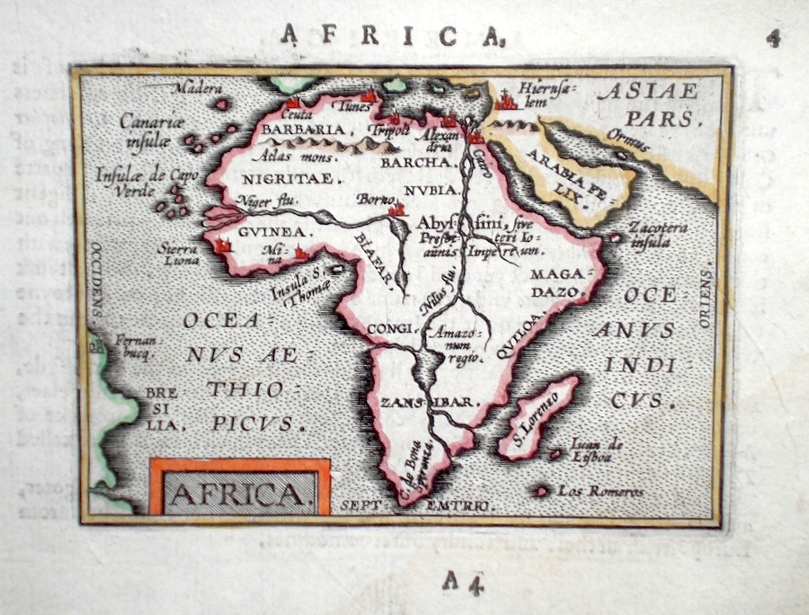
Africa Ortelius, A. (c. 1603) 10 x 8.5 Fine early map of the continent by Abraham Ortelius, engraved in small format by Philippe Galle, and published in the Epitome, or pocket-edition of the "Theatrum Orbis Terrarum". This map from an English text edition of c.1603 published in London and thus one of the first world atlases published in England. Fine condition. Later colour 180.00 GBP |
|
Africa 'Particular Draughts of some of the Chief African Islands in the Mediterranean, Atlantic and Ethiopic Oceans' Bowen, E. (1766) 43 x 36 Very interesting and detailed collection of several Island maps on one sheet. The separate maps are: Malta and Gozo, Cape Verde Islands, St. Helena, Madeira, Tenerife. Additionally a Map of the bay of Agoa del Saldanha (South Africa), Table Bay and a plan of the Dutch Fort at the Cape of Good Hope. Copious notes on the relevant history and topography accompany each map. Condition excellent. Later hand colour. 150.00 GBP |

|
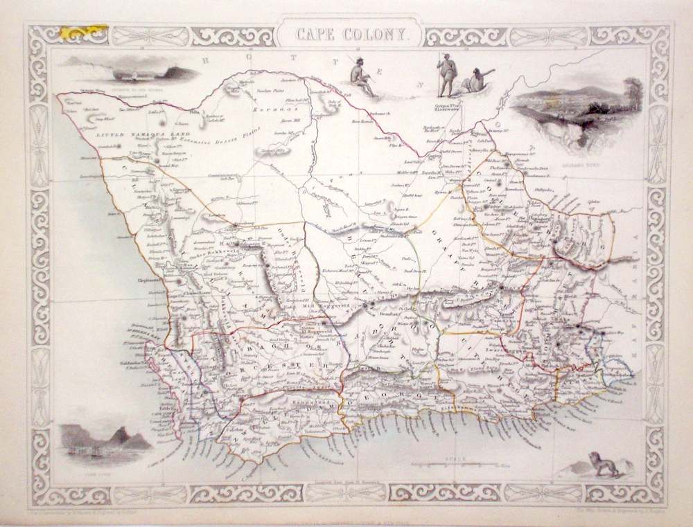
Africa Cape Colony Rapkin, J. (1851) 33 x 27 Fine map of the Colony by John Rapkin, for John Tallis's highly decorative "The Illustrated Atlas". The vignettes show; Cape Town, Grahamstown, and The Entrance to the Knysna. Single page (no central fold). Original colour as published. Condition fine. 140.00 GBP |
|
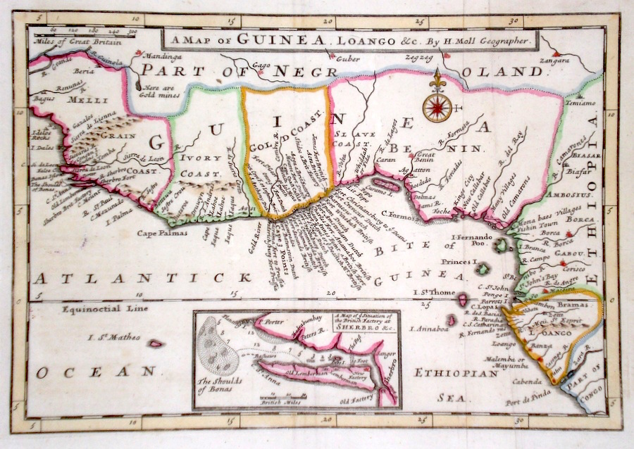
Africa 'A Map of Guinea Loango &c. By Herman Moll Geographer' Moll, H. (c. 1730) 26 x 18 Interesting and detailed map of the West African Guinea coast by the influencial engraver Herman Moll. The engraving notes many of the forts and towns now of historical interest in the area. The inset map shows the site of a new factory at Sherbro, on the Atlantic coast. A strong impression. Later colour. Fine condition 98.00 GBP |
|
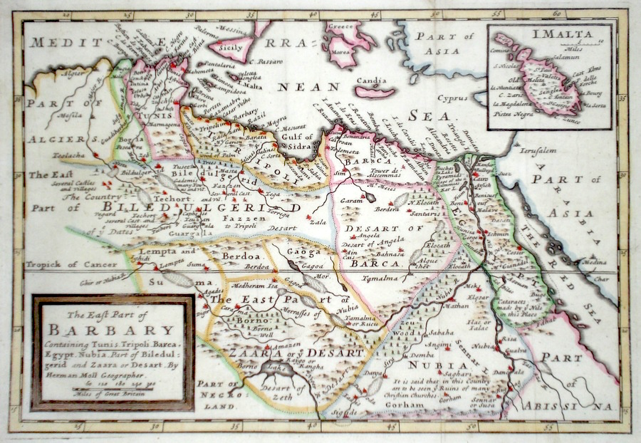
Africa 'The East part of Barbary' Moll, H. (c. 1730) 26 x 18 Interesting and detailed Map of the North Africa area by the influencial engraver Herman Moll. The inset map shows The Island of Malta. A strong impression. Later colour. Fine condition 98.00 GBP |
|
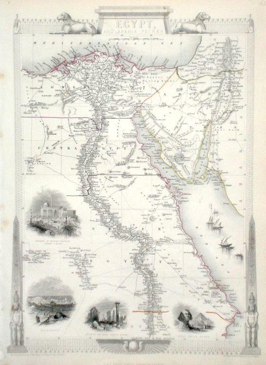
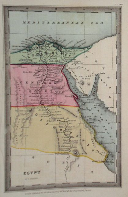
Africa Egypt & Arabia Rapkin, J. (1851) 26 x 36 Fine map of the Country engraved by John Rapkin, for John Tallis's highly decorative "The Illustrated Atlas". The vignettes show; Mosque of Sultan Hassan in Cairo, Alexandria, Ruins in Karnac, Great Sphinx of Ghizeh. Single page map, (no central fold). Original colour as published. Condition fine. 100.00 GBP |
|
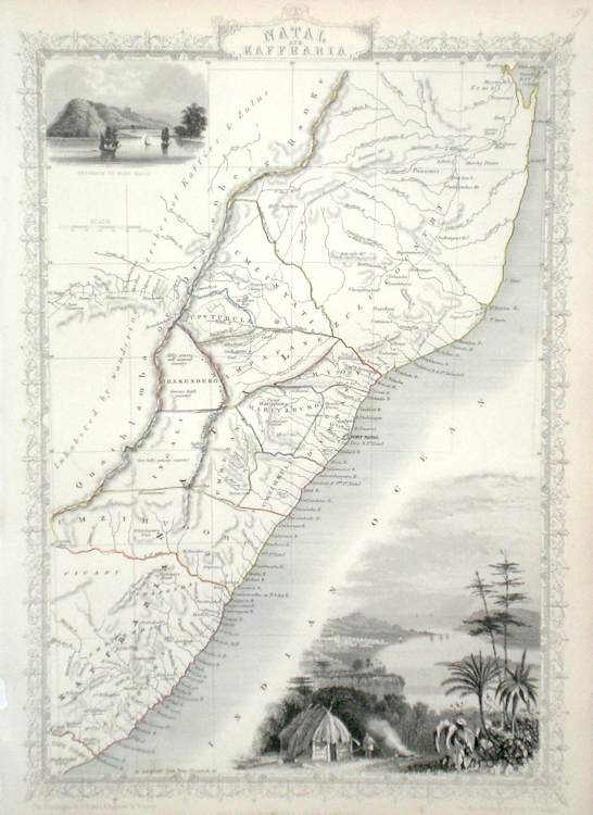
Africa Natal and Kafraria Rapkin, J. (1851) 25 x 36 Fine map of the area by John Rapkin, for John Tallis's highly decorative "The Illustrated Atlas". The vignettes show; Entrance to Port Natal, Port Natal and Durban. Single page (no central fold). Original colour as published . Condition fine. 95.00 GBP |
|
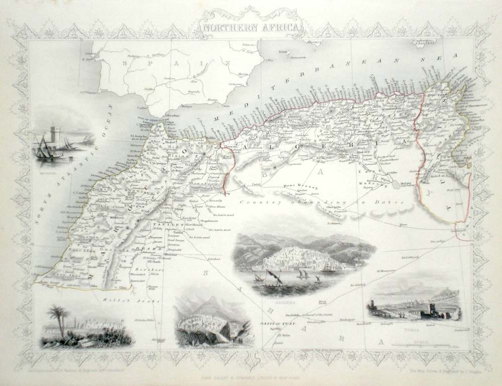
Africa Northern Africa Rapkin, J. (1851) 34 x 26 Fine map of the area by John Rapkin, for John Tallis's highly decorative "The Illustrated Atlas". The countries featured are Marocco, Algeria and Tunis. The vignettes show; Mogador, Marocco, Constantine, Algiers, Tuinis Single Page map (no central fold). Original colour as published. Condition fine. 85.00 GBP |
|
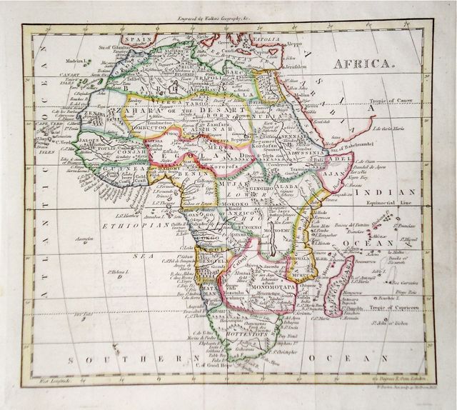
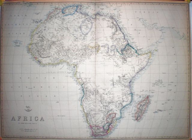
Africa Findlay, A. (c. 1820) 29 x 24 Fine map of Africa engraved by Alexander Findlay and published by Thomas Kelly. The central area of Africa is largely unmapped. Condition excellent. Later colour 85.00 GBP |
|
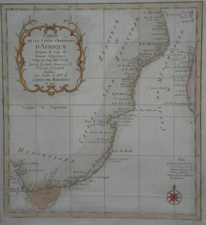
Africa 'Carte de la Coste Orientale D'Afrique depuis Le Cap De Bonne Esperance jusqu'an Cap Del Gada...' Bellin, J. N. (c. 1740) 23 x 25 Attractive chart of the South-East Coast of Africa by Bellin for the Compte de Maurepas. Charts the coast of the Mozambique Canal between Africa and Madagascar. Later colour. Old folds but excellent condition. 70.00 GBP |
|
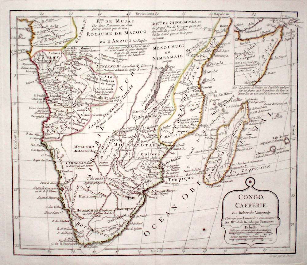
Africa 'Congo, Cafrerie' De Vaugondy, R. (c. 1795) 29 x 25 Interesting map of Southern Africa by Robert De Vaugondy. Shows the Continent south of the Equator and an inset map of the Horn of Africa. Also includes the Island of Madagascar. Original colour 60.00 GBP |
|
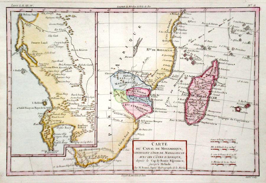
Africa 'Carte du Canal de Mosambique, contenant L'Isle de Madagascar...' Bonne, R. (c. 1780) 32 x 22 Map of the eastern and southern coast of Africa by the French engineer and cartographer Rigobert Bonne. Shows the Island of Madagascar and the Mozambique Channel and various islands of the Indian ocean. An inset section shows the Cape of Good Hope area in much greater scale. Later colour 60.00 GBP |
|
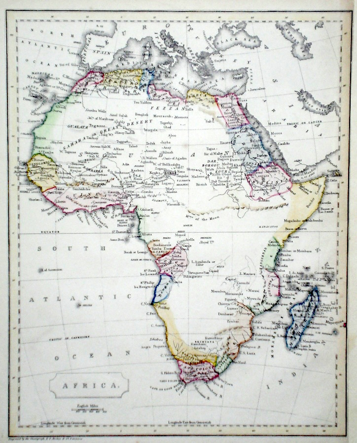
Africa 'Africa from the best Authorities' Russell, J. (1818) 22.5 x 19 Africa from Guthrie's Geography. Engraved by John Russell. Original hand colour. Excellent condition 60.00 GBP |

|
Africa Starling, T. (c. 1832) 15 x 9 Uncommon and finely engraved map of the continent from The Royal Cabinet Atlas. Bright original colouring. 55.00 GBP |

|
Africa Findlay, A. (c. 1820) 26 x 20 Attractive map of Africa engraved by Alexander Findlay. Later colour. 50.00 GBP |
|
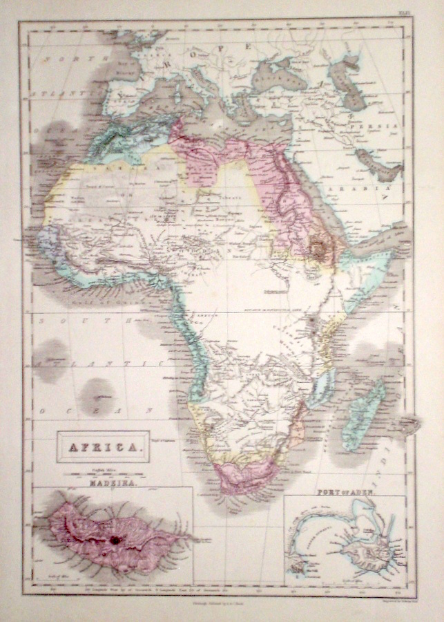
Africa Hall, S. (1854) 27 x 39 Finely engraved map of The Continent of Africa, by Sidney Hall. Steel engraving published in the "General Atlas of The World". Inset maps of Madeira and the Port of Aden Condition excellent 50.00 GBP |
|
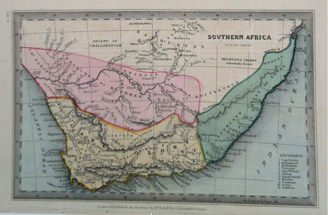
Africa 'Southern Africa' Starling, T. (c. 1832) 15 x 9 Uncommon and finely engraved map of the southern area of the continent, from The Royal Cabinet Atlas. Bright original colouring. A key details the various districts. 50.00 GBP |
|
Africa Becker & Co. (c. 1850) 20 x 27 Attractive steel engraved map of the continent by Becker and Co. for Barclays Dictionary. Original colour with some later colour 40.00 GBP |
|
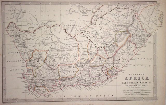
Africa 'Southern Africa comprising Cape Colony, Natal, with Orange Free States' Johnston, A. K. (1873) 34 x 23 Detailed map showing the various states of the Cape Colony, with Natal and Orange Free State. Original colour 40.00 GBP |
|
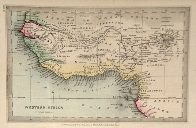
Africa Western Africa Starling, T. (c. 1832) 15 x 9 Uncommon and finely engraved map of the known regions of western Africa from The Royal Cabinet Atlas. Bright original colouring. 40.00 GBP |
|
Africa Darton, W. (c. 1805) 21 x 19 The African continent from Walkerís Geography. Later hand colour. Traces of old folds, but generally good condition 35.00 GBP |
|
Africa Dispatch Atlas (1863) 62.5 x 45 Early outline colour, double page. 30.00 GBP |
|
Africa 'A New Map of Africa from the best Authorities' Neele, J. Adam's Geography (1824 Ed.) 23 x 19 Map of Africa with later hand colour. 30.00 GBP |

|
Africa Fenner, R. (1828) 15 x 12 Highly detailed steel engraved map of the continent by Robert Fenner for "Fenner's Pocket Atlas". The central area of the continent is shown largely as an unknown area. Later full wash colour 25.00 GBP |

|
Egypt Starling, T. (c. 1832) 9 x 15 Uncommon and finely engraved map of the country from The Royal Cabinet Atlas. Bright original colouring. 45.00 GBP |
|
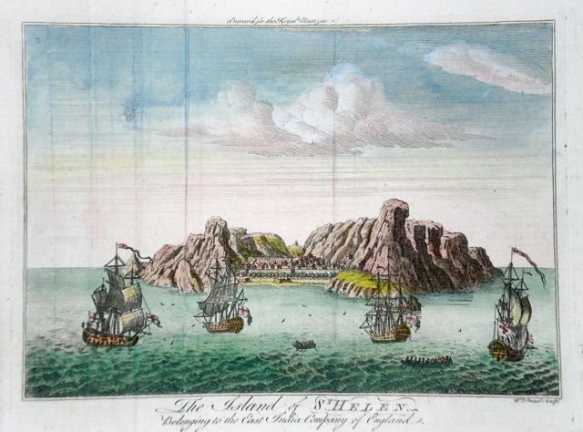
Africa 'The Island of St. Helen' Proud, W. (1759) 21 x 16.5 St. Helena Island 1200 miles from the African coast. Discovered by the Portugese in 1502 it became a British colony in 1834. Copperplate view later hand colour. Good condition 40.00 GBP |
|
Africa 'Suite de la Coste De Guinee' Bellin, J. (c. 1750) 44 x 23 Finely engraved coastal chart of what is now the coast of Ghana. Traces of vertical folds but very good condition. Later hand colour. 75.00 GBP |

|
South Africa 'Cape of Good Hope' Hall, S. (1817) 25 x 21 Steel engraved map of the southern tip of Africa by Aaron Arrowsmith and engraved by Sidney Hall. Later colour. Excellent condition. 40.00 GBP |

|
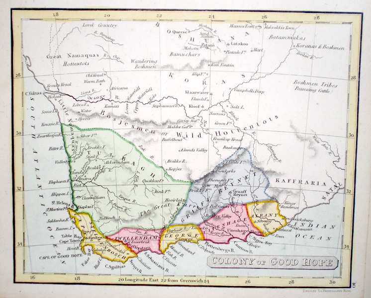
Africa 'Colony of Good Hope' Fenner, R. (1828) 15 x 12 Steel engraved map of the Colony by Robert Fenner for “Fenner's Pocket Atlas”. Later full wash colour to the seven Provinces 25.00 GBP |