Asia
|
Asia 'Pontus Euxinus' Ortelius, A. (c. 1618) 50 x 36 Superb map of The Black sea in antiquity by Abraham Ortelius. Published by Petrus Bertius in the Atlas "Theatrum Geographiae Veteris". This rare atlas compiled by Bertius used purchased Ortelius copperplates and other plates from Mercator to publish a classical atlas similar to the Ortelius Parergon. The map covers the area of the Pontus Euxinus now known as the Black sea and its surrounding countries. In classical time this was of major importance as a crossroads for trade between Europe and Asia. To the north the Maeotis Palus now known as the Sea of Azov. Features include two fine cartouches. Latin text to verso. Later hand colour. Condition-slightly trimmed to left hand vertical margin otherwise excellent. 495.00 GBP |


|
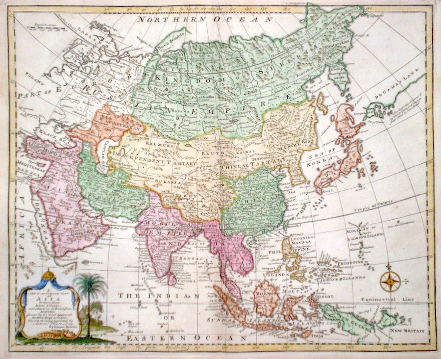
Asia 'A New and Accurate Map of Asia' Bowen, E. (1766) 43 x 35 Finely engraved and detailed map of Asia by Emanuel Bowen. Much detail of this vast area is given. Notable on this map is the large and erroneous coastline labeled Degama's Land to the extreme north east. Although Bering earlier could not find this land the error persisted in cartography until finally disproved by Cook. Other features include a cartouche depicting a rural scene. Condition excellent, a dark impression on thick paper. Later hand colour 385.00 GBP |
|
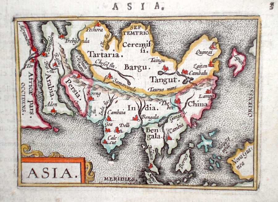
Asia Ortelius, A. (c. 1603) 10 x 8.5 Fine early map of the continent by Abraham Ortelius, engraved in small format by Philippe Galle, and published in the Epitome, or pocket-edition of the "Theatrum Orbis Terrarum". This map from an English text edition of c.1603 published in London and thus one of the first world atlases published in England. Fine condition. Later colour 195.00 GBP |
|
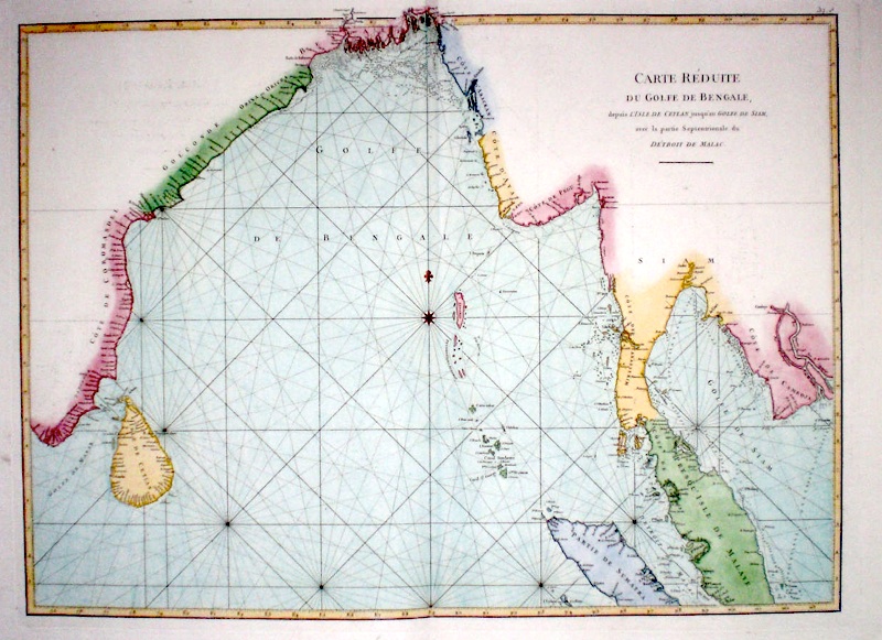
Asia 'Carte Reduite Du Golfe de Bengale' De Mannevillette (c. 1775) 67 x 50 Large folio sea chart of the northern Indian Ocean and the Bay of Bengal by the French hydrographer Jean Baptiste Apres De Mannvillette. Shows the area from Sri Lanka across to the Straits of Malacca and also includes the Gulf of Thailand. Later colour. Fine unmarked condition. 175.00 GBP |
|
Asia Rapkin, J. (1851) 32 x 26 Fine map of The Continent engraved by John Rapkin, for John Tallis's highly decorative "The Illustrated Atlas". The vignettes show; Walrus in the Arctic, Tartars, Russian people, Petra, Sun birds of India and The Philippines. Single page map, (no central fold). Original colour as published. Condition fine. 150.00 GBP |

|
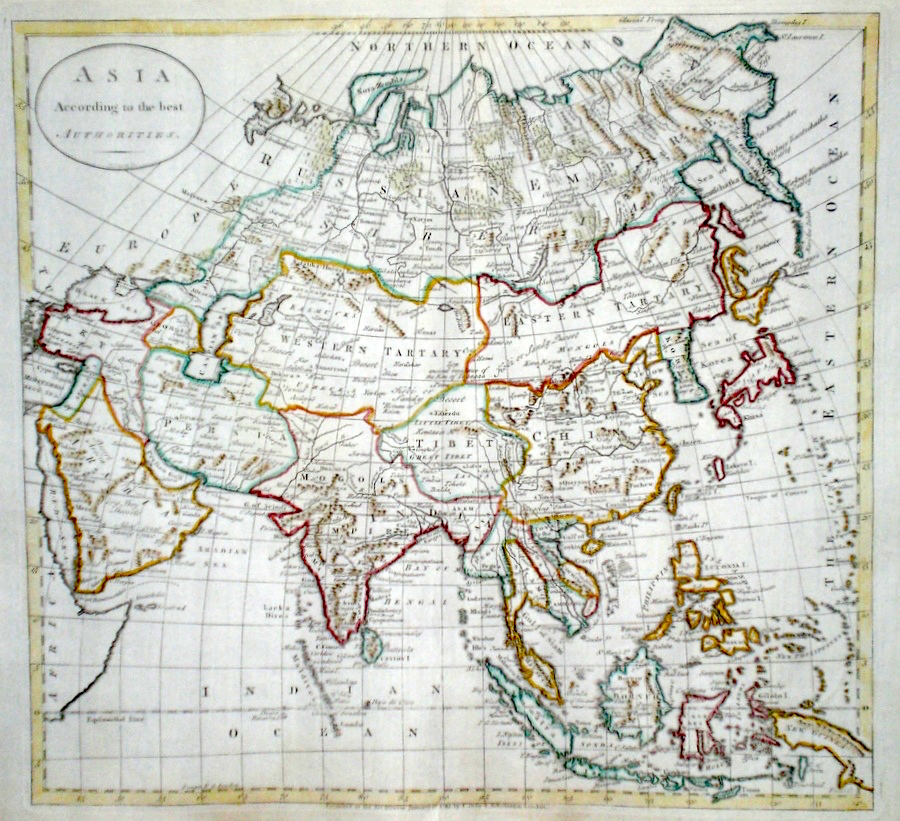
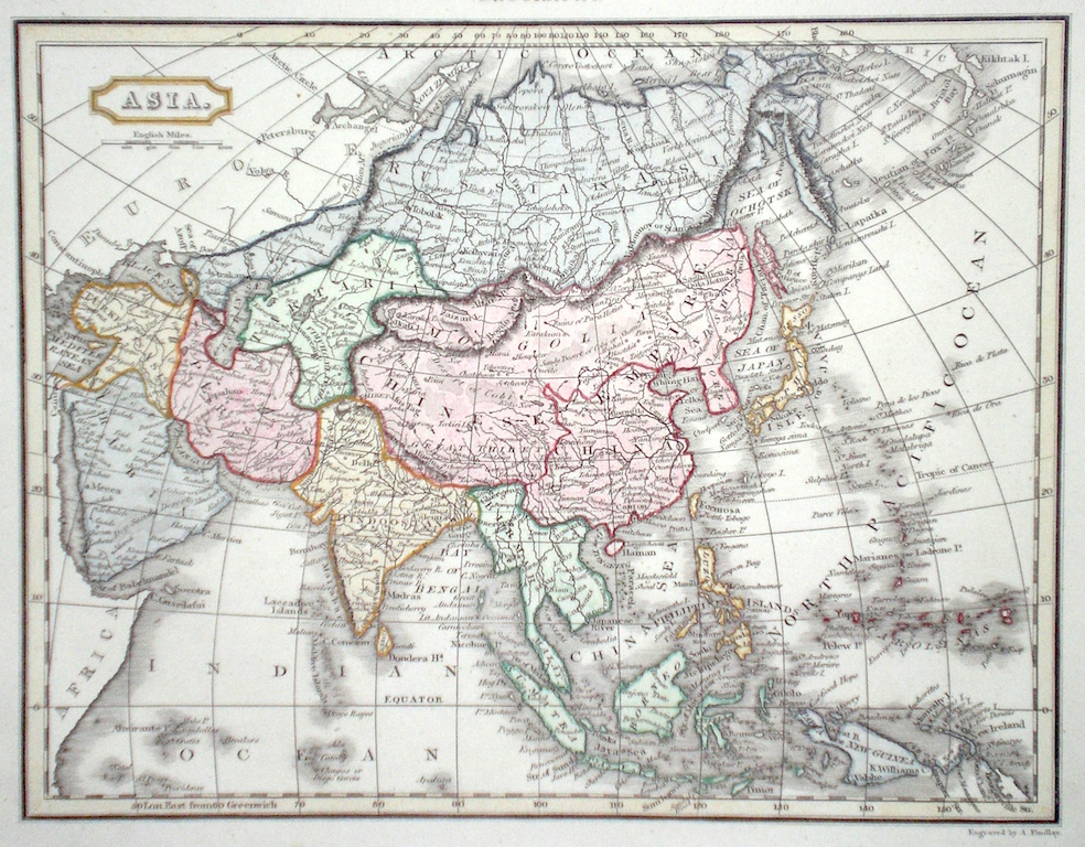
Asia 'Asia According to the best Authorities' Kitchen, T. (c. 1785) 37 x 34 Finely engraved map of Asia by Thomas Kitchen for The Universal History. Later colour. Condition excellent. 135.00 GBP |
|
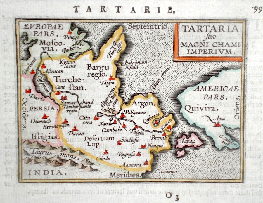
Asia 'Tartaria sive Magni Chami Imperium' Ortelius, A. (c. 1603) 10 x 8.5 Fine early map of Northern and polar regions of Asia, by Abraham Ortelius , engraved in small format by Philippe Galle, and published in the Epitome, or pocket- edition of the "Theatrum Orbis Terrarum". This map from an English text edition of c.1603 published in London and thus one of the first world atlases published in England. An interesting map, also showing the area now known as the Bering Strait, Japan and the North West coast of America. Fine condition. Later colour 120.00 GBP |
|
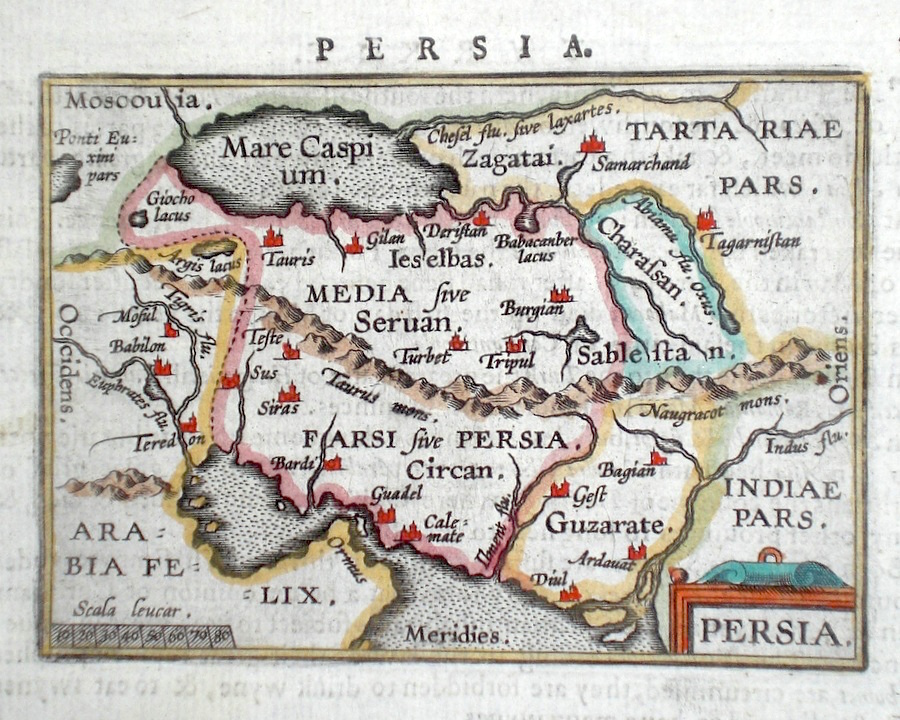
Asia 'Persia' Ortelius, A. (c. 1603) 10 x 8.5 Fine early map of Persia by Abraham Ortelius, engraved in small format by Philippe Galle, and published in the Epitome, or pocket-edition of the "Theatrum Orbis Terrarum". This map from an English text edition of c. 1603 published in London and thus one of the first world atlases published in England. Fine condition. Later colour 98.00 GBP |
|
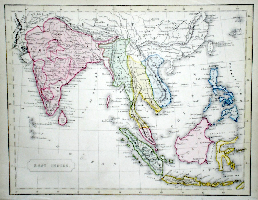
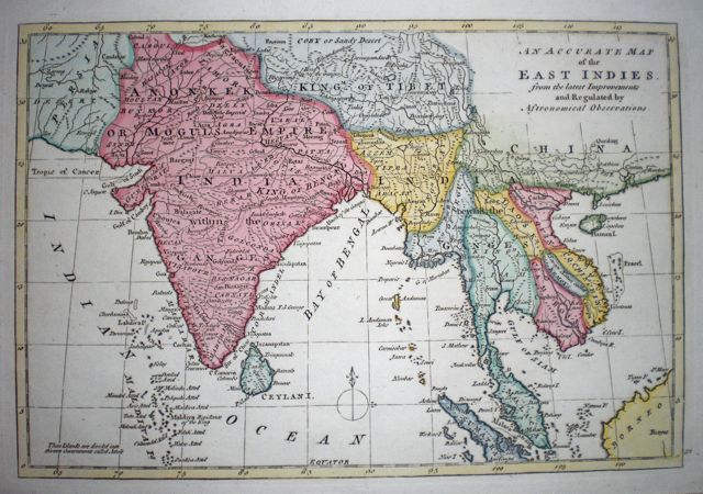
Asia 'An Accurate Map of the East Indies' Bowen, E. (c. 1760) 29 x 20 Later hand colour, Good margins. 95.00 GBP |
|
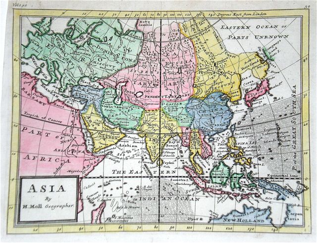
Asia 'Asia by H. Moll, Geographer.' Moll, H. (c. 1736) 27 x 20 Fine early engraving of the Asian continent. Dark impression, later hand colour, good condition. 95.00 GBP |
|
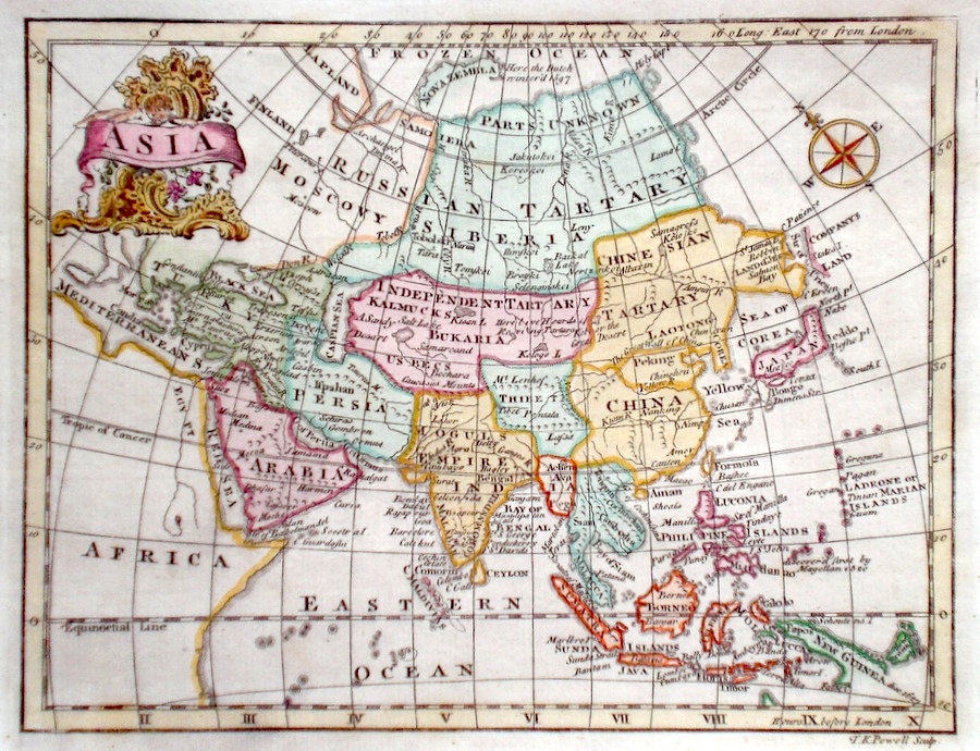
Asia Powell, T. K. (c. 1787) 22 x 17 Finely engraved map of Asia by Thomas K.Powell, published in Turner's View of the Earth 1787. Features include an attractive cartouche. The Eastern extension of Siberia towards North America, and Kamchatska is not shown and the map exhibits the speculative shape of early maps in this region. Later colour 80.00 GBP |
|
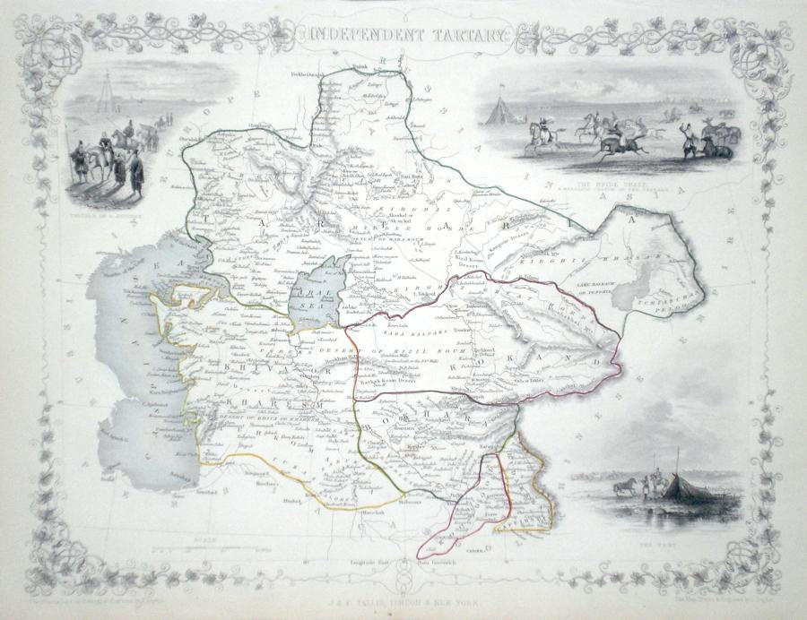
Asia 'Independent Tartary' Rapkin, J. (1851) 35 x 26 Fine map of the area east of the Caspian Sea by John Rapkin, for John Tallis's highly decorative "The Illustrated Atlas". The vignettes show; The Bride chase- a marriage custom of the Tartars, Tartars on a journey and The Tent. Single page map (no central fold). Original colour as published. Condition fine. 80.00 GBP |
|
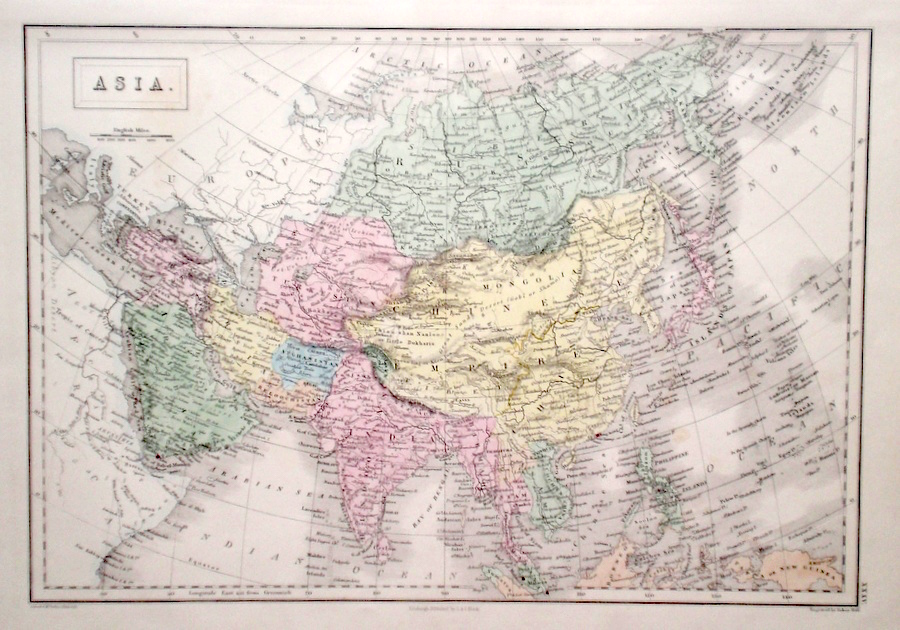
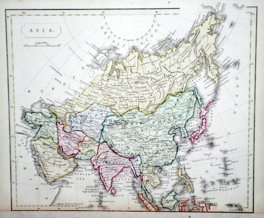
Asia Findlay, A. (c. 1820) 32 x 25 Fine map of the continent engraved by Alexander Findlay and published by Thomas Kelly. Condition excellent. Later colour 65.00 GBP |
|
Asia 'Asia from the best Authorities' Russell, J. (1818) 22 x 19 Asia from Guthrie's Geography. Engraved by John Russell. Shows New Guinea only partly charted. Original colour 60.00 GBP |

|
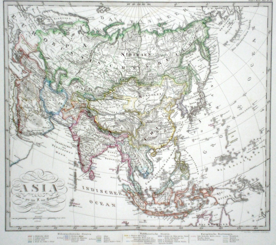
Asia Perthes, J. (1868) 36 x 33 Finely lithographed and detailed map covering Asia. By Justus Perthes for Stieler's Hand-Atlas. Original colouring, excellent condition. 60.00 GBP |
|
Asia Hall, S. (1854) 28 x 37 Finely engraved map of Asia, by Sidney Hall. Steel engraving published in the "General Atlas of The World". Condition excellent. 50.00 GBP |
|
Asia Findlay, A. (c. 1820) 26 x 20 Attractive map of Asia engraved by Alexander Findlay. Later colour. 50.00 GBP |
|
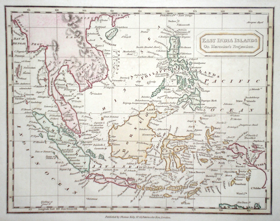
Asia 'East India Islands' Findlay, A. (c. 1820) 26 x 20 Attractive map of South East Asia engraved by Alexander Findlay. New Guinea shown as only partially mapped. Later colour. 50.00 GBP |
|
Asia Starling, T. (c. 1832) 15 x 9 Uncommon and finely engraved map of the Continent from The Royal Cabinet Atlas. Bright original colouring to the various countries. 50.00 GBP |

|
Asia Dispatch Atlas (1863) 65 x 46 Early outline colour, two verticle folds. 45.00 GBP |

|
Asia Becker & Co. (c. 1850) 27 x 20 Attractive steel engraved map by Becker and Co. for Barclays Dictionary. Original colour with some later colour 40.00 GBP |
|
Asia East Indies Becker & Co. (c. 1850) 27 x 20 Attractive steel engraved map by Becker and Co. for Barclays Dictionary. Original colour with some later colour 40.00 GBP |