Bedfordshire
(Bedford, Luton, Dunstable, Leighton Buzzard, Biggleswade, Sandy)
|
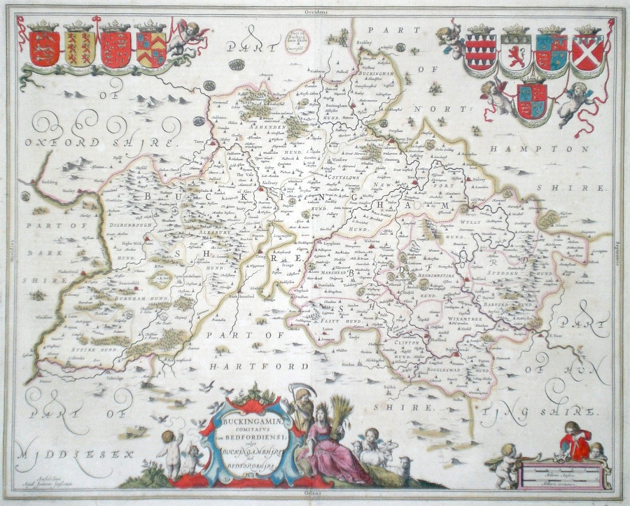
Bedfordshire 'Buckingamiae Comitatus cum Bedfordiensi; vulgo Buckingamshire and Bedfordshire' Jansson, J. (1646) 51 x 41 Buckinghamshire and Bedfordshire - neighbouring counties engraved by Dutch cartographer Johannes Jansson. A contemporary and competitor of Blaeu, his Atlas of English counties was finished at a similar time to that of Blaeu. The maps of Buckinghamshire and Bedfordshire are here engraved on one sheet compared to Blaeu who published these counties on single separate sheets. The maps are based on the respective Speed maps. To the left heraldry associated with Buckinghamshire, and to the right that of Bedfordshire. North is to the right. French text verso. Bright original hand colouring. 325.00 GBP |


|
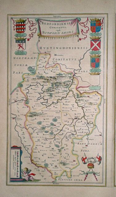
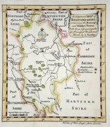
Bedfordshire Bedfordeshire and Huntingdonshire Hole, W. (1622) 31 x 25 Decorative and rare engraving representing Bedfordshire and Huntingdonshire counties by William Hole for Michael Drayton's Polyolbion. Decorated with water nymphs, and allegorical figures to illustrate the main topographical features, rivers, towns etc. Michael Drayton (1563 - 1631) was an important poet and literary figure. A contemporary of Shakespeare and Spenser, the Polyolbion is considered to be his masterpiece. He is buried in Westminster Abbey. Later colour. Traces of worm to lower corners faintly affecting the engraving. Otherwise excellent 180.00 GBP |

903 - 163 |
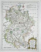
Bedfordshire 'Bedfordiensis Comitatus Anglis Bedfordshire' Blaeu, J. (c. 1645) 24.5 x 42 Superbly engraved and decorative map. Single sheet, Latin text to verso. Original colour. Some light toning, good condition. 185.00 GBP |
|
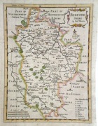
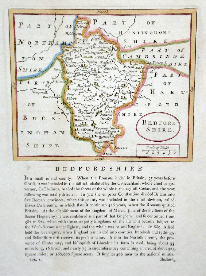
Bedfordshire 'A Mapp of Bedford shire...' Blome, R. (c. 1673) 26 x 32 Decorative map of the County by Richard Blome for his publication "Britannia". The largest series of county maps published by Blome, and generally based on those of Speed. Maps by Blome are characteristic and attractive. Fine condition, later colour. 120.00 GBP |
|
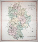
Bedfordshire 'Bedfordshire divided into Hundreds' Bowen E. and T. (1767) 22.5 x 33 Very finely engraved map of the County by Emanuel and Thomas Bowen from the "Atlas Anglicanus". The maps are generally derived from those in "The Large English Atlas", and extensive county information accompanying the maps is also a feature of this series. A rare item. Bright original colouring. 120.00 GBP |
|
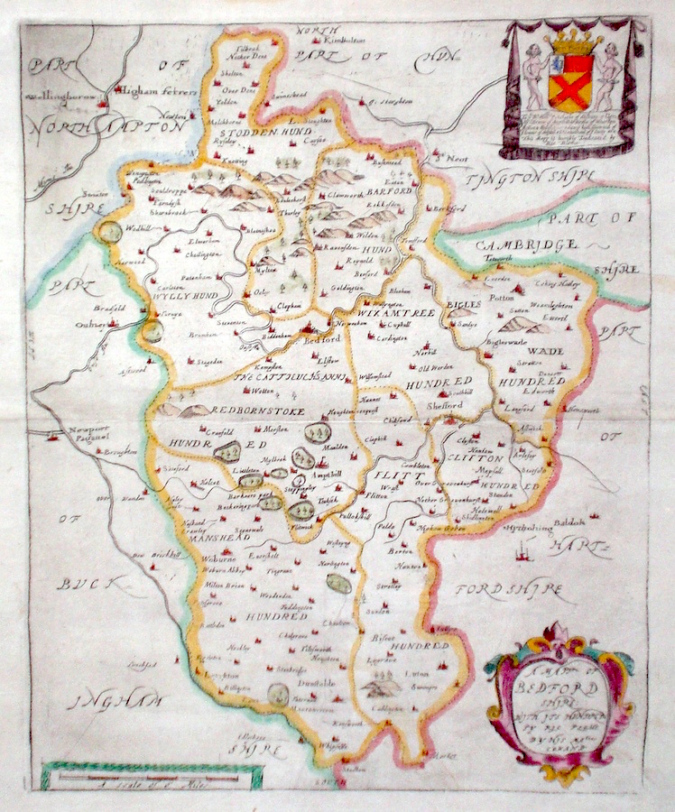
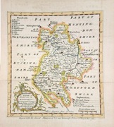
Bedfordshire 'Bedford comitatus olim pars Cathifuclanorum' Saxton C. & Kip W. (c. 1637) 34 x 28 Fine map of the county by Christopher Saxton, engraved by William Kip. Published in the 1637 edition of Camden's Britannia, and one of the earliest maps of the county. Later colour. Good condition 95.00 GBP |
|
Bedfordshire 'Bowles's New Medium Map of Bedford shire...' Bowen, E. & T. (1785) 23 x 33 Finely engraved and detailed map of the county from "Bowles's New Medium English Atlas". The maps in this series are based on those in Emanuel and Thomas Bowen's Atlas Anglicanus, and feature extensive county information on the map. They are distinguished primarily by having newly engraved cartouches, distances from London added to towns, and different imprints at the bottom. Full original colour. Some slight offsetting to the left hand side, otherwise fine condition 98.00 GBP |
||||||||||||||
|
Bedfordshire 'Bedfordshire by Robt. Morden' Morden, R. (c. 1722) 40 x 32 Finely engraved map of the county by Robert Morden published in Camden's Britannia. Later colour, fine condition with good margins. 98.00 GBP |
|
Bedfordshire 'A Map of Bedfordshire from the Best Authorities' Stockdale, J (1805) 40 x 50 Crisp copy with full body colour, good margins, two longitudinal folds. 90.00 GBP |

|
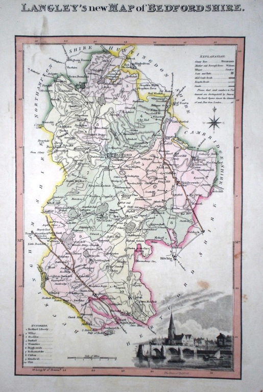
Bedfordshire 'Langley's new Map of Bedfordshire' Langley, E. (c. 1818) 18 x 26 Attractive and uncommon map of the county by the partnership of Edward Langley and William Belch from their publication Langley's New County Atlas of England and Wales. The vignette shows a view of Bedford. Fine original hand colouring. 65.00 GBP |
|
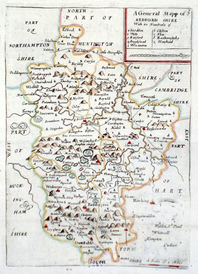
Bedfordshire 'A General Map of Bedford shire' Blome, R. (c. 1731) 17 x 23 Finely engraved map of the county by an anonymous hand, possibly Blome from the atlas "England Exactly Described or a Guide to Travellers…" first published by Thomas Taylor, but herewith from the later edition published by Thomas Bakewell. A major addition to the earlier plates is that roads and distances between towns are now included, after the road surveys of John Ogilby. Fine condition. Later colour 65.00 GBP |
|
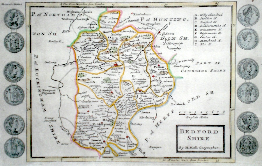
Bedfordshire Moll, H. (c. 1724) 32 x 20 Finely engraved map of the county by Herman Moll for the publication "A New Description of England and Wales…" The maps in this series include engraved borders of local architectural and antiquarian interest. A unique feature. On this map early British coins. Later colour, fine condition. 60.00 GBP |
|
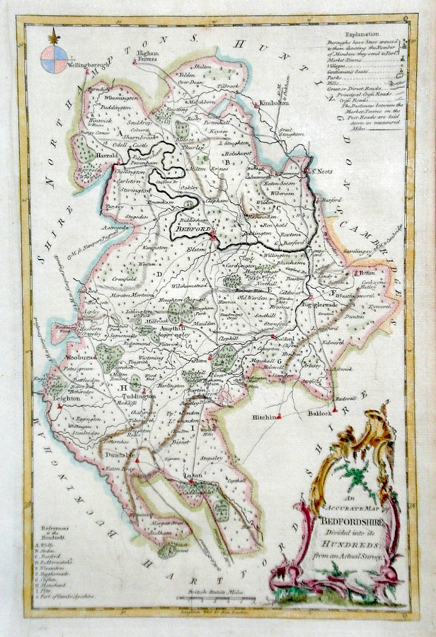
Bedfordshire 'An Accurate Map of Bedfordshire divided into its hundreds...' Rollos, G. (c. 1769) 19 x 29 Finely engraved map of the county by George Rollos for the publication "England Displayed". Later colour 50.00 GBP |
|
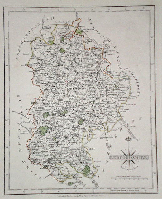
Bedfordshire 'A New Map of Bedfordshire' Cary, J (1809) 48 x 54 Early wash colour, good margins, minimal offsetting, horizontal fold. New English Atlas. 50.00 GBP |
|
Bedfordshire 'An Improved Map of Bedfordshire' Cowley, J. (1744) 14 x 18 Bedfordshire from the rare publication The Geography of England. Published by Robert Dodsley. Later hand colour. 55.00 GBP |
|
Bedfordshire 'Bedfordshire by Robt. Morden' Morden, R. (c. 1701) 15.5 x 21 Map similar in style to Morden's maps for Camden's Britannia, but reduced in size. This series is very much rarer. Later hand colour. 3 cm re-margined bottom left corner. 45.00 GBP |
|
Bedfordshire 'Bedfordshire Divided into it's Hundreds' Bowen, E. (c. 1758) 17 x 20 Clearly engraved map of Bedfordshire from the General Magazine Of Arts and Sciences. Later hand colour. 45.00 GBP |
|
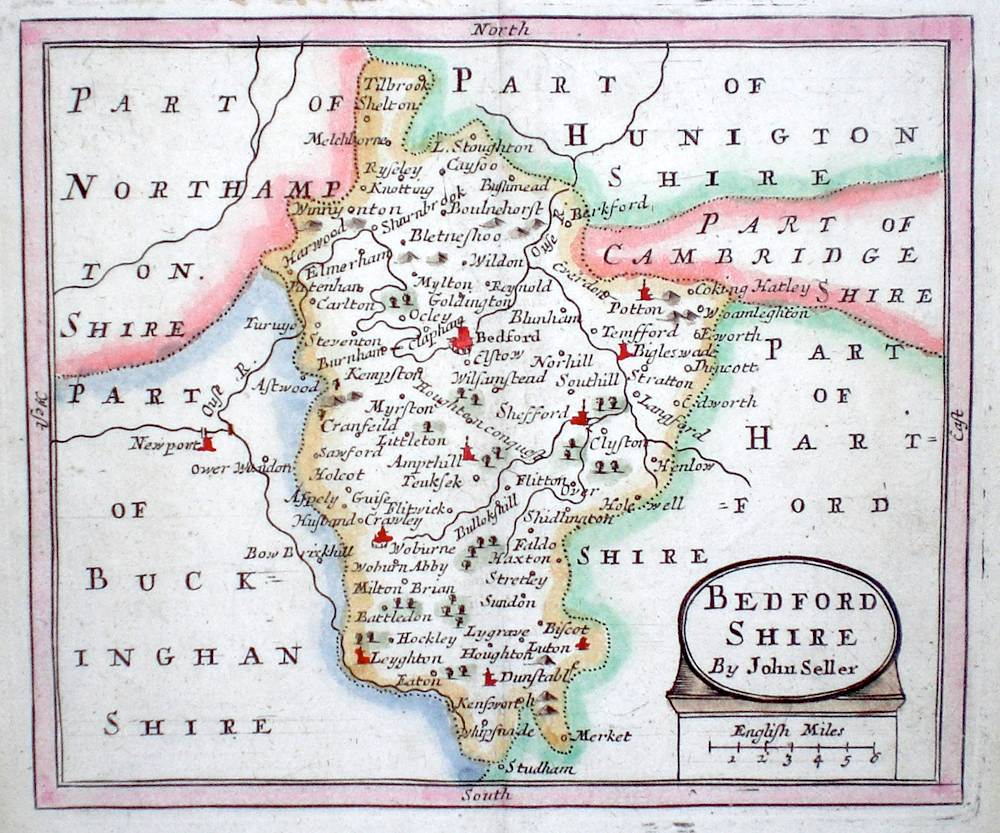
Bedfordshire 'Bedfordshire by John Seller' Seller, J. (c. 1703) 15 x 13 Fine map of the county by the Hydrographer and instrument maker John Seller for his "Anglia Contracta". This series of maps were first published in 1695. They were later used in a simplified form by Francis Grose for his "Supplement to the Antiquities of England and Wales", published from 1787. 50.00 GBP |
|
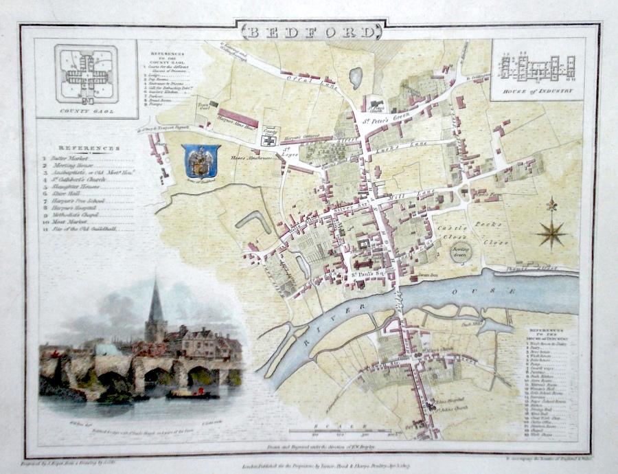
Bedford Cole G. (c. 1810) 24 x 19 Fine town plan of Bedford by George Cole and John Roper. The engraving bottom left is of St Peters church viewed from across the river by G. Cooke. Later colour 40.00 GBP |
|
Bedfordshire Teesdale, H (1829) 35 x 42 Early wash colour, good condition. 40.00 GBP |
|
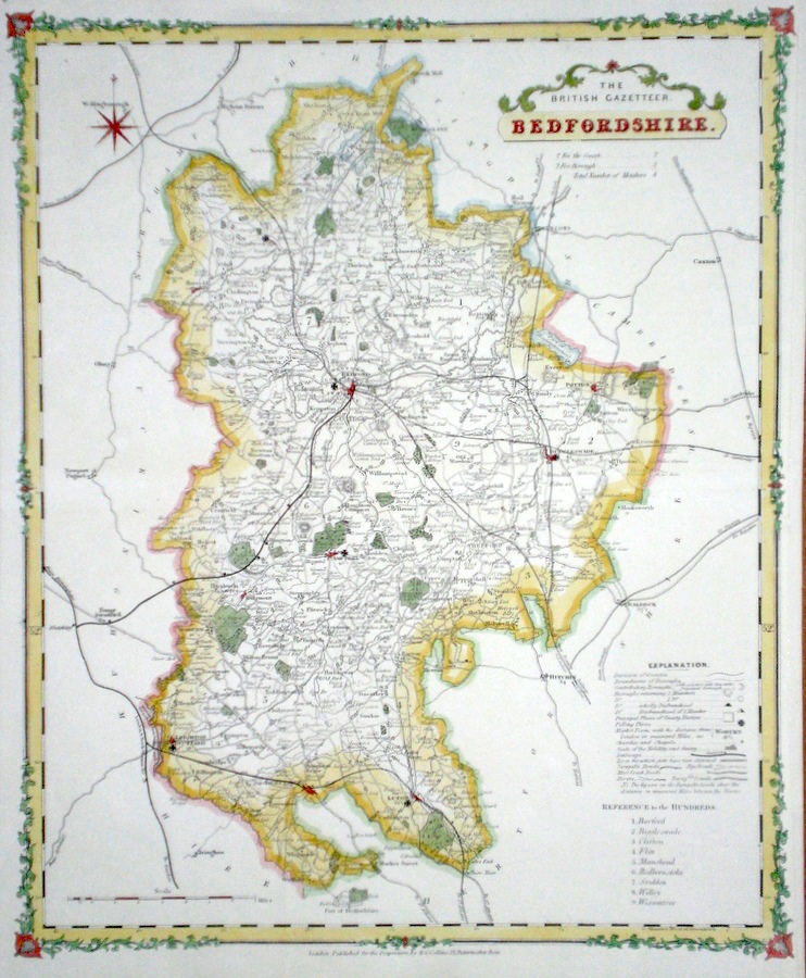
Bedfordshire Collins, H. (c. 1860) 35 x 48 Attractive and large size map of the county by Henry Collins for his British Gazeteer. Engraved by lithography. Later colour 40.00 GBP |
|
Bedfordshire Cary, J. (1793) 22 x 27 Bedfordshire by John Cary from his New and Correct Atlas. Characteristic fine and detailed engraving. Original colour. Fine condition 35.00 GBP |
|
Bedfordshire Seller, J. (c. 1795) 15 x 21 Attractive map of the County by John Seller published in Francis Grose's "Antiquities of Great Britain". Text below and verso. Later colour. Excellent condition 30.00 GBP |
|
Bedfordshire 'A Map of Bedfordshire Drawn from the Best Authorities' Kitchen, T. (1764) 26 x 20 Detailed map showing roads, borough towns, market towns and a wealth of county information. Later hand colour. 30.00 GBP |