Westmoreland
Including Appleby, Kendal, Windermere, Ambleside, Kirkby Lonsdale
|
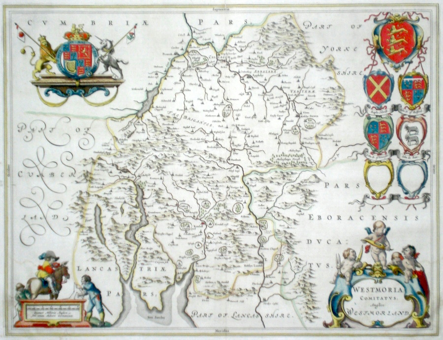
Westmoreland 'Westmoria Comitatus Anglice Westmoreland' Blaeu, J. (c. 1646) 50 x 38 Very fine map of the County by Joan Blaeu. The map embodies the finest features of Dutch Cartography of the Seventeenth century. Superbly engraved and arranged, with shields and coats of arms. To the left cartouche surveyors are consulting with a mounted cavalier. To the lower right cartouche four putti are shown with cloth and cloth making pools. Large paper copy. French text verso. Bright Original colour. A few marks in the margin do not affect the engraving. 245.00 GBP |
|
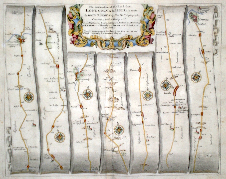
Westmoreland 'The continuation of the Road from London to Carlisle in com. Cumbr.' Ogilby, J. (1698) 42 x 33 The road from Garstang to Lancaster, Boulton, Burton, Kendal, Thrumby, Penrith, Carlisle. From John Ogilby's Britannia, generally considered one of the most important cartographical works of the seventeenth century. Features include town plans of Lancaster, Carlisle, and a fine cartouche. Later colour. Plate number 38. Fine condition 170.00 GBP |
|
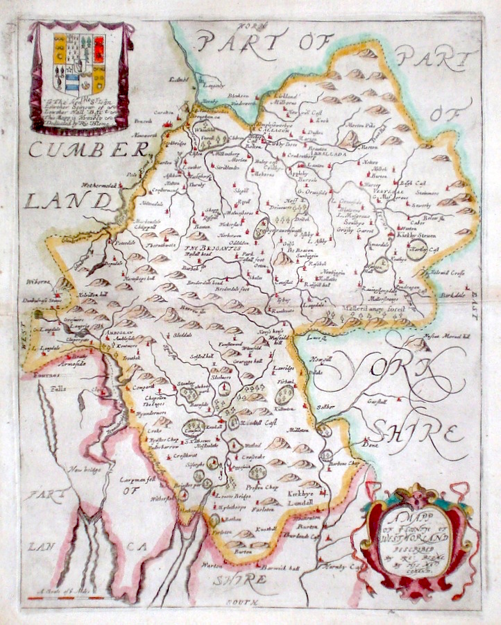
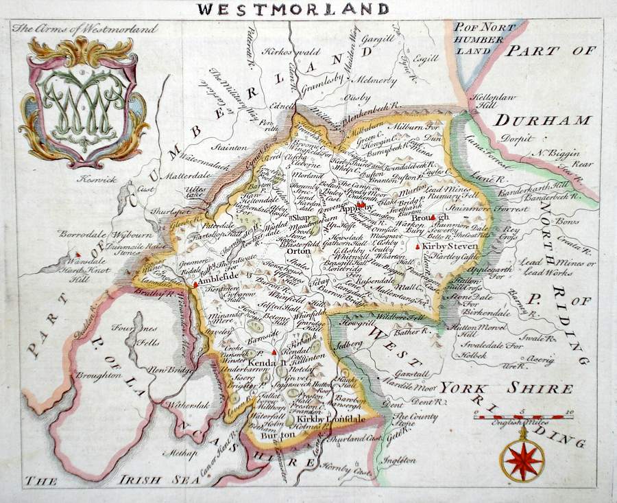
Westmoreland 'A Mapp of ye Countie of Westmorland...' Blome, R. (1673) 25 x 32 Decorative map of the County by Richard Blome for his publication "Britannia". The largest series of county maps published by Blome, and generally based on those of Speed. Maps by Blome are characteristic and attractive. Fine condition, later colour. 140.00 GBP |


|
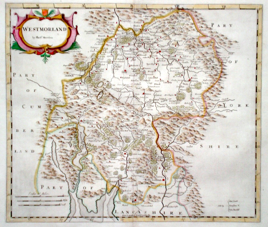
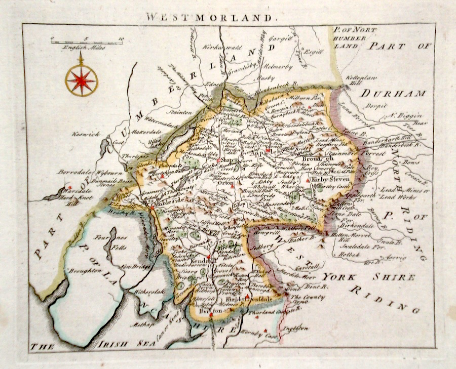
Westmoreland 'Westmoreland by Robt. Morden' Morden, R. (c. 1722) 42 x 36 Finely engraved map of the county by Robert Morden. From the 1722 edition of Camden's Britannia. Excellent condition. Later colour 110.00 GBP |
|
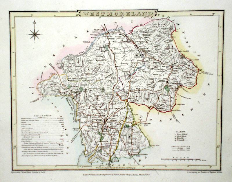
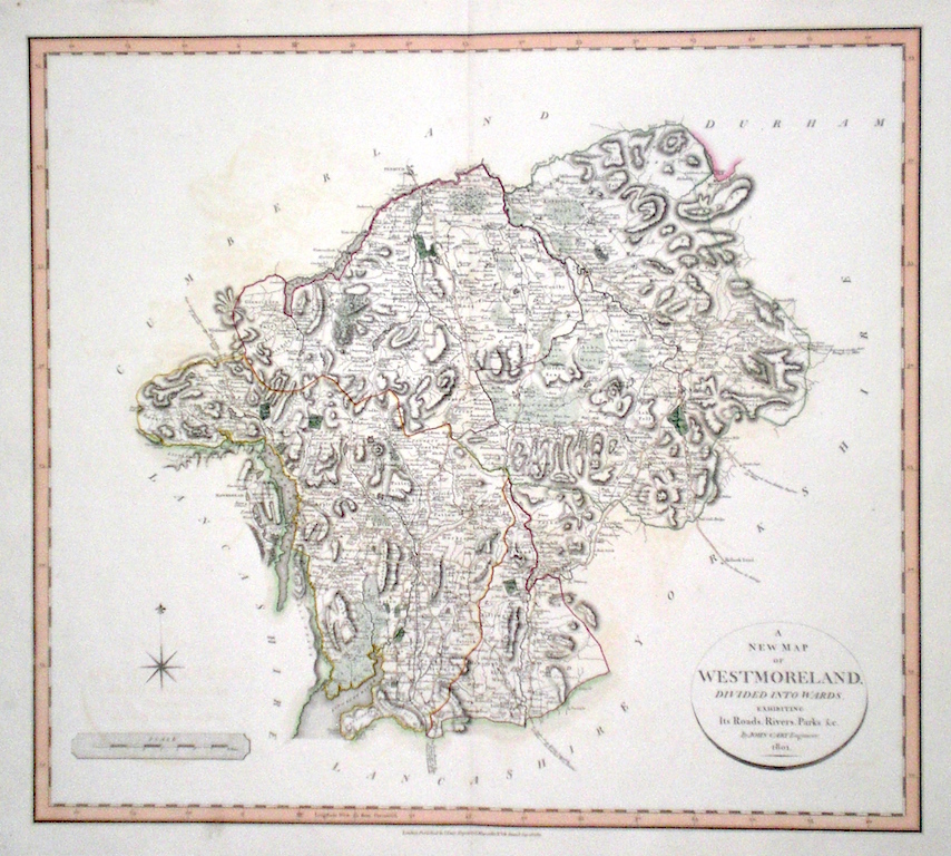
Westmoreland 'A New Map of Westmorland divided into Hundreds exhibiting its Roads, Rivers, Parks' Cary, J. (1809) 54 x 49 Superbly engraved map of the county by John Cary. From "Cary's New English Atlas". The atlas was issued in parts from 1801 to 1809 and published as a complete work in 1809. Very fine original hand colour. 95.00 GBP |
|
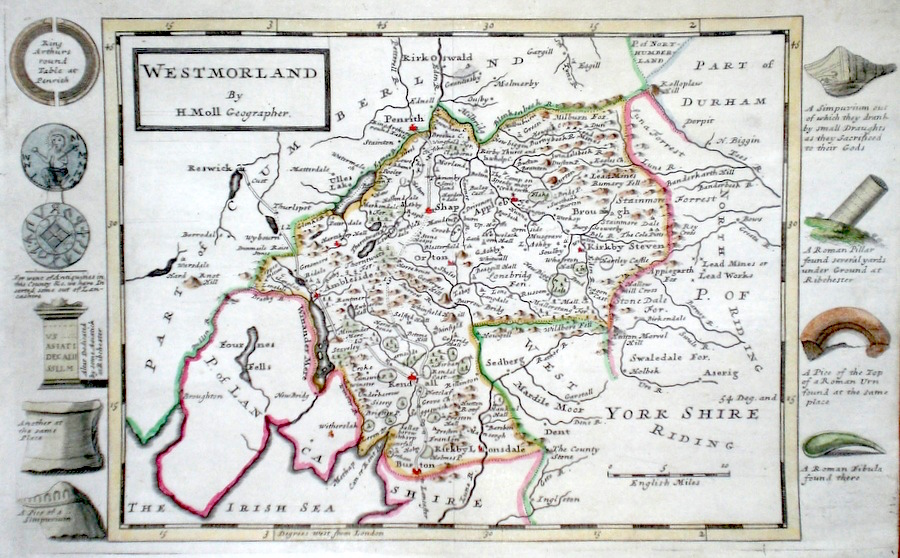
Westmoreland Moll, H. (c. 1724) 31 x 20 Finely engraved map of the county by Herman Moll for the publication "A New Description of England and Wales…" The maps in this series include engraved borders of local architectural and antiquarian interest. A unique feature. On this map various Roman objects and ecclesiastical monuments. Later colour, fine condition. 60.00 GBP |
|
Westmoreland 'A New Map of Westmoreland divided into wards' Smith, C. (1804) 50 x 45 Large size and decorative map of the County by Jones, Smith & Co. for Smith's New English Atlas. The first map of the County to show longitudes measured from the meridian of Greenwich. Very fine original hand colouring. 60.00 GBP |

|
Westmoreland 'A Map of Westmoreland from the Best Authorities' Cary, J. Camden's Britannia (1789) 48.5 x 40 Finely engraved, highly detailed double page map, showing Ullswater, Windermere, etc. 60.00 GBP |
|
Westmoreland Rocque, J. (c. 1769) 20 x 17 Finely engraved map of the county by John Rocque for the pubication "England Displayed". Later colour 50.00 GBP |
|
Westmoreland Simpson, S. (1746) 18 x 16 Fine map of the county by Samuel Simpson for his publication "The Agreeable Historian". Most of the maps in this rare series are said by Simpson to be based on those of Herman Moll. Margin added to top and title in manuscript. Later colour 50.00 GBP |
|
Westmoreland Moule, T. (c. 1848) 27 x 20.5 Decorative steel engraving from Barclays Complete and Universal Dictionary. Later colour, good condition. 45.00 GBP |
|
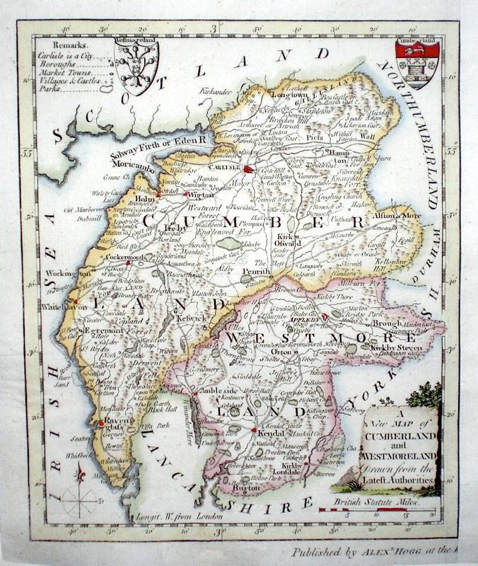
(Cumberland and) Westmoreland 'A New Map of Cumberland and Westmoreland drawn from the Latest Authorities' Conder, T. (c. 1784) 16 x 19 Finely engraved map showing the two Counties. Engraved by Thomas Conder for the publication "The New British Traveller". Features include Coats of Arms of both counties and an attractive title cartouche. Later colour 40.00 GBP |
|
Westmoreland Lewis, W. (c. 1835) 14 x 10 Detailed and attractive miniature map of the Region by William Lewis for his "Lewis's New Traveller's Guide". A particular feature of this charming series of maps is the clear and precise engraving of the roads. Adjacent numbers indicating the distances from London. Also included with the map is the accompanying page of text giving the county information relevant to travellers,- principal towns and inns are listed, distances between towns, principal fair dates, and even sites for the best views of the county. Later colour. 35.00 GBP |

|
Westmoreland Roper, J. (c. 1810) 24 x 18 Detailed and decorative map of the county by Cole and Roper for The British Atlas. Original hand colouring. Excellent condition. 35.00 GBP |