Buckinghamshire
Including Aylesbury, Milton Keynes, Slough, Buckingham, High Wycombe
|
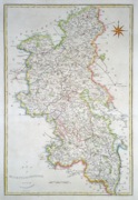
Buckinghamshire 'Buckingham both Shyre, and shire-towne describ.' Speed, J. (c. 1676) 51 x 38 John Speed's superb map of Buckinghamshire, Bassett and Chiswell edition. The map is finely constructed with town plans of Buckingham and unusually, Redding (sic). In a cartouche to the left of the town plan of Redding, Speed explains that he did not have space for a town plan of Redding in his map of Berkshire so he put it in a space available in the Buckinghamshire map! Heraldic shields, and architectural devices complete the attractiveness of this map. English text verso. Bright hand colour. Excellent condition 465.00 GBP |


|
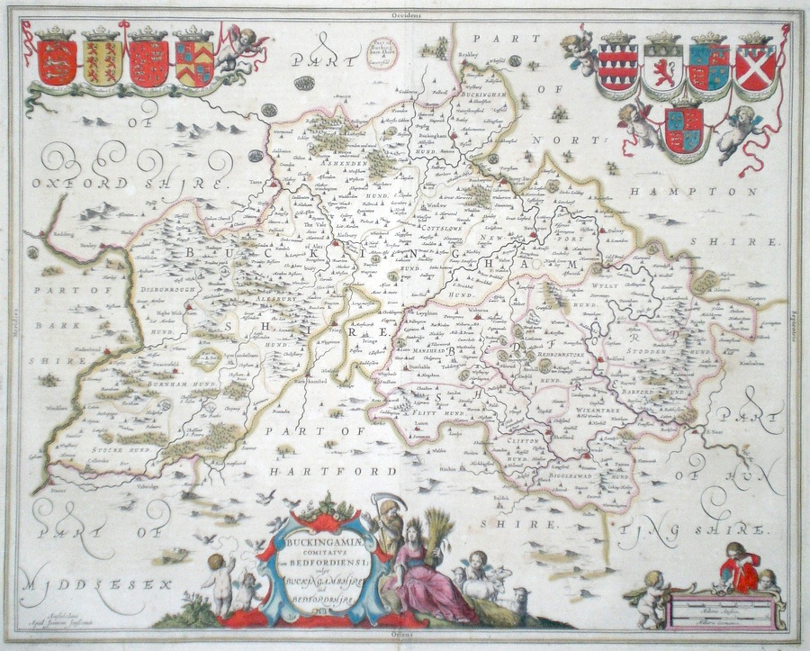
Buckinghamshire 'Buckingamiae Comitatus cum Bedfordiensi; vulgo Buckingamshire and Bedfordshire' Jansson, J. (1646) 51 x 41 Buckinghamshire and Bedfordshire - neighbouring counties engraved by Dutch cartographer Johannes Jansson. A contemporary and competitor of Blaeu, his Atlas of English counties was finished at a similar time to that of Blaeu. The maps of Buckinghamshire and Bedfordshire are here engraved on one sheet compared to Blaeu who published these counties on single separate sheets. The maps are based on the respective Speed maps. To the left heraldry associated with Buckinghamshire, and to the right that of Bedfordshire. North is to the right. French text verso. Bright original hand colouring. 325.00 GBP |
|
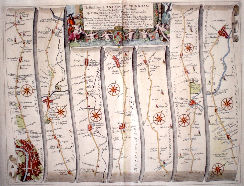
Buckinghamshire 'The Road from London to Buckingham' Ogilby, J. (c. 1698) 44 x 34 The road from London to Buckingham and the continuation from Buckingham to Banbury. From John Ogilby's seminal publication, “Britannia”, generally considered one of the most important cartographical works of the seventeenth century. Features- London (town plan), Uxbridge, Amersham, Wendover, Aylesbury, Buckingham. Continuation features the road to Banbury. Later colour, Excellent condition. 240.00 GBP |
|
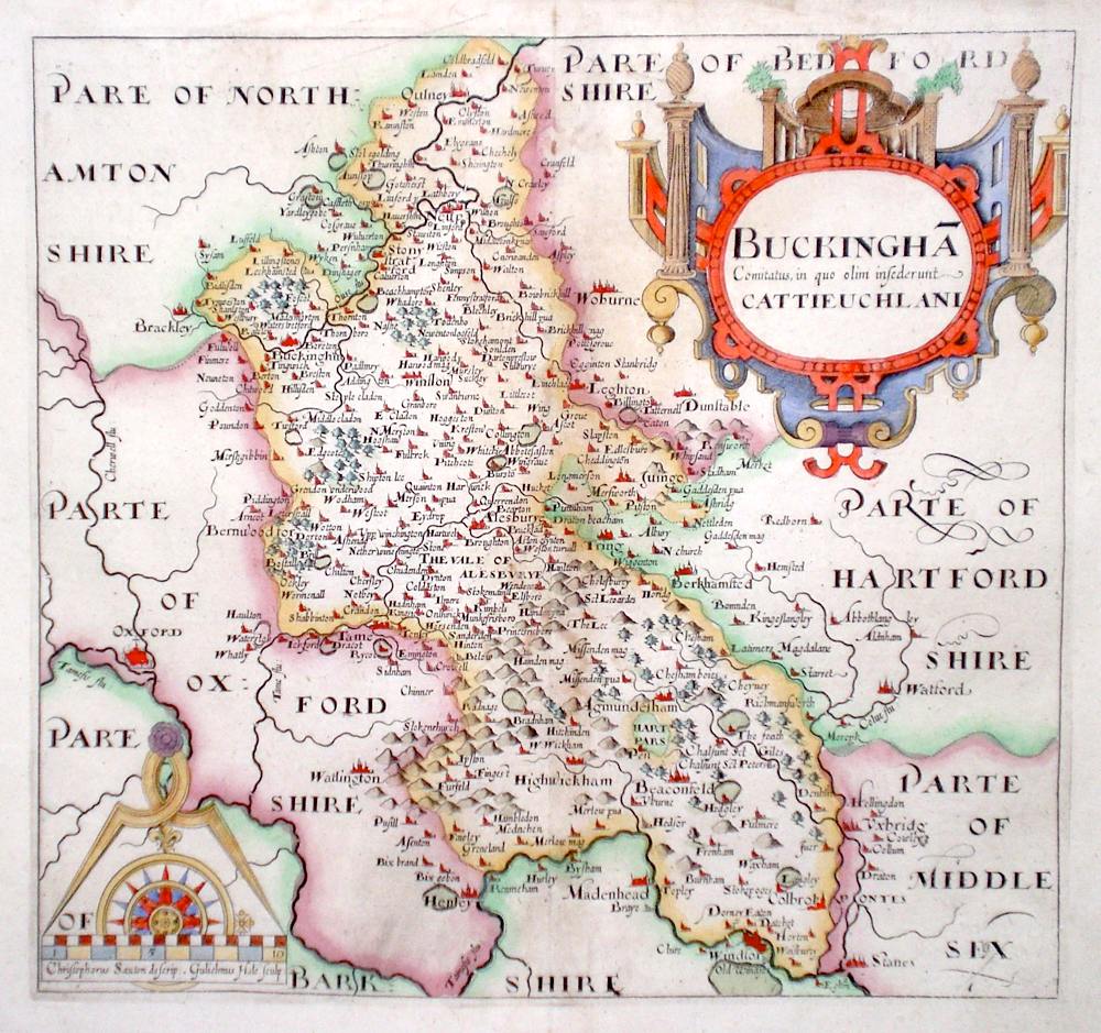
Buckinghamshire 'Buckingha Comitatus in quo olim insederunt Cattieuchlani' Hole, W. (1637) 29 x 27 Fine early map of Buckinghamshire engraved by William Hole after Christopher Saxton. From the English text edition of Camden's Britannia. Bright later colour. Some slightly thin areas but otherwise excellent condition. 230.00 GBP |
|
Buckinghamshire 'A Mapp of Buckingham shire with the Hundreds By Ric; Blome by his Ma ty.Comand' Blome, R. (1673) 25 x 32 A Superb copy of Richard Blome's map of Buckinghamshire (after Speed). A dark impression on thick paper with broad margins, attractive early colour. 185.00 GBP |
|
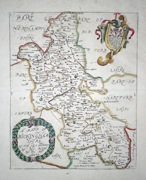
Buckinghamshire 'Buckinghamiensis Comitatus Anglis Buckinghamshire' Blaeu, J. (1646/1664) 27 x 42 Superbly engraved and decorative map. Single sheet. Dutch text to verso. Later colour. Excellent condition. 180.00 GBP |

|
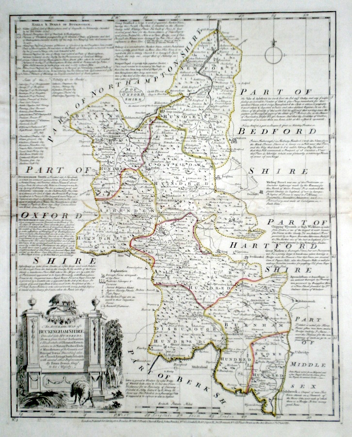
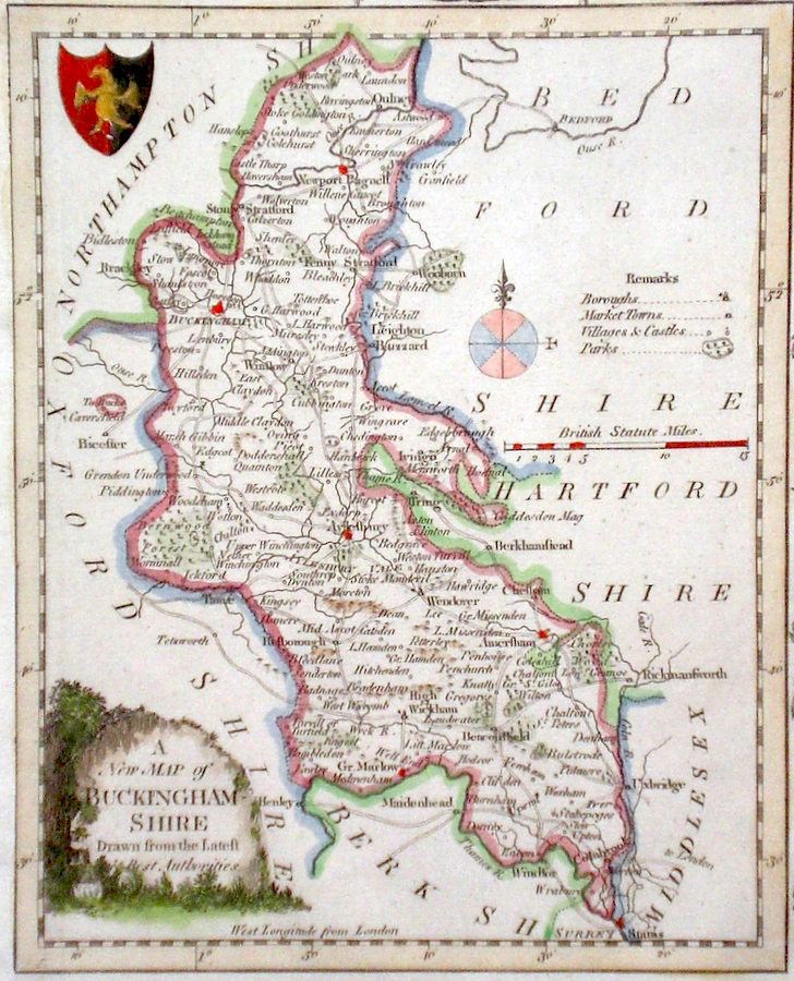
Buckinghamshire 'An Accurate Map of Buckinghamshire' Bowen, E. (c. 1777) 40 x 50 Finely engraved map of the county by Emanuel Bowen for the Royal English Atlas. The maps in this series are reduced in size from the Large English Atlas but still carry extensive county information. Uncommon item. Original colour to the Hundreds as published. 160.00 GBP |
|
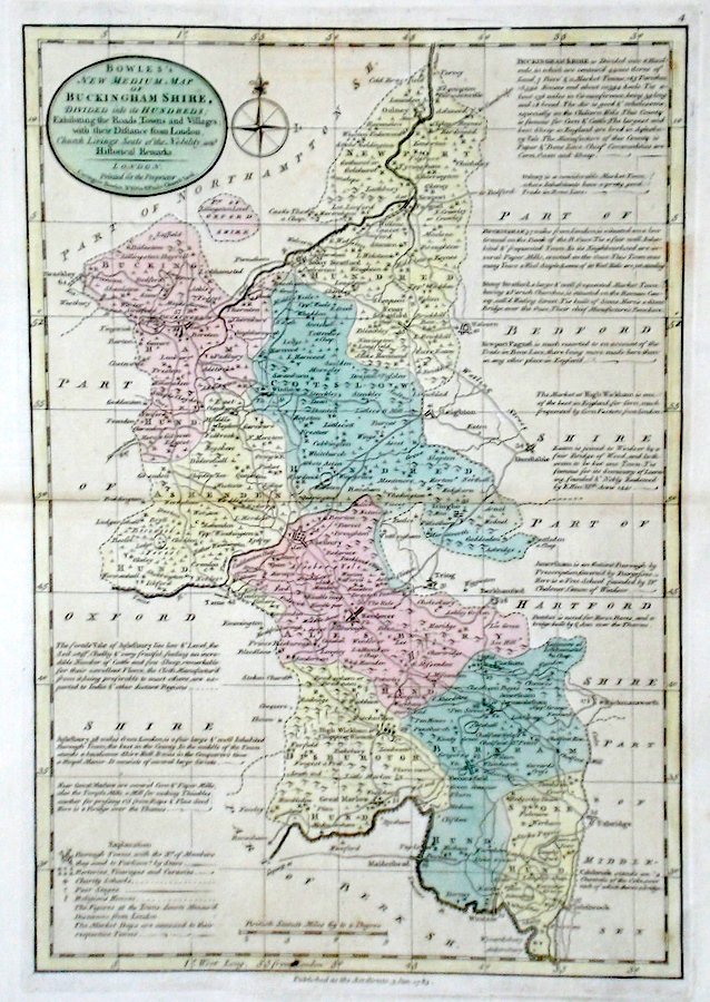
Buckinghamshire 'Bowles's New Medium Map of Buckingham shire...' Bowen, E. & T. (1785) 23 x 33 Finely engraved and detailed map of the county from "Bowles's New Medium English Atlas". The maps in this series are based on those in Emanuel and Thomas Bowen's Atlas Anglicanus, and feature extensive county information on the map. They are distinguished primarily by having newly engraved cartouches, distances from London added to towns, and different imprints at the bottom. Full original colour. Some slight offsetting to the left hand side, othewise Fine condition 150.00 GBP |
||||||||||||||
|
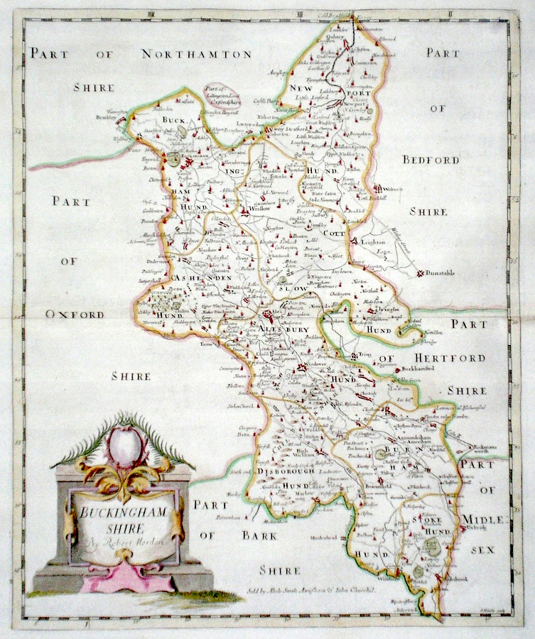
Buckinghamshire 'Buckinghamshire by Robt. Morden' Morden, R. (c. 1722) 35 x 42 Finely engraved map of the county by Robert Morden for the 1722 edition of Camden's Britannia. Later colour. Condition excellent 150.00 GBP |
||||||||||||||
|
Buckinghamshire 'Buckinghamshire divided into Hundreds…' Bowen E. & T. (1767) 22.5 x 33 Very finely engraved map of the County by Emanuel and Thomas Bowen from the "Atlas Anglicanus". The maps are generally derived from those in "The Large English Atlas", and extensive county information accompanying the maps is also a feature of this series. A rare item. Bright original colouring. 120.00 GBP |
|
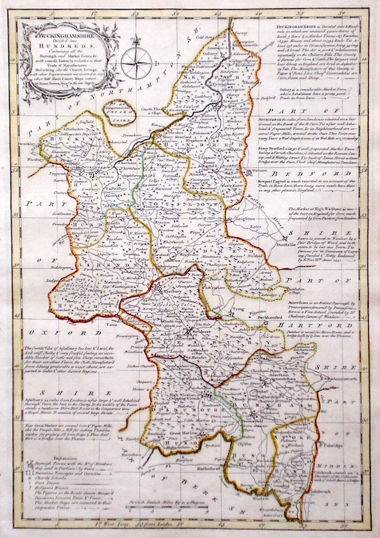
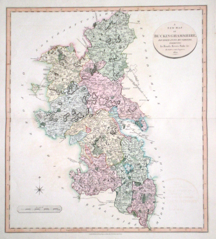
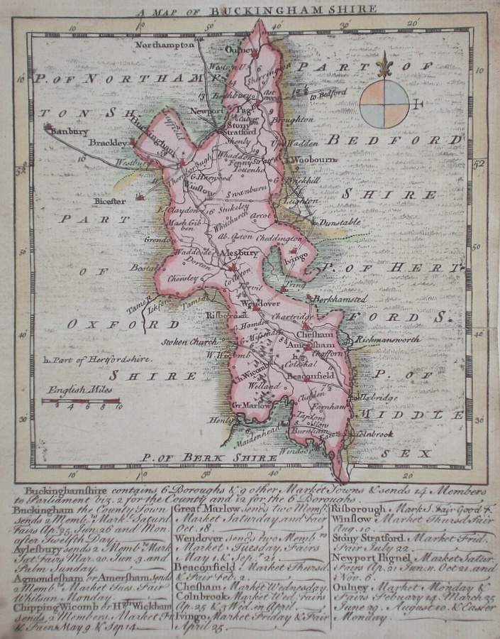
Buckinghamshire 'A New Map of Buckinghamshire divided into Hundreds exhibiting its Roads, Rivers, Parks...' Cary, J. (1809) 49 x 54 Superbly engraved map of the county by John Cary. From "Cary's New English Atlas". The atlas was issued in parts from 1801 to 1809 and published as a complete work in 1809. Very fine original hand colour. 125.00 GBP |
|
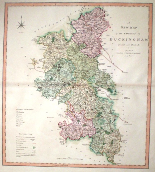
Buckinghamshire 'A New Map of the County of Buckingham divided into hundreds' Smith, C. (1804) 45 x 50 Large size and decorative map of the County by Jones, Smith & Co. for Smith's New English Atlas. The first map of the County to show longitudes measured from the meridian of Greenwich. Very fine original hand colouring. 110.00 GBP |
|
Buckinghamshire 'A Map of Buckinghamshire from the Best Authorities' Stockdale, J (1805) 35.5 x 53 Crisp copy with full body colour, good margins, two longitudinal folds. 110.00 GBP |
|
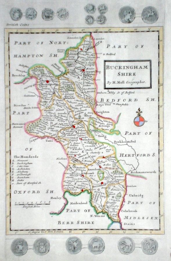
Buckinghamshire Moll, H. (c. 1724) 20 x 32 Finely engraved map of the county by Herman Moll for the publication "A New Description of England and Wales…" The maps in this series include engraved borders of local architectural and antiquarian interest. A unique feature. On this map early British coins. Later colour, fine condition. 70.00 GBP |
|
Buckinghamshire 'Buckinghamshire by Thos. Kitchen Geog.' Kitchen, T. (1786) 17 x 21 Finely engraved map showing a wealth of county information. Later hand colour. Good condition 55.00 GBP |
|
Buckinghamshire 'A Map of Buckinghamshire' Kitchin/Jefferys (1751) 13.5 x 18 Finely engraved map of the county by Thomas Kitchin and Thomas Jefferys from their publication "The Small English Atlas". This rare series of maps are distinctive by featuring considerable county information below the map. Later colour 55.00 GBP |
|
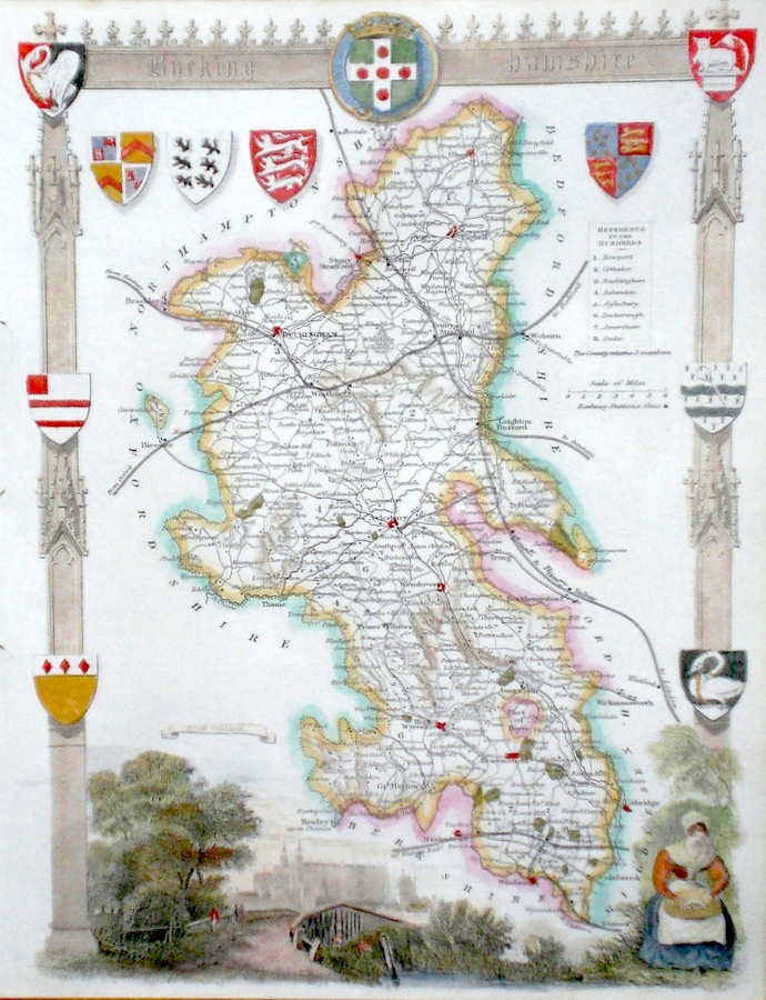
Buckinghamshire Moule, T. (c. 1850) 20 x 27 Attractive steel engraved map by Thomas Moule. Moule was a heraldry expert and antiquarian and the attractive embellishments on his maps make them amongst the last of the decorative maps to be published. Later colour. Good condition with margins. 55.00 GBP |
|
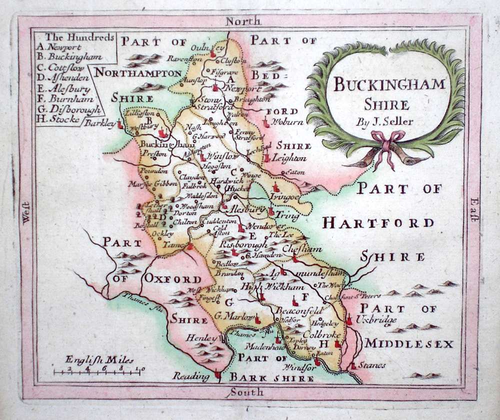
Buckinghamshire 'Buckinghamshire by J. Seller' Seller, J. (c. 1703) 15 x 13 Fine map of the county by the Hydrographer and instrument maker John Seller for his "Anglia Contracta". This series of maps were first published in 1695. They were later used in a simplified form by Francis Grose for his "Supplement to the Antiquities of England and Wales", published from 1787. 50.00 GBP |
|
Buckinghamshire 'A New Map of Buckingham-shire drawn from the latest and best Authorities…' Conder, T. (1784) 16 x 20 Finely engraved and decorative map of the county by Thomas Conder for the publication "The New British Traveller". Features include a cartouche title and coat of arms. Later colour 50.00 GBP |
|
Buckinghamshire Bowen E. (c. 1724) 12 x 19 Finely engraved map of the county by Emanuel Bowen and John Owen for the publication "Britannia Depicta". To the top are given details of the Road from London to Yarmouth and verso a section of the road through Colchester to Ipswich and Woodbridge is engraved. After John Ogilby. Later colour 50.00 GBP |

|
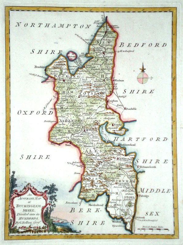
Buckinghamshire 'An Accurate Map of Buckingham-shire Divided into its Hundreds' Rollos, G. (1769) 21.5 x 29 Uncommon map of the county by Rollos. One of a small number of maps by this engraver which had been used for the publication 'England Displayed'. Later colour. 50.00 GBP |
|
Buckinghamshire 'A New Map of Buckinghamshire' Cary, J (1809) 48 x 54 Early wash colour, good margins, slight offsetting, horizontal fold, slight tear affecting left hand margin and into border. New England Atlas. 50.00 GBP |
|
Buckinghamshire 'A Map of Buckinghamshire from the Authorities' Cary, J. Camden's Britannia (1798) 36 x 53 Highly detailed double page map. Fine strong impression. 70.00 GBP |
|
Buckinghamshire Seller, J. (c. 1787) 14.5 x 12 Attractive map showing the hundreds. The text relating to the county accompanies, below the map. Later hand colour. 35.00 GBP |
|
Buckinghamshire Becker, F. (c. 1842) 28 x 25 Detailed steel engraved map of the county with original colour. Published in Fisher's County Atlas, the only cartographical work from this company. 40.00 GBP |
|
Buckinghamshire Lewis, W. (c. 1835) 14 x 10 Detailed and attractive miniature map of the County by William Lewis for his "Lewis's New Traveller's Guide". A particular feature of this charming series of maps is the clear and precise engraving of the roads. Adjacent numbers indicating the distances from London. Also included with the map is the accompanying page of text giving the county information relevant to travellers - principal towns and inns are listed, distances between towns, principal fair dates, and even sites for the best views of the county. Later colour. 35.00 GBP |