Northumberland
Including Alnwick, Newcastle-upon-Tyne, Morpeth, Hexham, Berwick-upon-Tweed
|
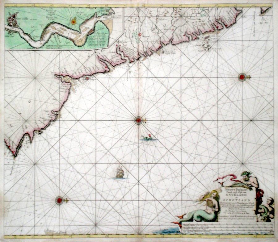
Northumberland 'Niewe Pascaert Vande oost cust van Engeland en Schotland...' Van Keulen, J. (c. 1685) 59 x 51 Fine sea chart of the coast of England from Flamborough in Yorkshire to the Firth of Forth by the prolific printing house of Van Keulen, Amsterdam. Inset chart of the river Tyne and Newcastle. Three compass roses indicate that North is to the right. A fine title cartouche shows a Mermaid and Mermen. Later colour. Condition excellent. 225.00 GBP |


|
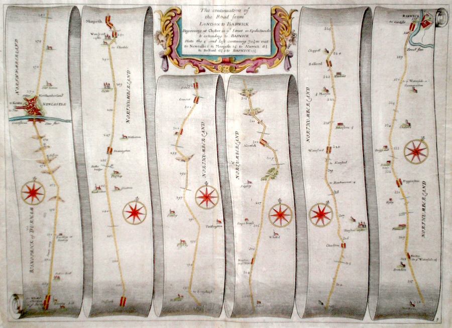
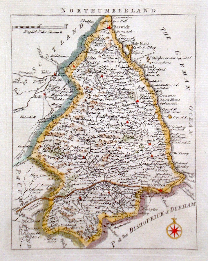
Northumberland 'The continuation of the Road from London to Barwick' Ogilby, J. (c. 1698) 44 x 33 The road from Chester le Street, to Newcastle, Morpeth, Alnwick, Belford, Berwick. From John Ogilby's Britannia, generally considered one of the most important cartographical works of the seventeenth century. Features include town plan of Newcastle, and a fine cartouche. Later colour. Plate number 9. Excellent condition. 180.00 GBP |
|
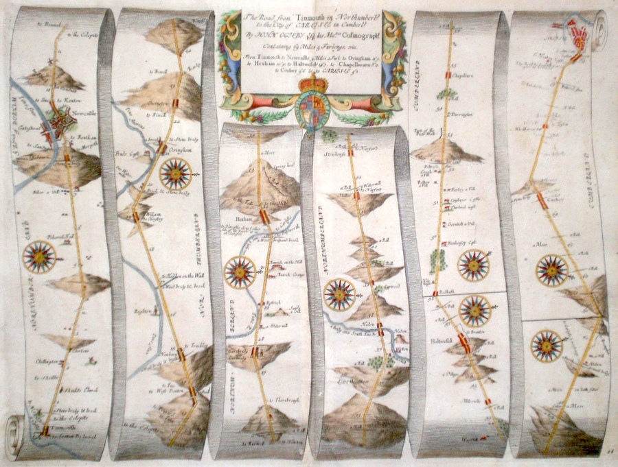
Northumberland 'The Road from Tinmouth in Northumberld. To the City of Carlisle in Cumberld.' Ogilby, J. (c. 1698) 44 x 34 The Road from Tinmouth, to Gateshead, Newcastle, Hexham, Haltwell, Corbey, Carlisle.. From John Ogilby's Britannia, generally considered one of the most important cartographical works of the seventeenth century. Features include town plans of Newcastle and Carlisle and a fine cartouche. Later colour. Plate number 86. Excellent condition 170.00 GBP |
|
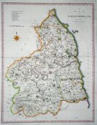
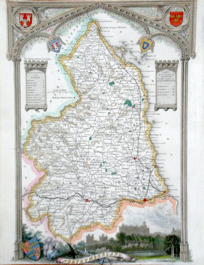
Northumberland 'Northumberland divided into Wards…' Bowen E. and T. (1767) 22.5 x 33 Very finely engraved map of the County by Emanuel and Thomas Bowen from the "Atlas Anglicanus". The maps are generally derived from those in "The Large English Atlas", and extensive county information accompanying the maps is also a feature of this series. This map also shows the Scots Way and The Picts Wall in detail. A rare item. Bright original colouring. 120.00 GBP |

|
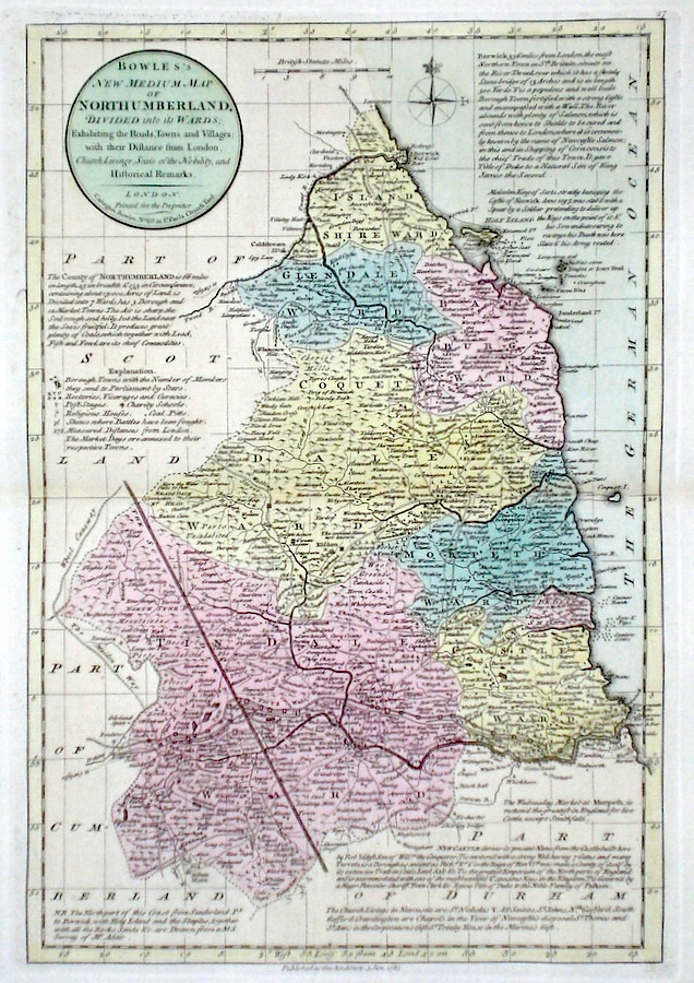
Northumberland 'Bowles's New Medium Map of Northumberland...' Bowen, E. & T. (1785) 23 x 33 Finely engraved and detailed map of the county from "Bowles's New Medium English Atlas". The maps in this series are based on those in Emanuel and Thomas Bowen's Atlas Anglicanus, and feature extensive county information on the map. They are distinguished primarily by having newly engraved cartouches, distances from London added to towns, and different imprints at the bottom. Full original colour. Fine condition. 110.00 GBP |
|
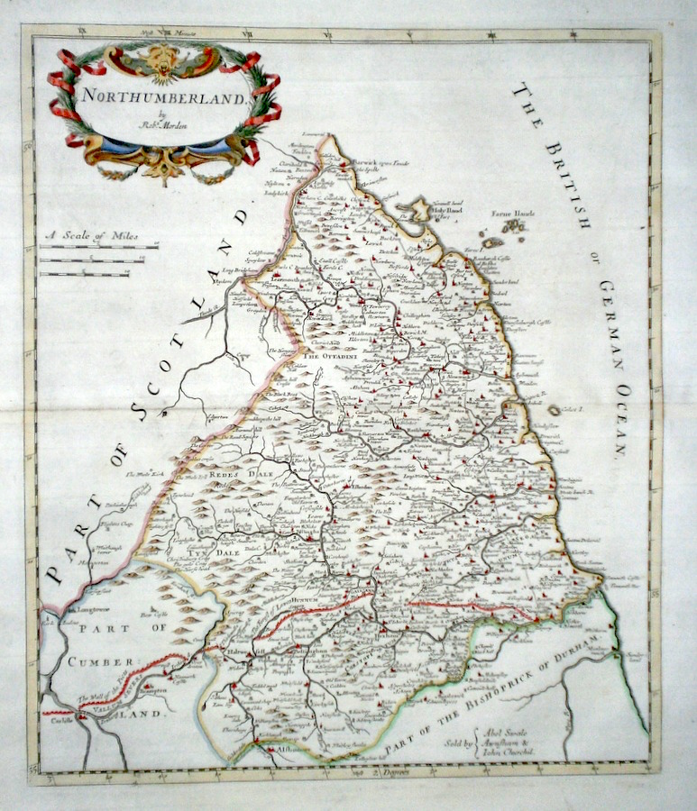
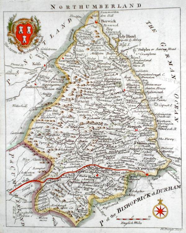
Northumberland 'Northumberland by Robt. Morden' Morden, R. (1722) 36 x 42 Superbly engraved and decorative map of the county by Robert Morden. From the 1722 edition of Camden's Britannia. Excellent condition with good margins. Later colour 95.00 GBP |
|
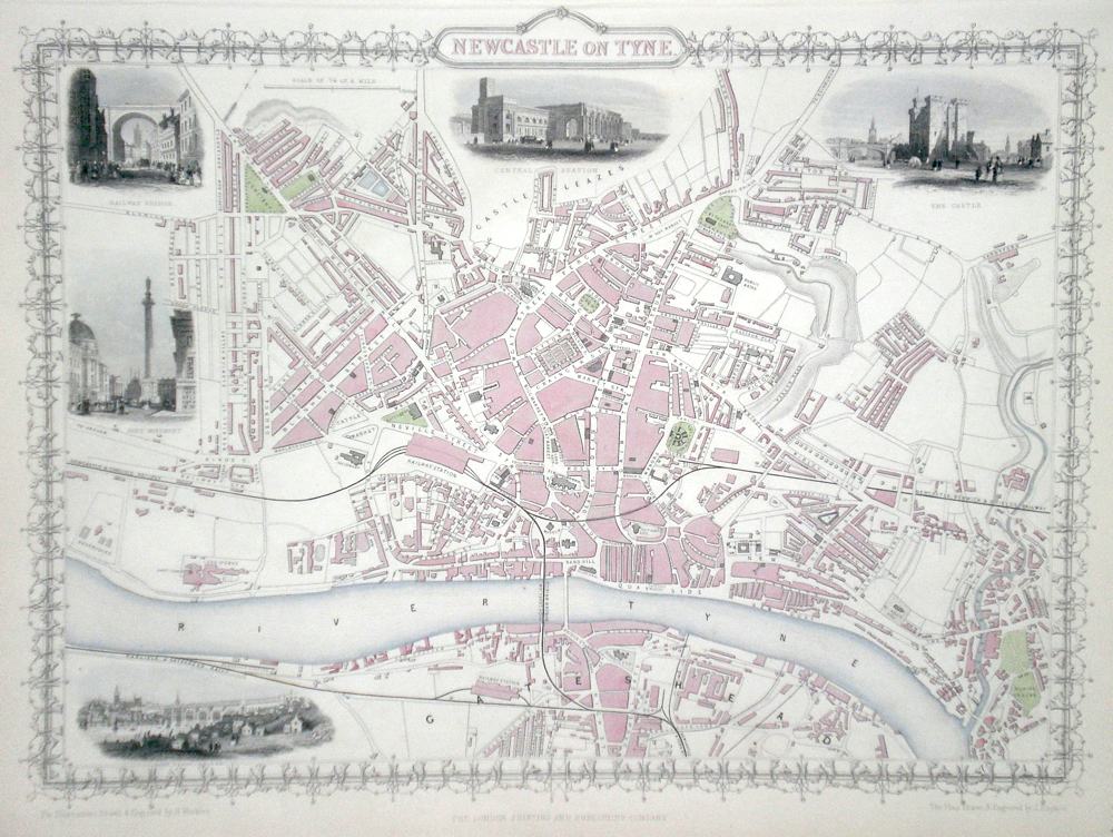
Northumberland 'Newcastle on Tyne' Rapkin, J. (1851) 36 x 26 Fine map of the City by John Rapkin, for John Tallis's highly decorative "The Illustrated Atlas". The vignettes show; The Central Station, The Castle, Railway Bridge, Grey Monument, High Level Bridge. Single Page map (no central fold). Later colour. Condition fine. 95.00 GBP |
|
Northumberland 'A Map of Northumberland from the Best Authorities' Cary, J. Camden's Britannia (1789) 40 x 51.5 Finely engraved and detailed map showing wards. Good condition. 55.00 GBP |
|
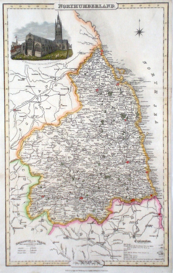
Northumberland Pigot, J. (c. 1826) 23 x 36 Finely engraved map of the county by James Pigot and Co. An early edition ca.1826. A particular feature of this series of county maps is the attractive accompanying vignette. In this case a view of St. Nicholas's Church in Newcastle. Some restoration to the top, but generally good condition. Later colour 50.00 GBP |
|
Northumberland Rocque, J. (c. 1769) 16 x 20 Finely engraved map of the county by John Rocque for the publication "England Displayed". Later colour 50.00 GBP |
|
Northumberland 'A New Map of Northumberland Drawn from the Latest Authorities' Conder, T. (1784) 16 x 19 Finely engraved and decorative map of the county by Thomas Conder for the publication "The New British Traveller". Features include a cartouche of a rural scene and coat of arms. Later colour 45.00 GBP |

|
Northumberland Simpson, S. (1746) 16 x 18 Fine map of the county by Samuel Simpson for his publication "The Agreeable Historian". Most of the maps in this rare series are said by Simpson to be based on those of Herman Moll. Later colour 50.00 GBP |
|
Northumberland Moule, T. (c. 1848) 20 x 27 Decorative Steel engraved map of the county by Thomas Moule. Inset view of Alnwick Castle. Later colour. 45.00 GBP |
|
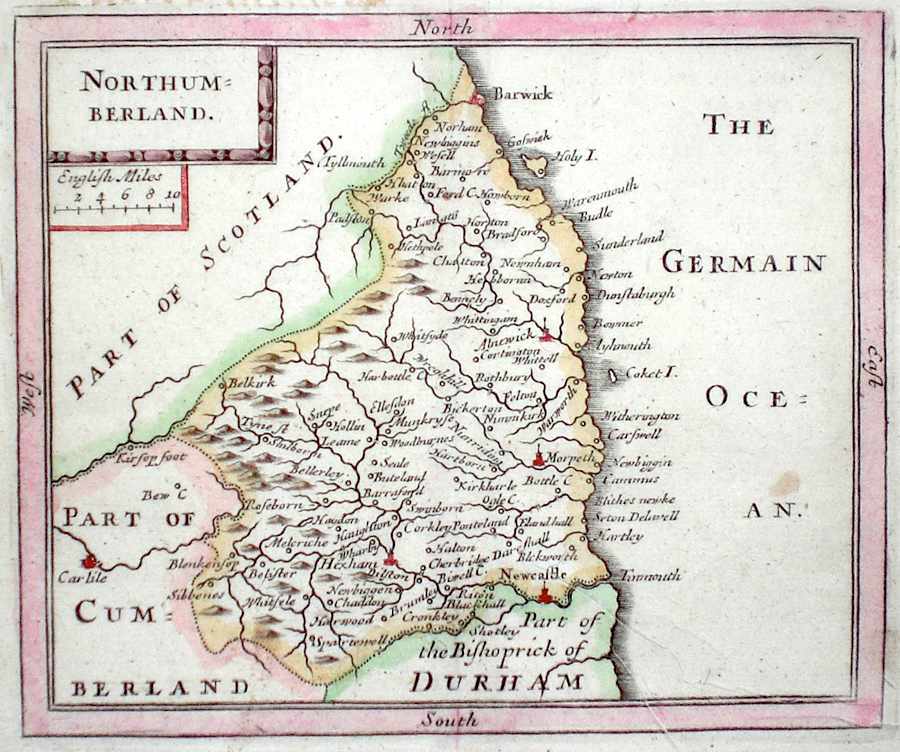
Northumberland Seller, J. (c. 1703) 15 x 13 Fine map by the Hydrographer and instrument maker John Seller for his "Anglia Contracta". The map is divided up into squares each side of which represents one mile. This series of maps were first published in 1695. They were later used in a simplified form by Francis Grose for his "Supplement to the Antiquities of England and Wales", published from 1787. 40.00 GBP |
|
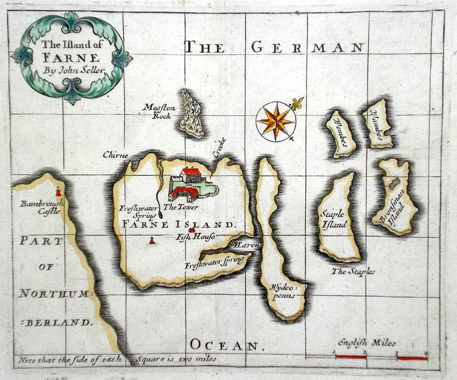
Northumberland 'The Island of Farne by John Seller' Seller, J. (c. 1703) 15 x 13 Fine map by the Hydrographer and instrument maker John Seller for his "Anglia Contracta". The map is divided up into squares each side of which represents one mile. This series of maps were first published in 1695. They were later used in a simplified form by Francis Grose for his "Supplement to the Antiquities of England and Wales", published from 1787. 40.00 GBP |
|
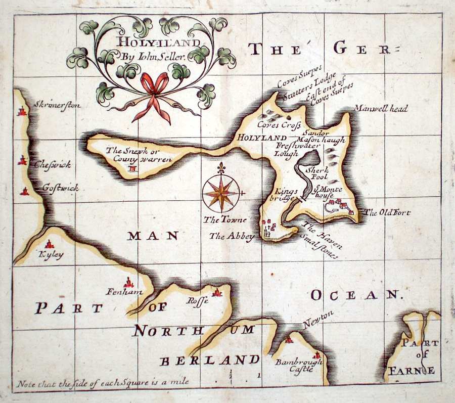
Northumberland 'Holyiland by John Seller' Seller, J. (c. 1703) 15 x 13 Fine map by the Hydrographer and instrument maker John Seller for his "Anglia Contracta". The map is divided up into squares each side of which represents one mile. This series of maps were first published in 1695. They were later used in a simplified form by Francis Grose for his "Supplement to the Antiquities of England and Wales", published from 1787. 40.00 GBP |
|
Northumberland Becker, F. (c. 1842) 28 x 36 Detailed steel engraved map of the county with original colour. Published in Fisher's County Atlas, the only cartographical work from this company. 38.00 GBP |
|
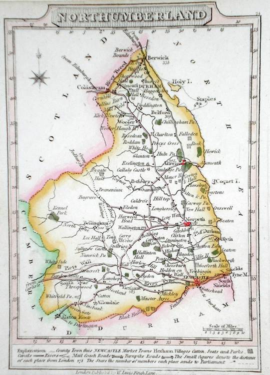
Northumberland Lewis, W. (c. 1835) 14 x 10 Detailed and attractive miniature map of the County by William Lewis for his "Lewis's New Traveller's Guide". A particular feature of this charming series of maps is the clear and precise engraving of the roads. Adjacent numbers indicating the distances from London. Also included with the map is the accompanying page of text giving the county information relevant to travellers - principal towns and inns are listed, distances between towns, principal fair dates, and even sites for the best views of the county. Later colour. 35.00 GBP |
|
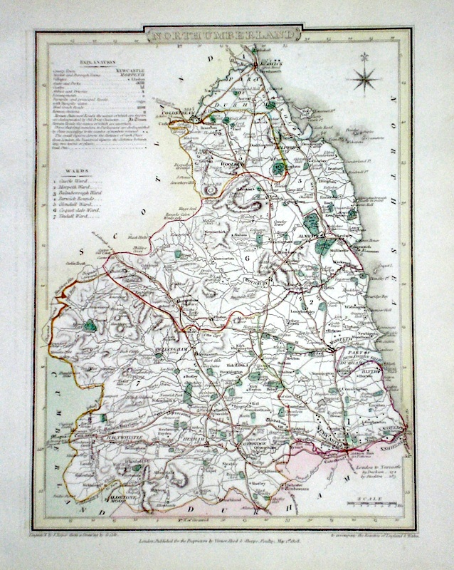
Northumberland Roper, J. (1810) 24 x 18 Detailed and decorative map of the county by Cole and Roper for The British Atlas. Original hand colouring. Excellent condition. 35.00 GBP |