Spain & Portugal


|
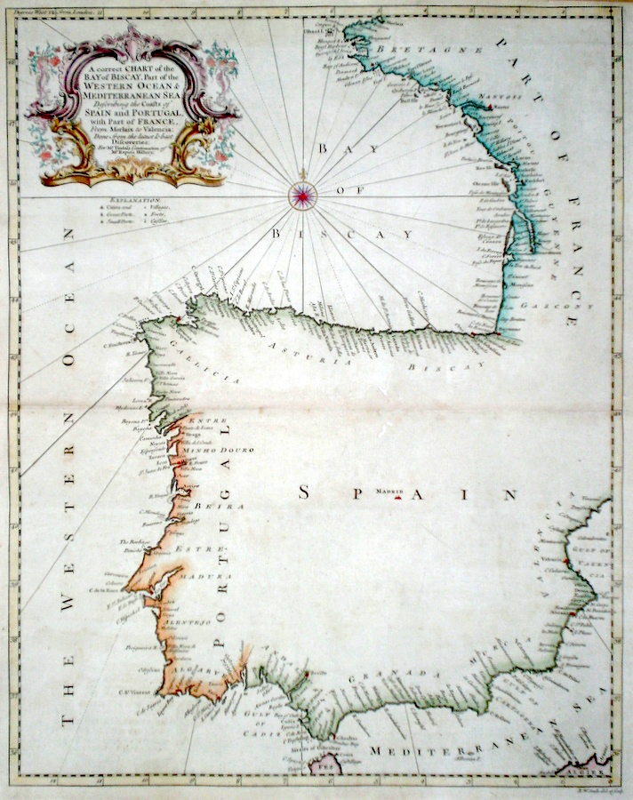
Spain & Portugal 'A Correct Chart of the Bay of Biscay, Part of the Western Ocean, and Mediterranean Sea...' Seale, R. (c. 1745) 38 x 48 A finely engraved and detailed chart of The Bay of Biscay by Richard Seale. Published in Tindal's translation of Paul Rapin De Toras's History of England. The map features extensive coastal details on the countries bordering the Bay, South Western France and Northern Spain. Also included is the complete coast of Portugal, and the mediterranean coast of Spain as far as the Gulf of Valencia. Excellent condition. Later colour. 220.00 GBP |
|
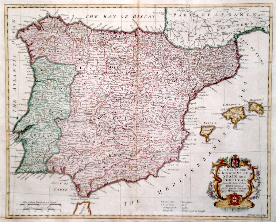
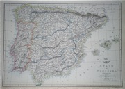
Spain & Portugal 'A Map of the Kingdoms of Spain and Portugal...' Seale, R. (c. 1745) 47 x 38 A finely engraved and detailed map of the Iberian Peninsula by Richard Seale. Published in Tindal's translation of Paul Rapin De Toras's History of England. The map features extensive detail on the countries of Spain, Portugal and includes the Balearic Islands. Excellent condition. Later colour. 195.00 GBP |
|
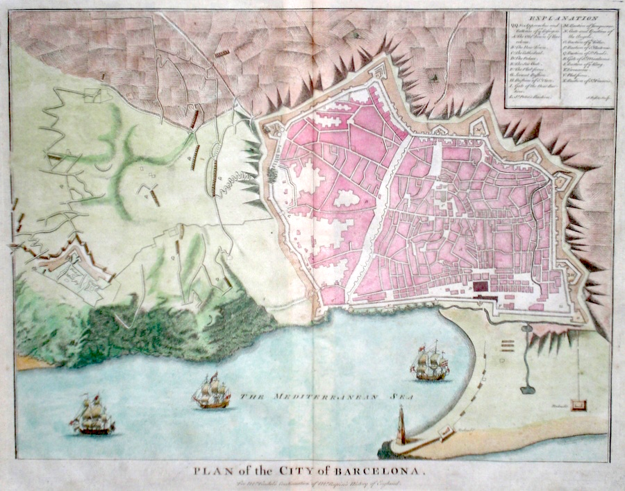
Spain 'Plan of the City of Barcelona' Basire, I. (c. 1740) 48 x 38 A finely engraved Plan of the City by Isaac Basire. Published in Tindal's translation of Paul Rapin De Toras's History of England. features include extensive detail and a table, top right explains the main areas of the City. An interesting item in excellent condition. Later colour. 180.00 GBP |
|
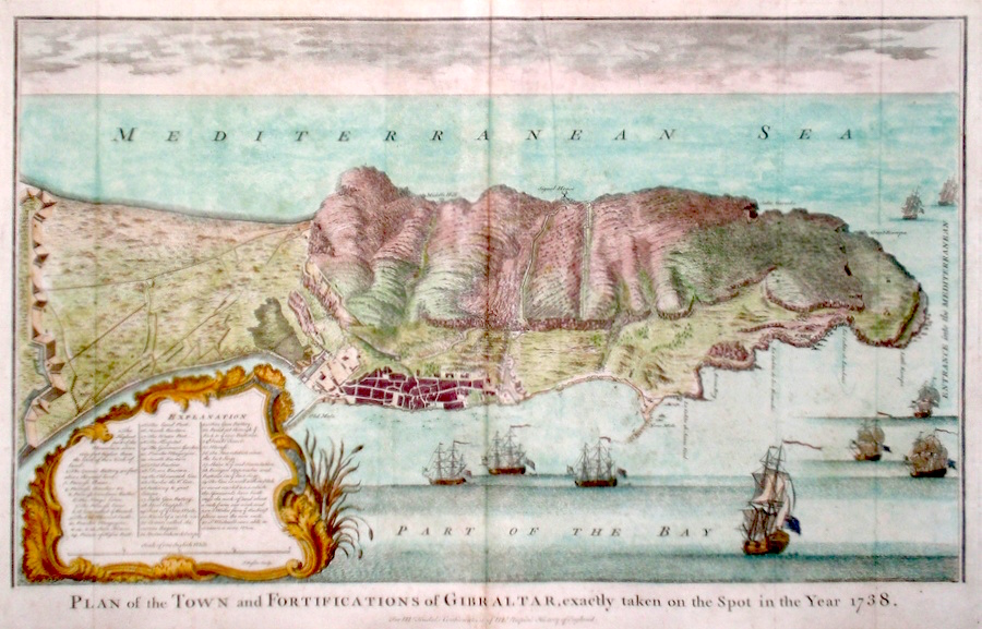
Spain 'Plan of the Town and Fortifications of Gibraltar exactly taken on the spot in the year 1738' Basire, I. (c. 1740) 58 x 37 A finely engraved Plan of the Town and Peninsula by Isaac Basire. Published in Tindal's translation of Paul Rapin De Toras's History of England. features include extensive detail and a table, bottom left explains the main areas of the Town. An interesting fleet of nine British warships is depicted off the coast. Old folds, excellent condition. Later colour. 150.00 GBP |
|
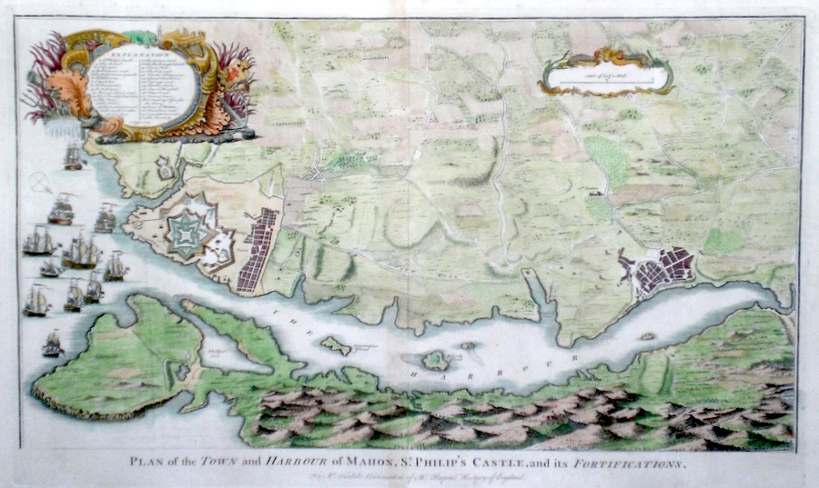
Spain, Menorca 'Plan of the Harbour and Town of Mahon...' Basire, I. (c. 1740) 63 x 37 A finely engraved Plan of the Town and Harbour in the island of Menorca by Isaac Basire. Published in Tindal's translation of Paul Rapin De Toras's History of England. features include extensive detail and a table, top left explains the main areas of the Town. An interesting fleet of eleven warships is depicted off the coast, ready to enter the harbour. Old folds, excellent condition. Later colour. 150.00 GBP |
|
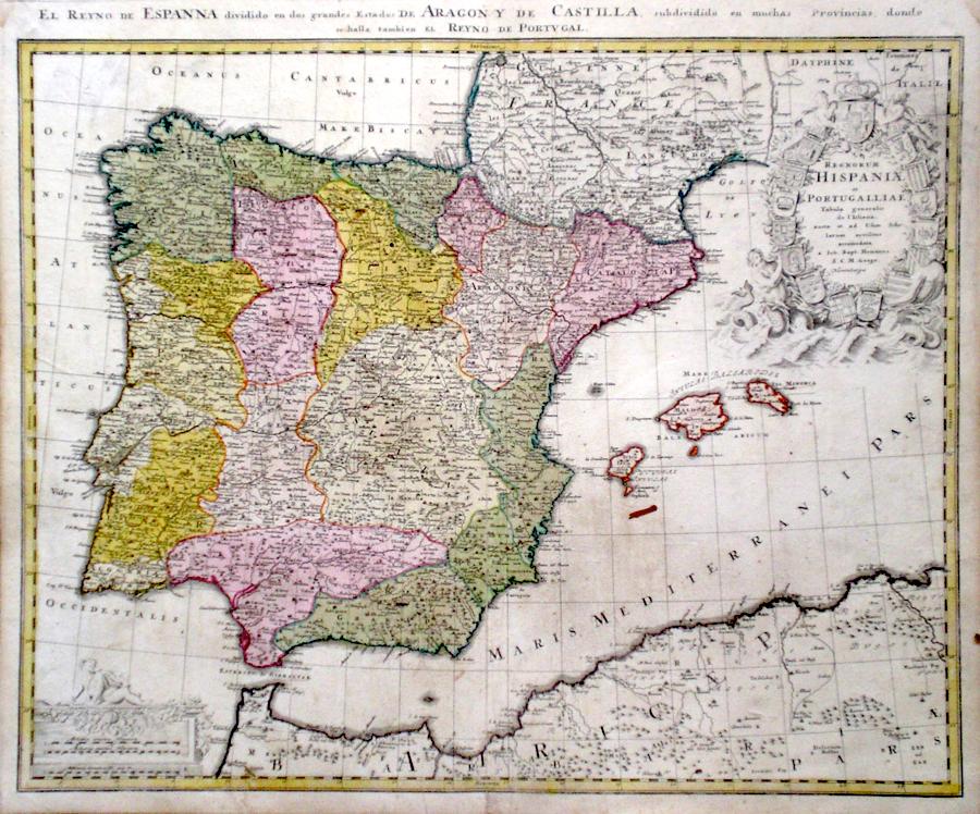
Spain & Portugal 'Regnorum Hispaniae et Portugalliae' Homann, J. B. (c. 1730) 59 x 49 Superb map of Spain and Portugal by the eminent engraver and mapseller Johann Baptist Homann. Features include a fine cartouche of shields decorated with the various heraldries of the Spanish states. Mer-men and other mythological figures completing the design. To the south in the Mediterranean sea the Balearic Islands are also delineated. The map is printed on very thick paper and embellished with full wash colour. 140.00 GBP |
|
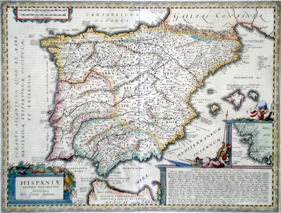
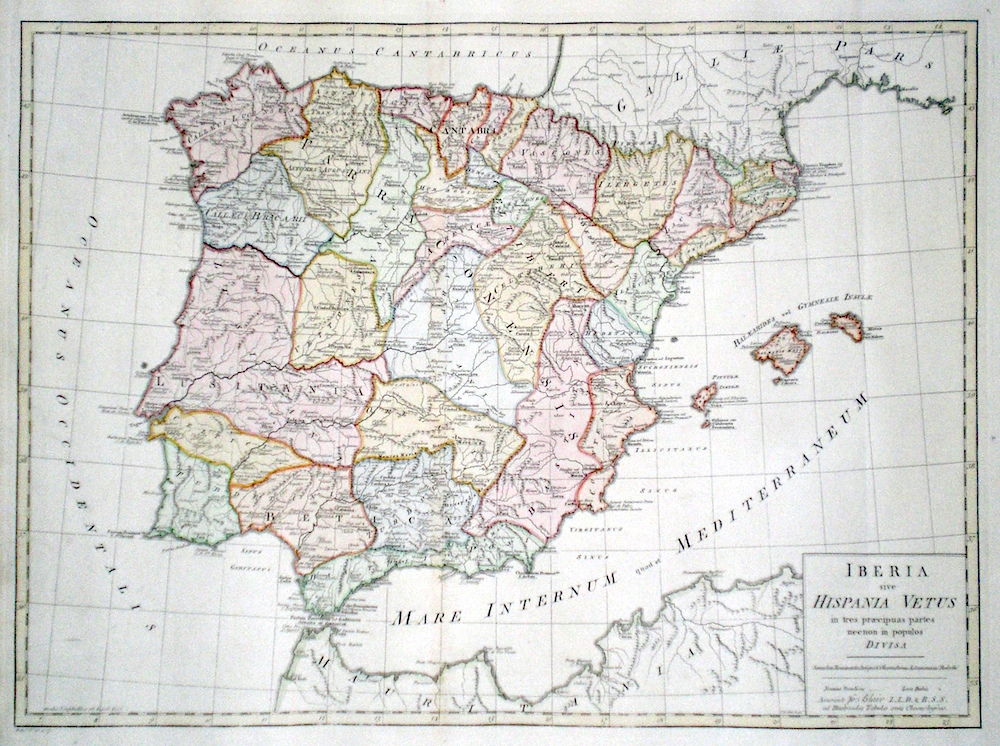
Spain & Portugal 'Iberia sive Hispania Vetus in tres praecipuas partes necnon in populos Divisa' Kitchen, T. (1768) 57 x 43 Finely engraved map of the Iberian Peninsula by Thomas Kitchen for John Blair's "The Chronology and History of The World". Covering the area which is now Spain and Portugal, the map shows the various cities and towns of antiquity accompanied by their more modern names. Fine condition. Later colour 125.00 GBP |
|
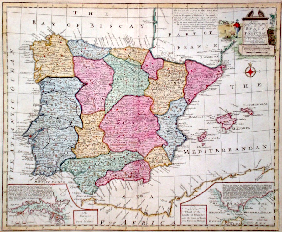
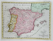
Spain & Portugal 'A New and Accurate Map of Spain and Portugal' Bowen, E. (c. 1766) 44 x 36 Fine map of Spain and Portugal by Emanuel Bowen. Features include a fine cartouche, and inset maps of The Straits of Gibraltar, and The Harbour of Port Mahon. Full hand colour, excellent condition. 120.00 GBP |
|
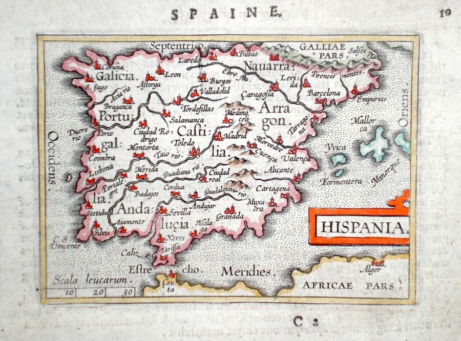
Spain & Portugal 'Hispania' Ortelius, A. (c. 1603) 10 x 8.5 Fine early map of Spain and including Portugal by Abraham Ortelius, engraved in small format by Philippe Galle, and published in the Epitome, or pocket- edition of the "Theatrum Orbis Terrarum". This map from an English text edition of c.1603 published in London and thus one of the first world atlases published in England. Fine condition. Later colour 120.00 GBP |
|
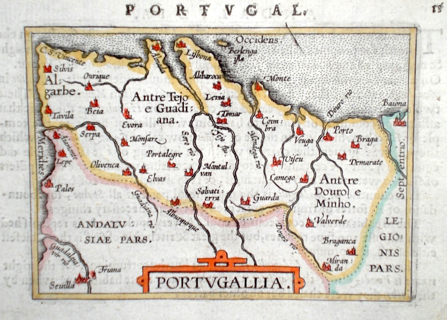
Portugal 'Portugallia' Ortelius, A. (c. 1603) 10 x 8.5 Fine early map of Portugal by Abraham Ortelius, engraved in small format by Philippe Galle, and published in the Epitome, or pocket-edition of the "Theatrum Orbis Terrarum". This map from an English text edition of c.1603 published in London and thus one of the first world atlases published in England. Fine condition. Later colour 98.00 GBP |
|
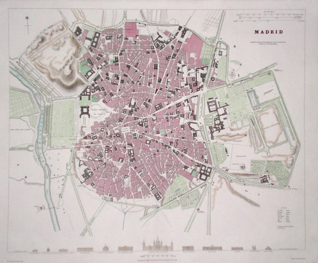
Spain 'Madrid' Henshall, J. (1831) 37 x 31 Finely executed plan of the city by J Henshall for The Society for the Diffusion of Useful Knowledge. Steel engraving, later colour 80.00 GBP |
|
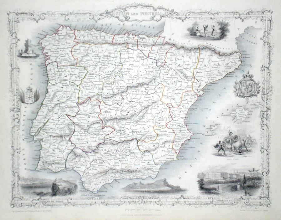
Spain and Portugal Rapkin, J. (1851) 35 x 26 Fine map of the Iberian Peninsula by John Rapkin, for John Tallis's highly decorative "The Illustrated Atlas". The vignettes show; Belem Castle, Lisbon, Gibraltar, Madrid, Bull Fight, Traditional Dancing etc., Single page map (no central fold). Original colour as published. Condition fine. 75.00 GBP |
|
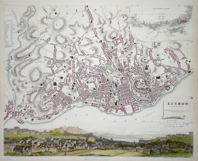
Portugal 'Lisbon' Henshall, J. (c.1833) 39 x 32 Finely executed plan of the city by Henshall for The Society for the Diffusion of Useful Knowledge. Inset plan of the location on the River Tagus, and fine view of the City. Steel engraving, later colour. 70.00 GBP |
|
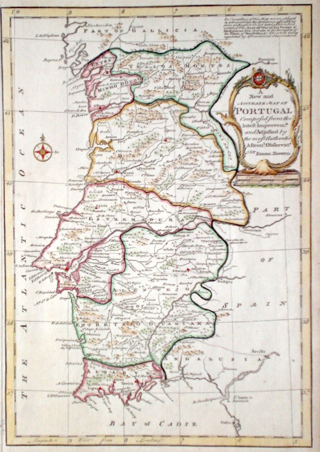
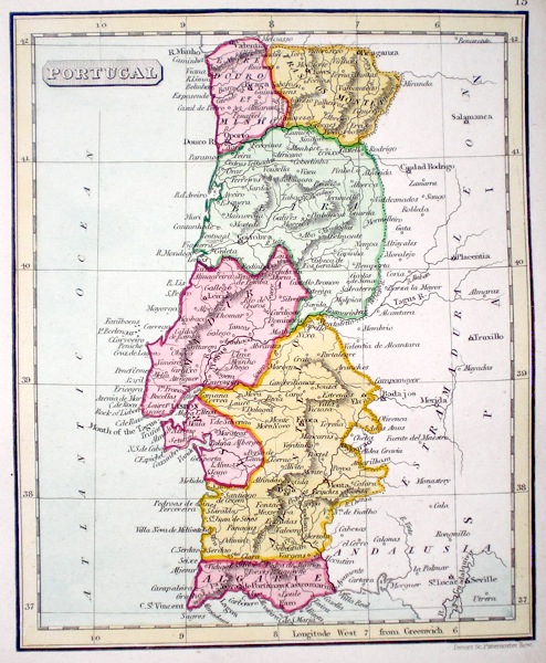
Portugal 'A New and Accurate Map of Portugal' Bowen, E. (c. 1766) 22 x 32 Fine map of Portugal by Emanuel Bowen. Features include a fine cartouche. Later hand colour, excellent condition. 60.00 GBP |
|
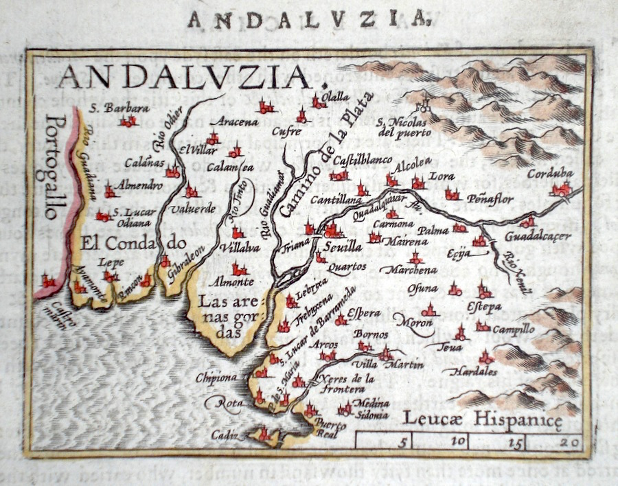
Spain Andaluzia Ortelius, A. (c. 1603) 10 x 8.5 Fine early map of the Andalucia region by Abraham Ortelius, engraved in small format by Philippe Galle, and published in the Epitome, or pocket-edition of the "Theatrum Orbis Terrarum". This map from an English text edition of c. 1603 published in London and thus one of the first world atlases published in England. Fine condition. Later colour 50.00 GBP |
|
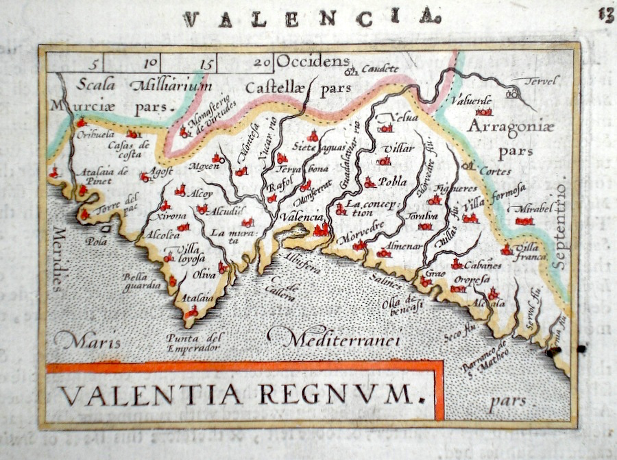
Spain Valentia Regnum Ortelius, A. (c. 1603) 10 x 8.5 Fine early map of the Valencia region by Abraham Ortelius, engraved in small format by Philippe Galle, and published in the Epitome, or pocket-edition of the "Theatrum Orbis Terrarum". This map from an English text edition of c. 1603 published in London and thus one of the first world atlases published in England. Fine condition. Later colour 50.00 GBP |
|
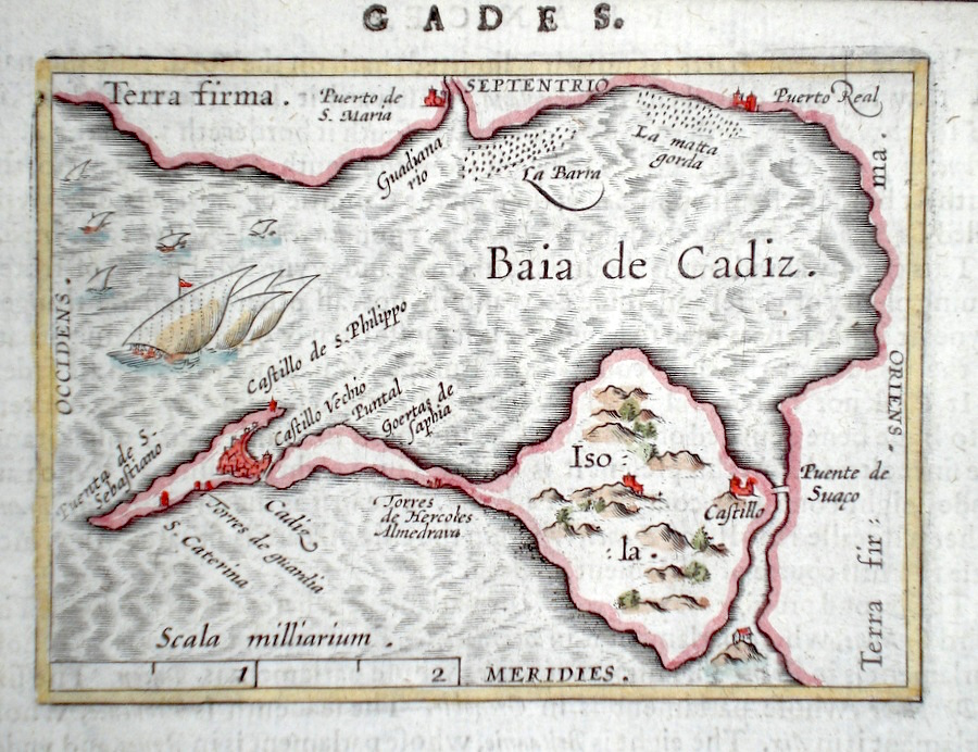
Spain Baia de Cadiz Ortelius, A. (c. 1603) 10 x 8.5 Fine early map of the Bay and Island of Cadiz by Abraham Ortelius, engraved in small format by Philippe Galle, and published in the Epitome, or pocket-edition of the "Theatrum Orbis Terrarum". This map from an English text edition of c. 1603 published in London and thus one of the first world atlases published in England. Fine condition. Later colour 50.00 GBP |
|
Spain 'A Map of Spain and Portugal Drawn from the best Authorities Cooke's New Encyclopaedia (c. 1789) 26.5 x 22 Later hand colour to the countries. Traces of old folds but generally excellent condition. Good margins. 50.00 GBP |
|
Spain Starling, T. (c. 1832) 15 x 9 Uncommon and finely engraved map of the country from The Royal Cabinet Atlas. A numbered key identifies each province. Bright original colouring. 40.00 GBP |
|
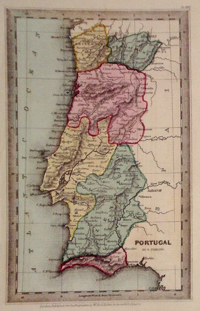
Portugal Starling, T. (c. 1832) 9 x 15 Uncommon and finely engraved map of the country from The Royal Cabinet Atlas. Bright original colouring. 40.00 GBP |
|
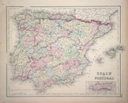
Spain and Portugal Colton's Atlas of the World (c. 1856) 38 x 30 Decorative map of Spain and Portugal by the New York publishing house of Colton. Original colour. 45.00 GBP |
|
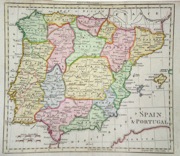
Spain. 'Spain and Portugal' (c. 1805) 23 x 20 Copperplate engraving of Spain and Portugal from Walker's Geography. Later full wash colour to the regions. 40.00 GBP |
|
Spain 'Spain and Portugal' Bell, A. (1797) 22 x 17 Copperplate engraving with later wash colour. Fine condition. 35.00 GBP |
|
Spain 'Spain and Portugal' Dispatch Atlas (1863) 43 x 31 Spain and Portugal including the Balearic Islands. Clean copy with original colour. 30.00 GBP |
|
Portugal Fenner, R. (1828) 12 x 15 Highly detailed steel engraved map of the Country by Robert Fenner for “Fenner's Pocket Atlas”. Later full wash colour 25.00 GBP |