Northamptonshire
Including Northampton, Peterborough, Corby, Kettering, Wellingborough
|
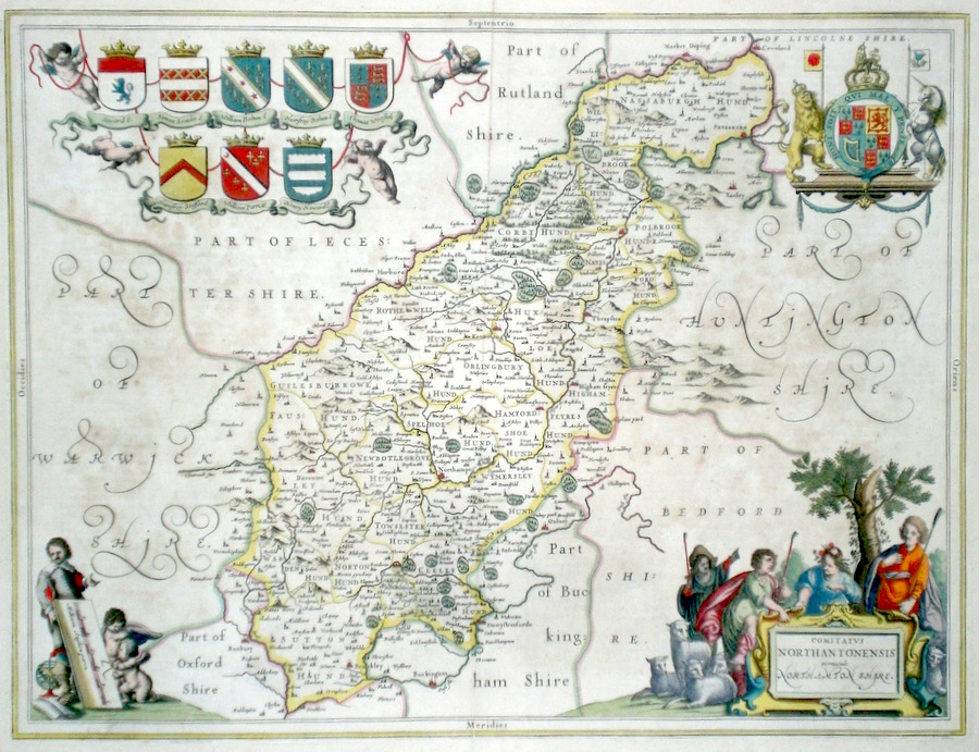
Northamptonshire 'Comitatus Northantonensis vernacule Northamptonshire' Blaeu, J. (c. 1645) 51 x 39 Very fine map of the County by Joan Blaeu. The map embodies the finest features of Dutch Cartography of the Seventeenth century. Superbly engraved and arranged, with shields and coats of arms. A fine cartouche shows a rural scene with sheep. German text verso. Bright Original colour. Occasional slight paper discolouration but generally excellent condition with full margins. 220.00 GBP |


|
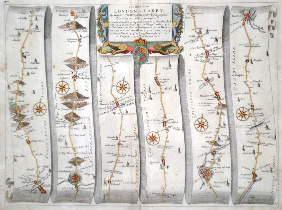
Northamptonshire 'The Road from London to Darby' Ogilby, J. (1698) 44 x 33 The road from Stony Stratford to Northampton, Harborough, Oadbey, Leicester, Loughborough, Kegworth, Derby. From John Ogilby's Britannia, generally considered one of the most important cartographical works of the seventeenth century. Features include town plans of Northampton, Leicester, Derby and a fine cartouche. Later colour. Plate number 40. Fine condition 180.00 GBP |
|
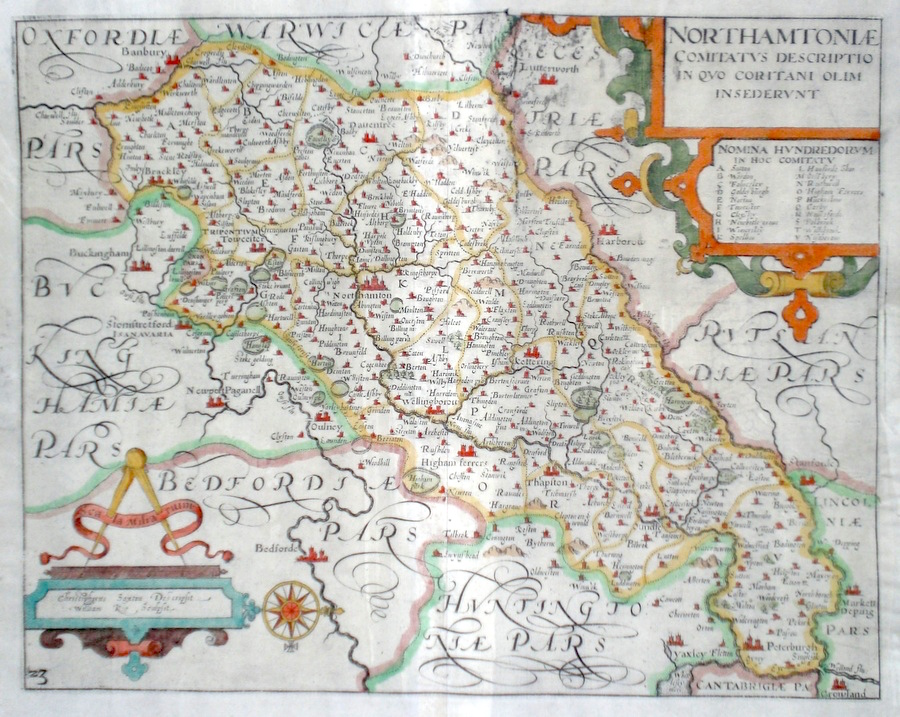
Northamptonshire 'Northamptoniae Comitatus Descriptio in Quo Coritani Olim Insederunt' Kip, W. (1637) 36 x 28 Fine early map of the county by William Kip after Christopher Saxton. From Camden`s Britannia. One of the earliest maps of the single county. No text verso. Excellent condition with good margins. Later colour. 185.00 GBP |
|
Northamptonshire 'A Mapp of the County of Northampton...' Blome, R. (1673) 31 x 26 Decorative map of the County by Richard Blome for his publication "Britannia". The largest series of county maps published by Blome, and generally based on those of Speed. North is to the right on this map. Maps by Blome are characteristic and attractive. Fine condition, later colour. 135.00 GBP |

|
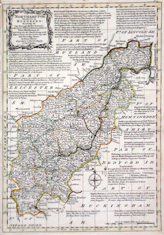
Northamptonshire 'Northampton divided into its Hundreds' Bowen E. & T. (1767) 22.5 x 33 Very finely engraved map of the County by Emanuel and Thomas Bowen from the "Atlas Anglicanus". The maps are generally derived from those in "The Large English Atlas", and extensive county information accompanying the maps is also a feature of this series. A rare item. Bright original colouring. 120.00 GBP |
|
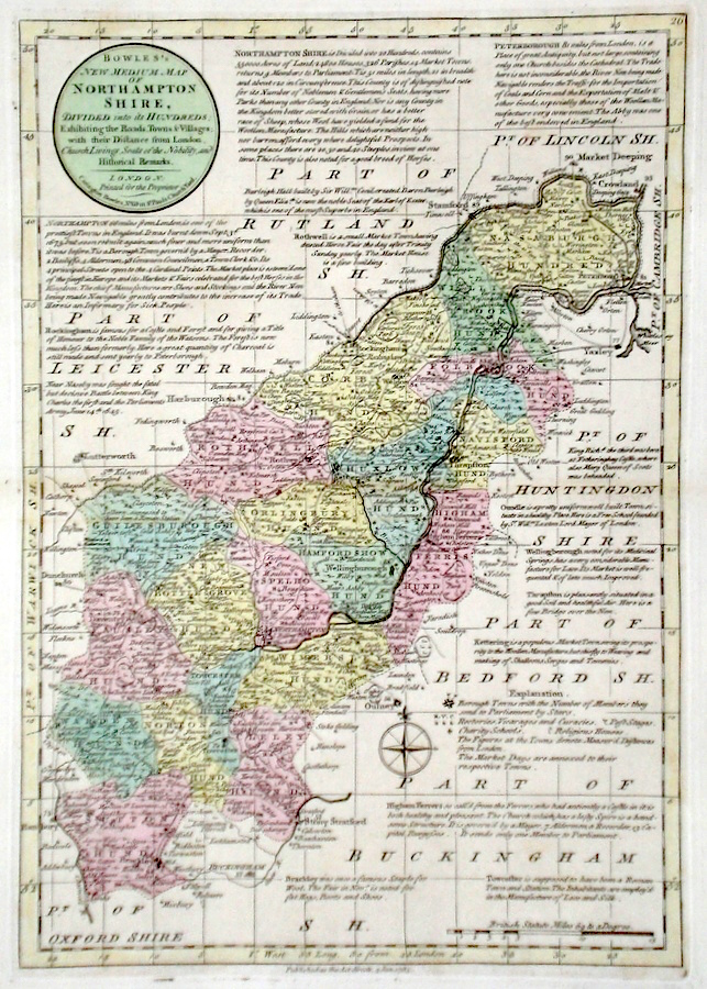
Northamptonshire 'Bowles's New Medium Map of Northampton shire...' Bowen, E. & T. (1785) 23 x 33 Finely engraved and detailed map of the county from "Bowles's New Medium English Atlas". The maps in this series are based on those in Emanuel and Thomas Bowen's Atlas Anglicanus, and feature extensive county information on the map. They are distinguished primarily by having newly engraved cartouches, distances from London added to towns, and different imprints at the bottom. Full original colour. Some slight offsetting to the left hand side, otherwise fine condition 98.00 GBP |
||||||||||||||
|
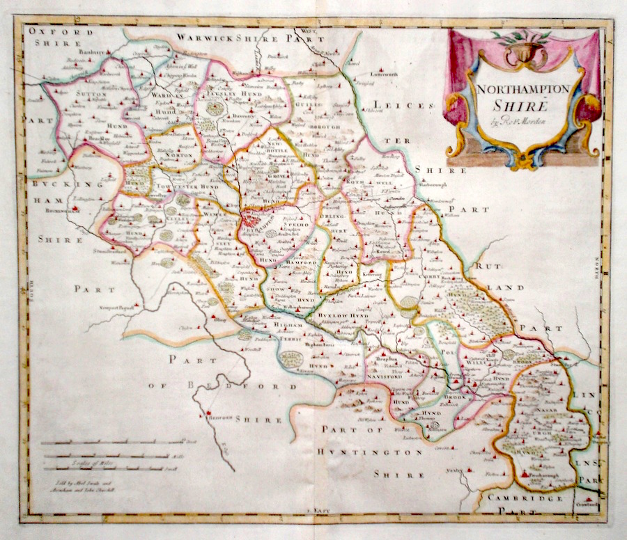
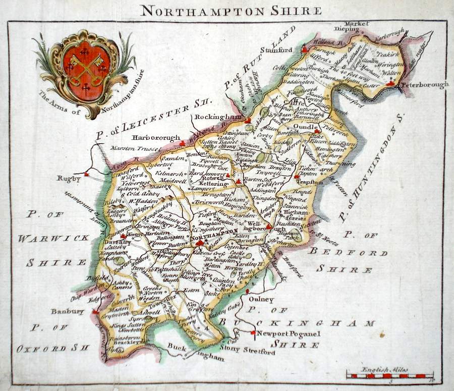
Northamptonshire 'Northamptonshire by Robt. Morden' Morden, R. (c. 1722) 42 x 37 Finely engraved map of the county by Robert Morden published in Camden's Britannia. Later colour, fine condition with good margins. 98.00 GBP |
||||||||||||||
|
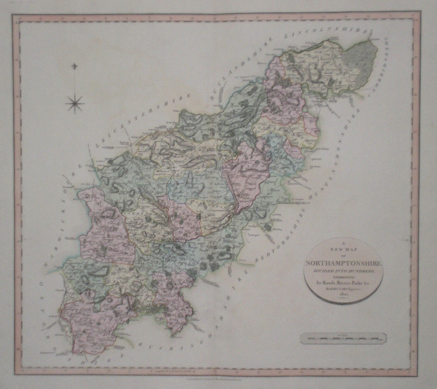
Northamptonshire 'A New Map of Northamptonshire divided into Hundreds exhibiting its Roads, Rivers, Parks...' Cary, J. (1809) 54 x 49 Superbly engraved map of the county by John Cary. From "Cary's New English Atlas". The atlas was issued in parts from 1801 to 1809 and published as a complete work in 1809. Very fine original hand colour. 80.00 GBP |


|
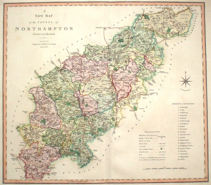
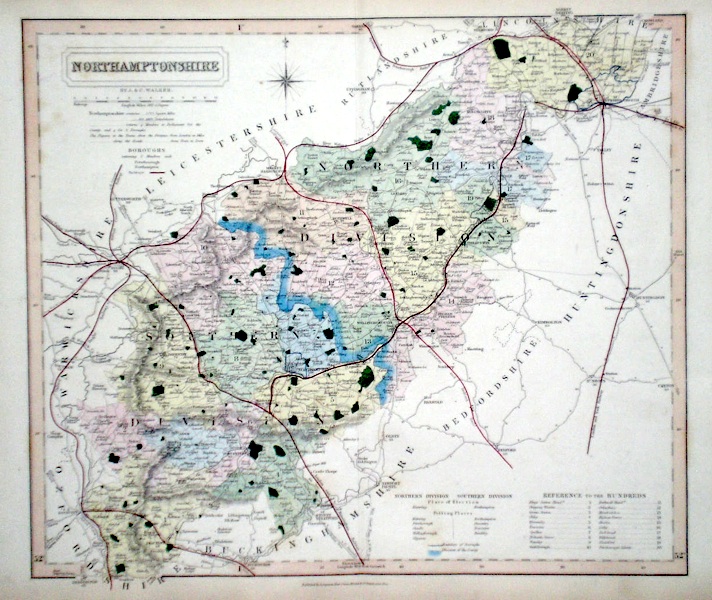
Northamptonshire 'A New Map of the County of Northampton divided into hundreds' Smith, C. (1804) 50 x 45 Large size and decorative map of the County by Jones, Smith & Co. for Smith's New English Atlas. The first map of the County to show longitudes measured from the meridian of Greenwich. Very fine original hand colouring. 70.00 GBP |
|
Northamptonshire 'A Map of Northamptonshire from the Best Authorities' Cary, J. (c. 1815) 49 x 44 Finely engraved map of the county by John Cary. The map as later editions of the Gough Camden Britannia but from a later publication. 55.00 GBP |
|
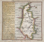
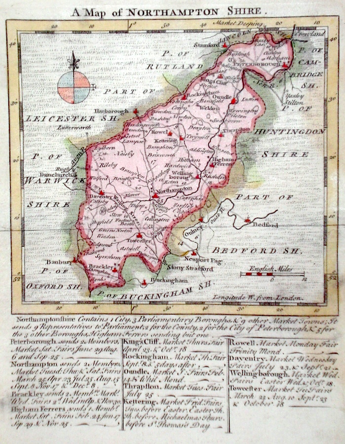
Northamptonshire 'A Map of Northampton Shire' Kitchen/Jefferys (1751) 13.5 x 18 Finely engraved map of the county by Thomas Kitchin and Thomas Jefferys from their publication "The Small English Atlas". This rare series of maps are distinctive by featuring considerable county information below the map. Later colour 50.00 GBP |
|
Northamptonshire Simpson, S. (1746) 18 x 16 Fine map of the county by Samuel Simpson for his publication "The Agreeable Historian". Most of the maps in this rare series are said by Simpson to be based on those of Herman Moll. Margin partly added to bottom. Later colour 40.00 GBP |
|
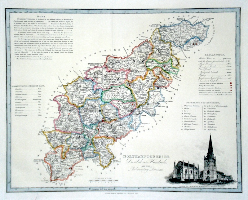
Northamptonshire 'Northamptonshire divided into Hundreds and the Parliamentary Divisions' Darton, W. (c. 1820) 45 x 36 Attractively engraved map of the county by William Darton. The vignette shows Higham Ferrers Church and School House. Later colour 50.00 GBP |
|
Northamptonshire Moule, T. (c. 1845) 20 x 26 Decorative Steel engraved map of the county by Thomas Moule. Inset views of Nothampton, Queens Cross, Althorpe and Peterborough Castle. Later colour. 50.00 GBP |

|
Northamptonshire Baker, B. (c. 1807) 23 x 19 Northamptonshire from Laurie and Whittle`s New and Improved English Atlas. Originally engraved by Benjamin Baker for the Universal Magazine. Original colour. 50.00 GBP |
|
Northamptonshire Walker J & C (c. 1860) 38 x 33 Finely engraved and detailed map of the county by John and Charles Walker from their “British Atlas”. Original colour. Excellent condition 38.00 GBP |
|
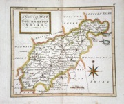
Northamptonshire A Correct Map of Northamptonshire Hutchinson, T. (c. 1748) 17 x 15 Northamptonshire from Thomas Osborne's Geographia Magnae Britanniae. Traces of old central fold. Later hand colour. 35.00 GBP |
|
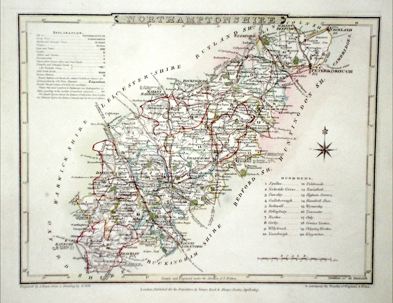
Northamptonshire Roper, J. (c. 1810) 24 x 18 Detailed and decorative map of the county by Cole and Roper for The British Atlas. Original hand colouring. Excellent condition. 30.00 GBP |
|
Northamptonshire A Map of Northamptonshire Toms, W. (c. 1742) 15 x 15.5 Northamptonshire by Thomas Badeslade and William Toms. Highly characteristic map giving a large amount of county information in a dedicated column. Later hand colour. 30.00 GBP |