Hampshire
Including Winchester, Southampton, Portsmouth, Bournemouth, Basingstoke, Newport
|
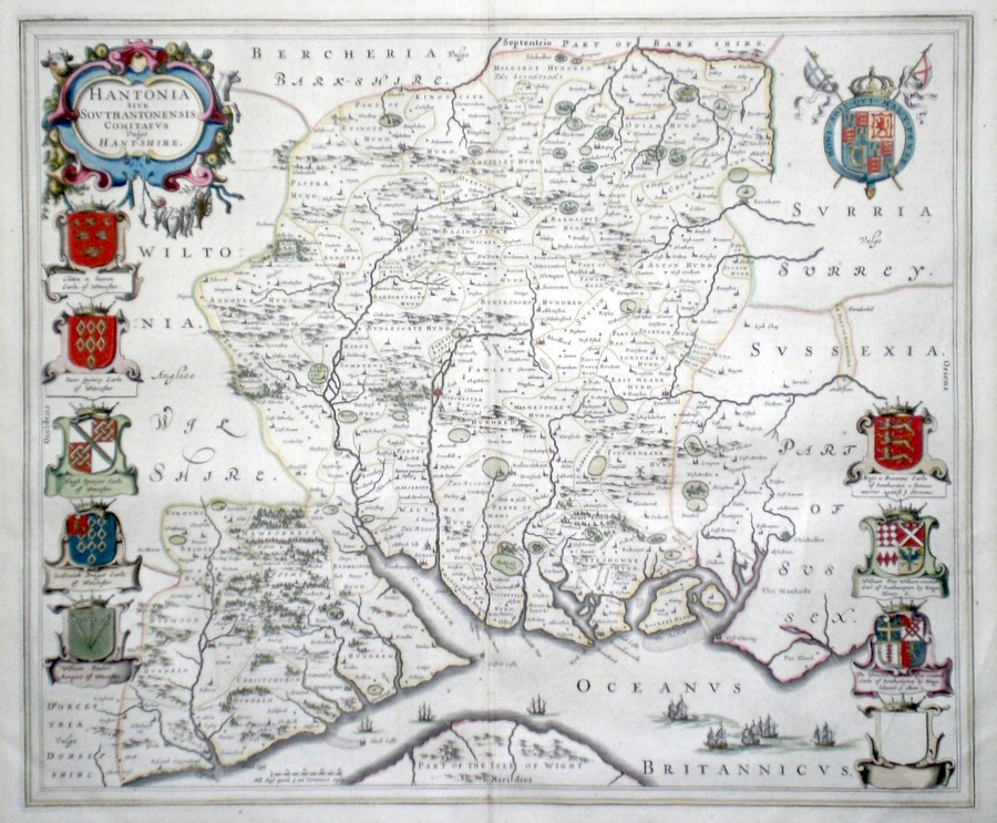
Hampshire 'Hantonia sive Southantonensis Comitatus vulgo Hantshire' Blaeu, J. (1645/62) 50 x 42 Finely engraved map of the County by Joan Blaeu. The map is based on Speed's map of Hampshire. Features include decorative heraldic shields and a cartouche portraying farm animals, fish and a lobster. Engraved in Amsterdam the map embodies all the finest aspects of Dutch cartographical style. French text verso. Original colouring. Fine condition. 495.00 GBP |
||||||||||||||


|
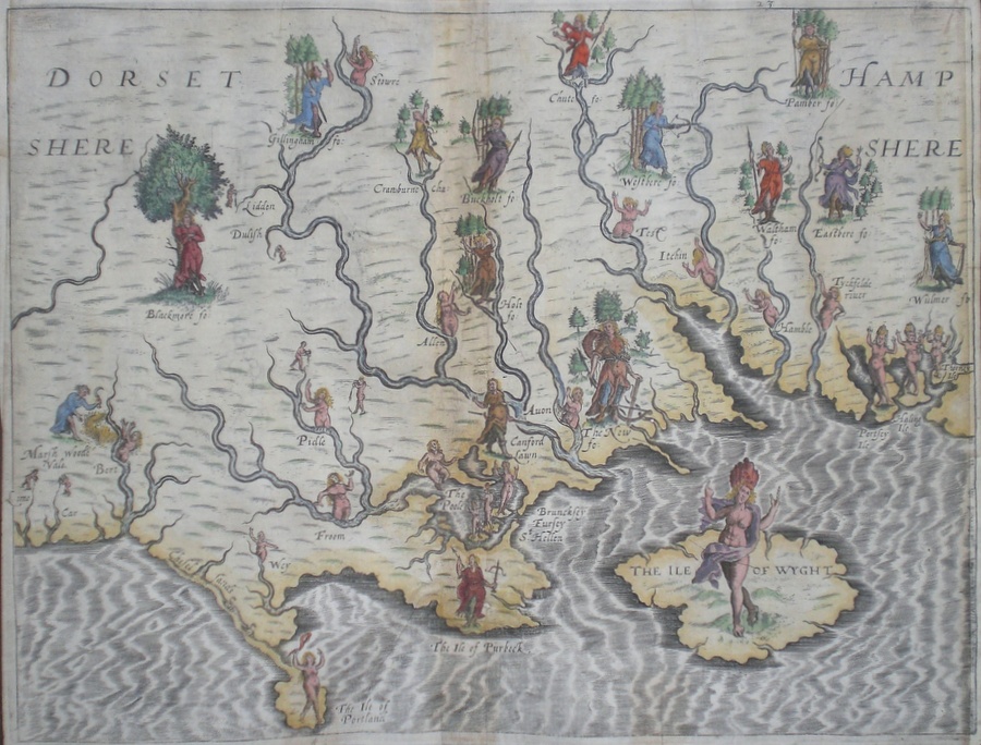
Hampshire 'Hampshere Dorsetshere' Hole, W. (1613) 33.5 x 25 Decorative and rare engraving representing the Hampshire and Dorset counties and Isle of Wight by William Hole for Michael Drayton’s Polyolbion. Richly decorated with many water nymphs, huntsmen, farmworkers, and allegorical figures to illustrate the main topographical features, river system, towns etc. Later colour. This copy with reinstated neat lines to the left and right otherwise in excellent condition. Michael Drayton (1563-1631) was an important poet and literary figure. A contemporary of Shakespeare and Spenser, the Polyolbion is considered to be his masterpiece. He is buried in Westminster Abbey 365.00 GBP |
||||||||||||||
|
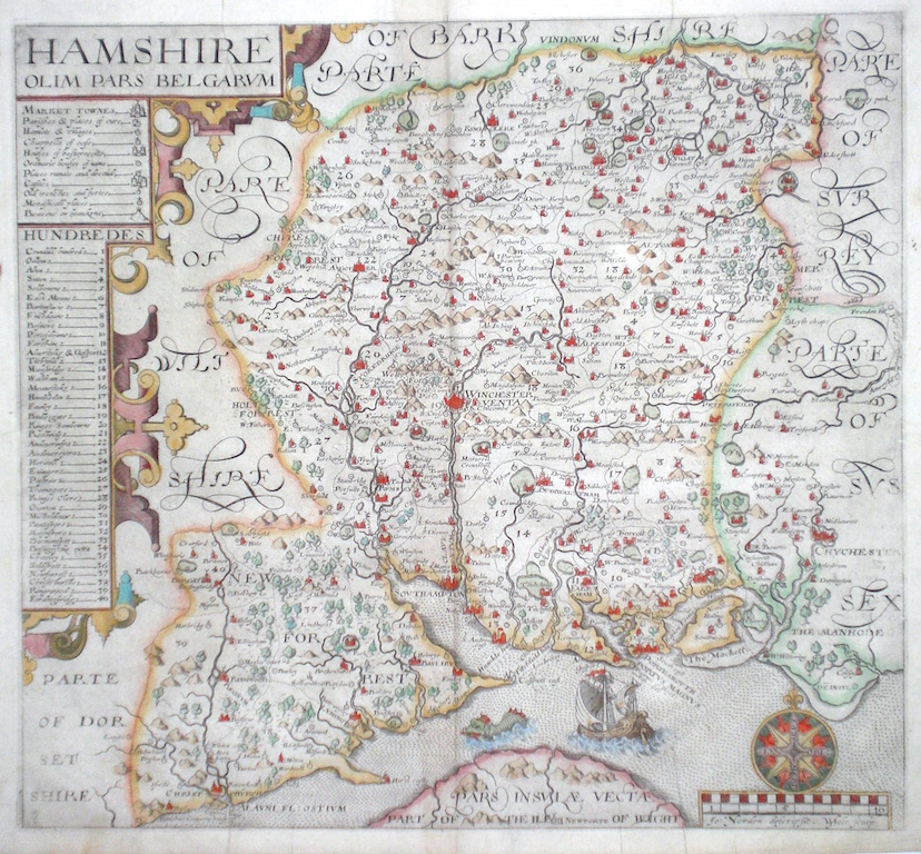
Hampshire 'Hamshire olim pars Belgarum' Hole W. (1610) 32 x 29.5 Fine early map of the county by William Hole after John Norden. From the first English translation edition of Camden's Britannia. One of the earliest maps of the single county and predating Speed. No text verso. This copy with generous margins all round. Later colour. Relevant text will be supplied with this map. 335.00 GBP |
||||||||||||||
|
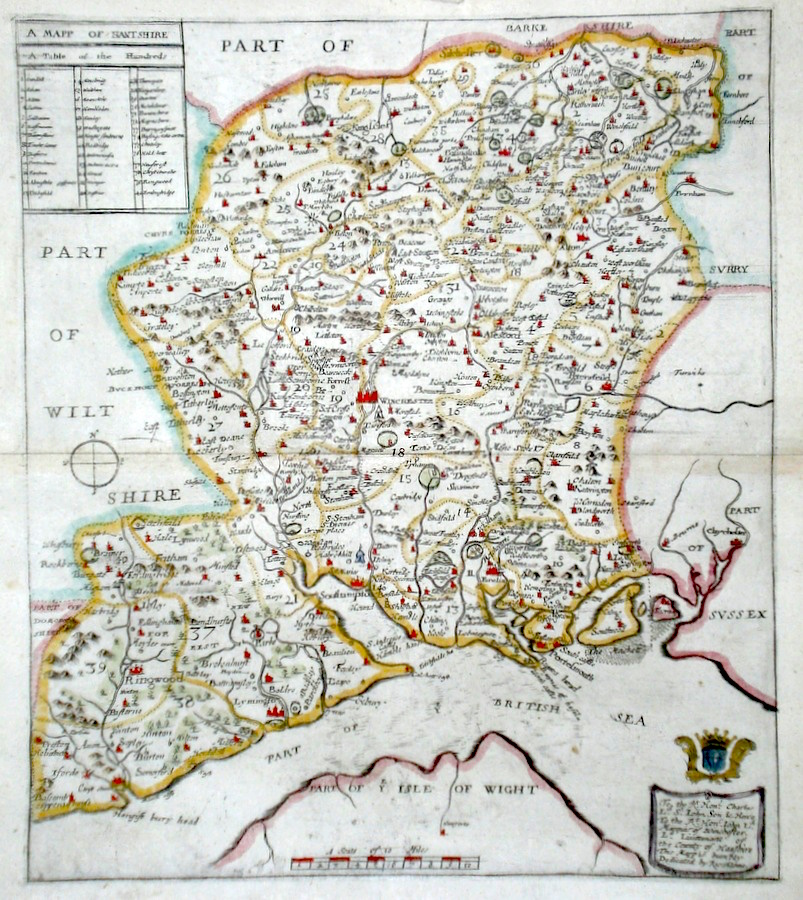
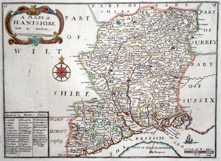
Hampshire 'A Mapp of Hantshire' Blome, R. (1673) 26 x 30 Decorative map of the County by Richard Blome for his publication "Britannia". The largest series of county maps published by Blome, and generally based on those of Speed. Maps by Blome are characteristic and attractive. Fine condition, later colour. 250.00 GBP |
||||||||||||||
|
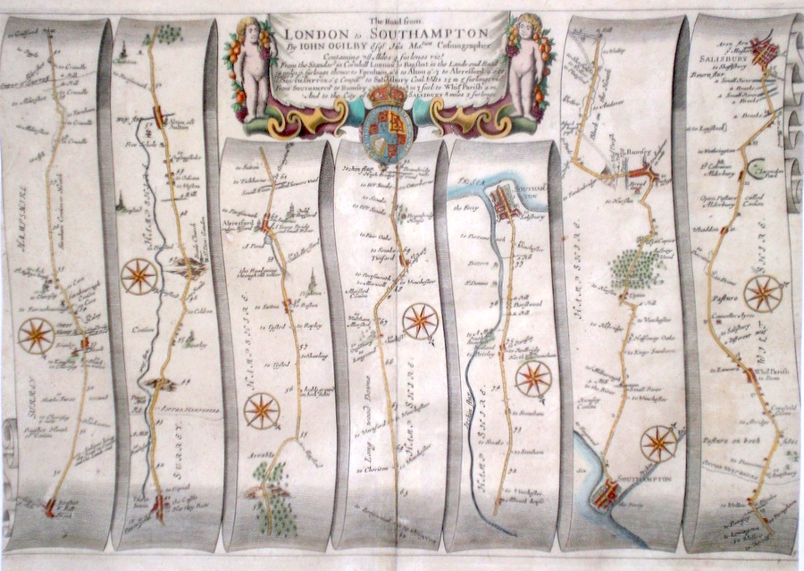
Hampshire 'The Road from London to Southampton' Ogilby, J. (1698) 45 x 34 The Road from Bagshot to Farnham, Alton, Alresford, Southampton. From Southampton to Romsey, Whiteparish, Salisbury. From John Ogilby's Britannia, generally considered one of the most important cartographical works of the seventeenth century. Features include town plans of Southampton and Salisbury, and a fine cartouche. Later colour. Plate number 34. Slight Trimming to the right margin, but otherwise excellent condition. 220.00 GBP |
||||||||||||||
|
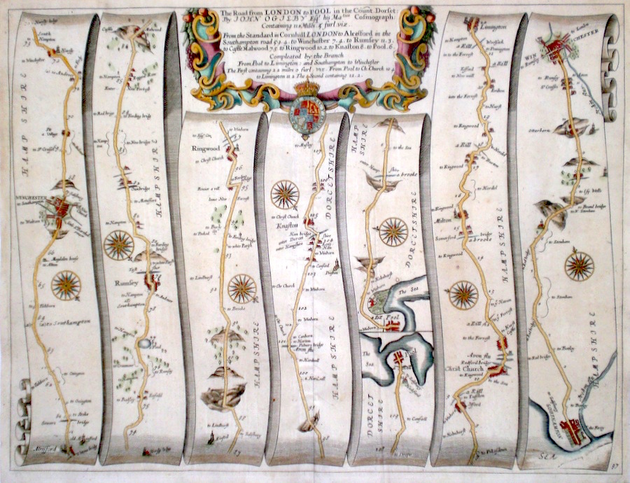
Hampshire 'The Road from London to Pool in the Count. Dorset...' Ogilby, J. (1698) 45 x 34 The road from Alresford and Winchester to Romsey, Ringwood, Knapton, Poole. The Road from Poole and Christchurch, to Lymington, and from Southampton to Winchester. From John Ogilby's Britannia, generally considered one of the most important cartographical works of the seventeenth century. Features include miniature town plans of Winchester and Southampton and a fine cartouche. Later colour. Plate number 97. Excellent condition. 195.00 GBP |
||||||||||||||
|
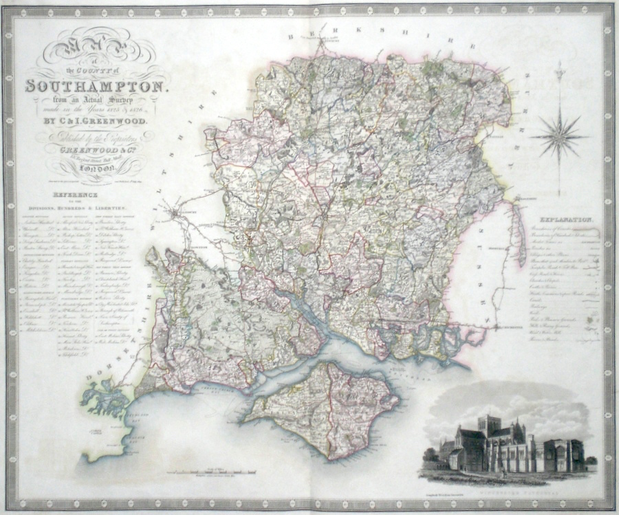
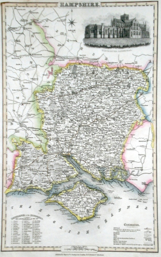
Hampshire 'Map of the County of Southampton, from an Actual Survey made in the years 1825 and 1826' Neele, J. & J. (1829) 70 x 58 Finely engraved and detailed map of the county of Hampshire by Christopher and John Greenwood. The brothers published their county maps from their original surveys over the period 1817 until 1833, and then in 1834 as an atlas. With their large size, accuracy and decorative vignettes the maps are generally recognised as being amongst the finest published in England in the nineteenth century. On this map the vignette is of Winchester Cathedral. Original hand colouring. 175.00 GBP |
||||||||||||||
|
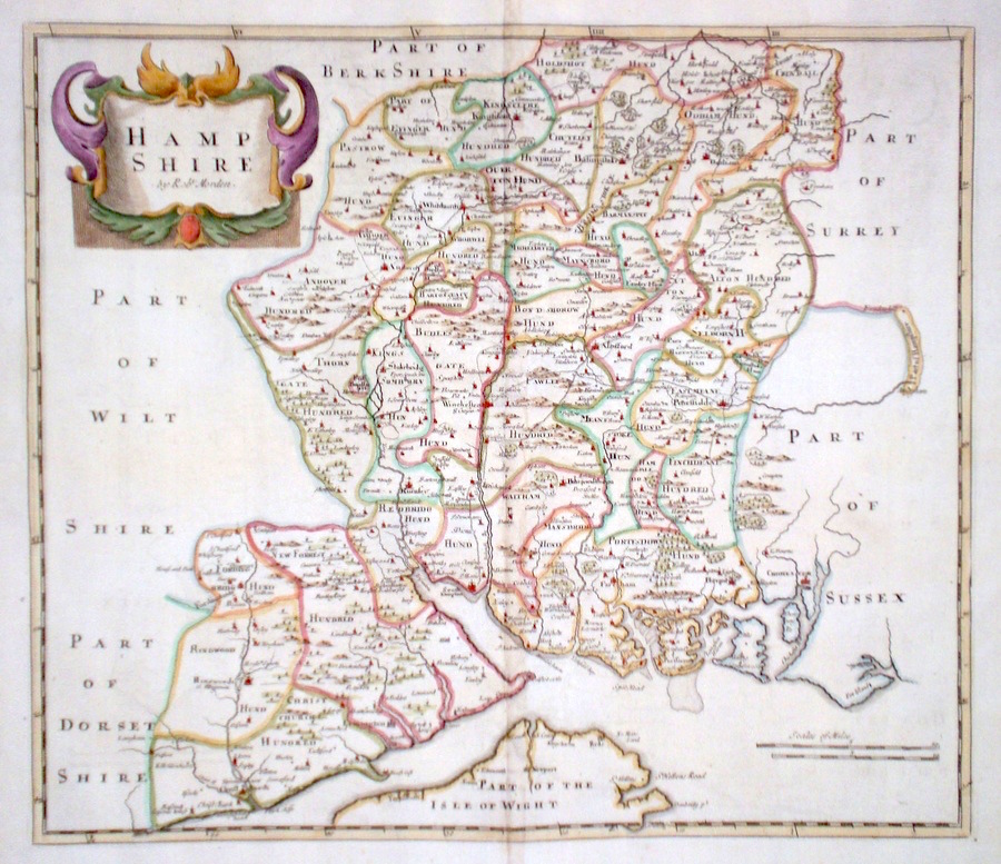
Hampshire Morden, R. (1722) 43 x 37 Superbly engraved and decorative map of the county by Robert Morden. From the 1722 edition of Camden's Britannia. Excellent condition with good margins. Later colour 175.00 GBP |
||||||||||||||
|
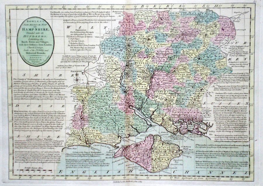
Hampshire 'Bowles's New Medium Map of Hamp shire..' Bowen, E. & T. (1785) 33 x 23 Finely engraved and detailed map of the county from "Bowles's New Medium English Atlas". The maps in this series are based on those in Emanuel and Thomas Bowen's Atlas Anglicanus, and feature extensive county information on the map. They are distinguished primarily by having newly engraved cartouches, distances from London added to towns, and different imprints at the bottom. Full original colour. Fine condition. 175.00 GBP |
||||||||||||||
|
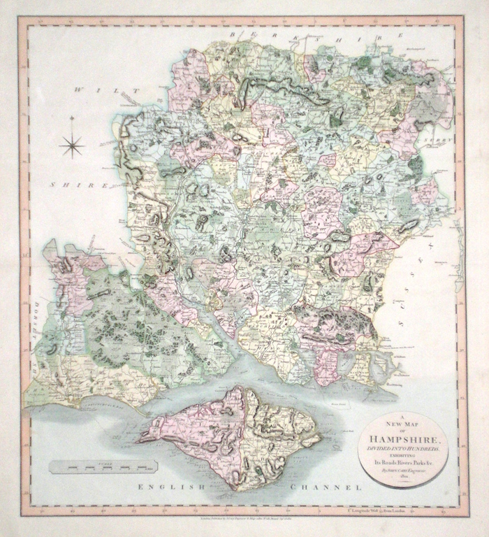
Hampshire 'A New Map of Hampshire divided into Hundreds exhibiting its Roads, Rivers, Parks...' Cary, J. (1809) 49 x 54 Superbly engraved map of the county by John Cary. From "Cary's New English Atlas". The atlas was issued in parts from 1801 to 1809 and published as a complete work in 1809. Very fine original hand colour. 160.00 GBP |
||||||||||||||
|
Hampshire 'A Mapp of Hantshire with its Hundreds' Palmer, R. (c. 1731) 24 x 18 Finely engraved map of the county by Richard Palmer from the atlas "England Exactly Described or a Guide to Travellers…" first published by Thomas Taylor, but herewith from the later edition published by Thomas Bakewell. A major addition to the earlier plates is that roads and distances between towns are now included, after the road surveys of John Ogilby. Fine condition. Later colour 120.00 GBP |
||||||||||||||
|
Hampshire Pigot, J. (c. 1826) 23 x 36 Attractive and detailed steel engraved map by James Pigot from his publication Pigot & Co.'s British Atlas. Features include a fine vignette engraving of Winchester Cathedral. Original hand colour. Excellent condition 60.00 GBP |
|
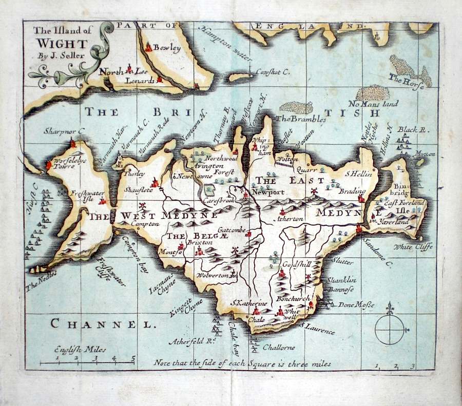
Hampshire 'The Island of Wight by J. Seller' Seller, J. (c. 1703) 15 x 13 Fine map by the Hydrographer and instrument maker John Seller for his "Anglia Contracta". The map is divided up into squares each side of which represents three miles. This series of maps were first published in 1695. They were later used in a simplified form by Francis Grose for his "Supplement to the Antiquities of England and Wales", published from 1787. 60.00 GBP |
|
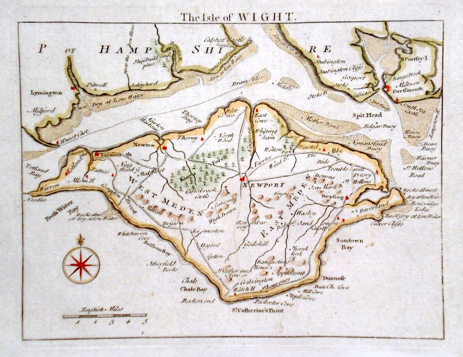
Hampshire 'The Isle of Wight' Rocque, J. (c. 1769) 21 x 16 Finely engraved map of the Island by John Rocque Kitchen for the publication "England Displayed". Additionally to the Island the shoals around the Island and Solent, are shown in detail. Later colour 60.00 GBP |
|
Hampshire Moule, T. (c. 1845) 21 x 27 Decorative Steel engraved map of the county by Thomas Moule. Inset view of Southampton. Later colour. 60.00 GBP |
|
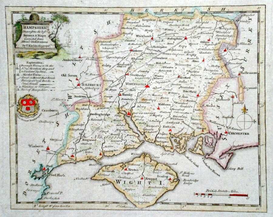
Hampshire 'Hampshire drawn from the best surveys and maps...' Kitchen, T. (c. 1786) Finely engraved and detailed map of the county by Thomas Kitchen. Showing Roads, Borough and market towns etc. Later colour. 58.00 GBP |
|
Hampshire 'Isle of Wight' Moule, T (c. 1845) 27 x 21 Decorative steel engraved map of the Island by Thomas Moule. Inset view of Carisbrook Castle. Later colour. 50.00 GBP |

|
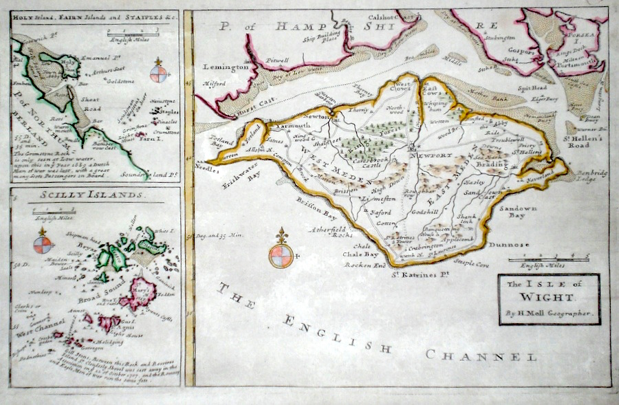
Hampshire Isle of Wight Moll, H. (c. 1724) 32 x 20 Finely engraved map of the Island by Herman Moll for the publication "A New Description of England and Wales…" To the left, smaller maps of Scillies and of Holy Island. Later colour, fine condition. 50.00 GBP |
|
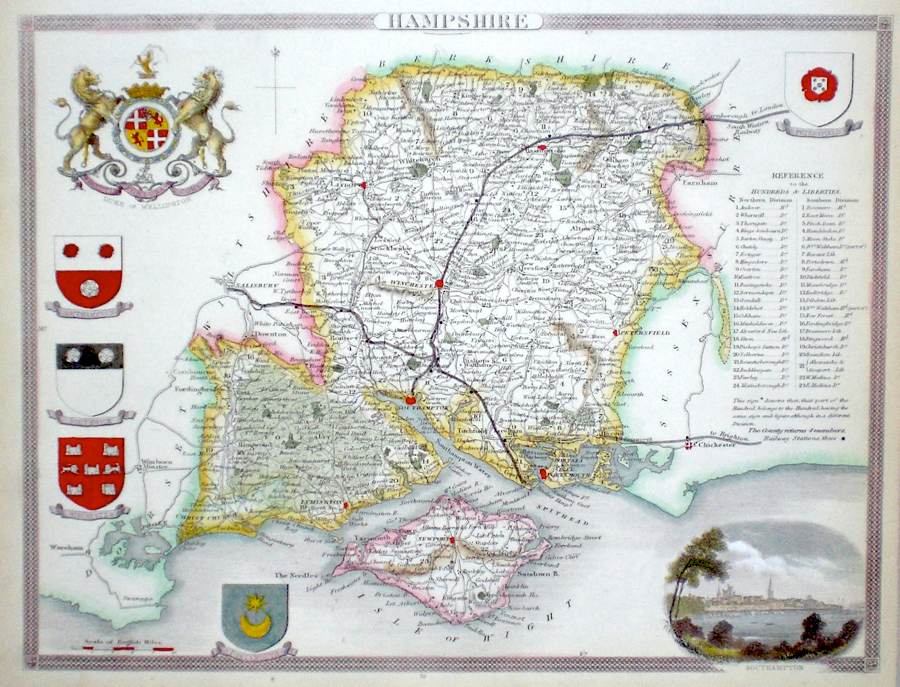
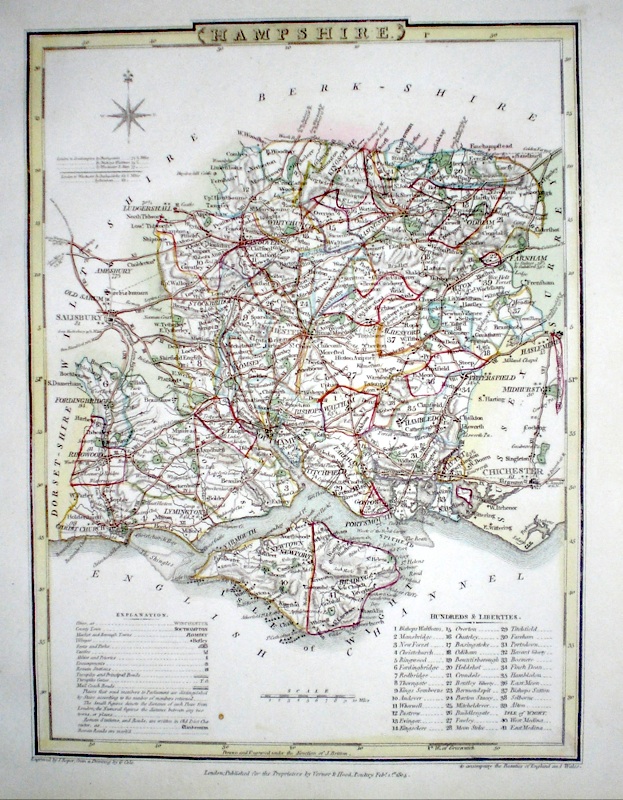
Hampshire Roper, J. (1810) 18 x 24 Detailed and decorative map of the county by Cole and Roper for The British Atlas. Original hand colouring. Excellent condition. 45.00 GBP |
|
Hampshire Lewis, W. (c. 1835) 10 x 14 Detailed and attractive miniature map of the County by William Lewis for his "Lewis's New Traveller's Guide". A particular feature of this charming series of maps is the clear and precise engraving of the roads. Adjacent numbers indicating the distances from London. Also included with the map is the accompanying page of text giving the county information relevant to travellers - principal towns and inns are listed, distances between towns, principal fair dates, and even sites for the best views of the county. Later colour. 40.00 GBP |

|
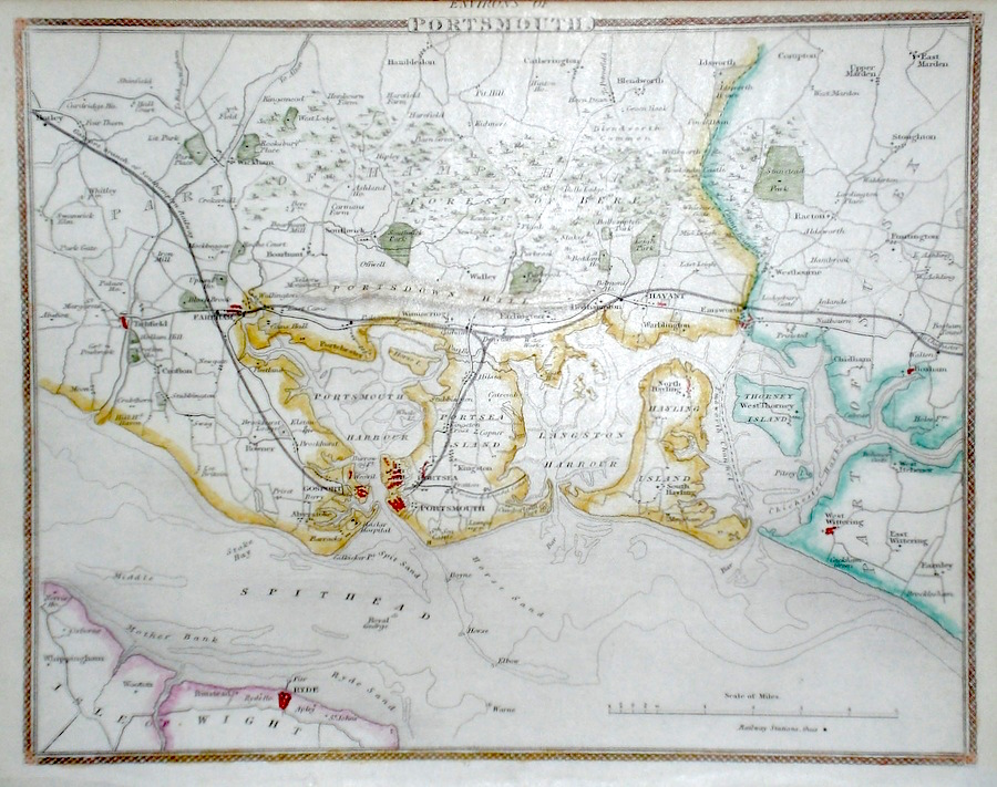
Hampshire 'Environs of Portsmouth' Moule, T. (c. 1850) 26 x 19 Attractive steel engraved map by Thomas Moule. Moule was a heraldry expert and antiquarian and the attractive embellishments on his maps make them amongst the last of the decorative maps to be published. Later colour. Good condition with margins. 40.00 GBP |