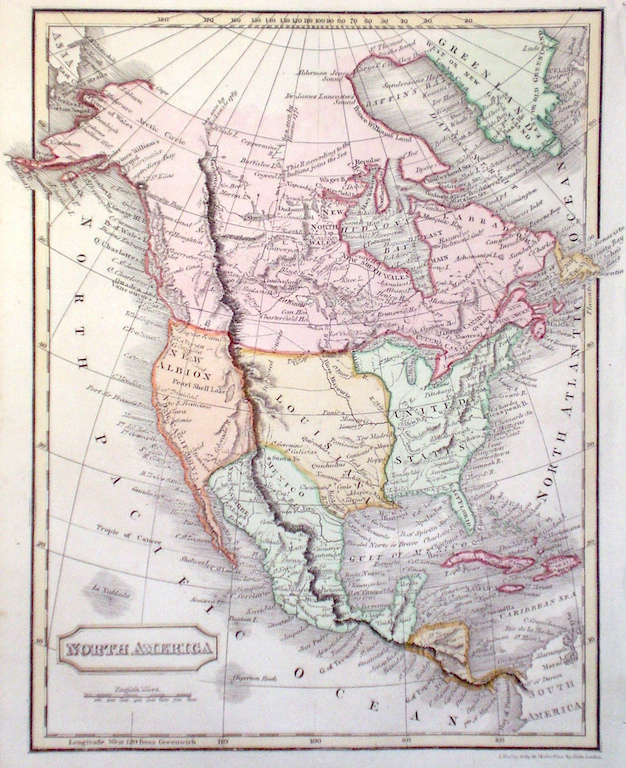
North America
|
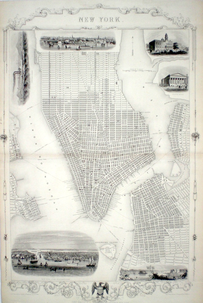
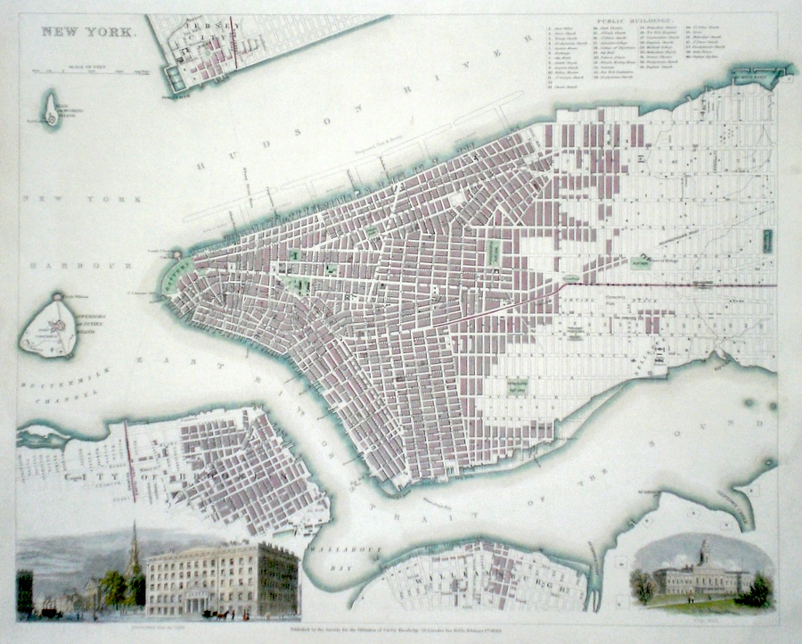
New York Rapkin, J. (1851) 35 x 54 Superb plan of the city, engraved by John Rapkin, for John Tallis's highly decorative "The Illustrated Atlas". The vignettes show; New York from Williamsburg, The Narrows from Fort Hamilton, Custom House, City Hall, Brooklyn, A New York Steamer. Uncoloured as published. Double page engraving extended at top and bottom. Good margins. Fine condition. 900.00 GBP |


|
North America 'Partie Meridionale de la Louisiane, avec la Florida, la Caroline et la Virginie' Santini, P. (c. 1776) 58 x 49 Fine map by the Venetian cartographer Santini, after the influential map of D'Anville. Shows the location of several Native American Tribes. Later colour. 595.00 GBP |

|
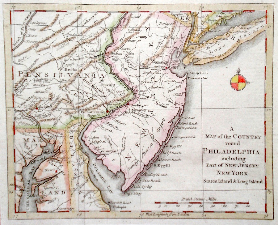
North America 'A Map of the Country round Philadelphia including part of New Jersey New York Staten Island and Long Island' 1776 22 x 18 Rare map of the area around Philadelphia from Chesapeake Bay to Long Island. Published in the Gentleman's Magazine during the American revolutionary war. Features include New Jersey and Long Island almost completely depicted and much of Pennsylvania, Delaware and Maryland. Later colour ,condition excellent. 285.00 GBP |
|
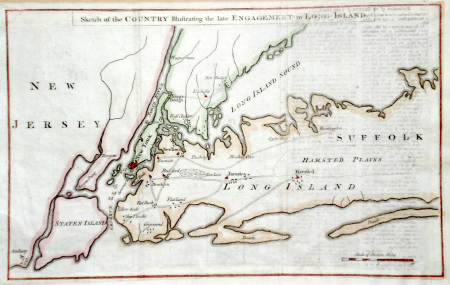
North America 'Sketch of the country illustrating the late Engagement of Long Island' 1776 31.5 x 20 Historic map of the area around New York published in the Gentleman's Magazine. The map accompanies one of the first accounts of the Battle of Long Island in the summer of 1776 during which General Washington's force was heavily defeated by a large British Army force under General Howe. Later colour, slight offsetting but generally excellent condition. 285.00 GBP |
|
North America 'New York' anon. (c. 1840) 38 x 31 Finely engraved plan of the city (unattributed) by the Society for the Diffusion of Useful Knowledge. Features include engraved views of Broadway from the park and City Hall. Original colour and additional later colour. 275.00 GBP |
|
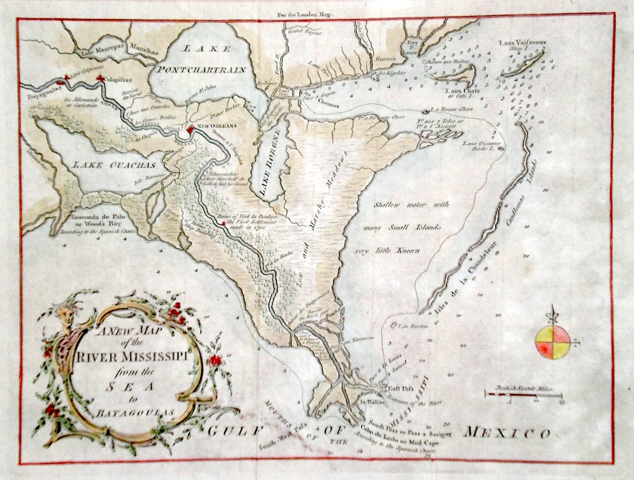
North America 'A New Map of the River Mississipi from the Seas to Bayagoulas' Kitchen, T. (1761) 24 x 18 An uncommon and interesting map of the Mississipi delta engraved for the London Magazine. The map notes several of the early settlements and also soundings taken in the Gulf of Mexico around the delta. The Bayagoula (top left) were a tribe of Native Americans whose numbers were severely affected by the smallpox brought to the Americas by Europeans. Later colour, condition excellent 255.00 GBP |
|
North America Rapkin, J. (1851) 26 x 34 Magnificent map of North America, engraved by John Rapkin, for John Tallis's highly decorative "The Illustrated Atlas". The vignettes show; Eskimaux dog sled, Beavers, Niagara Falls, Wapiti, Native North Americans, Ancient Monument in Mexico, and a Convoy of Diamonds. In The Arctic the North West passage is only hinted at by a small gap in the coast line at the Barrow Strait, otherwise Greenland is shown as a continuation of the North American Land mass. Iceland is also shown with a vignette of Mount Hecla. Single page map, (no central fold). Original colour as published. Condition fine. 240.00 GBP |

|
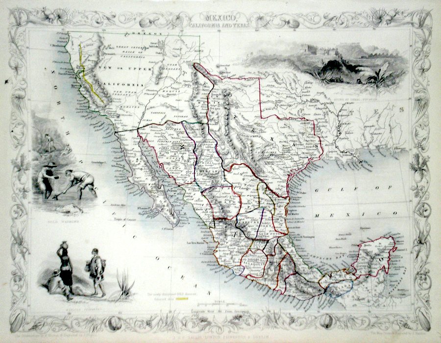
North America Mexico, California, and Texas Rapkin, J. (1851) 34 x 26 Fine map of the area, engraved by John Rapkin, for John Tallis's highly decorative "The Illustrated Atlas". The vignettes show; Gold Washing, Mexican people, and Ruins at Uxmal in Yucatan. The newly discovered goldfield in California are shown marked with a yellow line. Single page map, (no central fold). Original colour as published. Condition fine. 240.00 GBP |
|
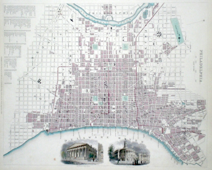
North America 'Philadelphia' anon (c. 1840) 30 x 38 Finely engraved plan of the city (unattributed) by the Society for the Diffusion of Useful Knowledge. Features include engraved views of the United States Bank, and the Exchange. Later colour. 200.00 GBP |
|
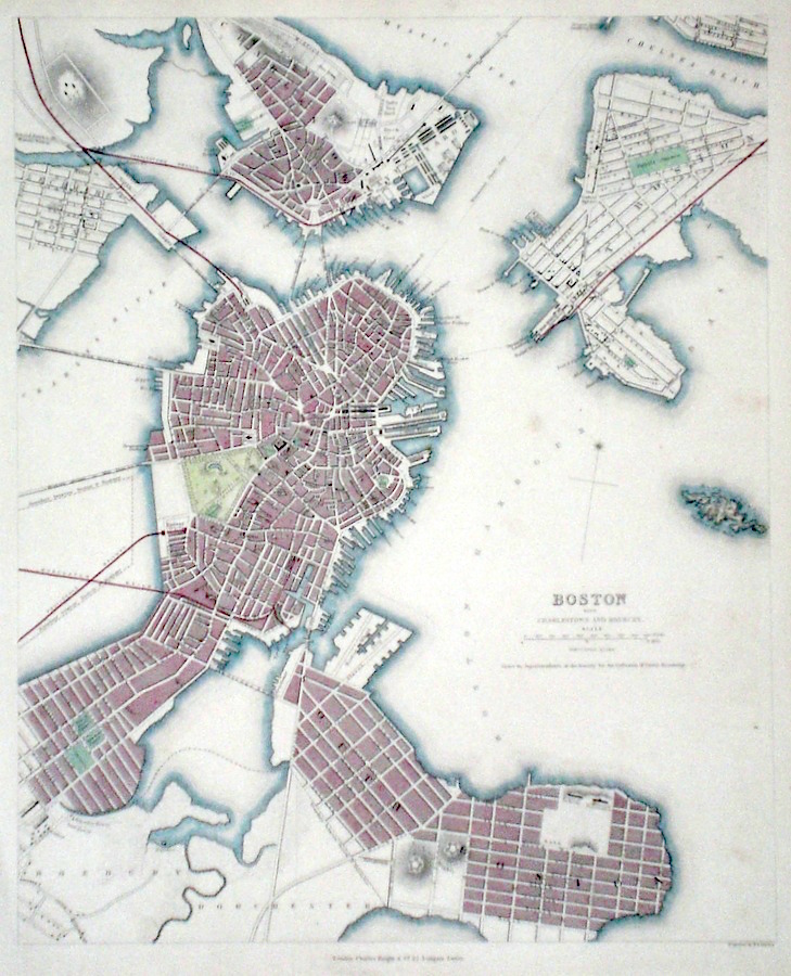
North America 'Boston' Davies, B.R. (c. 1840) 31 x 38 Finely engraved plan of the city by B.R. Davies for the Society for the Diffusion of Useful Knowledge. Features include Charlestown and Roxbury. Early colour with additional Later colour. 200.00 GBP |
|
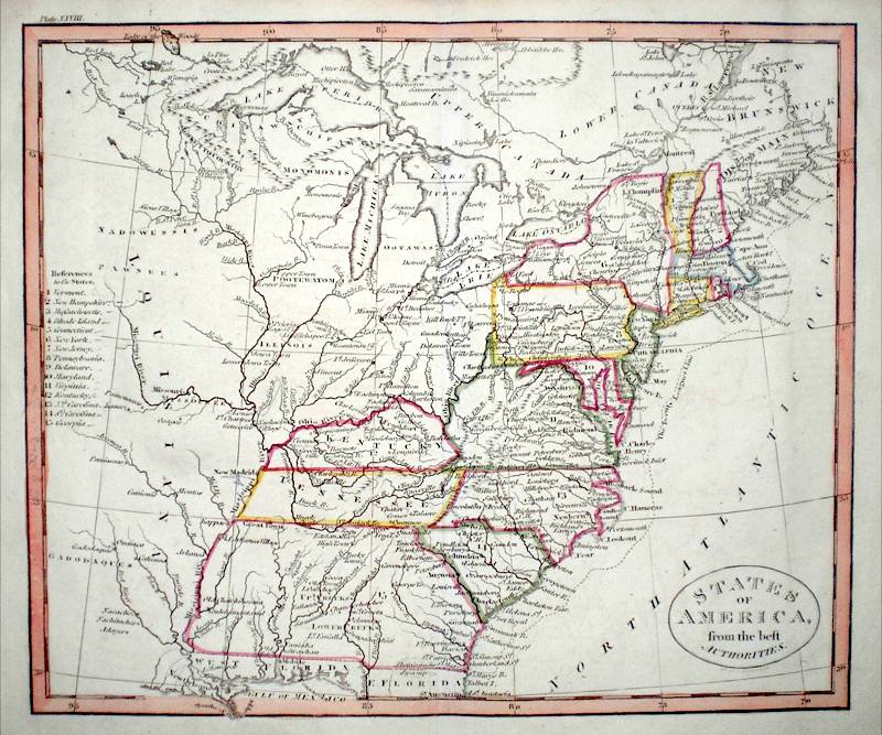
North America 'States of America from the best Authorities' Russell, J. (c. 1818) 23 x 19 States of America from Guthrie's Geography. Engraved by John Russell. A key identifies the fifteen states delineated. Bright original colour. Excellent unmarked condition. 125.00 GBP |
|
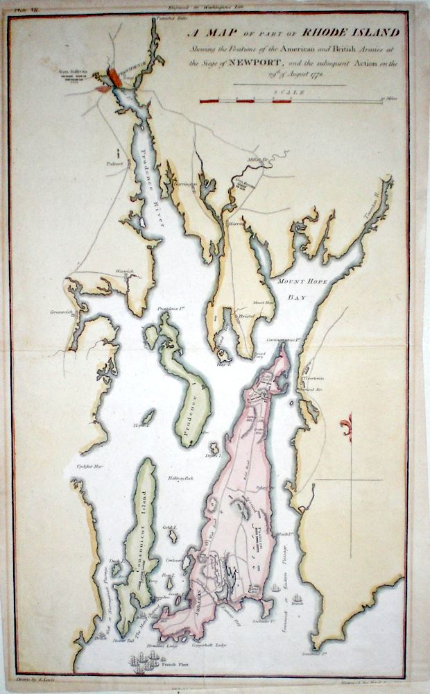
North America 'A Map of part of Rhode Island showing the positions of the American and British Armies at the siege of Newport' Lewis, S. (c. 1806) 25 x 43 Map showing the area of Rhode Island during the siege of Newport and the subsequent action on the 29th of August 1778. The positions of various defences and Generals Sullivan, Fayette, and Greene are given. To the south the positions of the British and French fleets. This map published with Marshall's " Life of Washington ". The map is relatively rare since not many plans of this engagement are readily available to collectors. This copy laid down on acid free card (will be sent packaged flat). Later colour 120.00 GBP |
|
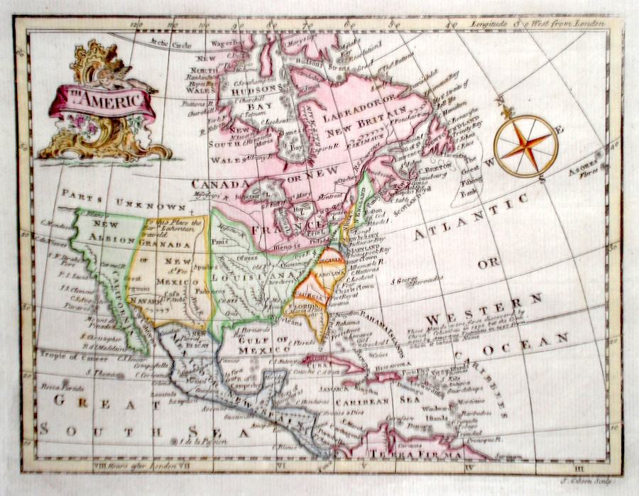
North America Gibson, J. (c. 1787) 22 x 17 Finely engraved map of North America by John Gibson, published in Turner's View of the Earth 1787. Features include an attractive cartouche. The North Western regions are largely labeled as parts unknown .Later colour 120.00 GBP |
|
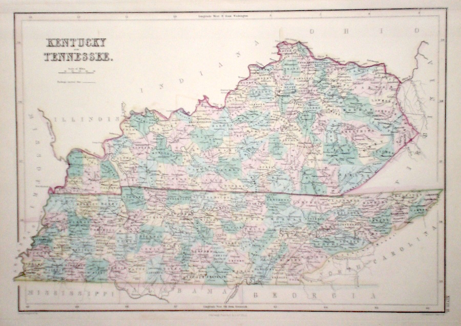
North America 'Kentucky and Tennessee' Hall, S. & Hughes, W. (1854) Finely engraved map of Kentucky and Tennessee, by Sidney Hall and William Hughes. Steel engraving published in the "General Atlas of The World". Condition excellent 98.00 GBP |
|
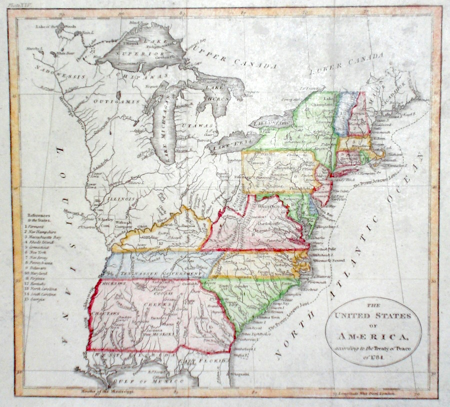
North America 'The United States of America according to the treaty of peace of 1784' Russell, J. (1806) 20 x 19 Fine detailed map of The United States by John Russell for Guthrie's "A New Geographical, Historical, and Commercial Grammar". Features include a table to the left referencing 15 states delineated east of the Mississippi. Good condition. Later colour 95.00 GBP |
|
North America 'North America from the best Authorities' Russell, J. (1818) 23 x 19 North America from Guthrie's Geography. Engraved by John Russell. Original hand colour. Excellent condition 90.00 GBP |

|
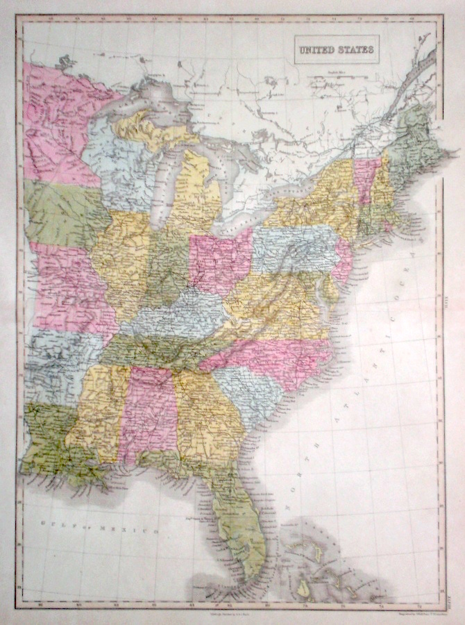
North America 'United States' Hall S. (c. 1854) 37 x 52 Fine large map of The United States, by Sidney Hall. Steel engraving published in the "General Atlas of The World". Later colour. Condition excellent. 85.00 GBP |
|
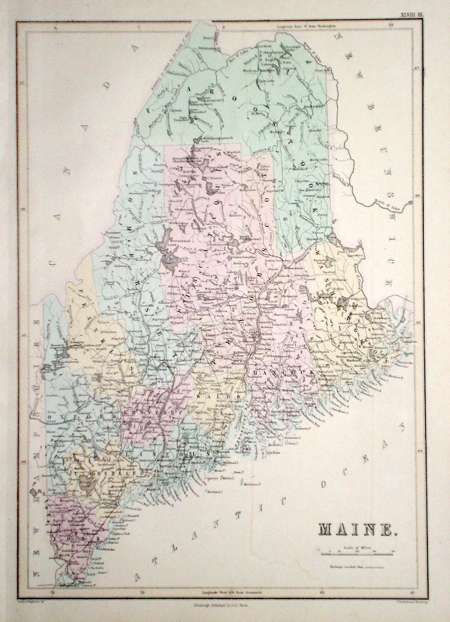
North America 'Maine' Hall, S. & Hughes, W. (1854) 27 x 39 Finely engraved map of Maine, by Sidney Hall and William Hughes. Steel engraving published in the "General Atlas of The World". Condition excellent 85.00 GBP |
|
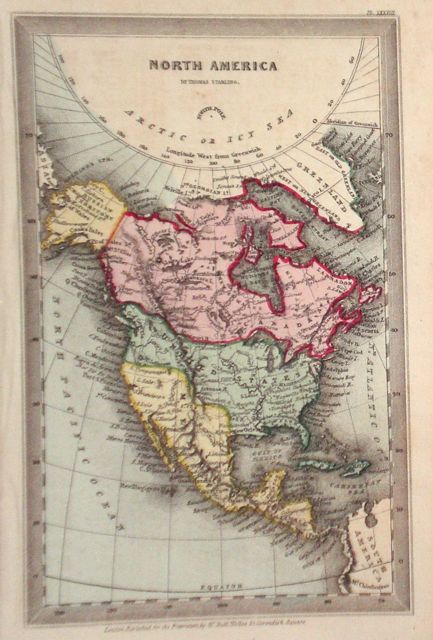
North America Starling, T. (c. 1832) 9 x 15 Uncommon and finely engraved map of North America from The Royal Cabinet Atlas. Bright original colouring. 80.00 GBP |
|
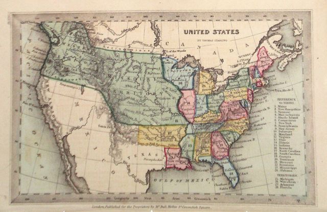
North America 'United States' Starling, T. (c. 1832) 15 x 9 Uncommon and finely engraved map of The United States from The Royal Cabinet Atlas. A numbered key identifies the various states (24) and the variuos territories (4). Bright original colouring. 80.00 GBP |
|
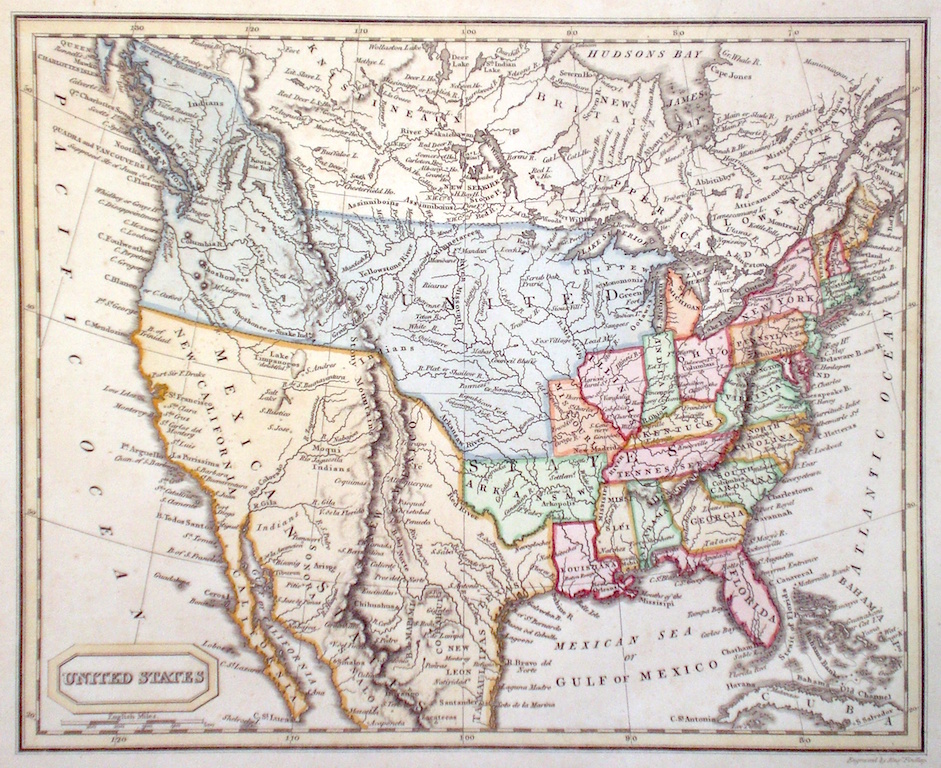
North America Findlay, A. (c. 1820) 24 x 20 Attractive map of The United States engraved by Alexander Findlay. Includes States such as Arkansas, Missouri, Illinois, and Louisiana, west of the Mississippi, but Texas is shown as a part of Mexico. West of The Great Lakes, areas are shown largely by the names of the various Native American Tribes. Later colour. 75.00 GBP |
|
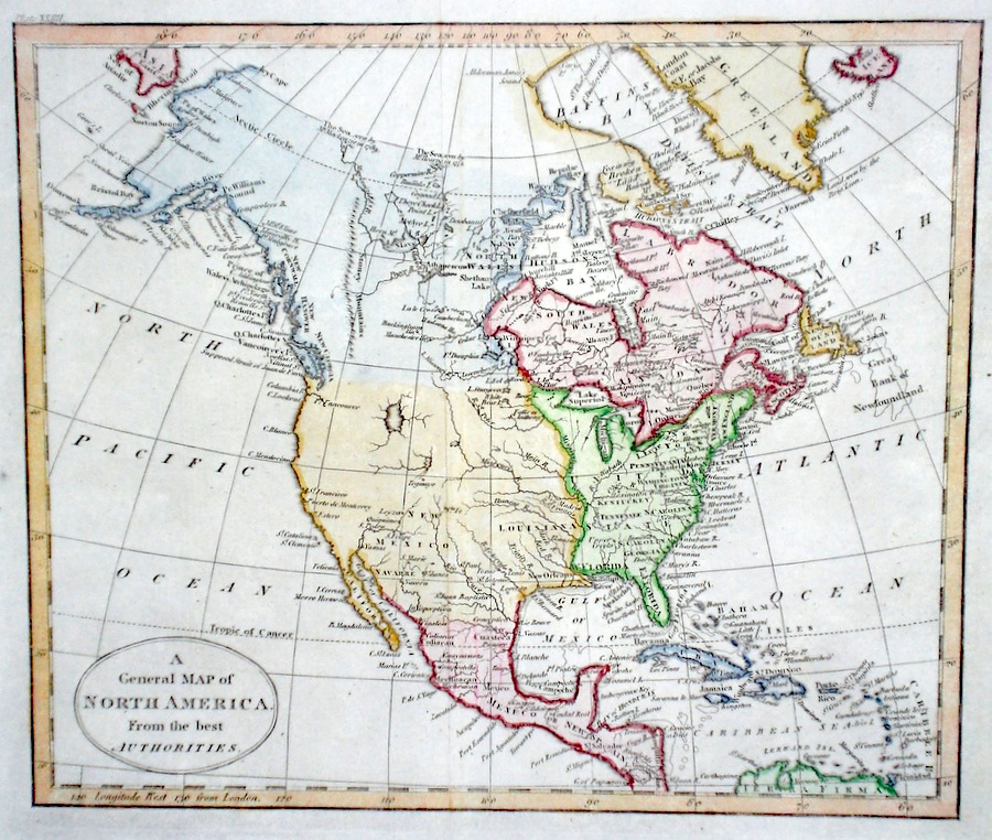
North America 'A General Map of North America from the best Authorities' Russell, J. (1806) 23 x 18 Fine detailed map of North America by John Russell for Guthrie's "A New Geographical, Historical, and Commercial Grammar". Features include no North West passage mapped, but noted on the map is the sea observed by McKenzie in 1789 and by Hearne in 1771, detailed labeling of the North western coastline and Eastern areas, Mexico and the Caribbean. Good condition. Later colour 70.00 GBP |
|
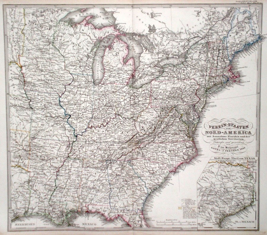
North America 'Verein-Staaten von Nord America' Perthes, J. (1868) 40 x 35 Finely lithographed and detailed map covering the Eastern United States, from The Great Lakes to the Gulf of Mexico. By Justus Perthes for Stieler's Hand-Atlas. The inset map completes the State of Texas. Original colouring, excellent condition. 60.00 GBP |
|
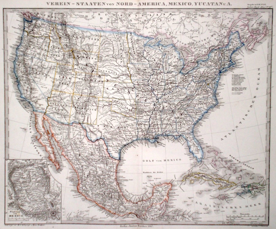
North America 'Verein-Staaten von Nord America, Mexico, Yucatan' Perthes, J. (1868) 40 x 34 Finely lithographed and detailed map covering the United States, and Mexico by Justus Perthes for Stieler's Hand-Atlas. The inset map shows the Plateau of Mexico in more detail. Original colouring, excellent condition. 60.00 GBP |
|
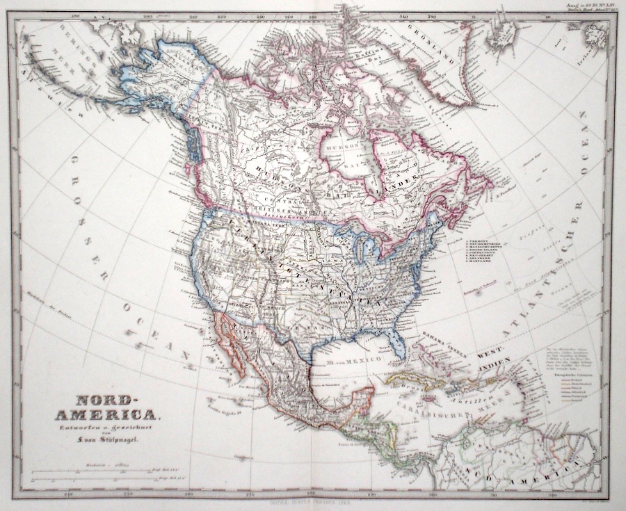
North America 'Nord-America' Perthes, J. (1868) 39 x 32 Finely lithographed and detailed map covering North America and including United States, Canada, Alaska (labeled as Russian America), Mexico, Central America, and the Caribbean. By Justus Perthes for Stieler's Hand-Atlas. Original colouring, excellent condition. 60.00 GBP |
|
North America Findlay, A. (c. 1820) 20 x 26 Attractive map of North America engraved by Alexander Findlay. Includes Central America and Mexico, Louisiana, United States etc. Much of the far North being only partly mapped. Later colour. 45.00 GBP |
|
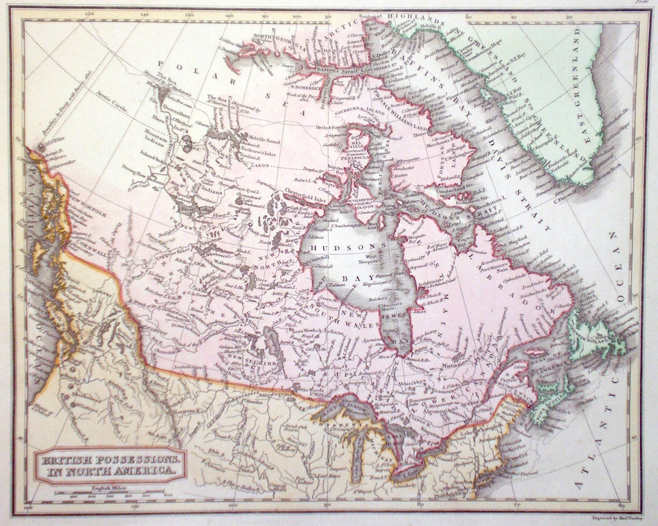
Canada 'British Possessions in North America' Findlay, A. (c. 1820) 24 x 20 Attractive map of Northern North America engraved by Alexander Findlay. Much of the area above Hudson's Bay is only partly mapped, and Baffin Island is shown connected to the mainland. Later colour 45.00 GBP |
|
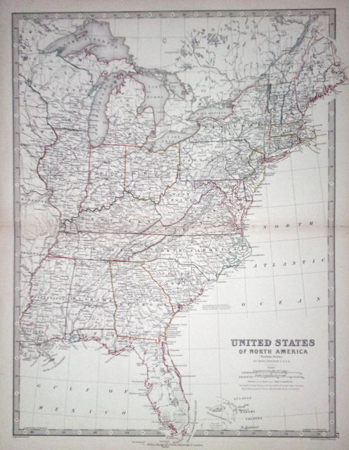
North America 'United States of North America. (Eastern States)' Johnston, A. K. (1873) 34 x 44 Detailed map of the states east of the Mississippi river. Original colour 45.00 GBP |