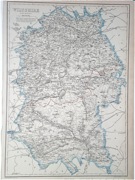
Wiltshire
Including Trowbridge, Salisbury, Swindon, Chippenham, Devizes, Marlborough, Warminster
|
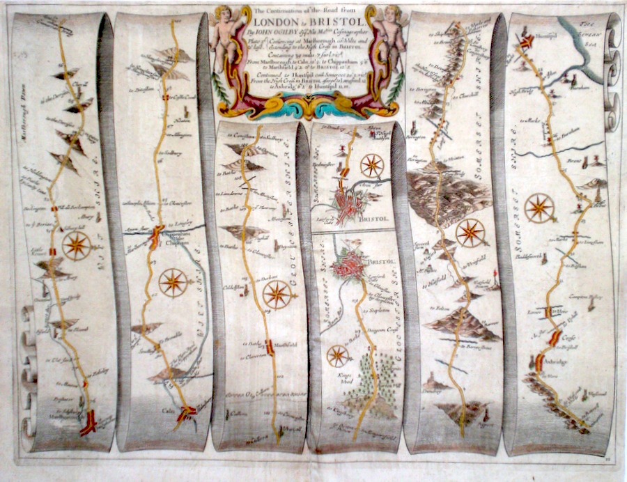
Wiltshire 'The Continuation of the Road from London to Bristol' Ogilby, J. (1698) 44 x 34 The road from Marlborough to Chippenham, Bristol. From Bristol to Axbridge and Huntspil. From John Ogilby's Britannia, generally considered one of the most important cartographical works of the seventeenth century. Features include miniature town plans of Bristol and a fine cartouche. Later colour. Plate number 11. Excellent condition. 200.00 GBP |


|
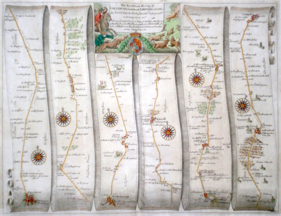
Wiltshire 'The Road from the City of Salisbury.com.Wilts to Campden com.Gloc...' Ogilby, J. (1698) 45 x 35 The Road from Salisbury to Everly, Burbich, Marlborough, Highworth, Lechlade, Burford, Stow-on-the-Wold, Campden. From John Ogilby's Britannia, generally considered one of the most important cartographical works of the seventeenth century. Features include town plans of Salisbury and Marlborough and a fine cartouche depicting rural sports. Later colour. Plate number 85. Excellent condition. 190.00 GBP |
|
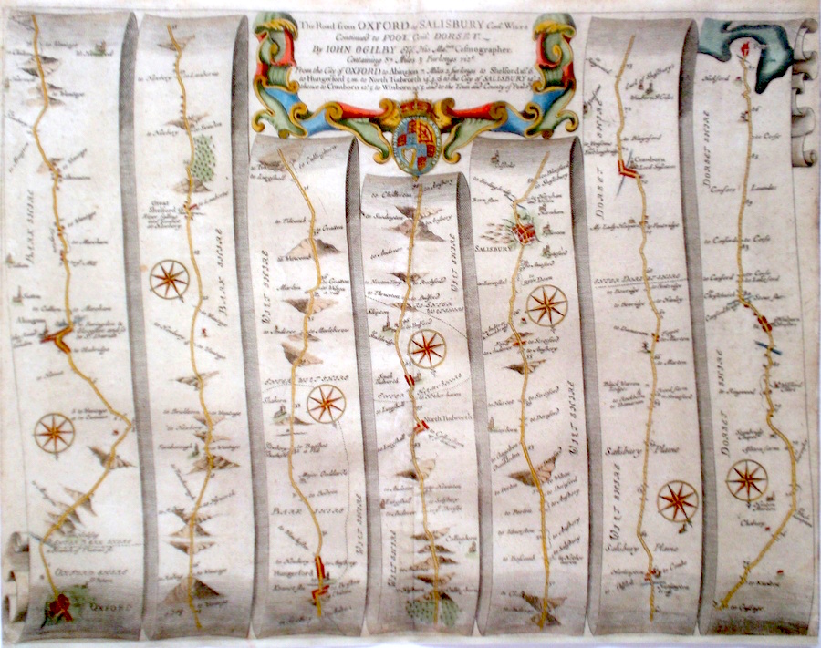
Wiltshire 'The Road from Oxford to Salisbury Com. Wilts Continued Pool Com. Dorset' Ogilby, J. (1698) 46 x 35 The Road from Oxford to Abingdon, Great Shelford, Hungerford, North Tudworth, Salisbury. Continuing to Cranborne, Wimborne Minster, Pool. From John Ogilby's Britannia, generally considered one of the most important cartographical works of the seventeenth century. Features include town plans of Oxford, Salisbury, and a fine cartouche. Later colour. Plate number 83. Closely trimmed at the bottom otherwise, excellent condition. 180.00 GBP |
|
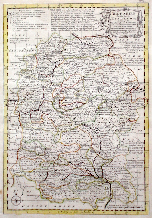
Wiltshire 'Wiltshire divided into its Hundreds…' Bowen E. & T. (1767) 22.5 x 33 Very finely engraved map of the County by Emanuel and Thomas Bowen from the "Atlas Anglicanus". The maps are generally derived from those in "The Large English Atlas", and extensive county information accompanying the maps is also a feature of this series. A rare item. Bright original colouring. 160.00 GBP |
||||||||||||||
|
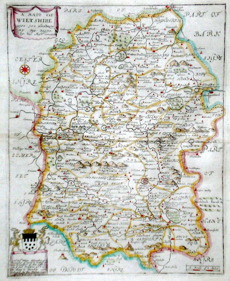
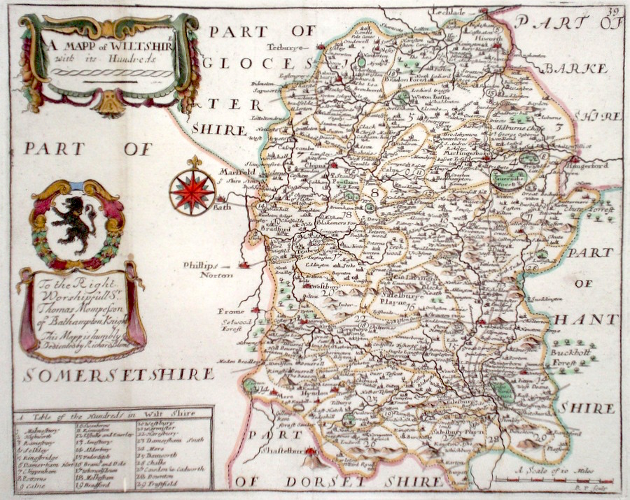
Wiltshire 'A Mapp of Wiltshire...' Blome, R. (1673) 26 x 32 Decorative map of the County by Richard Blome for his publication "Britannia". The largest series of county maps published by Blome, and generally based on those of Speed. Maps by Blome are characteristic and attractive. Fine condition, later colour. 150.00 GBP |
|
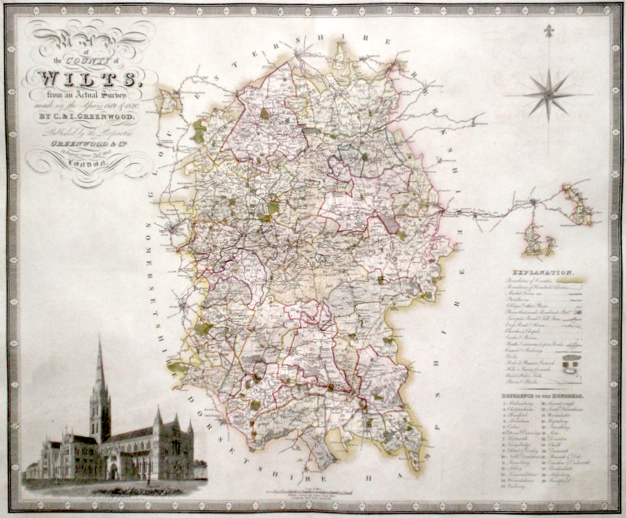
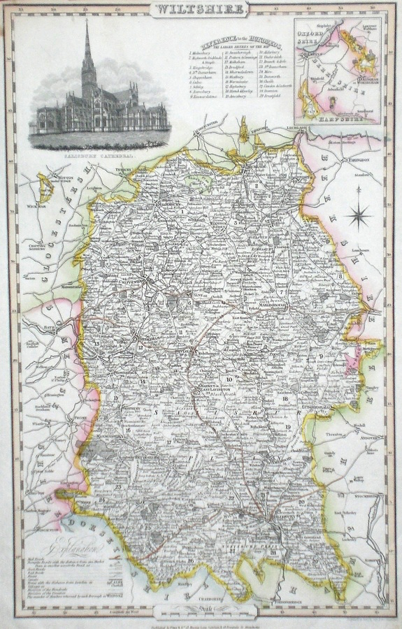
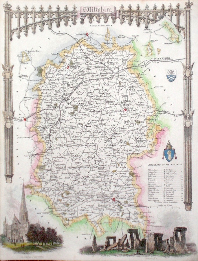
Wiltshire 'Map of the County of Wiltshire, from an Actual Survey made in the years 1819 and 1820' Walker, J. & C. (1829) 69 x 57 Finely engraved and detailed map of the county by Christopher and John Greenwood. The brothers published their county maps from their original surveys over the period 1817 until 1833, and then in 1834 as an atlas. With their large size, accuracy and decorative vignettes the maps are generally recognised as being amongst the finest published in England in the nineteenth century. On this map the vignette is of Salisbury Cathedral. Original hand colouring. 150.00 GBP |
|
Wiltshire 'A New Map of Wiltshire Divided into Hundreds, Exhibiting its Roads, Rivers, Parks, &c.' Cary, J. (1809) 48 x 55 Wiltshire by John Cary from Cary's New English Atlas, the largest of the Cary Atlases. Superb engraving with full original colouring 130.00 GBP |
||||||||||||||

|
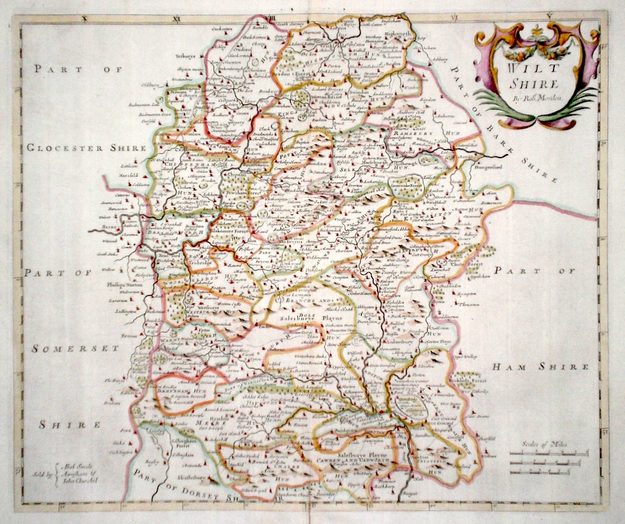
Wiltshire 'Wiltshire by Robt, Morden' Morden, R. (1722) 42 x 36 Superbly engraved and decorative map of the county by Robert Morden. From the 1722 edition of Camden's Britannia. Excellent condition with good margins. Later colour 120.00 GBP |
||||||||||||||
|
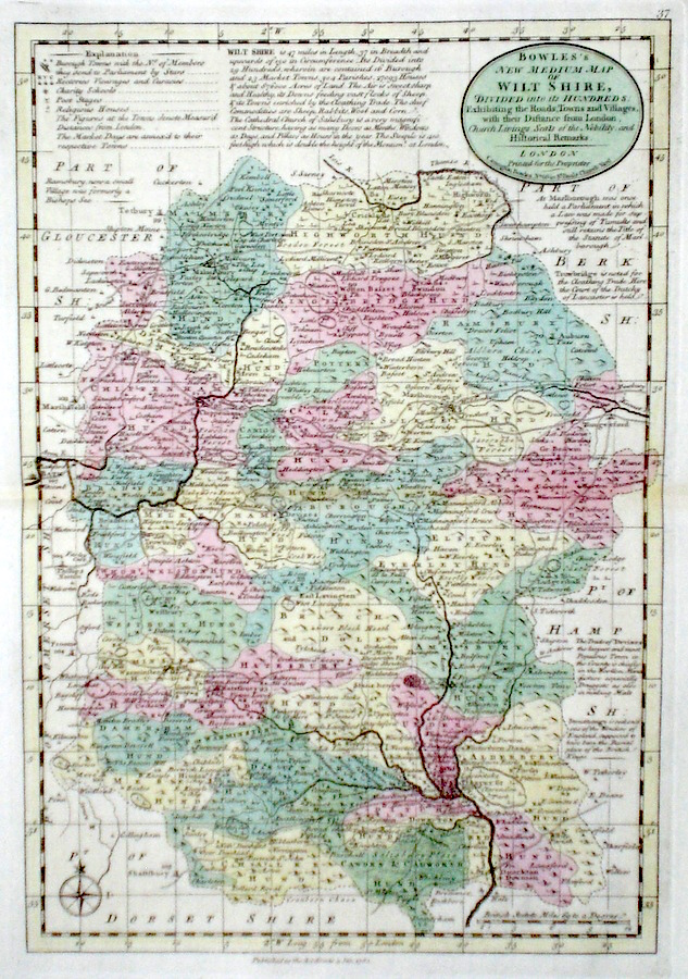
Wiltshire 'Bowles's New Medium Map of Wilt shire...' Bowen, E. & T. (1785) 23 x 33 Finely engraved and detailed map of the county from "Bowles's New Medium English Atlas". The maps in this series are based on those in Emanuel and Thomas Bowen's Atlas Anglicanus, and feature extensive county information on the map. They are distinguished primarily by having newly engraved cartouches, distances from London added to towns, and different imprints at the bottom. Full original colour. Fine condition. 120.00 GBP |
|
Wiltshire 'A Mapp of Wiltshire with its Hundreds' Blome, R. (c. 1731) 25 x 20 Finely engraved map of the county by Richard Blome from the atlas "England Exactly Described or a Guide to Travellers…" first published by Thomas Taylor, but herewith from the later edition published by Thomas Bakewell. A major addition to the earlier plates is that roads and distances between towns are now included, after the road surveys of John Ogilby. Fine condition. Later colour 95.00 GBP |
|
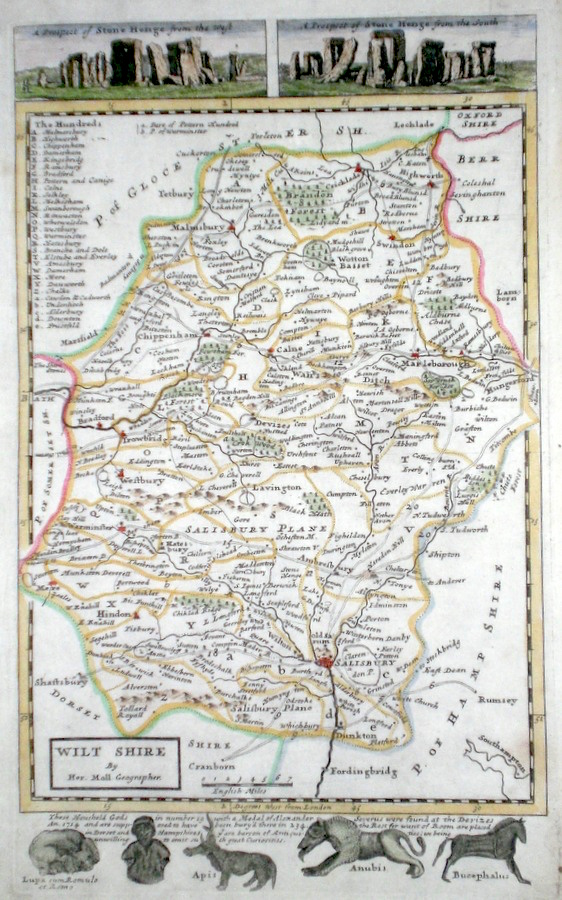
Wiltshire Moll, H. (c. 1724) 20 x 32 Finely engraved map of the county by Herman Moll for the publication "A New Description of England and Wales…" The maps in this series include engraved borders of local architectural and antiquarian interest. A unique feature. On this map effigies of Roman household Gods and two separate views of Stonehenge. Later colour, fine condition. 65.00 GBP |
|
Wiltshire Pigot, J. (c. 1826) 23 x 36 Attractive and detailed steel engraved map by James Pigot from his publication Pigot & Co.'s British Atlas. Features include a fine vignette engraving of Salisbury Cathedral. Original hand colour. Excellent condition 60.00 GBP |
|
Wiltshire Simpson, S. (1746) 16 x 18 Fine map of the county by Samuel Simpson for his publication "The Agreeable Historian". Most of the maps in this rare series are said by Simpson to be based on those of Herman Moll. Later colour 55.00 GBP |

|
Wiltshire Moule, T. (c. 1848) 21 x 27 Decorative Steel engraved map of the county by Thomas Moule. Inset views of Stonehenge and Salisbury Cathedral. Later colour. 55.00 GBP |
|
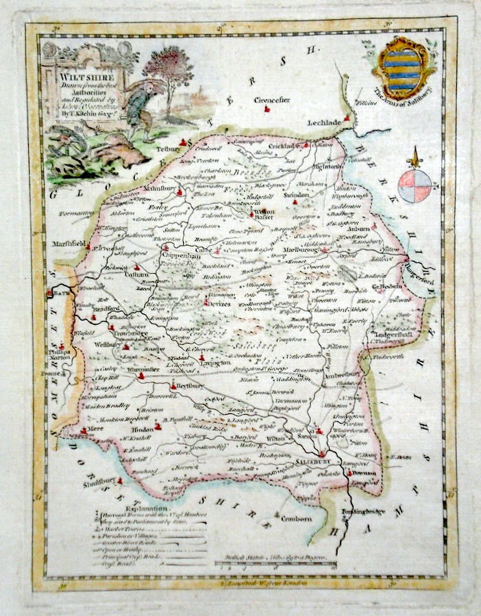
Wiltshire 'Wiltshire Drawn from the best Authorities…' Kitchen, T. (c. 1769) 17 x 22 Finely engraved map of the county by Thomas Kitchen for the publication "England Displayed". The cartouche, shows a local rural scene, and the Coat of Arms are of Salisbury. Later colour 50.00 GBP |
|
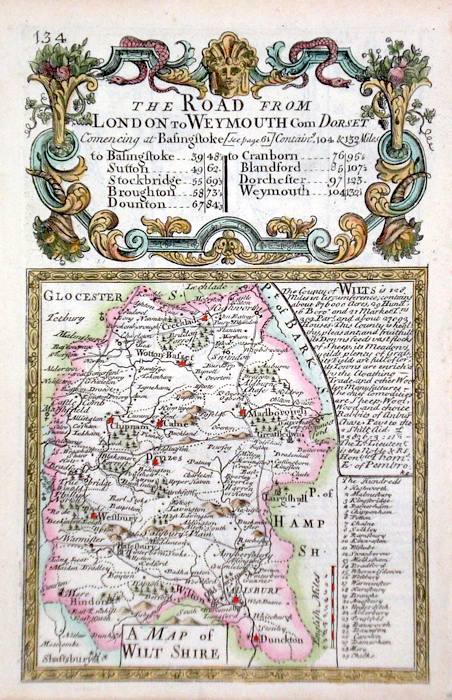
Wiltshire 'A Map of Wiltshire' Bowen, E. (c. 1724) 12 x 19 Finely engraved map of the County by Emanuel Bowen and John Owen for the publication "Britannia Depicta". To the top are given details of the Road from London to Weymouth and verso the roads to Newmarket and Bury St.Edmunds are featured. After John Ogilby. Later colour 40.00 GBP |
|
Wiltshire Lewis, W. (c. 1835) 10 x 14 Detailed and attractive miniature map of the County by William Lewis for his "Lewis's New Traveller's Guide". A particular feature of this charming series of maps is the clear and precise engraving of the roads. Adjacent numbers indicating the distances from London. Also included with the map is the accompanying page of text giving the county information relevant to travellers - principal towns and inns are listed, distances between towns, principal fair dates, and even sites for the best views of the county. Later colour. 35.00 GBP |
|
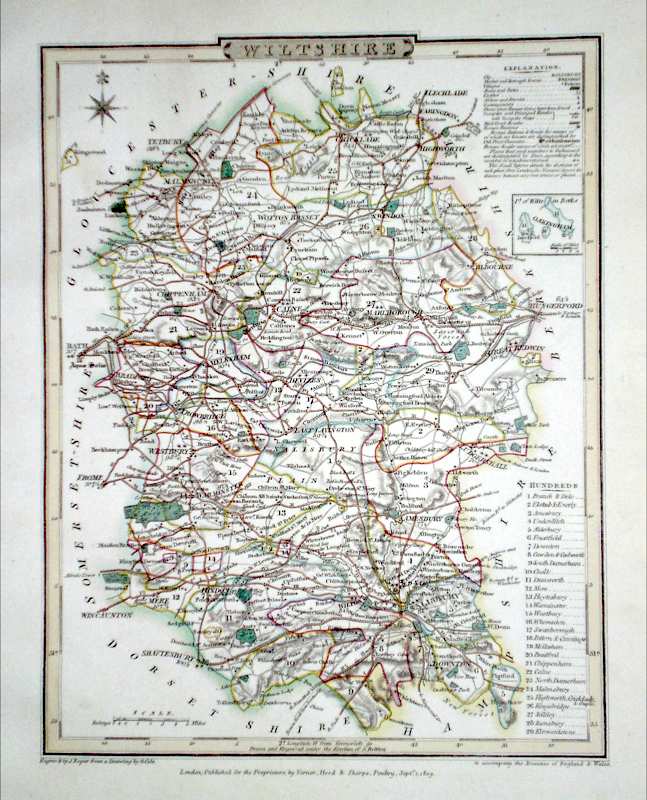
Wiltshire Roper, J. (1810) 18 x 24 Detailed and decorative map of the county by Cole and Roper for The British Atlas. Original hand colouring. Excellent condition. 35.00 GBP |
|
Wiltshire Dispatch Atlas (1863) 31 x 43 Early outline colour. 25.00 GBP |