Russia
|
Russia 'Troisieme Partie De La Carte d'Asie contenant La Siberie et quelques autres parties de La Tartarie…' D'Anville, J. B. B. (c. 1753) 107 x 52 Superb map of Eastern Russia and Siberia by Jean Baptiste Bourguignon d'Anville engraved by Guillaume de La Haye. Two elephant folio sheets joined as issued. Covers the area from the Caspian Sea to Kamchatka and Northern Japan. Notable for its interior detail and clarity the map represents one third of D'Anville's famous map of Asia. The map is enhanced by a very fine cartouche engraved by Gravelot which depicts bears with salmon, and travel by reindeer sled in an arctic environment. The rococo design surmounted by six putti type figures blowing the winds. Early outline colour with additional later colour. Condition is excellent. A fine example of an influencial map by one of France's foremost cartographers produced at a time when French cartography was unsurpassed. 395.00 GBP |


|
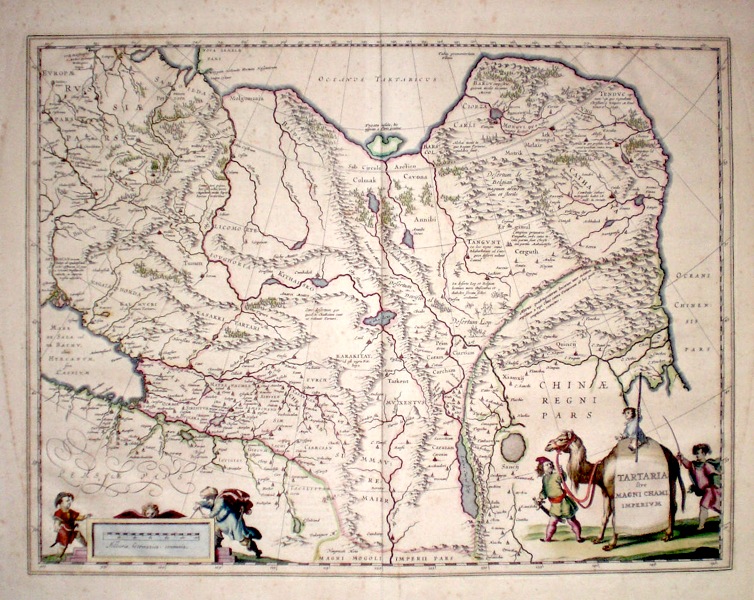
Russia 'Tartaria sive Magni Chami Imperium' Blaeu, W. J. (c. 1640) 50 x 38 Decorative and finely engraved map of northern and central Asia extending from the Caspian sea and the Volga to the Pacific. Shows China with the great wall prominently engraved, and the tip of Korea. To the west of the wall are depictions of various mythical creatures. Original colour. Dutch text verso. Excellent condition 340.00 GBP |
|
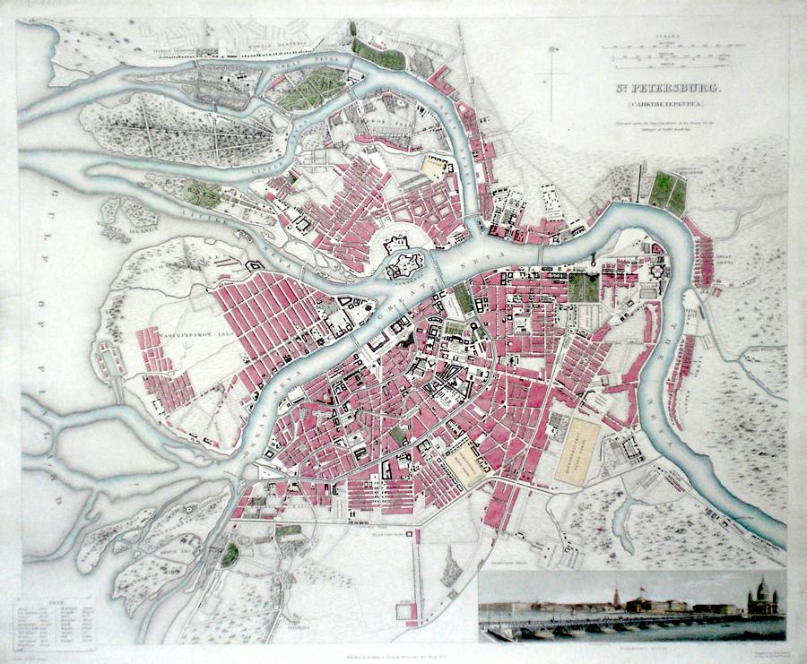
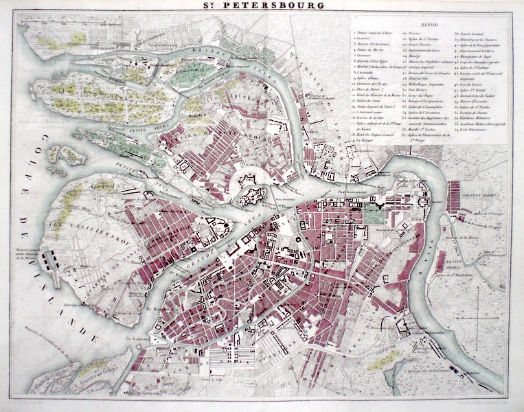
Russia 'St. Petersburg' Davies, B. R. (c. 1834) 39 x 34 Benjanin Rees Davies' fine map of St Petersburg for The Society For Diffusion of Useful Knowledge. Published circa 1834 the plan features a view across the Isakiefskoi Bridge to the Winter Palace, Admiralty and War Office. Later colour. Excellent condition. 180.00 GBP |
|
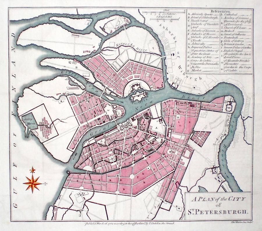
Russia 'A Plan of the City of St. Petersburg' Kitchen, T. (c. 1784) 30 x 27 Fine copperplate plan of the city by Thomas Kitchin. Published circa 1784 by Cadell, features include a key top right referencing all the important buildings and areas of the city. Later hand colour. Some old folds, and added margin at bottom right, but generally excellent condition. 180.00 GBP |
|
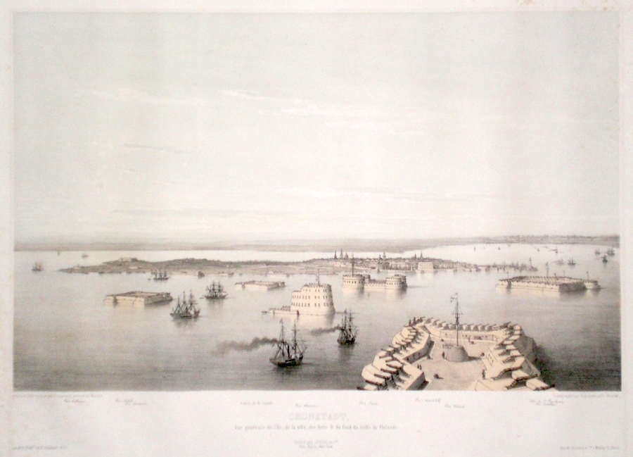
Russia 'Kronstadt' Ciceri & Benoist (c. 1850) 50 x 37 Very fine lithograph of Kronstadt, St. Petersburg by Eugene Ciceri and Phillipe Benoist after the marine painter D'Ossoard. Kronstadt is a town situated on Kotlin Island in the Eastern Baltic within the jurisiction of St. Petersburg and is its main port. The Island was captured by Peter the Great from the Swedes in 1703. Peter The Great founded the town as the main port for the Russian Navy in the Baltic. The view shows the series of Forts and Batteries protecting the City, and they are listed below the image. The publishing stamp of Goupil, Paris is located below the Title. On thick paper with full margins. Some traces of spotting are primarily confined to the margins otherwise in excellent condition. 150.00 GBP |
|
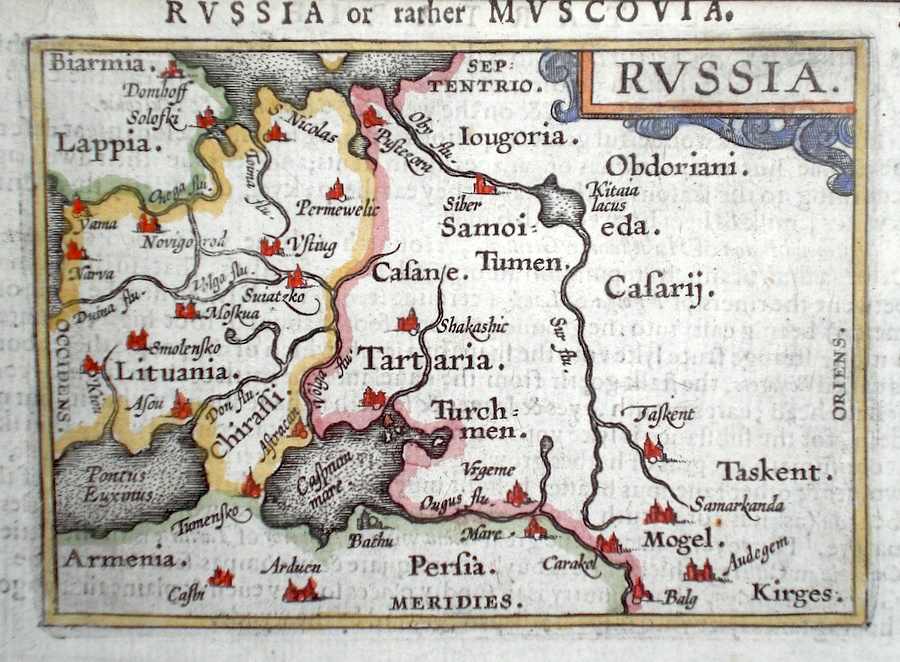
Russia Ortelius, A. (c. 1603) 10 x 8.5 Fine early map of Russia by Abraham Ortelius , engraved in small format by Philippe Galle, and published in the Epitome, or pocket-edition of the "Theatrum Orbis Terrarum". This map from an English text edition of c. 1603 published in London and thus one of the first world atlases published in England. Fine condition. Later colour 140.00 GBP |
|
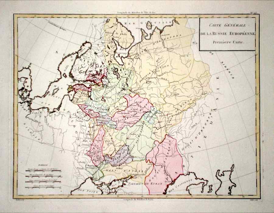
Russia 'Carte Generale de la Russie Europeenne.' Mentelle, E. (c. 1797) 43 x 33 Russia in Europe. Fine map by the French Geographer and Historian Edme Mentelle from his Atlas Universel. French Cartography was at its most accomplished in the later eighteenth century, and Mentelle held various positions in the forefront of the science. As a tutor in the French Ecole Militaire it is thought that he tutored the young Napoleon Bonaparte. Original outline colour with later body colour. A crisp copy on thick paper with no central fold. 100.00 GBP |
|
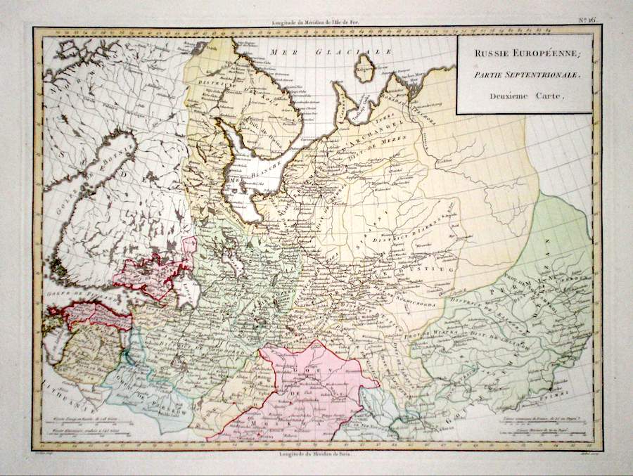
Russia 'Russie Europeenne Partie Septentrionale.' Mentelle, E. (c. 1797) 43 x 33 Russia in Europe. Northern part. Fine map by the French Geographer and Historian Edme Mentelle from his Atlas Universel. French Cartography was at its most accomplished in the later eighteenth century, and Mentelle held various positions in the forefront of the science. As a tutor in the French Ecole Militaire it is thought that he tutored the young Napoleon Bonaparte. Original outline colour with later body colour. A crisp copy on thick paper with no central fold. 100.00 GBP |
|
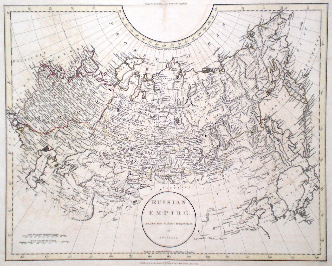
Russia 'Russian Empire Drawn from the best Authorities….' Russell, J. (c. 1799) 48 x 38 Fine map of The Russian Empire by John Charles Russell for Guthrie's " New System of Geography". Includes also Japan and Corea. Double page folio size map, original hand colour 95.00 GBP |
|
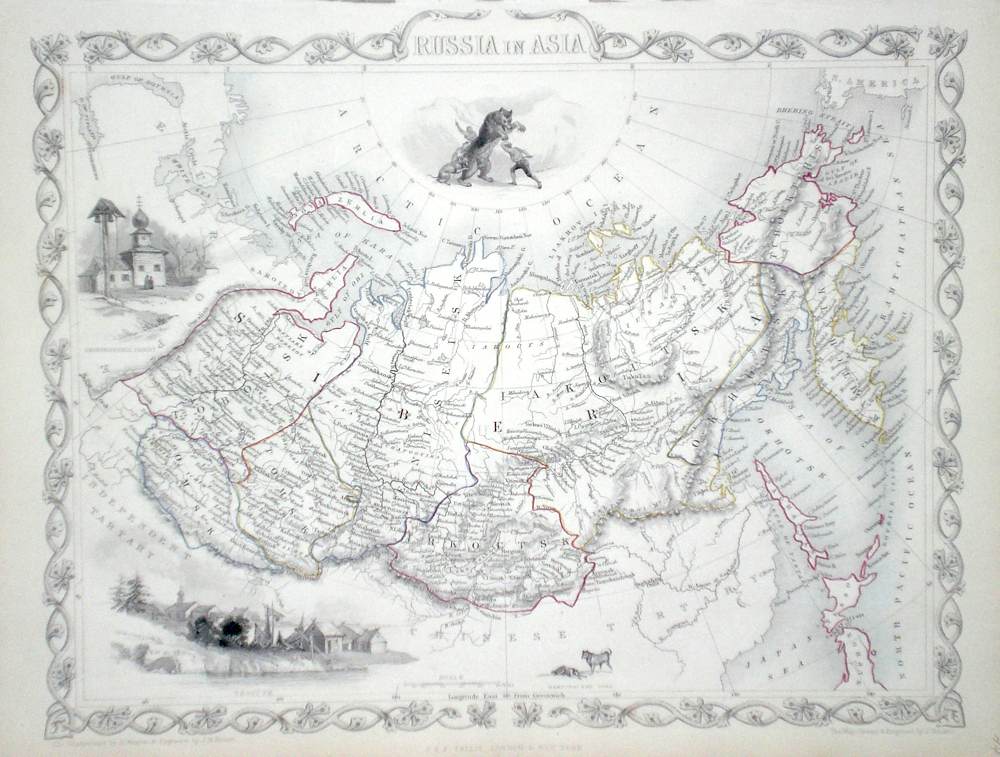
Russia 'Russia in Asia' Rapkin, J. (1851) 35 x 26 Fine map of the Siberian area by John Rapkin, for John Tallis's highly decorative "The Illustrated Atlas". The vignettes show; Skorskarski Pagost, Troitsk, Kamchatskan Dogs, The North Polar region is not mapped but the area is filled with a vignette of Bear Hunting. Single page map (no central fold). Original colour as published. Condition fine. 95.00 GBP |
|
Russia 'Russia in Europe' Rapkin, J. (1851) 25 x 35 Fine, detailed map of the area by John Rapkin, for John Tallis's highly decorative "The Illustrated Atlas". The vignettes show; The Neoskoi Prospect St. Petersburg, Travelling Sledge, Russian Bear, Napoleon's Flight from Moscow. Single page map (no central fold). Original colour as published. Condition fine. 95.00 GBP |

|
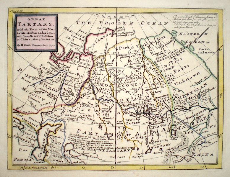
Russia 'Great Tartary with the tract of the Muscovite Ambassador's travels from Moscow to Pekin...' Moll, H. (1732) 27 x 20 Attractively engraved map by Herman Moll of the area which is now Russia in Asia. From the Atlas Minor published by T. and J. Bowles. The map shows the route taken by the Russian Ambassador on his travels to Pekin, (Beijing). Original colour. Fine condition. 95.00 GBP |
|
Russia St. Petersburg Dufour, A. (c. 1842) 26 x 21 Fine steel engraved plan of the city by the French geographer Adolphe-Hippolyte Dufour. Later colour 70.00 GBP |
|
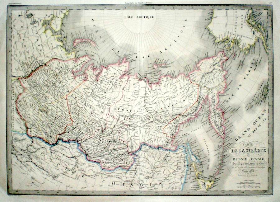
Russia 'Carte de La Siberie ou Russie D'Asie' Lapie, P. (c. 1838) 56 x 40 Large size and very detailed map of Siberia published in Paris by the firm of Lapie. Longitude is taken from the meridian of Paris. Original outline colour. 70.00 GBP |
|
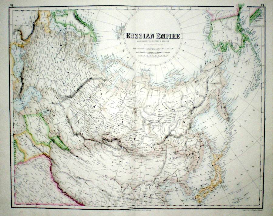
Russia 'Russian Empire' Swanston, G. H. (c. 1870) 52 x 41 Large size and detailed map of Asiatic Russia by Swanston for the Royal Illustrated Atlas of Modern Geography published by Fullarton. Includes Mongolia, Manchuria, Japan and Korea, Kamchatska etc. Alaska is marked as part of the U.S. Printed in colour and finished by hand. 60.00 GBP |
|
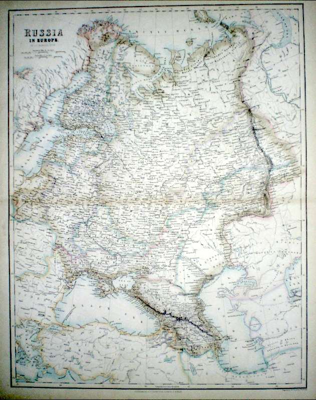
Russia 'Russia in Europe' Swanston, G. H. (c. 1870) 41 x 52 Large size and detailed map of Western Russia by G.H. swanston for the Royal Illustrated Atlas of Modern Geography published by Fullarton. Printed colour finished by hand. 60.00 GBP |
|
Russia 'The Russian Empire in Europe and Asia' Cookeís New Encyclopaedia (c. 1789) 32 x 22 The Russian Empire from Cooke's New Encyclopaedia. Traces of old folds but excellent condition. Later hand colour 40.00 GBP |
|
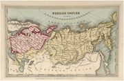
Russia 'Russian Empire' Starling, T. (c. 1832) 15 x 9 Uncommon and finely engraved map of the Russian Empire from The Royal Cabinet Atlas. Bright original colouring to the main areas. 45.00 GBP |
|
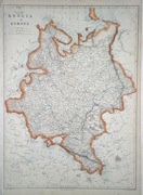
Russia 'Russia in Europe' Lowry, J. (1863) 31 x 43 Highly detailed map covering the areas of Russia, Estonia, Latvia, Belarus, Ukraine, etc. Original colour. 35.00 GBP |