Lancashire
Including Lancaster, Liverpool, Manchester, Preston, Bolton, Warrington, Barrow-in-Furness
|
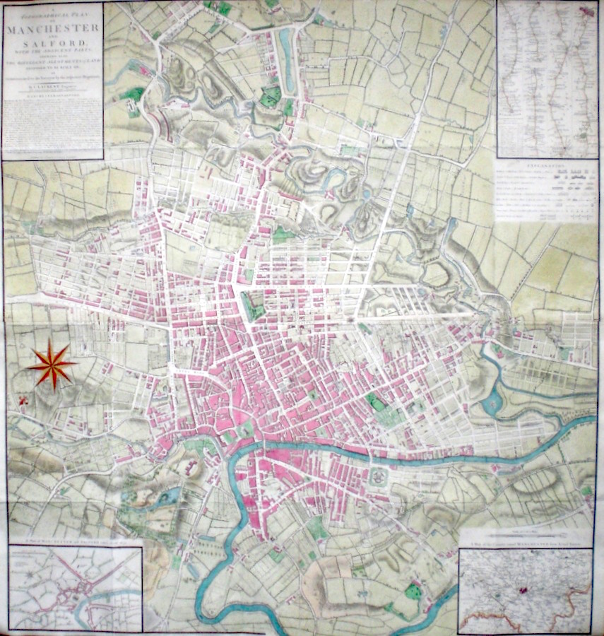
Lancashire 'A Topographical Plan of Manchester and Salford; with the adjacent Parts...' Laurent, C. (c. 1793) 91 x 104 Magnificent large plan of Manchester and environs by the London geographer and engraver Charles Laurent. Features include, top right a map of the road from Manchester to London in strip form as originated by John Ogilby, and a key to symbols used. Bottom right a map of the country around Manchester. Bottom left a plan of the Manchester and Salford area as in 1650. To the left a large and decorative compass rose. Originally folded, some intersections have been strengthened verso, otherwise condition is excellent. Later colour. 360.00 GBP |


|
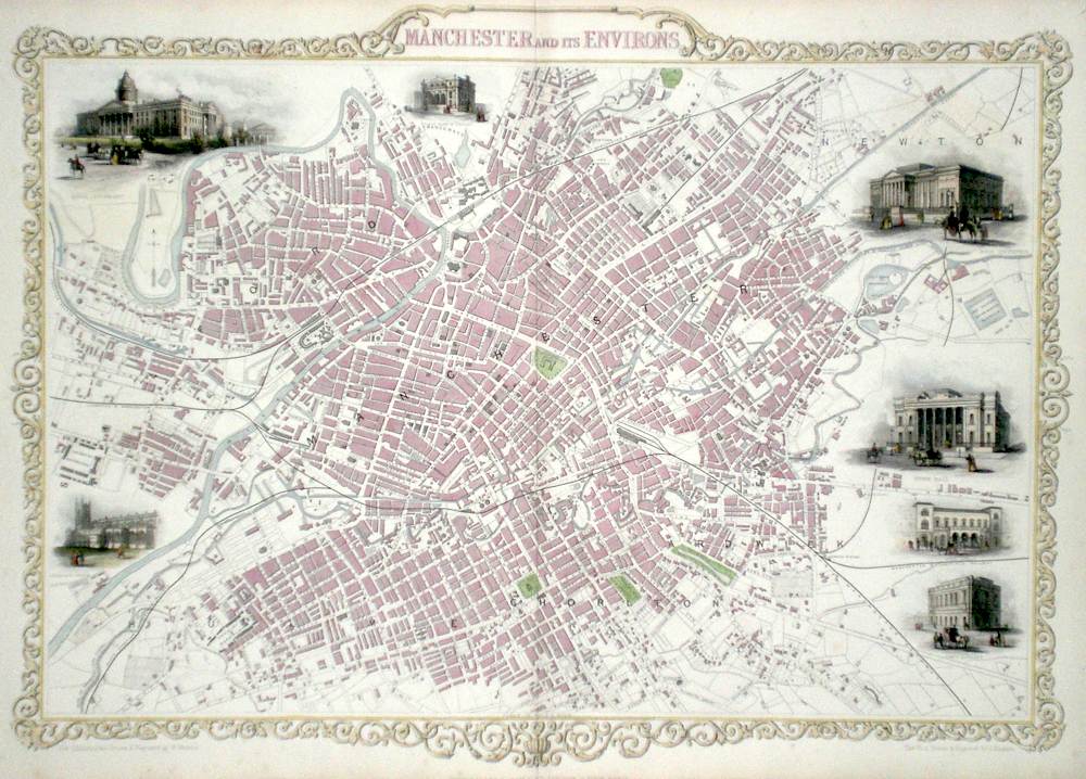
Lancashire 'Manchester and Its Environs' Rapkin, J. (1851) 50 x 36 Superb map of the City engraved by John Rapkin, for John Tallis's highly decorative "The Illustrated Atlas". The vignettes show; Royal Institution, Town Hall, Post Office, Free Library, Collegiate Church, Royal Infirmary, Branch Bank of England. Double page map. Later colour. Condition fine. 240.00 GBP |
|
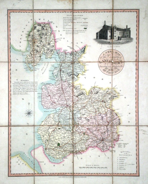
Lancashire 'A New Map of th County of Lancashire, divided into Hundreds by Mr. Thomas Dix' Dix, T. (1816) 36 x 45 Decorative folding map of the county by Thomas Dix, published by William Darton Junior. Dissected into twelve sections and backed with canvas. Publishers label to verso. Original wash colour to the hundreds. The vignette shows the College at Manchester. Some wear to canvas at intersections, a few age related marks to the surface mostly confined to the margins, but overall a rare item in excellent condition. 200.00 GBP |
|
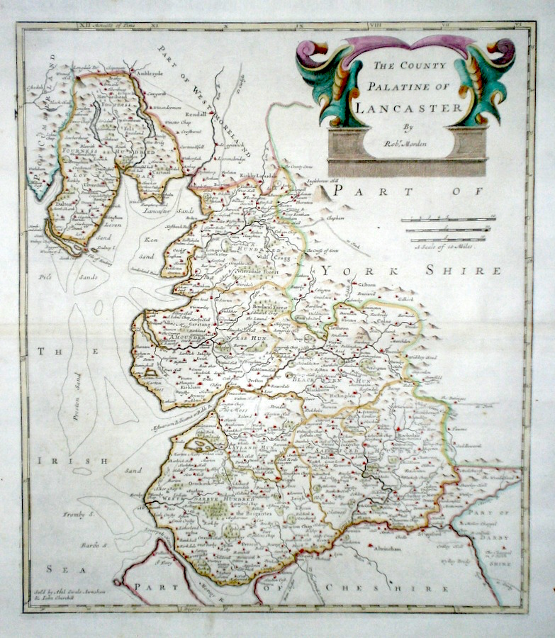
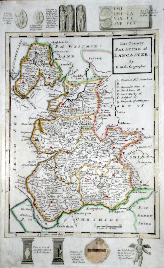
Lancashire 'The County Palatine of Lancaster' Morden, R. (1722) 43 x 37 Superbly engraved and decorative map of the county by Robert Morden. From the 1722 edition of Camden's Britannia. Excellent condition with good margins. Later colour 150.00 GBP |
|
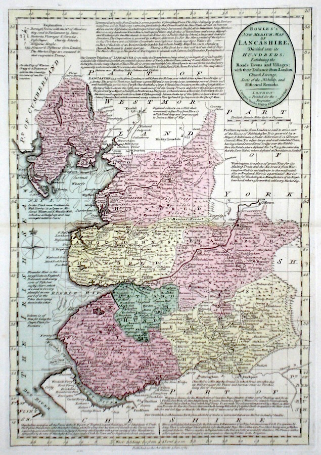
Lancashire 'Bowles's New Medium Map of Lancashire...' Bowen, E. & T. (1785) 23 x 33 Finely engraved and detailed map of the county from "Bowles's New Medium English Atlas". The maps in this series are based on those in Emanuel and Thomas Bowen's Atlas Anglicanus, and feature extensive county information on the map. They are distinguished primarily by having newly engraved cartouches, distances from London added to towns, and different imprints at the bottom. Full original colour. Fine condition. 150.00 GBP |
|
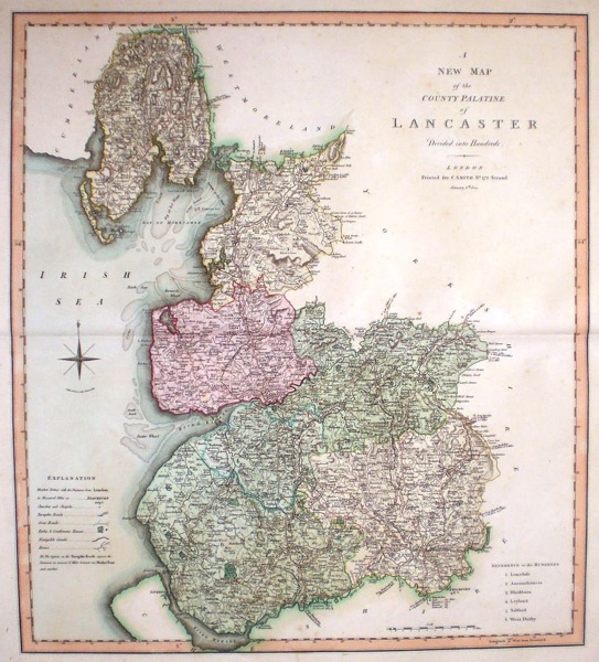
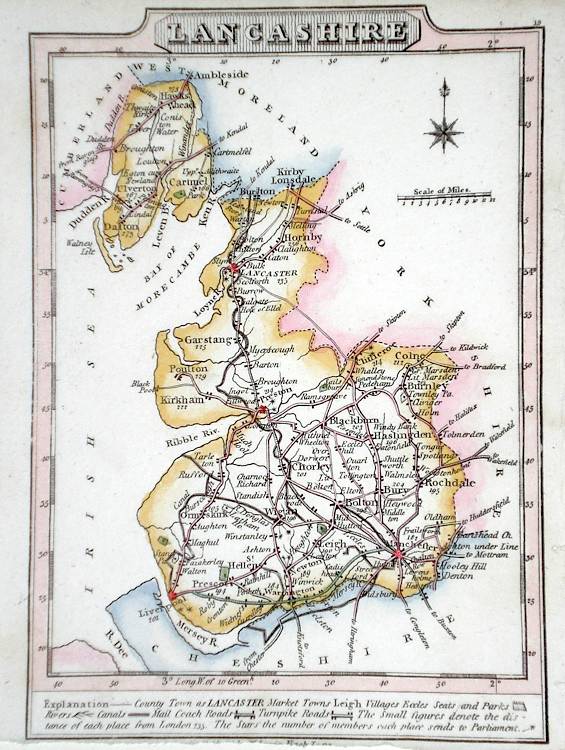
Lancashire 'A New Map of the County Palatine of Lancaster divided into hundreds' Smith, C. (1804) 45 x 50 Large size and decorative map of the County by Jones, Smith & Co. for Smith's New English Atlas. The first map of the County to show longitudes measured from the meridian of Greenwich. Very fine original hand colouring. 130.00 GBP |
|
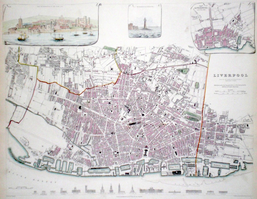
Lancashire Liverpool Starling, T. (c. 1836) 39 x 31 Finely engraved plan of the city by Thomas Starling for The Society for the Diffusion of Useful Knowledge. Features include; top left, view of Liverpool in 1729, top centre, The Black Rock Lighthouse, and top right a plan of Liverpool in 1729. Along the bottom- engravings of the major buildings. Later colour. Infirmary, Branch Bank of England. Double page map. Later colour. Condition fine. 120.00 GBP |
|
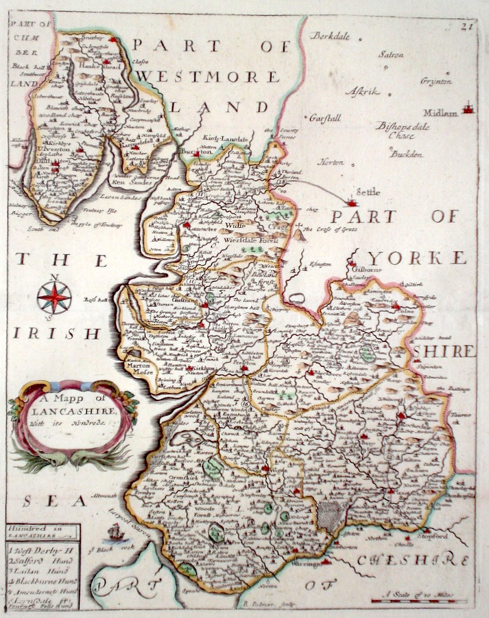
Lancashire 'A Mapp of Lancashire with its hundreds' Palmer, R. (c. 1731) 19 x 24 Finely engraved map of the county by Richard Palmer from the atlas "England Exactly Described or a Guide to Travellers…" first published by Thomas Taylor, but herewith from the later edition published by Thomas Bakewell. A major addition to the earlier plates is that roads and distances between towns are now included, after the road surveys of John Ogilby. Fine condition. Later colour 120.00 GBP |
|
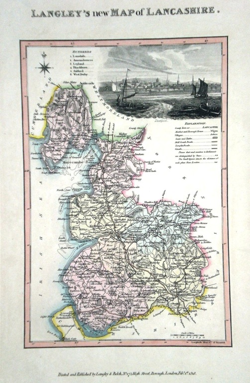
Lancashire 'Langley's new Map of Lancashire' Langley, E. (c. 1818) 18 x 26 Attractive and uncommon map of the county by the partnership of Edward Langley and William Belch from their publication Langley's New County Atlas of England and Wales. The vignette shows a view of Liverpool. Fine original hand colouring. 95.00 GBP |
|
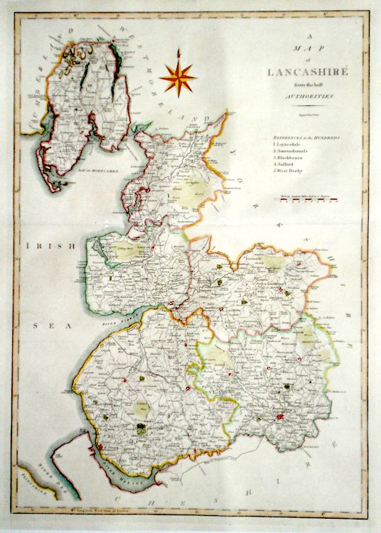
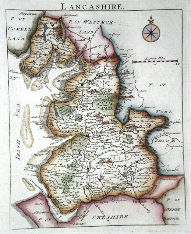
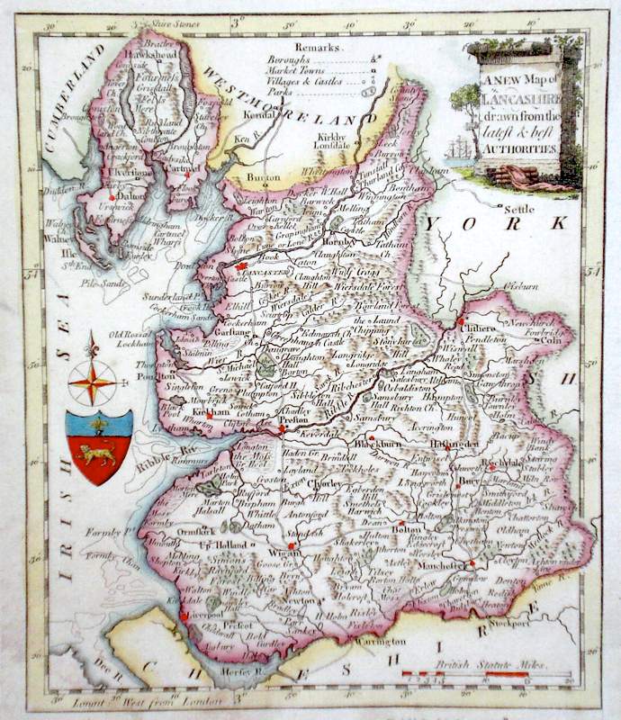
Lancashire 'A map of Lancashire from the best Authorities' Cary, J. (1789) 38 x 53 Finely engraved and detailed county map by John Cary for Camden's Britannia. Later colour. Condition excellent 95.00 GBP |
|
Lancashire Moll, H. (c. 1724) 20 x 31 Finely engraved map of the county by Herman Moll for the publication "A New Description of England and Wales…" The maps in this series include engraved borders of local architectural and antiquarian interest. A unique feature. On this map various ancient and ecclesiastical monuments. Later colour, fine condition. 75.00 GBP |
|
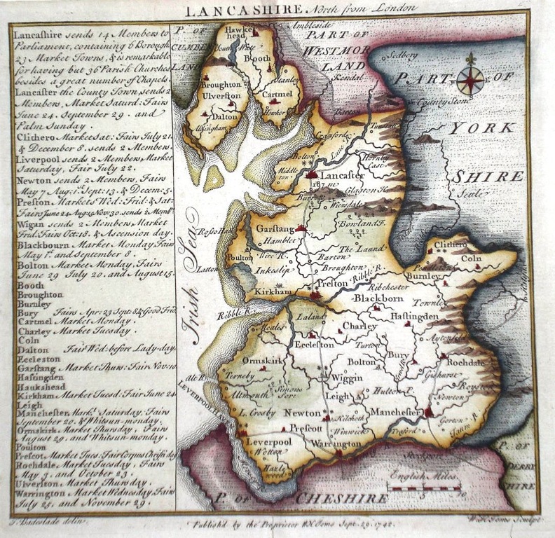
Lancashire Toms, W. (c. 1836) 15 x 15 Characteristic and attractive map of the county from Chorographia Britanniae. Drawn by Thomas Badeslade and engraved and published by William Henry Toms. The panel to the left gives extensive county information. Later colour. 75.00 GBP |
|
Lancashire Rocque, J. (1769) 16 x 21 Finely engraved map of the county by the innovative Huguenot engraver and cartographer John Rocque. This map from the publication 'England Displayed'. Large paper margin copy with later hand colouring. 75.00 GBP |
|
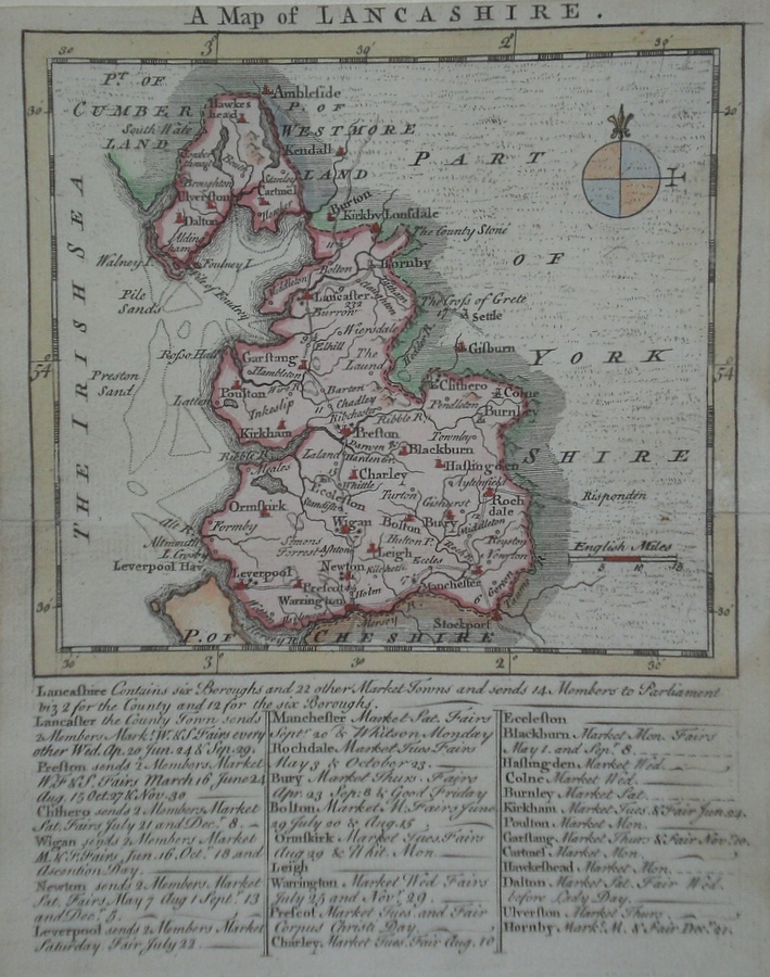
Lancashire 'A Map of Lancashire' Kitchin/Jefferys (1751) 13.5 x 18 Finely engraved map of the county by Thomas Kitchin and Thomas Jefferys from their publication "The Small English Atlas". This rare series of maps are distinctive by featuring considerable county information below the map. Later colour. 70.00 GBP |
|
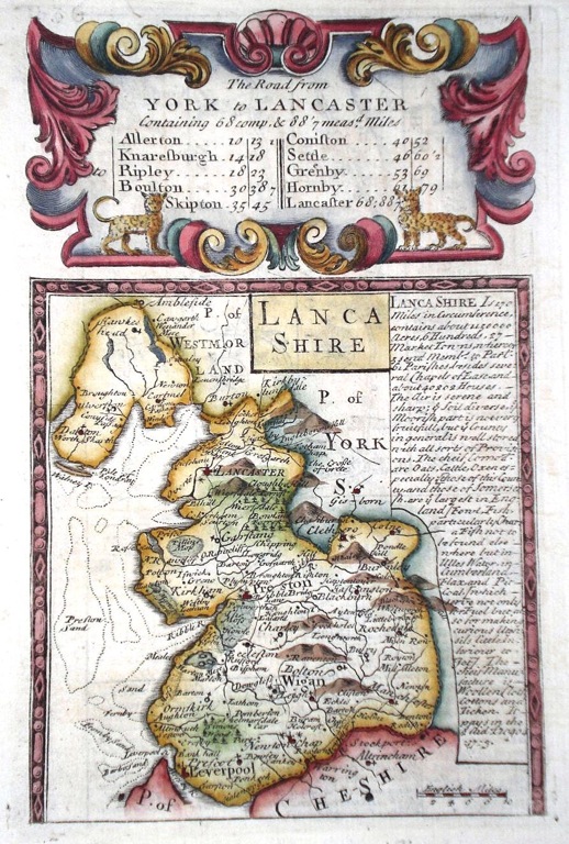
Lancashire Bowen, E. (1764) 12 x 19 Charming copperplate engraved map of the county from Britannia Depicta by Emanuel Bowen. The panel on the right gives detailed county information. Verso is a strip road map, Merioneth to Carnarvan. Later colour 70.00 GBP |
|
Lancashire 'A New Map of Lancashire Drawn from the latest and best Authorities' Kitchin, T. (c. 1784) 16 x 19 Finely engraved map of the county by Thomas Kitchin for the publication 'The New British Traveller' Features include a Coat of Arms, and decorative title cartouche. Later colour 55.00 GBP |
|
Lancashire Cary, J. (1821) 21 x 27 Finely engraved map of the county by John Cary from the 1821 edition of his New and Correct Atlas. Excellent condition with particularly fine original colour. 55.00 GBP |

|
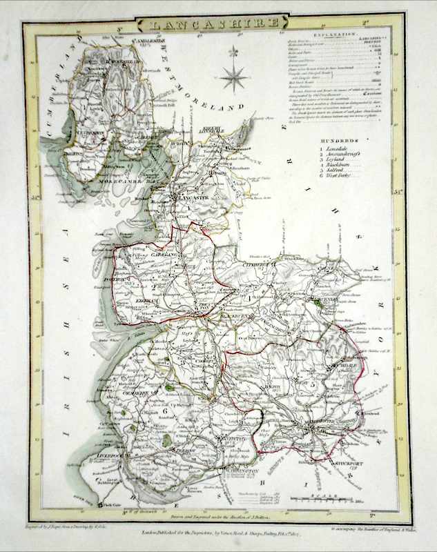
Lancashire Roper, J. (1810) 18 x 24 Detailed and decorative map of the county by Cole and Roper for The British Atlas. Original hand colouring. Excellent condition. 50.00 GBP |
|
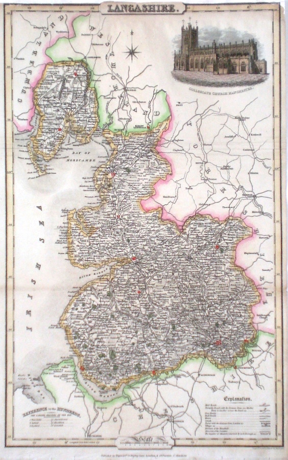
Lancashire Pigot, J. (c. 1826) 23 x 36 Finely engraved map of the county by James Pigot and Co. An early edition ca.1826. A particular feature of this series of county maps is the attractive accompanying vignette. In this case a view of Collegiate Church of Manchester. Some restoration to the top, but generally good condition. Later colour. 50.00 GBP |
|
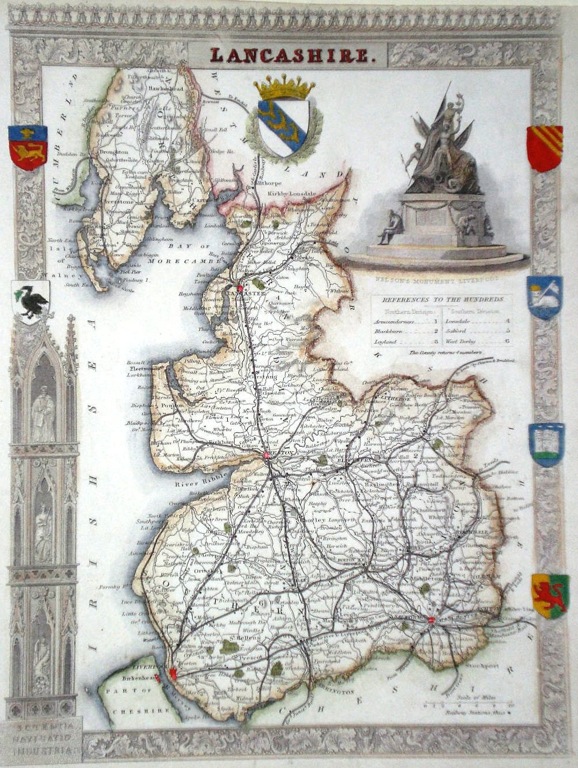
Lancashire Moule, T. (c. 1848) 20 x 27 Finely detailed steel engraved map of the county by Thomas Moule. Originally issued in Moule's 'English Counties Delineated' Maps from this series are generally considered to be amongst the most decorative issued in the nineteenth century. The vignette depicts Nelson's monument in Liverpool. Later colour 45.00 GBP |
|
Lancashire Lewis, W. (c. 1835) 10 x 14 Detailed and attractive miniature map of the County by William Lewis for his "Lewis's New Traveller's Guide". A particular feature of this charming series of maps is the clear and precise engraving of the roads. Adjacent numbers indicating the distances from London. Also included with the map is the accompanying page of text giving the county information relevant to travellers - principal towns and inns are listed, distances between towns, principal fair dates, and even sites for the best views of the county. Later colour. 40.00 GBP |
|
Lancashire Dispatch Atlas (1863) 46 x 66 Early outline colour. 40.00 GBP |
|
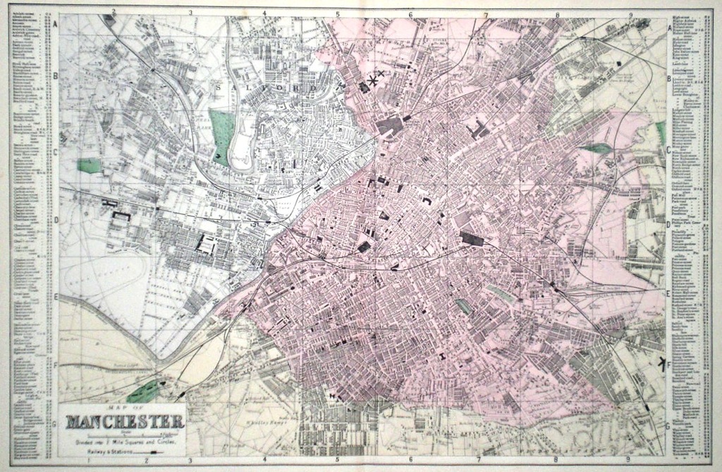
Lancashire 'Map of Manchester' Bacon, G. W. (c. 1883) 49 x 32 Attractive town plan by George Washington Bacon from Bacon's New Ordnance Atlas of the British Isles 35.00 GBP |