Durham
Including Durham, Sunderland, Stockton-on-Tees, Darlington, Hartlepool, Gateshead, Washington
|
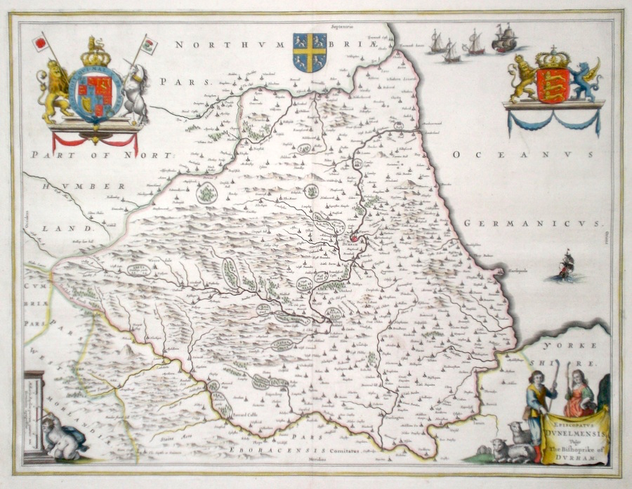
Durham 'Episcopatus Dunelmensis vulgo the Bishopricke of Durham' Blaeu, J. (c. 1646) 50 x 38 Very fine map of the County by Joan Blaeu. The map embodies the finest features of Dutch Cartography of the Seventeenth century. Superbly engraved and arranged, with shields and coats of arms. To the lower left cartouche a putti is checking the mileage of the survey. To the lower right cartouche a shepherd and shepherdess are shown along with their charges. Large paper copy. French text verso. Bright Original colour. Excellent condition. 295.00 GBP |
||||||||||||||


|
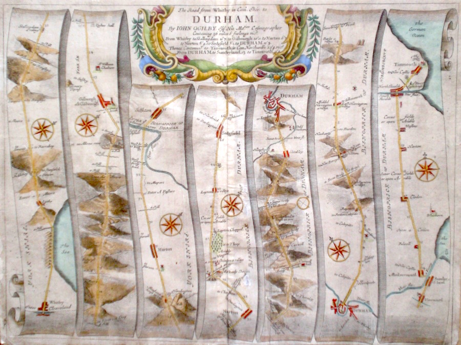
Durham 'The Road from Whitby to Durham' Ogilby, J. (c. 1698) 44 x 33 The road from Whitby to Guisborough, Stockton, Sedgefield, Durham. The road from Durham to Sunderland, and Teignmouth. From John Ogilby's Britannia, generally considered one of the most important cartographical works of the seventeenth century. Features include town plans of Durham and Teignmouth and a fine cartouche. Later colour. Plate number 99. Some old creases but generally good condition. 180.00 GBP |
||||||||||||||
|
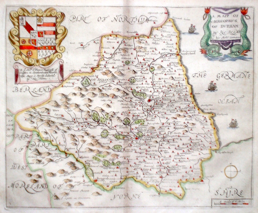
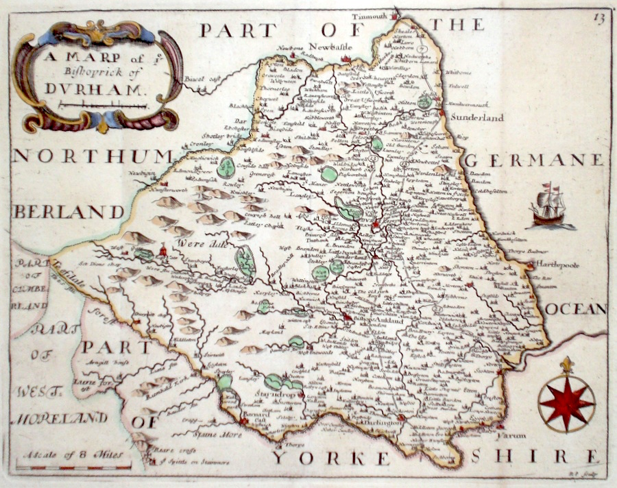
Durham 'A Map of Ye Bishoprick of Durham' Blome, R. (1673) 32 x 26 Decorative map of the County by Richard Blome for his publication "Britannia". The largest series of county maps published by Blome, and generally based on those of Speed. Maps by Blome are characteristic and attractive. Fine condition, later colour. 130.00 GBP |
||||||||||||||
|
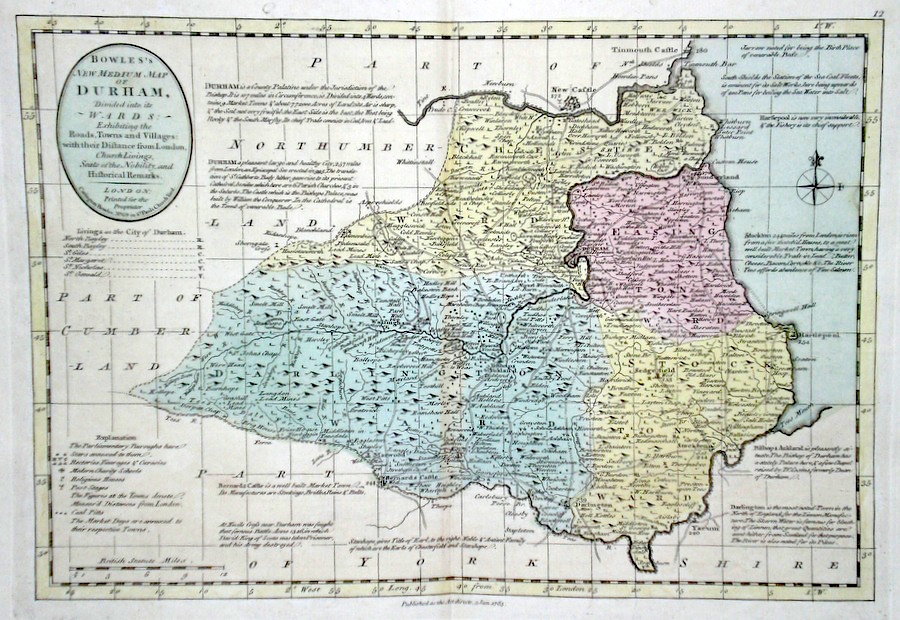
Durham 'Bowles's New Medium Map of Durham...' Bowen, E. & T. (1785) 33 x 23 Finely engraved and detailed map of the county from "Bowles's New Medium English Atlas". The maps in this series are based on those in Emanuel and Thomas Bowen's Atlas Anglicanus, and feature extensive county information on the map. They are distinguished primarily by having newly engraved cartouches, distances from London added to towns, and different imprints at the bottom. Full original colour. Fine condition. 130.00 GBP |
||||||||||||||
|
Durham 'Episcopatus Dunelmensis vulgo the Bishoprick of Durham. By Robt. Morden' Morden, R. (1722) 43 x 37 Finely engraved map of the county by Robert Morden for the 1722 edition of Camden's Britannia. Later colour. Condition excellent 98.00 GBP |

|
Durham 'A Mapp of ye Bishoprick of Durham' Palmer R. (c. 1731) 24 x 19 Finely engraved map of the county by Richard Palmer from the atlas "England Exactly Described or a Guide to Travellers…" first published by Thomas Taylor, but herewith from the later edition published by Thomas Bakewell. A major addition to the earlier plates is that roads and distances between towns are now included, after the road surveys of John Ogilby. Fine condition. Later colour 95.00 GBP |
|
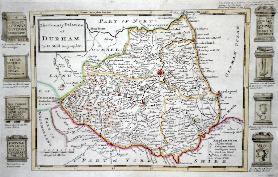
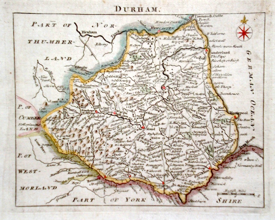
Durham 'The County Palatine of Durham' Moll, H. (c. 1724) 32 x 20 Finely engraved map of the county by Herman Moll for the publication "A New Description of England and Wales…" The maps in this series include engraved borders of local architectural and antiquarian interest. A unique feature. On this map various ancient and ecclesiastical monuments. Later colour, fine condition. 60.00 GBP |
|
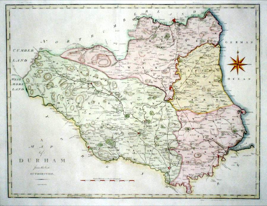
Durham 'A Map of Durham from the Best Authorities' Cary, J. (1789) 52 x 40 Finely engraved double page map of the county by John Cary for the first edition of Richard Gough's translation of Camden's Britannia. A dark impression with good margins all round. Later colour 60.00 GBP |
|
Durham Rocque, J. (c. 1769) 20 x 16 Finely engraved map of the county by John Rocque for the publication "England Displayed". Later colour 55.00 GBP |
|
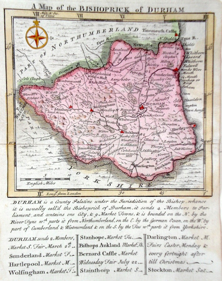
Durham 'A Map of the Bishoprick of Durham' Kitchin/Jefferys (1751) 13.5 x 18 Finely engraved map of the county by Thomas Kitchin and Thomas Jefferys from their publication "The Small English Atlas". This rare series of maps are distinctive by featuring considerable county information below the map. Later colour 55.00 GBP |
|
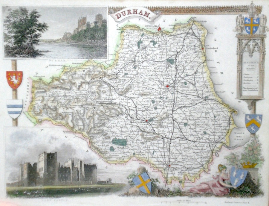
Durham Moule T. (c. 1848) 26 x 21 Decorative Steel engraved map of the county by Thomas Moule. Inset views of Raby Castle and Durham. Later colour. 50.00 GBP |
|
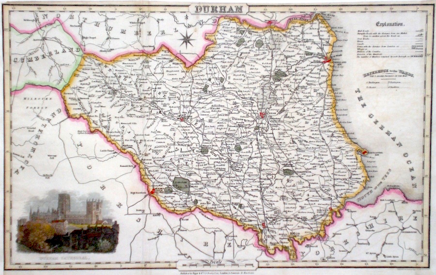
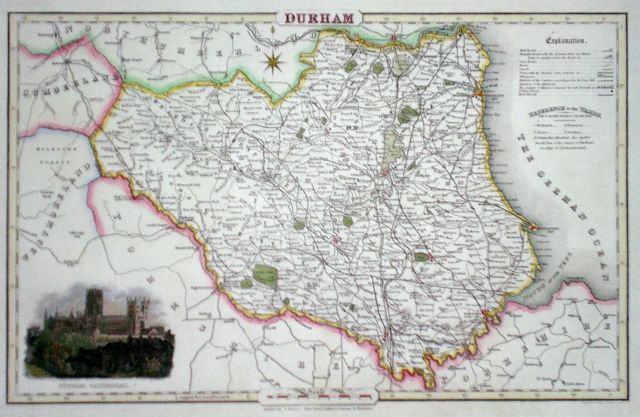
Durham Pigot, J. (c. 1826) 36 x 23 Finely engraved map of the county by James Pigot and Co. An early edition ca.1826. A particular feature of this series of county maps is the attractive accompanying vignette. In this case a view of Durham Cathedral. Re-margined to the left, generally good condition. Later colour 50.00 GBP |
|
Durham Slater, I. (c. 1847) 36 x 23 Fine map of the county by Isaac Slater, from his New British Atlas, after Pigot. Inset view of Durham Cathedral. Later colour 50.00 GBP |
|
Durham 'A New and Correct Map of Durham Drawn from the Best Authorities' Kitchin, T. (c. 1784) 23 x 18 Finely engraved map of the county by Thomas Kitchin for the publication 'The New British Traveller' Features include a Coat of Arms, and decorative Title Cartouche and decorative border. Later colour 40.00 GBP |

|
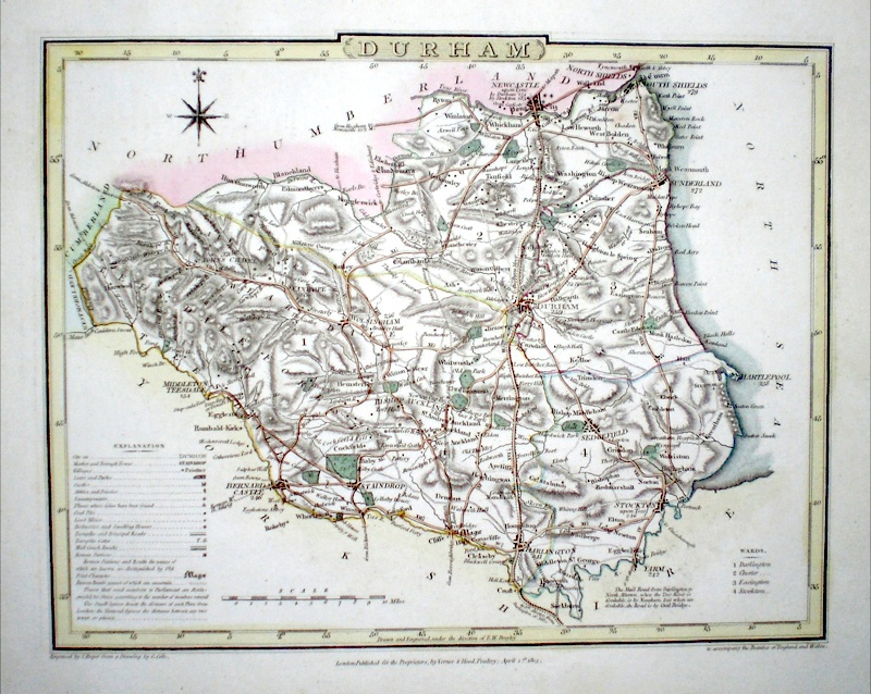
Durham Roper, J (1810) 22.5 x 18.5 Finely engraved map of the county by John Roper after the drawing of George Cole, from 'The British Atlas'. Original colour. The explanation (bottom left) gives considerable county information, such as locations of coal pits, lead mines, refineries and smelting houses, places of discovery of coins, etc. 40.00 GBP |
|
Durham Lewis, W. (c. 1835) 14 x 10 Detailed and attractive miniature map of the County by William Lewis for his "Lewis's New Traveller's Guide". A particular feature of this charming series of maps is the clear and precise engraving of the roads. Adjacent numbers indicating the distances from London. Also included with the map is the accompanying page of text giving the county information relevant to travellers - principal towns and inns are listed, distances between towns, principal fair dates, and even sites for the best views of the county. Later colour. 35.00 GBP |

|
Durham Roper, J. (1810) 18 x 24 Detailed and decorative map of the county by Cole and Roper for The British Atlas. Original hand colouring. Excellent condition. 30.00 GBP |