Cumberland
Including Carlisle, Whitehaven, Workington, Penrith, Keswick, Brampton
|
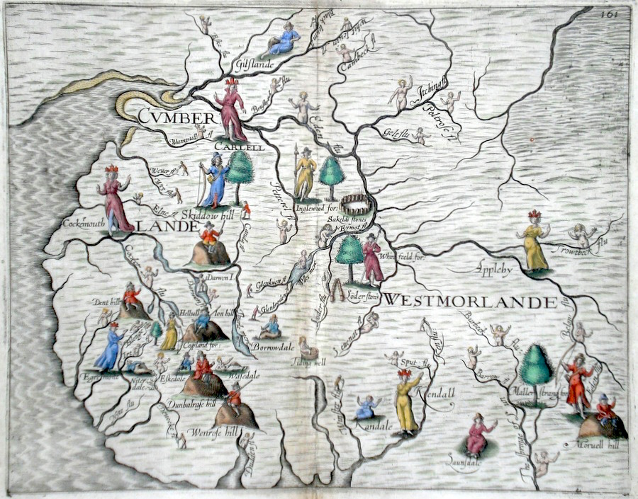
Cumberland 'Cumberlande Westmorlande' Hole, W. (c. 1622) 32 x 25 Decorative and rare engraving representing the Cumberland and Westmoreland counties by William Hole for Michael Drayton's Polyolbion. Richly decorated with numerous water nymphs, huntsmen, farmworkers, and allegorical figures to illustrate the main topographical features, river system, towns etc. Later colour. This copy in excellent condition. Michael Drayton (1563-1631) was an important poet and literary figure. A contemporary of Shakespeare and Spenser, the Polyolbion is considered to be his masterpiece. He is buried in Westminster Abbey 395.00 GBP |


|
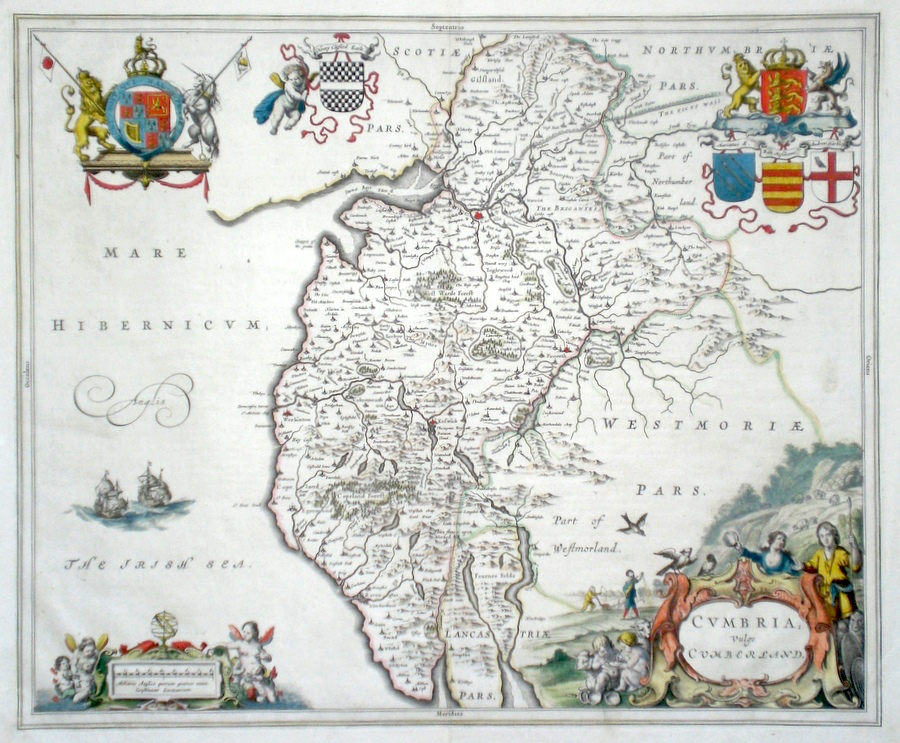
Cumberland 'Cumbria Vulgo Cumberland' Blaeu, J. (c. 1646) 50 x 38 Very fine map of the County by Joan Blaeu. The map embodies the finest features of Dutch Cartography of the Seventeenth century. Superbly engraved and arranged, with shields and coats of arms. To the lower left cartouche two mother sea-nymphs are attending to their children. To the lower right cartouche an agricultural scene with farmers and children writing whilst their parents attend to their animals. The pict's wall is also depicted on this map to the north. Large paper copy. French text verso. Bright Original colour. Excellent condition. 250.00 GBP |
|
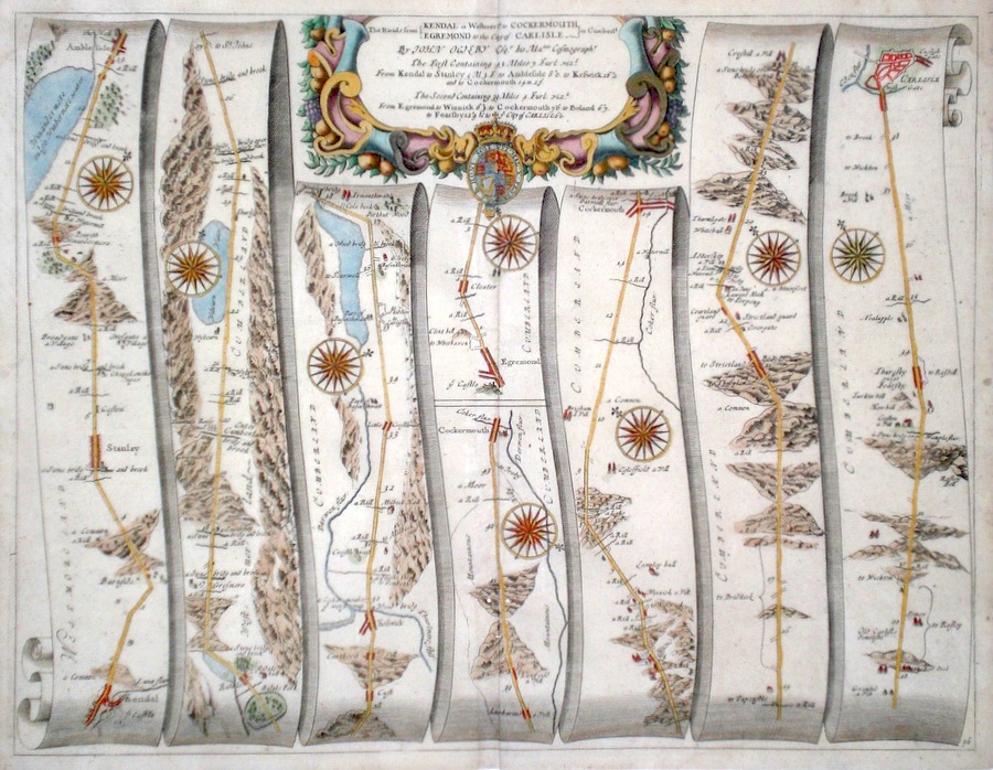
Cumberland 'The Roads from Kendal in Westmer.ld to Cockermouth and Egremond to the City of Carlisle in Cumberld' Ogilby, J. (1698) 44 x 34 The road from Kendal to Ambleside, Keswick, Cockermouth. The Road from Egremond to Cockermouth, Carlisle. From John Ogilby's Britannia, generally considered one of the most important cartographical works of the seventeenth century. Features include several of the large lakes of the area depicted. Town plan of Carlisle,and a fine cartouche. Later colour. Plate number 96 180.00 GBP |
|
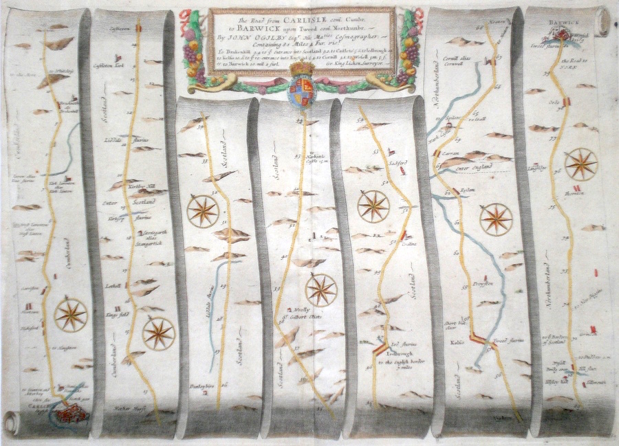
Cumberland 'The Road from Carlisle com. Cumbr. To Barwick upon Tweed com Northumbr.' Ogilby, J. (1698) 45 x 34 The road from Carlisle to Brackenhill, Castleton, Jedborough, Kelso, Cornhill, Berwick on Tweed. From John Ogilby's Britannia, generally considered one of the most important cartographical works of the seventeenth century. Features include town plans of Carlisle, Berwick, and a fine cartouche. An unusual plate in that much of the route is within Scotland. Ogilby also acknowledges the surveyor to be Gr.King Lichen. Later colour. Plate number 62. Fine condition 170.00 GBP |
|
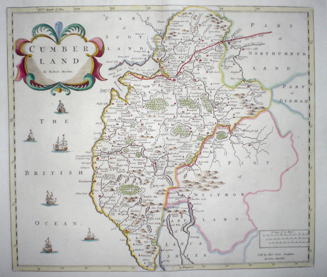
Cumberland 'Cumberland by Robert Morden' Morden, R. (c. 1722) 43 x 37 Finely engraved map of the county by Robert Morden. From the 1722 edition of Camden's Britannia. Decorative map with later colour. 125.00 GBP |
|
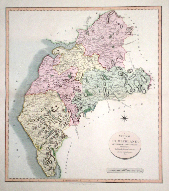
Cumberland 'A New Map of Cumberland divided into Hundreds exhibiting its Roads, Rivers, Parks...' Cary, J. (1809) 54 x 49 Superbly engraved map of the county by John Cary. From "Cary's New English Atlas". The atlas was issued in parts from 1801 to 1809 and published as a complete work in 1809. Very fine original hand colour. 105.00 GBP |
|
Cumberland 'Bowles's New Medium Map of Cumberland and Westmoreland...' Bowen, E. & T. (1785) 23 x 33 Finely engraved and detailed map of the two counties from "Bowles's New Medium English Atlas". The maps in this series are based on those in Emanuel and Thomas Bowen's Atlas Anglicanus, and feature extensive county information on the map. They are distinguished primarily by having newly engraved cartouches, distances from London added to towns, and different imprints at the bottom. Full original colour. Fine condition. 98.00 GBP |

|
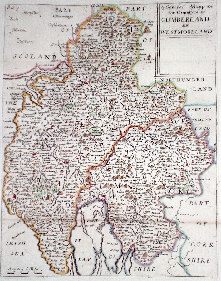
Cumberland 'A Generall Mapp of the Countyes of Cumberland and Westmoreland' Blome, R. (c. 1731) 20 x 25 Finely engraved map of the county by Blome from the atlas "England Exactly Described or a Guide to Travellers…" first published by Thomas Taylor, but herewith from the later edition published by Thomas Bakewell. A major addition to the earlier plates is that roads and distances between towns are now included, after the road surveys of John Ogilby. Fine condition. Later colour 95.00 GBP |
|
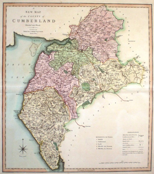
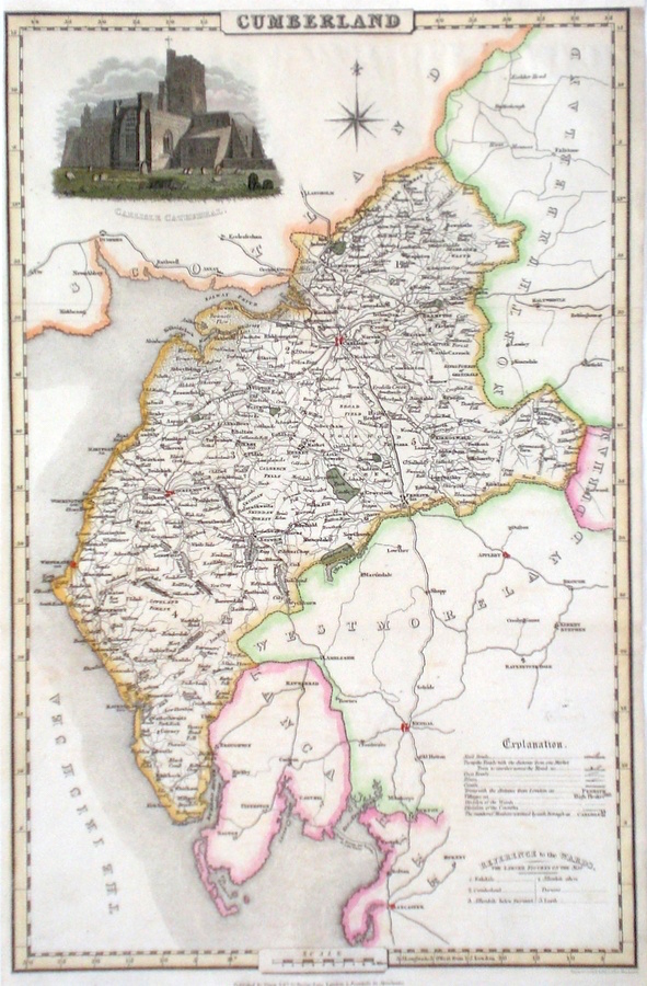
Cumberland 'A New Map of the County of Cumberland divided into wards' Smith, C. (1804) 45 x 50 Large size and decorative map of the County by Jones, Smith & Co. for Smith's New English Atlas. The first map of the County to show longitudes measured from the meridian of Greenwich. Very fine original hand colouring. 70.00 GBP |
|
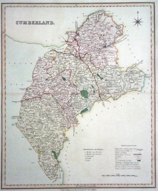
Cumberland Barnett, T. (1831) 34 x 42 Clearly engraved and decorative map of the county published by Henry Teesdale after Robert Rowe. Original colour. Excellent condition. 60.00 GBP |
|
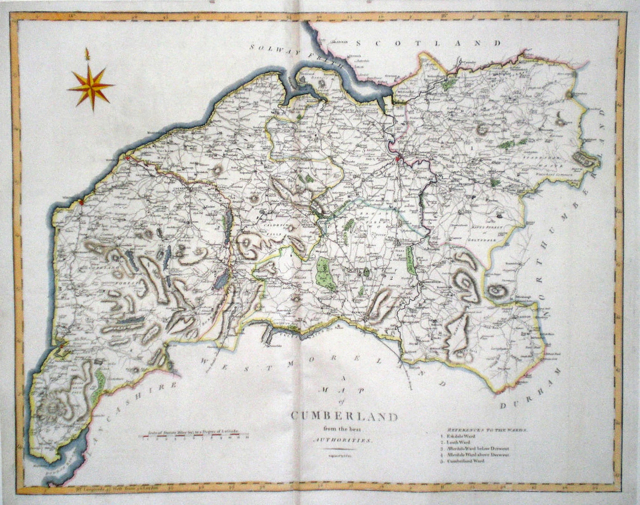
Cumberland 'A Map of Cumberland from the Authorities' Cary, J. Camden's Britannia (1798) 51 x 40.5 Finely engraved double page map. 60.00 GBP |
|
Cumberland
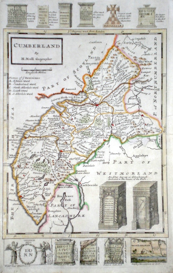
Moll, H. (c. 1724) 32 x 20 Finely engraved map of the county by Herman Moll for the publication "A New Description of England and Wales…" The maps in this series include engraved borders of local architectural and antiquarian interest. A unique feature. On this map various Roman objects and ecclesiastical monuments. Later colour, a small repair to the right hand side. Otherwise fine condition. 60.00 GBP |
|
Cumberland
Rocque, J. (c. 1769) 16 x 20 Finely engraved map of the county by John Rocque for the publication "England Displayed". Later colour 55.00 GBP |
|
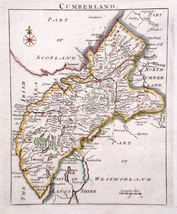
Cumberland 'A Map of Cumberland Drawn from the Best Authorities' Kitchen, T. (1764) 20 x 26 Detailed map showing roads, borough towns, market towns and a wealth of county information. Later hand colour. 45.00 GBP |
|
Cumberland
Pigot, J. (c. 1826) 23 x 36 Finely engraved map of the county by James Pigot and Co. An early edition ca.1826. A particular feature of this series of county maps is the attractive accompanying vignette. In this case a view of Carlisle Cathedral. Re-margined to the top, generally good condition. Later colour 45.00 GBP |
|
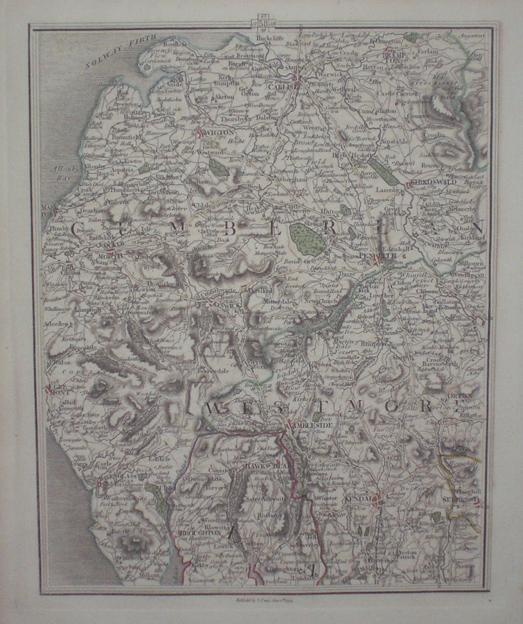
Cumberland
Cary, J. (c. 1790) 21 x 27 Sheet 58 of John Cary's Map of England and Wales published in 81 sheets. Covers the area of The Lake District. Original colour. 40.00 GBP |
|
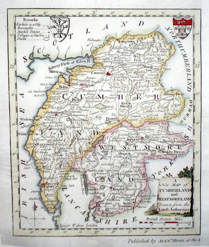
Cumberland
(and Westmoreland) 'A New Map of Cumberland and Westmoreland drawn from the Latest Authorities' Conder, T. (c. 1784) 16 x 19 Finely engraved map showing the two Counties. Engraved by Thomas Conder for the publication "The New British Traveller". Features include Coats of Arms of both counties and an attractive title cartouche. Later colour 40.00 GBP |
|
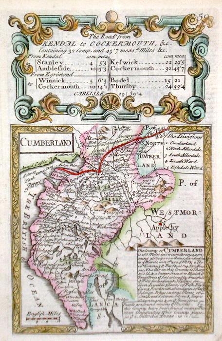
Cumberland Bowen, E. (c. 1724) 12 x 19 Finely engraved map of the County by Emanuel Bowen and John Owen for the publication "Britannia Depicta". To the top are given details of the Road from Kendal to Cockermouth and verso the road from Kendal to Keswick is featured. After John Ogilby. Later colour 40.00 GBP |
|
Cumberland Moule, T. (c. 1835) 20 x 26 Very decorative steel engraved map of the county by Thomas Moule. Inset view of Carlisle. Later colour, good margins. 40.00 GBP |
|
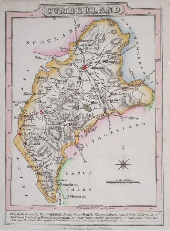
Cumberland Lewis, W. (c. 1835) 10 x 14 Detailed and attractive miniature map of the Region by William Lewis for his "Lewis's New Traveller's Guide". A particular feature of this charming series of maps is the clear and precise engraving of the roads. Adjacent numbers indicating the distances from London. Also included with the map is the accompanying page of text giving the county information relevant to travellers - principal towns and inns are listed, distances between towns, principal fair dates, and even sites for the best views of the county. Later colour. 35.00 GBP |