Belgium
|
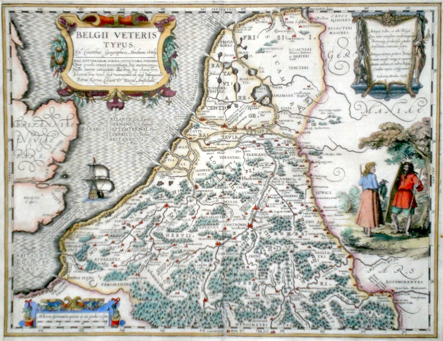
Belgium 'Belgii Veteris Typus' Kaerius, P. (c. 1618) 50 x 38 Superb and rare map of classical Belgium and Holland engraved by Petrus Kaerius (Peter van den Keere) after Abraham Ortelius. Published by Petrus Bertius in the Atlas "Theatrum Geographiae Veteris". This rare atlas compiled by Bertius used purchased Ortelius copperplates and other plates from Mercator to publish a classical atlas similar to the Ortelius Parergon. The area covered in this map known usually as the Low Countries. Features include three cartouches and a fine rural scene. Latin text to verso. Later hand colour. Condition - A fine dark impression. 580.00 GBP |


|
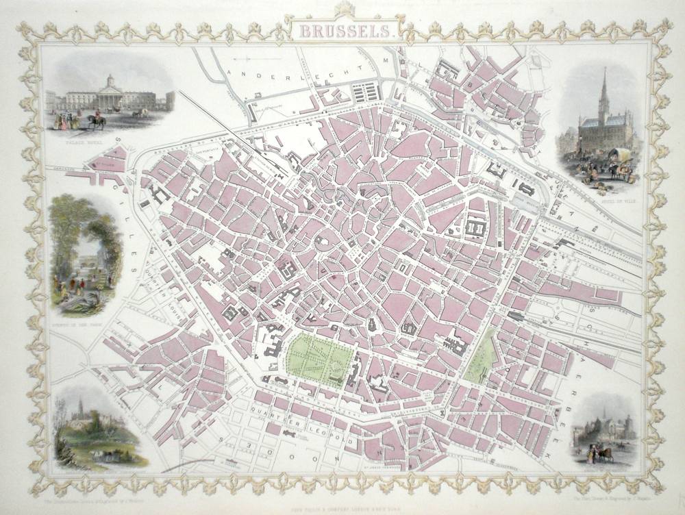
Belgium 'Brussels' Rapkin, J. (1851) 34 x 26 Fine map of the City by John Rapkin, for John Tallis`s highly decorative "The Illustrated Atlas". The vignettes show; Hotel de Ville, Church of St. Gudule, Brussels near the Porte D'Andelecht, Avenue in the Park Palace Royal. Single page (no central fold). Later colour. Condition fine. 160.00 GBP |
|
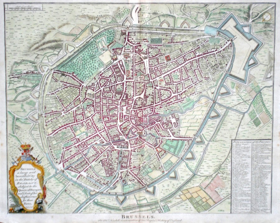
Belgium 'Brussels' Basire, I. (c. 1740) 48 x 40 A finely engraved Plan of the City by Isaac Basire. Published in Tindal's translation of Paul Rapin De Toras's History of England. Features include extensive detail and a table, bottom right explains the main areas of the City. An interesting item in excellent condition. Later colour. 150.00 GBP |
|
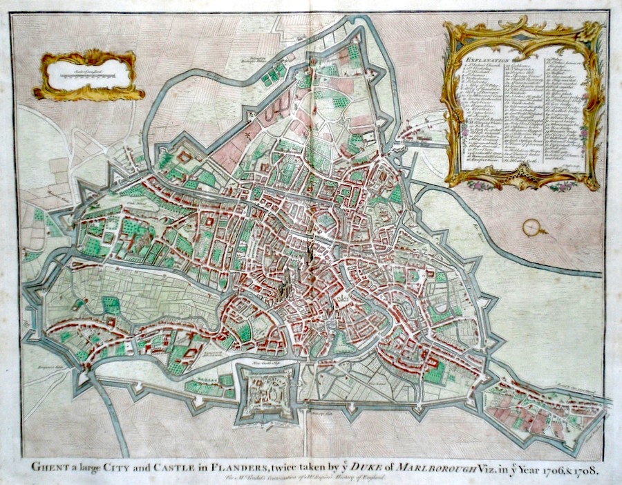
Belgium 'Ghent a large City and Castle in Flanders...' Basire, I. (c. 1740) 48 x 38 A finely engraved Plan of the City by Isaac Basire. Published in Tindal's translation of Paul Rapin De Toras's History of England. Features include extensive detail and a table top right explaining the main areas of the City. An interesting item in excellent condition. Later colour. 150.00 GBP |
|
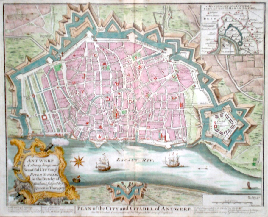
Belgium 'Plan of The City and Citadel of Antwerp' Basire, I. (c. 1740) 48 x 40 A finely engraved Plan of the City, by Isaac Basire. Published in Tindal's translation of Paul Rapin De Toras's History of England. features include extensive detail, and an inset map of the City's position in the Duchy of Brabant. An interesting item in excellent condition. Later colour. 150.00 GBP |
|
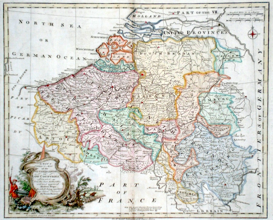
Belgium 'A New and Correct Map of the Netherlands or Low Countries...' Bowen, E. (c. 1745) 43 x 35 A finely engraved and detailed map of the Low countries by Emanuel Bowen. Published in Tindal's translation of Paul Rapin De Toras's History of England. The map features extensive detail on the area which is now Northern France, Belgium, Luxembourg and southern Holland. The map title is contained in a parrticularly fine cartouche, showing Rural and military aspects. Excellent condition. Later colour. 140.00 GBP |
|
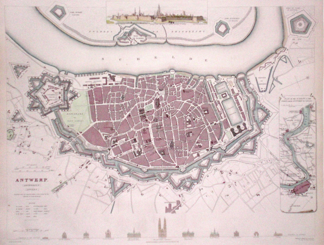
Belgium 'Antwerp' Davies, B. (1832) 40 x 31 Finely executed plan of the city by B R Davies for The Society for the Diffusion of Useful Knowledge. Inset plan of the environs of Antwerp and the Scheldt. Inset view of Antwerp. Steel engraving, later colour. 85.00 GBP |
|
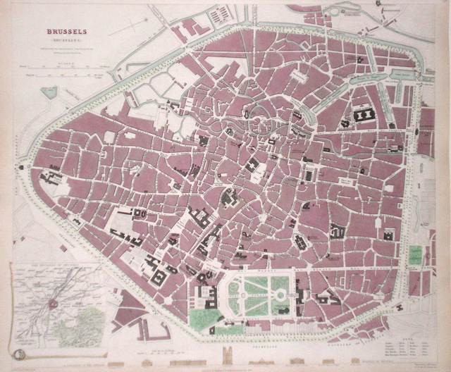
Belgium 'Brussels' Davies, B. (1837) 38 x 33 Finely executed plan of the city by B R Davies for The Society for the Diffusion of Useful Knowledge. Inset plan of the environs of Brussels. Steel engraving, later colour. 80.00 GBP |
|
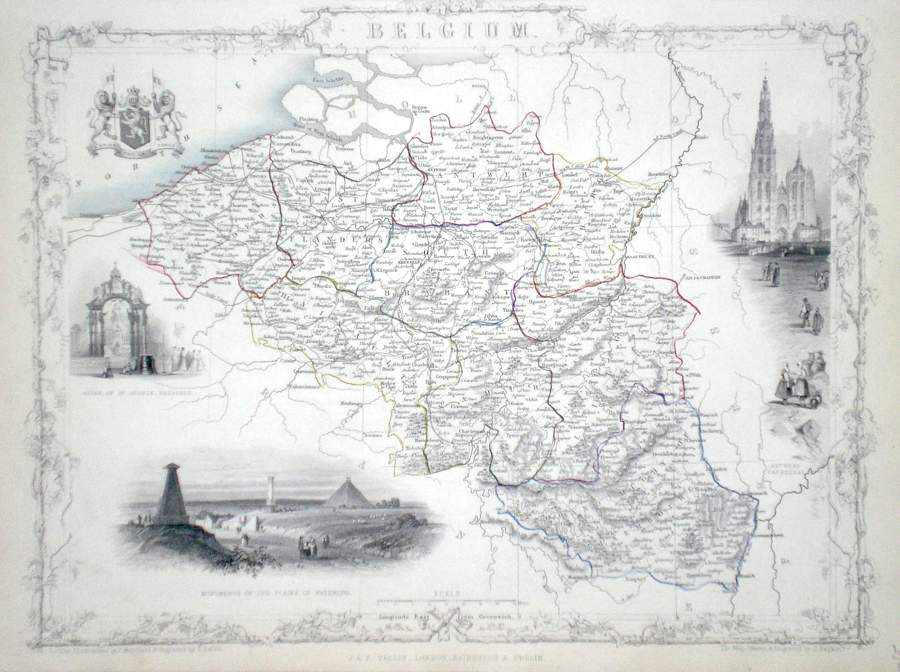
Belgium Rapkin, J. (1851) 36 x 26 Fine map of the Country by John Rapkin, for John Tallis's highly decorative "The Illustrated Atlas". The vignettes show; Altar of St. Gudule Brussels, Monuments on the Plains of Waterloo, Antwerp Cathedral. Single page map (no central fold). Original colour as published. Border at the top reduced with slight loss of border engraving o/w Condition fine. 80.00 GBP |
|
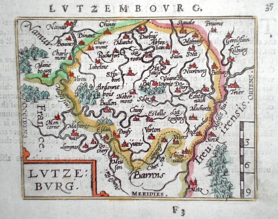
Belgium 'Lutzeburg' Ortelius, A. (c. 1603) 10 x 8.5 Fine early map of The Luxemburg Region by Abraham Ortelius, engraved in small format by Philippe Galle, and published in the Epitome, or pocket-edition of the "Theatrum Orbis Terrarum". This map from an English text edition of c. 1603 published in London and thus one of the first world atlases published in England. Fine condition. Later colour 50.00 GBP |
|
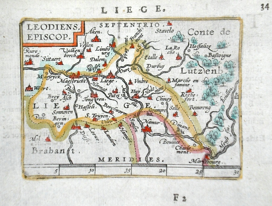
Belgium 'Leodiens Episcop.' Ortelius, A. (c. 1603) 10 x 8.5 Fine early map of the area of Liege, by Abraham Ortelius, engraved in small format by Philippe Galle, and published in the Epitome, or pocket-edition of the "Theatrum Orbis Terrarum". This map from an English text edition of c. 1603 published in London and thus one of the first world atlases published in England. Fine condition. Later colour 50.00 GBP |
|
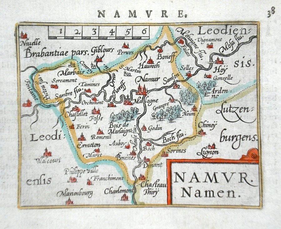
Belgium 'Namur Namen' Ortelius, A. (c. 1603) 10 x 8.5 Fine early map of the area of Namur, by Abraham Ortelius, engraved in small format by Philippe Galle, and published in the Epitome, or pocket-edition of the "Theatrum Orbis Terrarum". This map from an English text edition of c. 1603 published in London and thus one of the first world atlases published in England. Fine condition. Later colour 50.00 GBP |
|
Belgium Darton, W. (c. 1805) 22 x 18 Map of Austrian and French possessions and Luxemburg. Later outline hand colour. Traces of old folds but otherwise good condition 35.00 GBP |
|
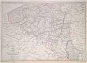
Belgium 'Belgium and the Duchy of Luxemburg' Dispatch Atlas (1863) 44 x 31 Early outline colour. 25.00 GBP |