The Baltic States
|
Baltic
States 'Baltic sea and Southern Scandinavia' De Lisle G. (c. 1788) 63 x 50 Large size and influential map of Southern Scandinavia and the Baltic Sea area by Guillaume de Lisle (1675-1726). This copy an edition of c. 1788 issued by the publisher and engraver J. A. Dezauche. The map features the lands bordering the Baltic, modern day Estonia, Latvia, and Lithuania, northern Poland and Denmark, from the Swedish west coast to St. Petersburg in the East. Original outline colour and later wash colour. Excellent condition 285.00 GBP |


|
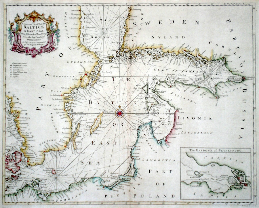
Baltic
States 'A Correct Chart of The Baltick or East Sea from ye Sound to St Petersburg...' Seale, R. (c. 1745) 48 x 38 A finely engraved and detailed chart of The Baltic Sea by Richard Seale. Published in Tindal's translation of Paul Rapin De Toras's History of England. The map features extensive coastal details on the countries bordering the Baltic and an inset plan of St. Petersburg. excellent condition. Later colour. 280.00 GBP |
|
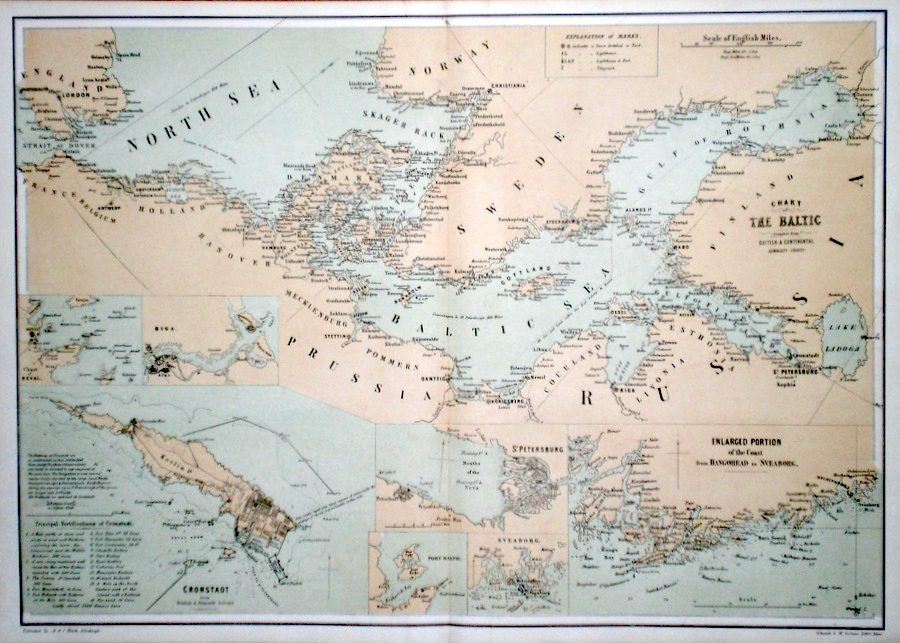
Baltic
States 'Chart of the Baltic' Schenck, J. (1854) 60 x 43 Lithographed double page chart of the Baltic by J Shenck and McFarlane. Numerous inset maps including Riga, Cronstadt, St. Petersburg etc. Condition excellent 50.00 GBP |
|
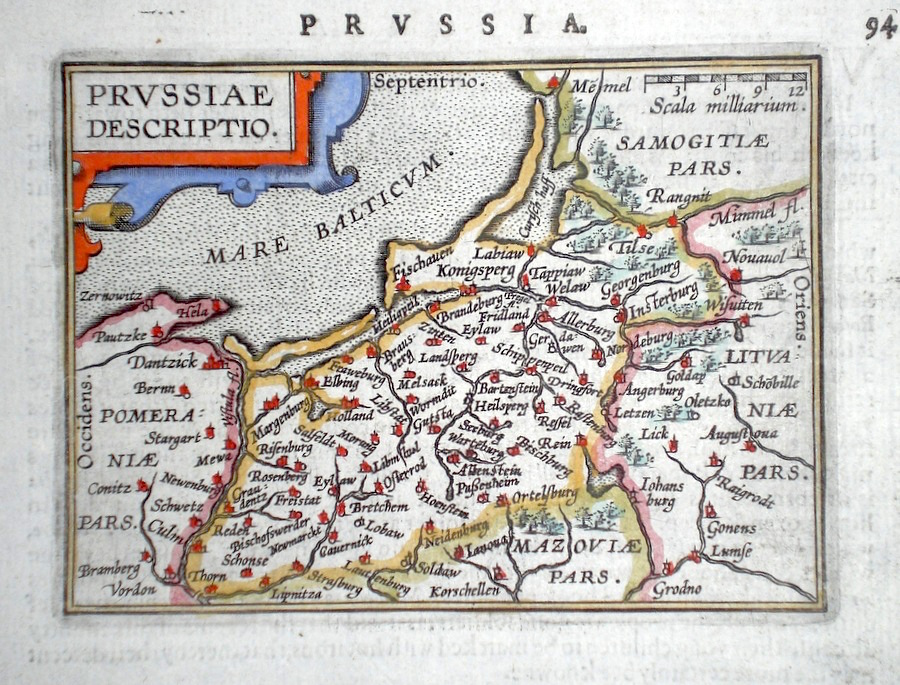
Baltic
States 'Prussia' Ortelius, A. (c. 1603) 10 x 8.5 Fine early map of Prussia by Abraham Ortelius, engraved in small format by Philippe Galle, and published n the Epitome, or pocket- edition of the "Theatrum Orbis Terrarum". This map from an English text edition of c. 1603 published in London and thus one of the first world atlases published in England. Fine condition. Later colour 50.00 GBP |
|
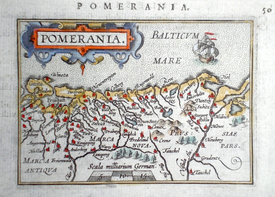
Baltic
States 'Pomerania' Ortelius, A. (c. 1603) 10 x 8.5 Fine early map of the Pomerania region of the Baltic coast, by Abraham Ortelius, engraved in small format by Philippe Galle, and published in the Epitome, or pocket- edition of the "Theatrum Orbis Terrarum". This map from an English text edition of c. 1603 published in London and thus one of the first world atlases published in England. Fine condition. Later colour 40.00 GBP |
|
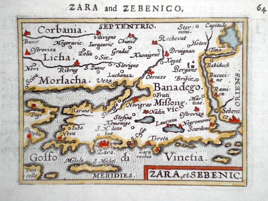
Baltic
States 'Zara et Sebenic' Ortelius, A. (c. 1603) 10 x 8.5 Fine early map of the region of the towns Zarba and Sebenica on the coast of Croatia, by Abraham Ortelius, engraved in small format by Philippe Galle, and published in the Epitome, or pocket-edition of the "Theatrum Orbis Terrarum". This map from an English text edition of c. 1603 published in London and thus one of the first world atlases published in England. Fine condition. Later colour 40.00 GBP |