Hungary
|
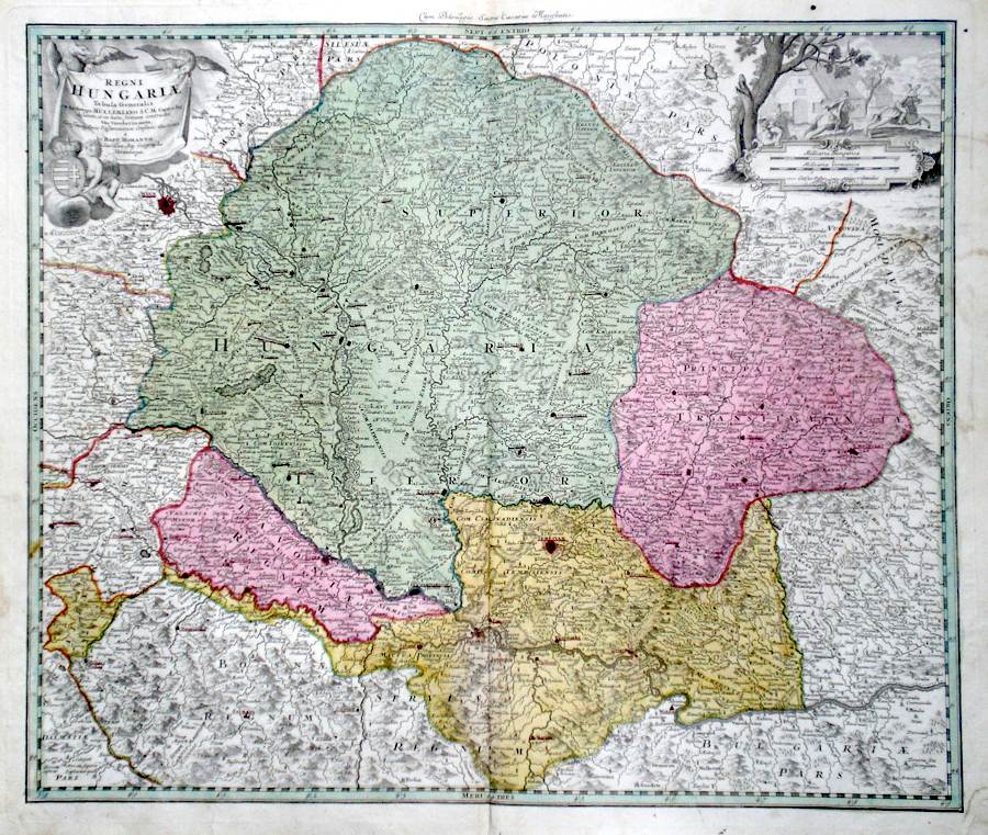
Hungaria 'Regni Hungariae' Homann, J. B. (c. 1730) 56 x 48 Superb map of Hungary and Transylvania by the eminent engraver and mapseller Johann Baptist Homann. Features include a fine title cartouche and a further cartouche of a rural scene with Horsemen in full gallop. To the south the map covers much of what is now Croatia and Bosnia. The map is printed on very thick paper and embellished with full wash colour. 200.00 GBP |


|
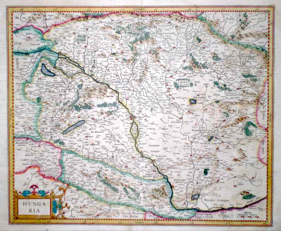
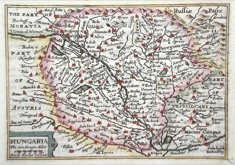
Hungaria Mercator, G. (c. 1633) 45 x 37 Detailed and attractive early map of the country by Gerard Mercator, arguably one of the greatest and most influencial of all cartographers. From a French text edition of his Atlas. Early colour. A carefully repaired tear bottom right largely in the margin, and some slight staining but otherwise a good copy. 190.00 GBP |
|
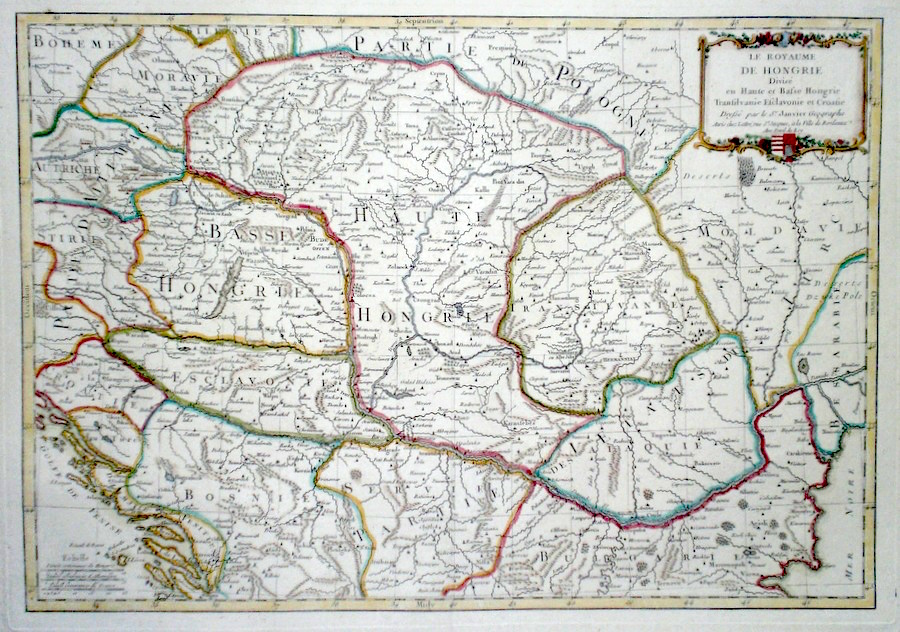
Hungary 'Le Royaume de Hongrie...' Janvier, J. (c. 1770) 45 x 32 Fine map of Hungary and adjacent states by the French Cartographer Jean Janvier. Original colour and some later colour. Fine condition 120.00 GBP |
|
Hungary 'Carte de la Hongrie' De Lisle G. (c. 1780) 65 x 47 Large size and detailed map of Hungary and nearby countries by Guillaume de Lisle (1675-1726). This copy an edition of c1780 issued by his successor Dezauche. The map extends from the south of Poland to Macedonia and from the Gulf of Venice eastwards to the Black Sea, Features include a large and decorative cartouche. A small area of restoration to the upper central fold , otherwise in good condition. Original colour. 120.00 GBP |

|
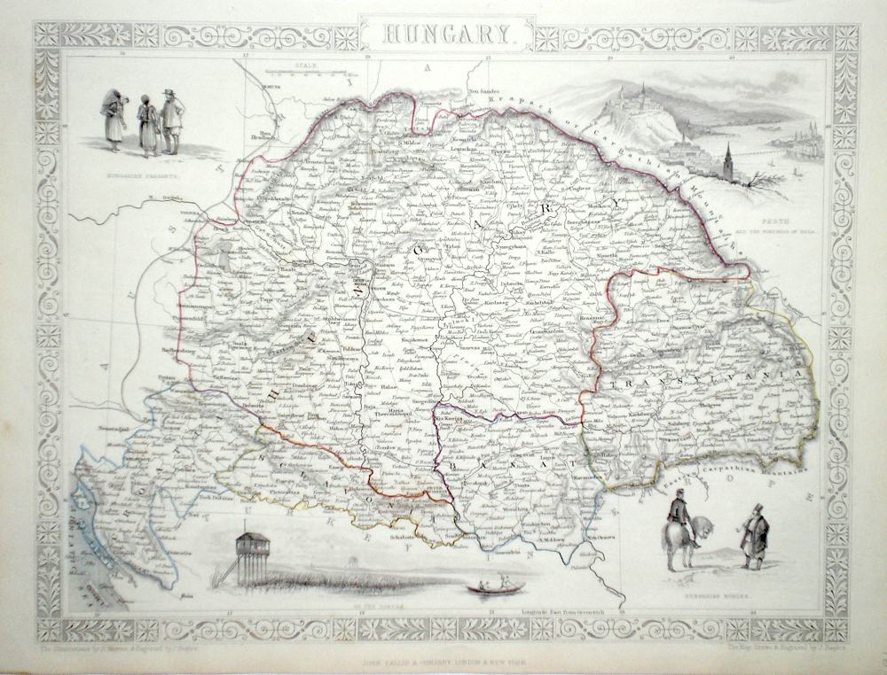
Hungary Rapkin, J. (1851) 33 x 26 Fine map of the Country engraved by John Rapkin, for John Tallis's highly decorative "The Illustrated Atlas". The vignettes show; A view of Pesth, Hungarian Nobles, view of the Danube, Hungarian workers. Single page map, (no central fold). Original colour as published... Condition fine. 90.00 GBP |
|
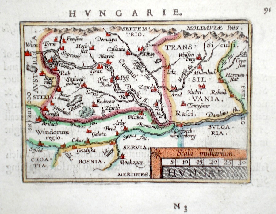
Hungary 'Hungaria' Ortelius, A. (c. 1603) 10 x 8.5 Fine early map of Hungary and including Transylvania by Abraham Ortelius , engraved in small format by Philippe Galle, and published in the Epitome, or pocket-edition of the "Theatrum Orbis Terrarum". This map from an English text edition of c.1603 published in London and thus one of the first world atlases published in England. Fine condition. Later colour 90.00 GBP |
|
Hungary 'Hungaria' Van Den Keere, P. (c. 1646) 12.5 x 9 Finely detailed miniature map of Hungary by Peter Van Den Keere. This map part of a series engraved for the miniature edition of John Speed "Prospect of the most famous parts of the world". Later colour 70.00 GBP |
|
Hungary 'Slavonia' Ortelius, A. (c. 1603) 10 x 8.5 Fine early map of the region south of the Danube known in antiquity as Illyricum, by Abraham Ortelius, engraved in small format by Philippe Galle, and published in the Epitome, or pocket-edition of the "Theatrum Orbis Terrarum". This map from an English text edition of c. 1603 published in London and thus one of the first world atlases published in England. Fine condition. Later colour 50.00 GBP |
