World Maps
|
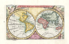
World Map 'A NEW MAP of ye WORLD' Morden, R. (1680 or later) 15.5 x 9.5 Twin hemisphere world map first produced for Robert Morden's 'Geography Rectified'. Shows California as an Island. Northwest America uncharted, New Holland and Van Dieman's land only partially charted. Later colour, traces of old folds, fine condition. (Shirley 503) 245.00 GBP |
|
World Map 'The World agreeable to the latest Discoveries' Powell, T. K. (c. 1787) 27 x 16 Fine twin hemisphere map of the world by Thomas K. Powell, published in Turner's View of the Earth 1787. Interesting features include Dimen's Land (Tasmania) shown as mainland Australia. In the eastern hemisphere an arctic island is labelled Greenland but in the western hemisphere Greenland is shown as part of mainland North America and labeled Groenland. Later colour 160.00 GBP |
|
World Map 'Map of the World from the best Authorities' Russell, J. (1806) 36 x 19 Fine twin hemispherical world map by John Russell for Guthrie's " A New Geographical, Historical, and Commercial Grammar". Features include Tasmania connected to Australia, New Guinea mapped only partially and no North West passage mapped. Good condition. Later colour 145.00 GBP |
|
World Map Hall, S. (1854) 39 x 24 Finely engraved twin hemispherical map of The World By Sidney Hall. Steel engraving published in the "General Atlas of The World". Condition excellent 120.00 GBP |
|
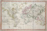
World Map 'The World on Mercator's Projection' Findlay, A. (c. 1820) 41 x 25 Fine map of The World engraved by Alexander Findlay and published by Thomas Kelly. The map shows The World on Mercator's projection, Australia has a partly mapped southern coast, New Guinea is mapped as an incomplete Island and North America is shown connected to Greenland. Fine condition Later colour 100.00 GBP |
|
World Map 'The World on Mercator's projection' Aikman, G. (1854) 41 x 28 Fine Mercator projection map of The World By Sidney Hall, and George Aikman. Steel engraving published in the "General Atlas of The World". Condition excellent 98.00 GBP |
|
World Map 'Chart of the World from the best Authorities' Russell, J. (1818) 30 x 19.5 The world on Mercator's projection from Guthrie's Geography, engraved by John Russell. Shows the southern coast of Australia and the coastline of New Guinea uncharted. Original colouring. Two vertical folds. Some age related marks but generally excellent condition. 85.00 GBP |
|
World 'Islands in the Atlantic' Rapkin, J. (1851) 26 x 36 Unusual map showing the Islands of Madeira, Azores, Bermuda, Canary and Cape Verde Islands, by John Rapkin, for John Tallis's highly decorative "The Illustrated Atlas". The vignettes show; Fayal, Villa Franca and Pico Azores, Chapel in the Rock Cape Verdes, Funchal, Four maps on a Single page, (no central fold). Original colour as published. Condition fine. 60.00 GBP |
|
World Map 'Map of the World from the best Authorities Russell, J. (1818) 38 x 20 Twin hemisphere world map from Guthrie's Geography, engraved by John Russell. Shows New Guinea and southern. Australia only partially charted. Original colour. Vertical folds, as issued and a few age related surface marks, otherwise excellent condition. 85.00 GBP |
|
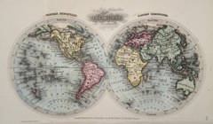
World Map The World Starling, T. (c. 1832) 15 x 9 The World in twin hemispheres. Eastern and western. Finely engraved and uncommon map from The Royal Cabinet Atlas. Bright original colouring. 60.00 GBP |
|
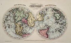
World Map The World Starling, T. (c. 1832) 15 x 9 The world in twin hemispheres. Unusual north polar and south polar projections. Finely engraved and uncommon map from The Royal Cabinet Atlas. Bright original colouring. 60.00 GBP |
|
World Map 'Chart of the World on Mercator's projection' Russell. J. (1806) 25 x 19 World map on Mercator's projectionby John Russell for Guthrie's " A New Geographical, Historical, and Commercial Grammar". Features include Tasmania connected to Australia, New Guinea mapped only partially and no North West passage mapped. Good condition. Later colour 60.00 GBP |
|
World Map Eastern Hemisphere Perthes, J. (1868) 29 x 31 Finely lithographed and detailed map covering The Eastern Hemisphere . By Justus Perthes for Stieler's Hand-Atlas. Original colouring, excellent condition. 60.00 GBP |
|
World Map 'The World in Hemispheres' Johnson, K. (c. 1890) 44 x 25 Finely engraved twin Hemisphere world map by Keith Johnson. Original outline colour to the continents, 50.00 GBP |


