Road Maps
|
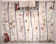
Buckinghamshire 'The Road from London to Buckingham' Ogilby, J. (c. 1698) 44 x 34 The road from London to Buckingham and the continuation from Buckingham to Banbury. From John Ogilby's seminal publication, “Britannia”, generally considered one of the most important cartographical works of the seventeenth century. Features- London (town plan), Uxbridge, Amersham, Wendover, Aylesbury, Buckingham. Continuation features the road to Banbury. Later colour, Excellent condition. 240.00 GBP |
|
Middlesex 'The Road from London to St Davids in Com Pembroke…' Ogilby, J. (c. 1698) 44 x 30 The road from London to St Davids. First section- passing through Westminster to Brantford, Hounslow, Colnbrook and on to Maidenhead, Henley, Dorchester and Abington. Features include a particularly fine miniature plan of London. From John Ogilby's Britannia, generally considered one of the most important cartographical works of the seventeenth century. Later colour. Plate number 14 . Very good condition. 210.00 GBP |
|
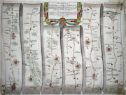
Hertfordshire 'The Road from London to Oakeham in com. Rutland' Ogilby, J. (c. 1675) 44 x 33 The road from London to Oakeham,- this section is from St. Albans through Luton, Bedford, Wellingborough, Kettering, Uppingham to Oakham. From John Ogilby's Britannia, generally considered one of the most important cartographical works of the seventeenth century. Features include a very fine cartouche depicting rural pursuits. Later colour. Plate number 47. Very good condition. 195.00 GBP |
|
Gloucestershire 'The Road from Bristoll to Worcester' Ogilby, J. (c. 1676) 44.5 x 31 The road from Bristol-to Acton, Dursley, Gloucester, Tewksbury, Severnstoake, to Worcester. From John Ogilby's Britannia, generally considered one of the most important cartographical works of the seventeenth century. Features include miniature town plans of Bristol, Gloucester and Worcester, and a fine cartouche. Later colour. Plate number 59. Excellent condition. 190.00 GBP |
|
Warwickshire 'The Continuation of the Road from London to Holyhead Plate 2d' Ogilby, J. (c, 1675) 44 x 31 The road from Towcester to Daventry, Coventry, Lichfield. From John Ogilby's Britannia, generally considered one of the most important cartographical works of the seventeenth century. Features include miniature town plans of Coventry and Lichfield. Decorative cartouche. Later colour. Plate number 22. Excellent condition. 175.00 GBP |
|
Warwickshire 'The Road from Hereford to Leicester' Ogilby, J. (c. 1676) 44.5 x 34 The road from Hereford - to Worcester, Droitwich, Bromsgrove, Allchurch, Meridan, Coventry to Leicester. From John Ogilby's Britannia, generally considered one of the most important cartographical works of the seventeenth century. Features include a very fine cartouche and miniature town plans of Hereford, Worcester, Coventry, and Leicester. Later colour. Plate number 72. Very good condition. 180.00 GBP |
|
Lincolnshire 'The Road from London to Boston in Lincolnshire. continued to the City of Lincoln' Ogilby, J. (c. 1676) 44 x 33.5 The road from Stilton - to Peterborough, Crowland and Boston. Continued from Boston to Heckington, Sleaford, to Lincoln. From John Ogilby's Britannia, generally considered one of the most important cartographical works of the seventeenth century. Other features include a very fine cartouche showing country pursuits. Later colour. Plate number 36. Some professional repairs with no loss of engraving, generally excellent condition. 180.00 GBP |
|
Shropshire 'The Continuation of the Road from Bristol to Chester' Ogilby, J. (c. 1676) 44.5 x 34.5 The road from Ludlow - to Church Stretton, Shrewsbury, Whitchurch to Chester. From John Ogilby's Britannia, generally considered one of the most important cartographical works of the seventeenth century. Other features include a fine cartouche. Later colour. Plate number 57. Excellent condition. 180.00 GBP |
|
Suffolk 'The Road from Ipswich com. Suffolk to Norwich' Ogilby, J. (1698) 44 x 33 The road from Ipswich, to Norwich passing through, Osmondston. The continuation from Norwich to Aylsham and thence to Cromer on the coast. Later colour. Some restoration to the lower corners and one or two surface marks but generally good condition. 180.00 GBP |
|
Norfolk 'The Road from Kings-Lyn to Norwich continued to Yarmouth in Norfolk' Ogilby, J. (c. 1676) 44.5 x 35 The road from Kings-Lyn -to Gayton, Mileham, Billingford to Norwich, continuing to Yarmouth. From John Ogilby's Britannia, generally considered one of the most important cartographical works of the seventeenth century. Other features include a very fine cartouche. Later colour. Plate number 76. Some professional repairs to the right hand side, left margin and centre fold strengthened. Otherwise good condition 170.00 GBP |
|
Norfolk 'The Road from King's-Lyn in co. Norf. To Harwich co. Essex' Ogilby, J. (c. 1676) 44.5 x 34.5 The road from Kings-Lyn-to Swaffam, Stanford, Thetford, Ickworth, Stowmarket, and Ipswich, continuing to Harwich by ferry. From John Ogilby's Britannia, generally considered one of the most important cartographical works of the seventeenth century. Other features include a very fine cartouche. Later colour. Plate number 75. Some professional repairs to the right margin, otherwise excellent condition. 165.00 GBP |
|
Wales 'The Road from St.Davids com Penbroke to Holywell com Flint' Ogilby, J. (c. 1675) 44 x 36 The road from St Davids to Holywell First section - St. Davids through Fiscard, Newport, Cardigan, Llanarch, Llanbadernvawr to Talabont. From John Ogilby's Britannia, generally considered one of the most important cartographical works of the seventeenth century. Features include a very fine cartouche.The journey is the Medieval route known as the Pilgrim's way. Later colour. Plate number 66. Very good condition. 160.00 GBP |
|
Wales The Continuation of the Road from St. Davids to Holywell' Ogilby, J. (c. 1675) 44 x 36 The road from St Davids to Holywell second section - Talabont through Machenllet, Aberangel, Llanum-Mowthy, Bala, Bettus, Ruthyn, to Holywell. From John Ogilby`s Britannia, generally considered one of the most important cartographical works of the seventeenth century. Features include a very fine cartouche. The journey is the Medieval route known as the Pilgrim's way. Later colour. Plate number 67. Very good condition. 160.00 GBP |
|
Huntingdonshire 'The Road from London to Flambourough Head….' Ogilby, J. (1698) 43 x 35 The road from London to Flamborough Head. From John Ogilby's Britannia, generally considered one of the most important cartographical works of the seventeenth century. This section is from Temsford through to Stilton, then Peterborough, Market Deeping, Morton, Sleeford, and on to Lincoln. Features include miniature town plans of Peterborough and Lincoln. Fine cartouche. Plate mark 41. Fine dark engraving in excellent unmarked condition with good margins. Later colour 140.00 GBP |
|
Devon 'The continuation of ye Road from London to Barstable in com. Devon' Ogilby, J. (1698) 44 x 33 Road map by John Ogilby, starting at Bridgewater and passing through Dulverton and South Moulton, to Barstable. Continuing to Torrington and Hatherley. Plate 33. Later colour. Condition - brittleness and some cracking of the margins particularly at lower right corner but not touching the engraved surface. Generally toned but otherwise reasonable. 120.00 GBP |
|
London to Rochester Cary, J. (c. 1810) 13 x 20 Fine road map by John Cary from his Publication "Cary's Survey of the High Roads from London" The scale of one inch to the mile enables individual Gentleman's country seats, hostelries, etc to be identified enabling the traveller to plan his journey. This example shows the road from London to Rochester and includes Southwark, Deptford, Greenwich, Welling, etc. Unusually excellent condition with fine original hand colouring. 45.00 GBP |
|
London
to High Wycombe Cary, J. (c. 1810) 13 x 20 Fine road map by John Cary from his Publication "Cary's Survey of the High Roads from London" The scale of one inch to the mile enables individual Gentleman's country seats, hostelries, etc to be identified enabling the traveller to plan his journey. This example shows the road from London to High Wycomb and includes Kensington, Shepherd's Bush, Ealing etc. Unusually excellent condition with fine original hand colouring. 45.00 GBP |
|
London
to Richmond Cary, J. (c. 1810) 13 x 20 Fine road map by John Cary from his Publication "Cary's Survey of the High Roads from London" The scale of one inch to the mile enables individual Gentleman's country seats, hostelries, etc to be identified enabling the traveller to plan his journey. This example shows the road from London to Richmond and includes Kensington, Chelsea, Fulham, Putney, etc. Unusually excellent condition with fine original hand colouring. 50.00 GBP |


