The Middle East
|
The Middle East 'Carte De Perse. (Persia)' De Lisle, G. (c. 1745) 61 x 48 Large size and detailed map of Persia by Guillaume De Lisle, published by Covens and Mortier. Includes detailed cartography of the area from the Black Sea eastwards to Afghanistan and from the northern Caspian sea south to the Persian Gulf and North-eastern Arabia. Original colour. A few surface marks to the top right corner but otherwise good condition on thick paper. A fine map from one of the most important French Cartographers. 225.00 GBP |
|
The Middle East 'Arabia' Rapkin, J. (1851) 35 x 26 Fine map of The Arabian Peninsula engraved by John Rapkin, for John Tallis's highly decorative "The Illustrated Atlas". The vignettes show; Mount Sinai, Arab men and Women, and the "Ship of the Desert" (Camel) Single page map, (no central fold). Original colour as published. Condition fine. 180.00 GBP |
|
The Middle East 'Palestinae seu Terrae Promissionis in duodecim Tribus partitae Facies Antiqua' Kitchen, T. (c. 1768) 58 x 43 Very fine map of Palestine and surrounding countries engraved by Thomas Kitchen for John Blair's "The Chronology and History of the World". Highly detailed, showing the tribes of Israel and their situations. Fine condition. Later colour. 165.00 GBP |
|
The Middle East 'A New and Accurate Map of Persia and the Adjacent Countries...' Bowen, E. (1766) 44 x 35 Finely engraved and detailed map of Persia by Emanuel Bowen. Features include a fine title cartouche with a caravan train and merchants. Condition excellent, a dark impression on thick paper. Later hand colour 120.00 GBP |
|
The Middle East 'An Accurate Map of The Holy Land Divided into the XII Tribes of Israel According to Sacred History...' Bowen, E. (1766) 23 x 32 Finely engraved map of the Holy Land by Emanuel Bowen. Condition excellent, a dark impression on thick paper. Later hand colour 100.00 GBP |
|
The Middle East 'A New and Accurate Map of Anatolia or Asia Minor with Syria and other Provinces of the Turkish Empire' Bowen, E. (c. 1766) 43 x 36 Fine map of the area south of the Black Sea, covering Turkey, Cyprus, Syria, Curdestan etc by Emanuel Bowen. Later colour, conition excellent. 100.00 GBP |
|
Constantinople Davies, B. R. (c. 1840) 40 x 33 Finely engraved plan of the city by B. R. Davies for the Society for the Diffusion of Useful Knowledge. Features include Scutari, Ghalatar and other outlying areas. Early colour with additional Later colour. 80.00 GBP |
|
Egypt 'Aegyptus' Ortelius, A. (c. 1603) 10 x 8.5 Fine early map of Egypt by Abraham Ortelius, engraved in small format by Philippe Galle, and published in the Epitome, or pocket-edition of the "Theatrum Orbis Terrarum". This map from an English text edition of c. 1603 published in London and thus one of the first world atlases published in England. Fine condition. Later colour 60.00 GBP |
|
The Middle East 'Terra Sancta' Ortelius, A. (c. 1603) 10 x 8.5 Fine early map of The Holy Land by Abraham Ortelius, engraved in small format by Philippe Galle, and published in the Epitome, or pocket-edition of the "Theatrum Orbis Terrarum". This map from an English text edition of c. 1603 published in London and thus one of the first world atlases published in England. Fine condition. Later colour 60.00 GBP |
|
The Middle East 'Natolia' Ortelius, A. (c. 1603) 10 x 8.5 Fine early map of the region now primarily Turkey, by Abraham Ortelius, engraved in small format by Philippe Galle, and published in the Epitome, or pocket-edition of the "Theatrum Orbis Terrarum". This map from an English text edition of c. 1603 published in London and thus one of the first world atlases published in England. Fine condition. Later colour 50.00 GBP |
|
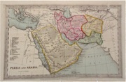
The Middle East 'Persia and Arabia' Starling, T. (c. 1832) 15 x 9 Uncommon and finely engraved map of the area from the Red Sea eastwards to what is now Afghanistan from The Royal Cabinet Atlas. Bright original colouring to the various countries. A numbered key identifies the various provinces. 45.00 GBP |
|
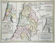
The Middle East 'Palaestina' Neele, J. (1824) 28 x 21 Copperplate map of the area now Israel and western Jordan as it appeared in Biblical times. Inset maps of the tribes occupying the area and Jerusalem. Later colour 50.00 GBP |


