Cornwall
Including Bodmin, Truro, Camborne, Redruth, St. Austell, Falmouth, Penzance, Newquay
|
Cornwall 'Cornwall olim pars danmoniorum' Saxton, C. / Kip, W. (c. 1637) 38 x 30 Attractive and finely engraved map of the county by William Kip after Christopher Saxton. Published in William Camden's Britannia. Features include, top left view of Launceston, a galleon, sea monster and compass rose. Bears the plate numbers I and 2. No text on the back. A few age related marks but a rare item with attractive and early colour. 285.00 GBP |
|
Cornwall Morden, R. (1722) 43 x 36 Superbly engraved and decorative map of the county by Robert Morden. From the 1722 edition of Camden's Britannia. Excellent condition with good margins. Some reinforcement of thinning paper to the left not affecting the map. Later colour 185.00 GBP |
|
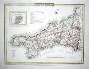
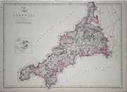
Cornwall 'Map of the County of Cornwall, from an Actual Survey made in the years 1826 and 1827' Dower, J. (1829) 69 x 60 Finely engraved and detailed map of the county by Christopher and John Greenwood. The brothers published their county maps from their original surveys over the period 1817 until 1833, and then in 1834 as an atlas. With their large size, accuracy and decorative vignettes the maps are generally recognised as being amoungst the finest published in England in the nineteenth century. On this map the vignette is of St. Michael's Mount. The inset map is of The Scilly Isles. Original hand colouring. 185.00 GBP |
|
Cornwall 'The Road from Barstable to Truro' Ogilby, J. (1698) 45 x 35 The Road from Hatherly, to Newport (Launceston), Camelford, crossing the river Camel to, Padstow, Truro. From John Ogilby's Britannia, generally considered one of the most important cartographical works of the seventeenth century. Features include town plan of Truro, and a fine cartouche. Later colour. Plate number 34. Slight Trimming to the top of the cartouche, but otherwise Excellent condition. 180.00 GBP |
|
Cornwall 'The continuation of the Road from London to the Lands-End' Ogilby, J. (1698) 48 x 34 The Road from Plymouth to Looe, Fowey, Tregony, St. Michael's Mount, Penzance, Sennan. From John Ogilby's Britannia, generally considered one of the most important cartographical works of the seventeenth century. Features include town plan of Plymouth and a fine cartouche. Later colour. Plate number 28. Trimmed and remargined to the left and right, slight loss of the road map engraving lower right. Otherwise good condition. 175.00 GBP |
|
Cornwall 'A New Map of Cornwall divided into Hundreds exhibiting its Roads, Rivers, Parks...' Cary, J. (1809) 54 x 49 Superbly engraved map of the county by John Cary. From "Cary's New English Atlas". The atlas was issued in parts from 1801 to 1809 and published as a complete work in 1809. Very fine original hand colour. 160.00 GBP |
|
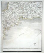
Cornwall 'A New and Correct Chart of the Channel Between England and France' Mount & Page (c. 1750) 50 x 64 Fine chart of the western English Channel covering the coasts of Devon and Cornwall and extending northwards into the Irish Sea and the west coast of Wales.. The Bristol channel is covered and the chart extends to Brittany in the South. This chart is the left hand page of a larger chart extending to the North sea. Later colour. 150.00 GBP |
|
Cornwall 'A Table of the Hundreds in the county of Cornwall' Blome, R. (c. 1731) 26 x 19 Finely engraved map of the county by an anonymous hand, possibly Blome from the atlas "England Exactly Described or a Guide to Travellers…" first published by Thomas Taylor, but herewith from the later edition published by Thomas Bakewell. A major addition to the earlier plates is that roads and distances between towns are now included, after the road surveys of John Ogilby. Fine condition. Later colour 130.00 GBP |
|
Cornwall 'A Map of Cornwall from the Best Authorities' Cary, J. (1805) 53 x 42 Finely engraved map of the county by John Cary for the Stockdale edition of Camden's Britannia. Inset map of Scilly Islands. Later colour 95.00 GBP |
|
Cornwall Pigot, J. (c. 1826) 36 x 23 Attractive and detailed steel engraved map by James Pigot from his publication Pigot & Co.'s British Atlas. Features include inset map of The Scilly Isles and a fine vignette engraving of St. Mary's Church Truro. Original hand colour. Excellent condition 90.00 GBP |
|
Cornwall 'Islands of Scilly' Halley, E. (c. 1730) 30 x 25 Chart of the Scilly Islands By Edmund Halley & Nathaniel Cutler published in the Atlas Maritimus & Commercialis. Features include the westerly spot marked where Sir Cloudesly Shovel and several of his fleet were lost in 1707. The incident led to increased efforts to make an accurate clock in order to calculate longitude. Later colour 60.00 GBP |
|
Cornwall 'A Modern Map of Cornwall Drawn from an actual Survey...' Conder, T. (1784) 21 x 18 Finely engraved and decorative map of the County by Thomas Conder for the publication "The New British Traveller". Features include a cartouche of a rural scene and a coat of arms. Later colour. 55.00 GBP |
|
Cornwall Seller, J. (c. 1703) 15 x 13 Fine map of the county by the Hydrographer and instrument maker John Seller for his "Anglia Contracta". This series of maps were first published in 1695. They were later used in a simplified form by Francis Grose for his "Supplement to the Antiquities of England and Wales", published from 1787. 50.00 GBP |
|
Cornwall Lewis, W. (c. 1835) 14 x 10 Detailed and attractive miniature map of the County by William Lewis for his "Lewis's New Traveller's Guide". A particular feature of this charming series of maps is the clear and precise engraving of the roads. Adjacent numbers indicating the distances from London. Also included with the map is the accompanying page of text giving the county information relevant to travellers - principal towns and inns are listed, distances between towns, principal fair dates, and even sites for the best views of the county. Later colour. 50.00 GBP |
|
Cornwall Roper, J. (1810) 24 x 18 Detailed and decorative map of the county by Cole and Roper for The British Atlas. Original hand colouring. Excellent condition. 50.00 GBP |
|
Cornwall Moule, T. (c. 1845) 26 x 20 Decorative Steel engraved map of the county by Thomas Moule. Inset view of Land's End. Later colour. 50.00 GBP |
|
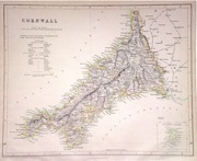
Cornwall Becker, F. (c. 1842) 35 x 29 Detailed steel engraved map of the county with original colour. Published in Fisher's County Atlas, the only cartographical work from this company. 45.00 GBP |
|
Cornwall 'Britannia Depicta or Ogilby Improved plate 66' Bowen, E. (c. 1724) 12 x 19 Finely engraved road map by Emanuel Bowen and John Owen for the publication "Britannia Depicta". The road depicted is Plymouth, Looe, Foy, Tregony. The coat of arms is for W. Looe. Later colour 40.00 GBP |
|
Cornwall 'Britannia Depicta or Ogilby Improved plate 82' Bowen, E. (c. 1724) 12 x 19 Finely engraved road map by Emanuel Bowen and John Owen for the publication "Britannia Depicta". The road depicted is from Hatherly in Devon to Launceston and Camelford. The coats of arms are those of Launceston and Camelford. Later colour 40.00 GBP |
|
Cornwall 'Britannia Depicta or Ogilby Improved plate 83' Bowen, E. (c. 1724) 12 x 19 Finely engraved road map by Emanuel Bowen and John Owen for the publication "Britannia Depicta". The road depicted is from Camelford to Padstow, St. Colomb, and Truro. The coat of arms is that of Truro. Later colour 40.00 GBP |
|
Central Cornwall Cary, J. (c. 1790) 21 x 27 Sheet 2 of John Cary's Map of England and Wales published in 81 sheets. Covers the area of Central Cornwall. Original colour. 30.00 GBP |


