Germany
|
Germany 'Ducatus Brunsvicensis accuratissima descriptio' Pitt, M. (1680-83) 49 x 40 Fine map of the Dukedom of Brunswick by Moses Pitt and Johann Waesberg. The Dukedom is in a central area of Germany and includes towns such as Hanover and Gottingen. Moses Pitt was a London bookseller who had proposed an ambitious twelve volume World atlas. In the event it proved too costly and only four volumes were completed. Volume III contained maps of Germany. Very fine condition with wide margins. Early (?) colour. 250.00 GBP |
|
Germany 'A Map of Germany divided into its Circles' Kitchen, T. (1768) 57 x 43 Magnificent map of Germany by Thomas Kitchen for John Blair's "The Chronology and History of The World". The map extends from the Baltic in the north to the Gulf of Venice in the south, and from Eastern areas of France across to Poland and Northern Hungary. Switzerland also shown. Comprehensive detail is given on the various Circles (Kingdoms) of Germany. Fine condition. Later colour. 125.00 GBP |
|
Germany Rapkin, J. (1851) 26 x 36 Fine and detailed map of the Country by John Rapkin, for John Tallis's highly decorative "The Illustrated Atlas". The vignettes show; Coburg, Palace at Saxe Gotha, Luther`s House Frankfurt, Cologne, Dresden, Silver mines in the Hartz mountains, Single page map (no central fold). Original colour as published. Condition fine. 85.00 GBP |
|
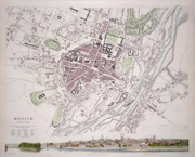
Germany 'Munich' Bradley, T. (1832) 40 x 33 Finely executed plan of the city by T Bradley for The Society for the Diffusion of Useful Knowledge. City panorama below. Steel engraving, later colour. 85.00 GBP |
|
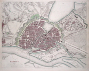
Germany 'Hamburg' Davies, B. (1841) 40 x 32 Finely executed plan of the city by B R Davies for The Society for the Diffusion of Useful Knowledge. Steel engraving, later colour. 75.00 GBP |
|
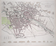
Germany 'Berlin' Henshall, J. (1833) 38 x 31 Finely executed plan of the city by J Henshall for The Society for the Diffusion of Useful Knowledge. Steel engraving, later colour. 80.00 GBP |
|
Germany 'Dresden' Henshall, W. (c. 1833) 38 x 32 Finely engraved plan of the city by Henshall for the Society for the Diffusion of Useful Knowledge. Features include a comparison of the main building engraved along the bottom line and a key to the bottom left. Early colour with additional later colour. 75.00 GBP |
|
Germany 'Frankfort' Nicholson, T. E. (c. 1837) 38 x 31 Fine plan of the city (Frankfurt) drawn by W. B Clarke and engraved by Nicholson for the Society for the Diffusion of Useful Knowledge. Features include a view of Frankfort from Sachsenhausen along the bottom line. Early colour with additional later colour. 75.00 GBP |
|
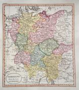
Germany 'Germany from the best Authorities' Russell, J. (1818) 19 x 22 Germany from Guthrie's Geography. Engraved by John Russell. Excellent condition 60.00 GBP |
|
Germany 'Berlin' Dufour, A. (c. 1842) 26 x 21 Fine steel engraved plan of the city by the French geographer Adolphe-Hippolyte Dufour. Later colour 50.00 GBP |
|
Germany 'Bohemia' Ortelius, A. (c. 1603) 10 x 8.5 Fine early map of the region now known as the Czech Republic, by Abraham Ortelius, engraved in small format by Philippe Galle, and published in the Epitome, or pocket-edition of the "Theatrum Orbis Terrarum". This map from an English text edition of c. 1603 published in London and thus one of the first world atlases published in England. Fine condition. Later colour 50.00 GBP |
|
Germany 'Silesiae Typus' Ortelius, A. (c. 1603) 10 x 8.5 Fine early map of Silesia, by Abraham Ortelius, engraved in small format by Philippe Galle, and published in the Epitome, or pocket-edition of the "Theatrum Orbis Terrarum". This map from an English text edition of c. 1603 published in London and thus one of the first world atlases published in England. Fine condition. Later colour 40.00 GBP |
|
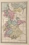
Germany 'German States' Starling, T. (c. 1832) 9 x 15 Uncommon and finely engraved map of the country from The Royal Cabinet Atlas. Bright original colouring to the various states. 35.00 GBP |
|
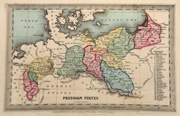
Germany 'Prussian States' Starling, T. (c. 1832) 15 x 9 Uncommon and finely engraved map of the Prussian States, an area now largely northern Germany and Poland, from The Royal Cabinet Atlas. Bright original colouring. A numbered key identifies the various states 40.00 GBP |
|
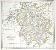
Germany 'A New Map of Germany Divided into Circles from the Best Authorities' Cooke's New Encyclopaedia (c. 1789) 24 x 22 Map of Germany and Central Europe showing the German States. Later colour. Traces of old folds but generally good condition. 35.00 GBP |
|
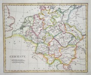
Germany Darton, W. (c. 1805) 22 x 18.5 Copperplate map of Germany including Austria, and illustrating the various states. Later colour. 35.00 GBP |


